About Mark

President of Springwater Trails, Inc

Crescent Trail “Way Finding” signs

The Crescent Trail recently started a new project to improve the blazing of the Crescent Trail in Perinton.  As we continue to build and blaze the Springwater Trail, I thought the Trail Committee should keep up with other organizations and how they blaze the trails.  The article below is copied exactly from a PDF posted on the Crescent Trail Yahoo Group.

By the way.  If you would like to be a member of the Springwater Trails Trail Committee, working with our Trail Master (Rick Henchen) to plan and build the Springwater Trail, please contact any board member or send an email to [email protected].

New Way Finding Signs on the Crescent Trail

December 3, 2014

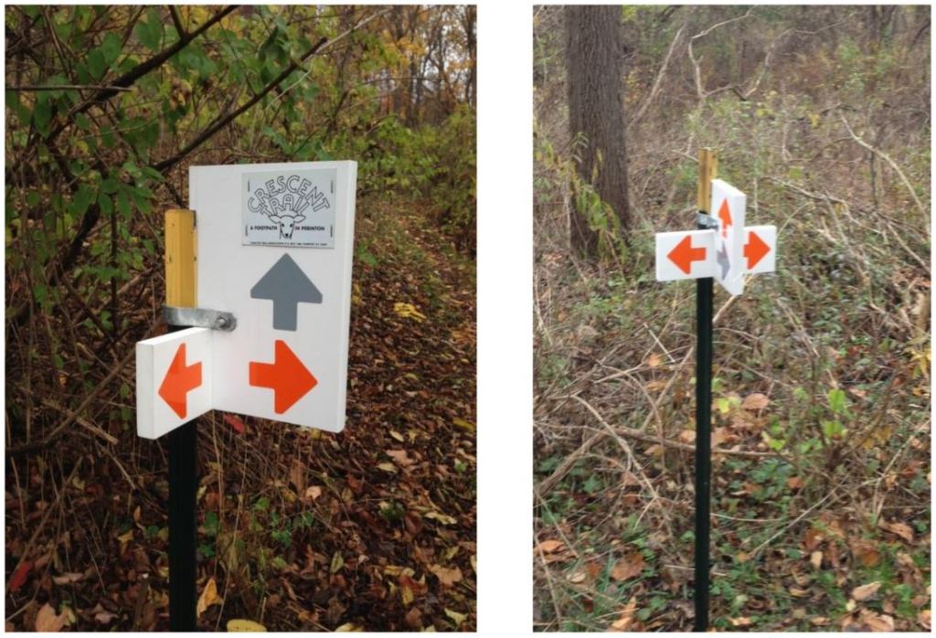
The Crescent Trail Association is beginning to install way finding signs on some sections of the trail system to help hikers keep on their intended paths. At this time we are producing signs that are simply colored arrows to point the direction of CTA trails at junctions and other locations where a hiker might wonder which way to go. Signs near access points to the trail system will have the Crescent Trail logo attached for identification. Dave Schaeffer came up with the concept and design of these new signs.

About 250 potential sites for signs on our 38+ mile system have been identified, so this will be a long term project. Signs at the more prominent locations, e.g. at trail parking lots, will be initiated by the Perinton Parks Department. CTA will concentrate on the way finding signs within the system.

The Horizon Hill area between Garnsey Road and Woodcliff Drive has several branches of the Crescent Trail system and many others, which have been the source of confusion for many first –time and even regular users, so our first priority for sign installation is there. As of this date, twelve signs have been installed in that area, with several more to come as weather permits.

Here are examples of some of the new signs:

WayFindingSignsJim Unckless, CTA Board Member

Stony Brook State Park – Sunday December 7 – 2:00PM

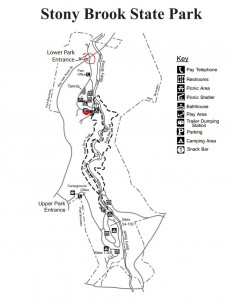
Stony BrookThis Sunday’s hike will be at Stony Brook State Park off route 36 just south of the village of Dansville. The East and West rim trails along the creek are closed for the winter so we will be hiking the snowmobile trails on the east side starting from route 36 about 500ft back north from the lower park entrance.We will be climbing up hill untill we get to the upper end of the park and then head west, coming down the west side wooded trail back to the lower parking lot.

IMG_6905     Most of this trail goes through forest with moderate uphill climbs. The upper park is mostly flat with a steep westerly down hill climb back  to the lower parking area. For those who don’t want to climb back down, car pooling from the upper park exit can be provided.

Hiking poles are recommended and good treaded footware are suggested. Bow hunting is permitted within the park, so orange clothing is also recommended.

IMG_6932The after-hike social will be at the Sunrise Resturant on Main Street downtown Dansville. There is plenty of parking in the rear.

Directions: Meet at the main parking lot inside the park from the Lower Park Entrance.  Click on the map above to see the parking area.  Click here for directions to the entrance.

Thanksgiving Vacation – No hike November 30.

Thank you for checking the Springwater Trails website. Generally Springwater Trails leads a two hour hike starting at 2:00PM on Sunday,  (during the months of June, July and August, we start at 4:00) and this spot provides details about the hike.  We are taking this week off to enjoy the Thanksgiving weekend.

You can keep up with our planning for the Winter Season of Springwater Trails hikes.  Check on the preliminary schedule.  If you want to help plan a hike this winter please contact our Winter Hike Coordinator at [email protected].

Springwater Trails is building a public hiking trail around the town of Springwater.  We are setting up a committee chaired by our Trail Master, Rick Henchen, to plan the details of this trail and to work with the DEC, and with other landowners in Springwater to continue the work on this trail.  If you are interested in serving on this committee, please contact us at [email protected].

Finally, please check back here next week for information about our hike at Stony Brook Park.

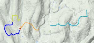
Trail Building – Schribner Rd (42.605,-77.541513) – November 23 @ 2:00PM

This Sunday is a trail building date for Springwater Trails.  We will continue the work done from Schribner to Giles in September when rain and the threat of more rain caused the climbing crew to retreat from the far hill.


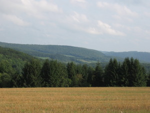
SchribnerJPGMost of this trail goes through forest, which means that clearing of fallen branches is a constant part of trail maintenance.  Bring loppers for small trees and branches, and gloves for hauling branches off of the trail.  Check the weather for appropriate foot wear but expect to complete a three mile hike with a climb of 260ft up and back down.

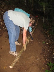
IMG_0708WWe will split into two groups to hike the trail from each end.  The climbers will start from the house, walk the beautiful new trail that was cut into the hill in September, then across the creek and up the hill.  The new trail begins where the orange tags leave the logging road half-way up the hill.  At the top of the hill, the trail crosses through the hardwood forest until it heads back down to the stream and out to the road.

The tourist group will carpool up Giles Rd to the other end of the trail.  After a stroll down to the creek, this group will start clearing trail while headed up to the top of the hill.  This will be the most challenging part of the hike, as the group looks for, and critiques the switch backs that Rick and Mark laid out.

Both groups will appoint a recorder and will carry yellow caution tape to be used to mark parts of the trail needing summer work to improve the experience.

IMG_0531When the two groups meet, they will be able to choose a central route back to the house, or they may continue to inspect the work of the other group on the main trail.  During the social at the house, the groups will report on their suggestions for the trail.  Please bring a dish to pass and your own beverage.  Coffee and tea will also be available.

Check the website for updates prior to the hike, so you will know the status of Schribner Rd and the snow.

Directions: During the winter, please approach from Tabors Corners, since the west ends of Giles Rd and Schribner Rd are both closed in the winter.  Good directions are available here. You may park on the road near the Giles/Schribner intersection or in the driveway, depending on the amount of snow we have this week.