Posted on by

Clark Gully Directions

Known for its several intense waterfalls, Clark Gully runs from South Hill Road down to Sunnyside. While the best time to view the waterfalls is Spring, the area also encompasses lovely forest overlooking breathtaking, scenic vistas of the surrounding hills and two large fields of wildflowers. 

Directions:

From Naples, take Rte 21 N to Rte 245, make right onto 245, go 3.9 miles, then left onto Sunnyside Road. Parking lot is on right-hand side.

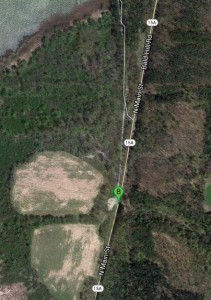
From Wayland and Springwater, take Rte 15A south to Rte 21N, make left onto 21N, then follow directions from Naples.

From Honeoye, take CR36/West Lake Road south to Rte 21, make a left onto Rte 21/Main Street and follow directions for Naples.

From Canandaigua, take Rte 21S past Woodville, left onto Parrish Road (just past Monica’s Pies), left onto Rte 245, left onto Sunnyside.

From Rochester, take 490E to last Victor exit (right before Thruway). Take Rte 96 through village of Victor. Make right onto Maple Avenue/Rte 444. Take left onto Rtes 5/20, right onto Rte 64S. Follow 64 to left as it winds around, right after Bristol Springs, then dumps into Rte 21S. Continue on 21S through Woodville them make left onto Parrish Road, left onto Rte 245 and left onto Sunnyside.

Posted on by

Hemlock Lake South Boat Launch

Click the map for directions from Google.

Click the map for directions from Google.

The south boat launch is about half a mile north of a DEC parking area located at the south end of the Hemlock Lake off of Rt 15A on the west side of the road.    From the road you will see a boat launch sign for the entrance, which is directly across 15A from the Reynolds Gull Parking Lot.

At the boat launch, you can drive down to the water to unload your boat, but parking is up above the road. If the launch area lot is full, the large lot at 15A is available.

From Springwater: Follow 15A North from Springwater for 2.3 miles.  Turn left into the parking area, then an immediate right to head down the access road. In about half a mile, the launch is on the left, and the parking area is on the right. 

From the Wheaton Hill / 15A intersection: Follow 15A North for 1.5 miles from Wheaton Hill. Turn left into the parking area, then an immediate right to head down the access road. In about half a mile, the launch is on the left, and the parking area is on the right. 

Heading north on 15A. Parking area is on the left.

Heading north on 15A. Parking area is on the left.

From the Johnson Hill / Old Bald Hill Rd South / 15A intersection: Follow 15A South for 0.3 miles.  Turn right into the parking area, then an immediate right to head down the access road. In about half a mile, the launch is on the right o the parking area, then an immediate right to head down the access road. In about half a mile, the launch is on the left, and the parking area is on the right. 

From Rochester: Follow East Henrietta Road (15A) south towards Springwater. 24 miles south of Rush, as you approach the south end of Hemlock Lake you will see a boat launch sign for Hemlock Lake. Turn right into the parking area, then an immediate right to head down the access road. In about half a mile, the launch is on the left, and the parking area is on the right. .

Posted on by

Springwater Trail at Sugarbush Hollow – Pardee Hollow Entrance – Directions

Directions to the Springwater Trail at Sugarbush Hollow entrance on Pardee Hollow Rd.

From Springwater: go North of 15A for .8mi from the light. Turn right on Wheaton Hill Rd (see the maple sign  ). At the tee, at the top of the hill, turn right onto Wetmore Rd. Bear right on Tabors Corner Rd. After 1.8 miles, turn left on Pardee Hollow Rd . Turn right at the tee to stay on Pardee Hollow Rd. Pass Coates Rd intersection, then the Sugar House on the left. Park on the west (right) side of Pardee Hollow Rd below the pond.

From Wayland: take Rt 21N for 5.6 miles. Turn left on Co Rd 38 (Garling House Rd AKA Rowe Rd). Take the first left onto Pardee Hollow Rd and continue for 3.2 miles. Park on the west side (left) of Pardee Hollow Rd just before the pond and the Sugar House.

From Honeoye: take W Lake Rd south. Turn right onto French Hill Rd. At the tee (at Dug Rd) turn right to stay on French Hill Rd. Take the first left on Garlinghouse/Atlanta Rd. Go Right on Pardee Hollow Rd and continue for 3.2 miles. Park on the west side (left) of Pardee Hollow Rd just before the pond and the Sugar House.

Posted on by

Rob’s Trail Parking Lot – West side of 15A – Directions

Rob’s Trail is located near the top of Bald Hill between Springwater and Hemlock NY. There are two parking lots, one on the west side of Rt 15A just north of Old Bald Hill Rd South. The other is on the east side of 15A (actually off of Old Bald Hill South). There is a connecting trail between the two parking lots – please watch for traffic while crossing 15A.

From Springwater:  Take Rt 15A north.  In 6.1 miles, the parking lot is on the left just after the north end of Old Bald Hill Rd South.

From Hemlock: Take Rt 15A south.  At 4.7 miles south of the 20A/15A intersection south of Hemlock, the parking lot is on the right.