Hello, Springwater Trails! Our Vermont Long Trail outing in the Camel’s Hump area begins in a little more than a month. Pam and Bill are looking forward to a stupendous time exploring the Green Mountains, hoping the weather gods smile on us to produce sunny skies, starry nights, and moderate temperatures. While Camel’s Hump’s 4,083′ elevation is not the highest mountain in Vermont, it is the favorite of many (including Bill) because the summit is accessed only by hiking; no roads, gondolas, cable cars etc. are available. Being above treeline, the summit also features rare alpine vegetation.
Here’s what we have at this point in time:
Date deadline – It is essential that Pam and Bill know who and how many are attending along with their skill level (refer to the skill level discussion below). Accordingly if you plan to come and haven’t already registered, please do so by August 1. Registrations after August 1 will not be accepted. For the signup sheet, click here
Facilities – Most of us are planning to camp, and have already made our reservations, at Little River State Park, a few miles from Waterbury. All attendees are responsible for making their own camping arrangements, whether through the reservation system or coordinating with a ST member to share a site. Chances are the campground is fully booked by now. We are allowed to double up on campsites to a maximum of 8 people. However, the person(s) reserving the campsite have the discretion to determine how many more campers can share the site. We’re also limited to 2 cars per site regardless of how many campers share the site. The basic campsite fee covers 4 people. Additional fees are imposed for other campers up to the 8 maximum. For those without campground reservations and are unable to secure a site, accommodations are available in Waterbury or nearby.
Remember that if you registered for a cabin, the facilities are spartan. There is no bathroom inside, no linens for the beds, and hardly any furniture. Plan accordingly.
Keep in mind that aside from the exceptions noted in the “Schedule” below, you are responsible for your own meals. The person(s) who reserved a campsite is not obligated to provide food for the others sharing the site. Of course this does not preclude the site “owner” and fellow campers from working out some arrangements on the meals. For those disinclined to prepare meals, Waterbury offers a variety of restaurants.
Skill levels – As most of you are aware, Springwater Trails recognizes 3 skill levels: Climbers, Tourists, and Naturalists. For the latter two categories, the hikes under consideration thus far are congruous with Springwater Trails outings. In other words, if you hike as a Tourist on ST hikes, you can hike the Tourist hikes in Vermont.
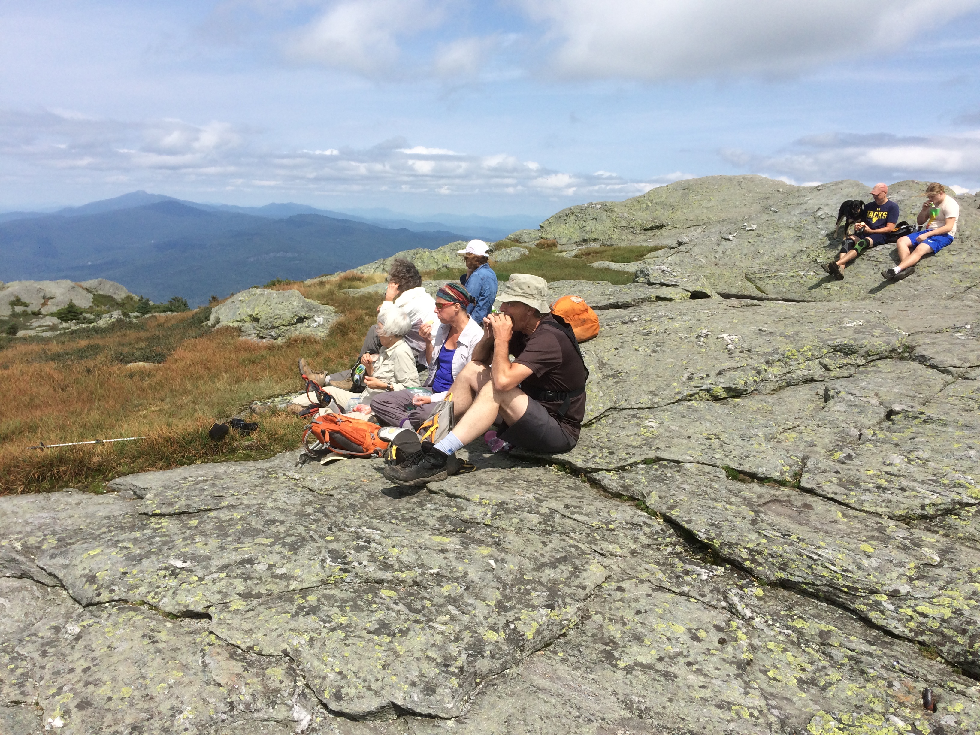
In contrast, the Climbers’ hikes in VT will be substantially more difficult than the average ST hike in 3 respects (1) more miles, (2) greater elevation gain, and (3) rough terrain. For example, the Tuesday hike up Camel’s Hump will entail a 2,000’+ net elevation gain to the summit plus additional ups and downs on the remainder. And the route under consideration – hiking to the Winooski River from Camel’s Hump – will result in a 9 mile day.
So we ask prospective Climbers to honestly assess their capabilities before deciding which hike to take. Furthermore as hike leaders, we reserve the right to approve or disapprove any would-be Climbers who are either new to ST or inactive in the past year. This is out of concern for everyone’s safety.
Schedule – As you’ll note, there are still details to work out, some of which depend on your response to this message, primarily how many are coming and the skill levels. Here’s what we have thus far:
Monday, August 20 – afternoon arrival at Little River State Park, set up camp, and meet at Pam and Bill’s campsite (Elm Leanto) at 6:00 for a potluck dinner. Everyone should bring a dish to share. After the meal, we will review the hiking schedule and arrange car pools. If you choose to not participate in the dinner, you still should come to the meeting afterward at 7:30.
Tuesday, August 21 – Tourists and Climbers, please meet at Pam and Bill’s campsite (Elm Leanto) and be ready to leave the campground by 9:00. Climbers and Tourists will start at the same trailhead at the base of the east side of Camel’s Hump. They’ll hike the same route ( a steady but moderate ascent on the Dean Trail) for about a mile to a junction with the Monroe Trail. At this point, the Tourists will bear left and continue their moderate ascent on the Dean Trail to the ridgeline and the intersection with the Long Trail. The group will then decide whether to hike along the Long Trail, considering time and other factors. The return hike will be down the Dean Trail. Meanwhile, the Climbers will have taken the Monroe Trail (right fork from the junction) to Camel’s Hump Clearing and then up to the summit via the Long Trail. Climbers will descend Camel’s Hump southbound on the Long Trail to the junction with the Dean Trail which they’ll follow to the trailhead.
Naturists will hike to a clothing-optional hot spring. Just kidding, Freudian slip! Naturalists will hike 2 ½ miles on the Long Trail along the Winooski River. The trail is practically flat but there is one shallow ford across a brook. One interesting tidbit about this hike is that the Long Trail crosses the Winooski River on a newly-constructed footbridge. At this point, you’re at the lowest elevation of the entire 272-mile Long Trail at 325′ above sea level. And two of the highest points loom on either side of the river: Camel’s Hump to the south and Mt. Mansfield (VT’s highest summit) to the north.
Tuesday evening, we will gather at a restaurant in Waterbury for a group dinner.
Wednesday, August 22 – Please be ready to leave the campground by 9:00. The exact hikes are yet to be worked out. We have some promising options at other locations, ranging from Mt. Abraham (south) to Mt. Mansfield (north).
Thursday, August 23 – Pack up and return home. Those who wish to stay longer may consult with Bill and Pam on other options.
Other Activities – For those wanting to participate in non-hiking activities, Little River State Park features a lake with concessionaire rentals of canoes and kayaks. The Waterbury and Stowe areas feature numerous tourists attractions. On the culinary front, the home bases of Green Mountain Coffee, Ben & Jerry’s Ice Cream, and Cabot Cheese are nearby. The Von Trapp family estate near Stowe draws many Sound of Music junkies. A simple drive around the VT countryside is a great way to enjoy the scenery of the Green Mountains. Finally, we recommend a visit to the Green Mountain Club’s Headquarters on Rt. 100 between Waterbury and Stowe. The venerable GMC has been the steward of the Long Trail for over 100 years. The HQ features 3-D displays of the Long Trail, historical information, and publications for sale.
Questions? – contact Bill at 802-345-3773 or [email protected]. Feel free to offer suggestions and advice as well. We’ll listen! Looking forward to seeing everyone!