
 There are three main parts to this event:
- a ranger led walking tour of the Mount Morris Dam (No dogs on the Dam tour)
- several concurrent hikes along the Letchworth Branch of the Finger Lakes Trail (Dogs on leash are welcome)
- an after hike dish-to-pass social at one of the picnic shelters near the Visitor Center. (Dogs on leash are welcome)
There is no cost to any part of this event, although donations are accepted. The hike combo special event will start at 12:15 PM (look for the Springwater Trails sandwich board sign) at the Visitor’s Center to sign up for the tour of the dam. Before the tour, visitors must complete, and sign a Mount Morris Dam Tour Liability Waiver to tour the Mt Morris Dam inner workings scheduled for 12:30 PM. (You may download, print and bring with you to save time). The tour will be followed at 2:00 PM by a hike on the Letchworth Branch of the Finger Lakes Trail on the east side of the Genesee River. We will congregate at 1:45 p.m. outside the Visitor Center for the 2 PM hike. Following the hike around 4 PM, join us for a dish-to-pass social at one of the pavilions at the Overlook Area of the Dam near the Visitor Center. Please bring beverages, a dish to pass, or donate $5.
The Dam Tour has been arranged with Harmony, one of the Mount Morris Dam Engineers, for Springwater Trails and is limited to between 20 and 30 attendees and is approximately an hour in length. For planning purposes, we are seeking a likely head count and any questions or comments at [email protected]. Inside the dam, temperature is 40 – 50 degrees F so a light wrap may be appropriate. 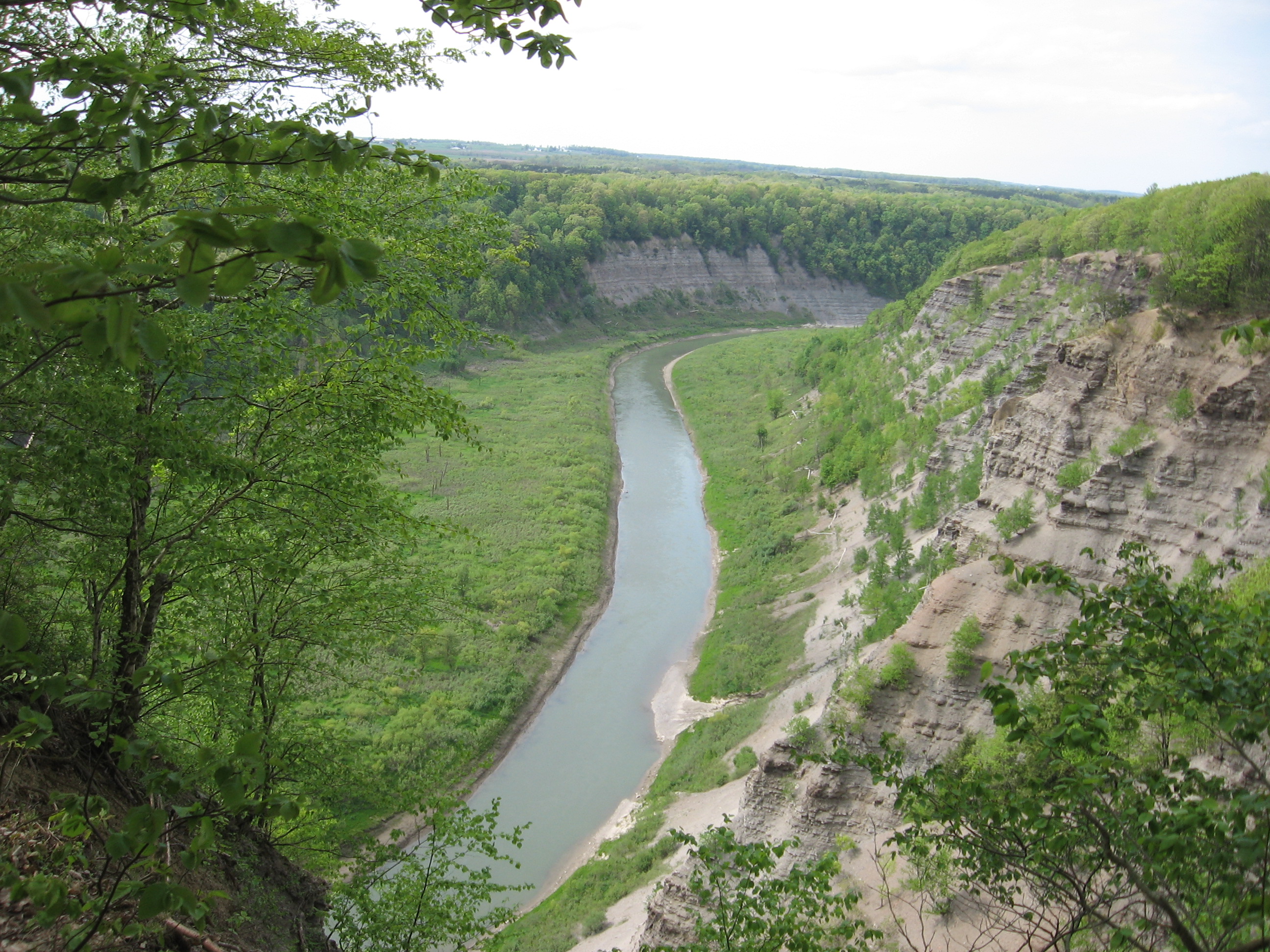 We would also like to point out that hikers, friends and families are welcome to attend any combination of the Dam tour, the trail hike and the social. Those who do not want to join the trail hike might want to take advantage of other opportunities in the area and return to the picnic area near the Visitor Center for the social. Possible activities include:
- A historic walking tour of Main Street, Mt Morris
- Historical Society Museum in the Mills Mansion (House) at 14 Main Street
- Shopping at the Antique shops, bakeries, or ice cream stands in Mt Morris
- Explore the Al Lorenz Livingston County Park
- Or a driving tour of the gorge at Letchworth State Park
 After the tour, hikers will congregate outside the Visitor Center. If you are not touring the dam, meet at 1:45 to divide into the Climbers, Tourists, Naturalists and Flatlanders groups. Tourists (a moderate hike of just under 4 miles) will carpool to Access D on River Road (right fork off of Rt 408) which is just before the power line grid and hike back to C (3.93 mi) Hog’s Back Overlook. There will be a pre-staged van (room for 7 passengers) to drive back to the parking lot. Climbers (a lengthier hike, nearly 5 miles) will start hiking from the Visitor Center parking area (Access B), and will follow the FLT yellow blazes past C to the blue access trail to Access Point D. The climbers will use the Tourist’s cars to get back to the parking lot. Naturalists (an easy hike of 2 miles with a pace aimed at looking at scenery, nature, and identifying plants) will also start from the parking lot and will hike to the Hog’s Back Overlook and then back to the parking area. The hike leader may adjust the turn around point based on the time. Flatlanders (and anyone not hiking, but staying for the social) will leave their vehicles at Visitor Center and stroll around the Dam Overlook Area, enjoy the Visitor Center exhibits and videos. They help set up for the social, and stake out a pavilion for the social. The Visitor Center closes at 4:30 PM (along with the bathrooms inside), but there are outside rest area buildings at the parking lot stocked with toilet paper, but no running water. Water will be in an orange cooler.
 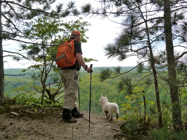 The forecast for Sunday is sunny and hot (80°). Please bring water to keep hydrated. A hat, sunglasses, sun lotion, and bug repellent are suggested as well. Expect some wet spots where the trail crosses streams and at access D. This plan has tourists driving a carpool to Access D and climbers driving those same cars back to the social. If you are willing to have another hiker drive your car, please bring a second set of keys and let us know your vehicle will be available. After the hikes, the dish-to-pass social will be held at a picnic shelter (there are several and are on a first come, first served basis) near the Parking and Overlook Area. Either bring a dish to pass or make a donation (suggested $5) to the social fund to help defray expenses, and bring a beverage of your choice. The dam tour and hike are free and are open to anyone interested, and there is no admittance fee. You do not need to be a member of Springwater Trails or any other hiking group to attend. Everyone is welcome and encouraged to stay for the social. To assist in planning, please RSVP prior to the hike. If you have any questions, please contact Katherine at 585-737-5205. The Mt Morris Dam Visitor Center is about 45 minutes from Springwater, so please plan ahead. If you have a GPS, try entering Mt Morris Dam as your destination (or the coordinates 42.730926, -77.906875). Or enter Visitor Center Rd, which is after the Damsite Road going south out of Mt Morris on Chapel Street. If you want to carpool from Springwater, meet at All Western Evergreen Farm, 6840 Liberty Pole Road, at 11:15 AM, as we will leave promptly at 11:30 AM. DIRECTIONS to Mt Morris Dam:
- From Springwater: Take Rt 15N and then left on Liberty Pole Rd. Stay on that road (County Rt 38, to County Rt 1A, to County Rt 1) all the way to Rt 63. There, take a left, and a quick right, onto Rt 258. At Rt 36, take a right and proceed to Mt Morris. Turn left onto NY-408 South (Chapel Street) at the first traffic light. Continue on Rt 408 S and watch for the sign to the Dam and turn right (west) onto Visitor Center Road (on 408 after the Damsite Road) to the parking area and walk to the Visitor Center.
- From Wayland: you can take I-390 north to Exit 7. Turn left at the exit on NY-408 south to Mount Morris. NY-408 goes left at traffic light on Main Street, then right at traffic light on Chapel Street. Continue on Rt 408 south and watch for the sign to the Dam and turn right (west) onto Visitor Center Road (on 408 after the Damsite Road) to the parking area and walk to the Visitor Center.
- From Hemlock and Honeoye: follow 20A west through Livonia and Lakeville to I-390 S. Take Exit 7 NY 408 south to Mt Morris. Turn left on NY-408 south to Mount Morris. NY-408 goes left at traffic light on Main Street, then right at traffic light on Chapel Street. . Continue on Rt 408 south and watch for the sign to the Dam and turn right onto Visitor Center Road (on 408 after the Damsite Road) to the parking area and walk to the Visitor Center.
- From Rochester: Take I-390S to Exit 7 NY 408S. Turn left on NY-408 S to Mount Morris. NY-408 goes left at traffic light on Main Street, then right at traffic light on Chapel Street. . Continue on Rt 408 south and watch for the sign to the Dam and turn right onto Visitor Center Road (after the Damsite Road) to the parking area and walk to the Visitor Center.