Wesley Hill Nature Preserve – Sunday February 17, 2:00 PM

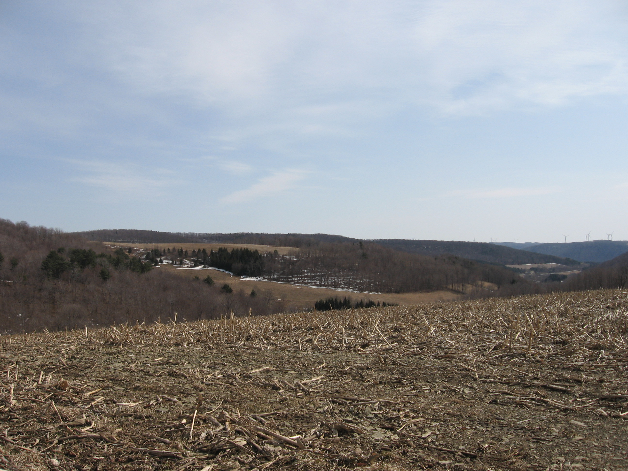
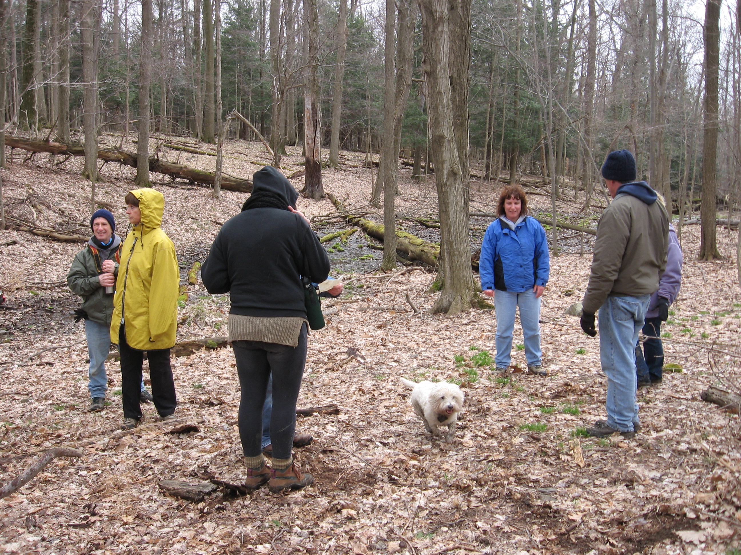
The Springwater Trails hikes this week will traverse forest, fields, gullies but probably not flower fields. For those of you who have hiked with the group here before this hike will start at a different spot – the original entrance to the preserve on Wesley Rd.

With a high of 20 forecast, expect parts of the trail to be icy.  Crampons for your shoes and/or poles for your hands will make the hike easier. And after the hike, we will warm up with a social at the Middletown Tavern in Naples.

A word of cautionEnter Wesley Rd from Gulick Rd. Do not try to access Wesley Rd from East Lake Rd, in spite of what your GPS might tell you. The road is closed below the trail head and if you try it you will readily see why.

Where did the trail go?Wesley Hill Nature Preserve was founded in 1999 by the generous donation of 90 acres by the children of three artists – John Weinrich, James Havens and Colburn Dugan – to the Finger Lakes Land Trust. Since that time the preserve has grown to over 390 acres by way of the purchase, by the land trust, of three parcels and a gift of the fourth.

Briggs Gully, the original Weinrich cabin, a bird watching area, breathtaking views of the surrounding hills, a pond and extensive forest with a wide array of wildlife are just some of the features this lovely
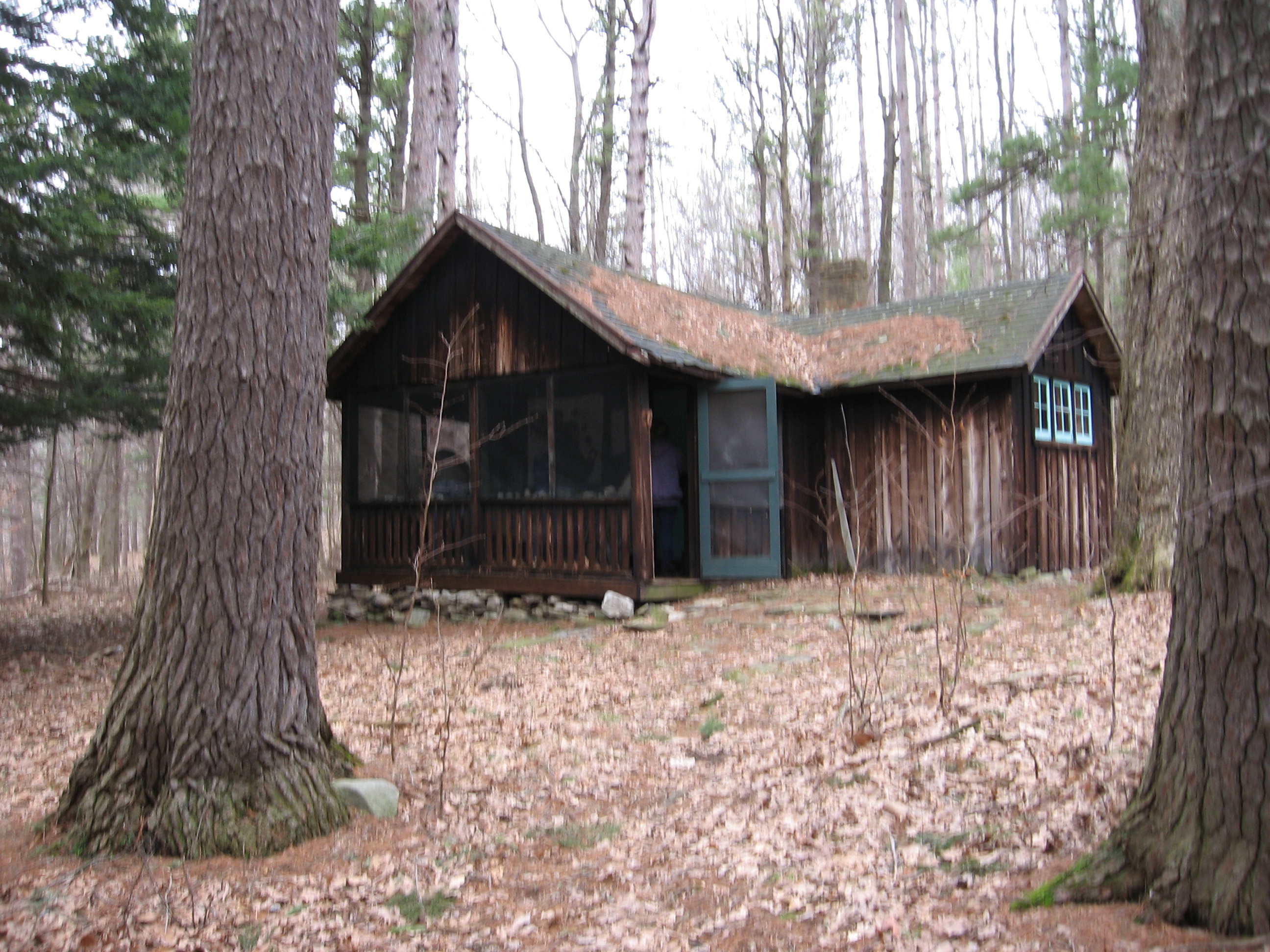
 The original cabinproperty offers.

Our hikes will start and end at the same point – the parking lot on Wesley Road. The preserve entrance is across the road from the parking area. From this entrance we will follow the trails laid out within the preserve, visiting the bottom of the preserve up to the top of the preserve on Gulick Rd.

The Tourists (led by Dena) will start on the yellow trail.  They will turn at the blue trail, follow it around the lower part of the preserve.  The blue trail connects back to the yellow trail and then returns to the parking area. (2 miles)

The Naturalists (led by Mark) will follow the tourists around the blue trail.  This group has not hiked the blue trail before and the Naturalists will take some time to discuss the various trees of the preserve and the specifics of the terrain.  (1.5 miles)

The Climbers (led by ?) will stay on the yellow trail until it comes to the red trail then continue on the red up to the Gulick Rd trail head, then around and then follow it back to yellow trail and to the original start point. (3.5 miles).

Wesley Hill
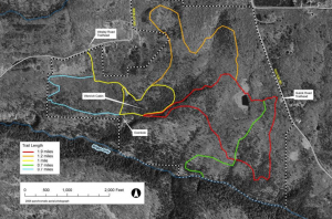
Maps are available at the kiosk at the trail entrance. Trails are all clearly marked and depending on weather and energy level there is the option for the groups to extend their hike onto adjacent trails. Tourists and naturalists will traverse gentle slopes and flat terrain; climbers will hoof it up some dandy hills.

Directions are available here. To get to the Middletown Tavern after the hike, go back up Wesley Rd.  Turn right on Gulick Rd and follow Gulick Rd for 8.4 miles all of the way to the stop sign at CR 36.  Turn left on CR 36.  The Middletown is on the right at the bottom of the hill at the intersection with Rt 21.

Planning the annual meeting

I want to bring you up to date on the Annual Meeting for the Springwater Trails.  The executive board is meeting to plan the activities for that day (March 24 following the Sunday hike).  If you have anything you would like covered at the annual meeting, please post a comment on this posting, or send an email to [email protected].

Dean reports that the nominating committee has nearly completed its work and has set a date of Feb 19 to announce their nominations.

Meanwhile, Ann and Jerri are gathering plans for spring hikes.  This schedule will be ready by the middle of March.

If you haven’t done so already, check out Page 2 of this newsletter for additional stories.

Spring Hikes

With this latest snow, I am sure everyone is looking forward to some skiing or snowshoes in Hi Tor on Sunday.  Unfortunately, we need to take advantage while we can!

But the purpose on this note is our spring hiking schedule.  As many of you know, Ann Lafford and Jerri Rounsville have agreed to coordinate the spring hikes (April through June). They are working with hike planners in the Springwater Trails hiking group to create a schedule with varied hikes appropriate for spring and early summer.  Which brings up your role – would you like to plan one of the 12 hikes that will be scheduled?  Planning a hike may be as easy as selecting your favorite hike from the last two years and selecting a  date that fits the schedule, to a big a project as finding a new location you want to explore, finding the land owners and getting permission, and planning the specific routes for climbers, tourists and naturalists.

The critical step is to decide to contribute to the spring hiking schedule!  Please contact Ann and Jerri at [email protected] to get started.

For information about our winter hike schedule, please visit our calendar page.

Snowshoeing the Springwater Trail

[singlepic id=64 w=320 h=240 float=left]The snow is deep and beautiful to snowshoe on up in the Springwater Mountains. The Springwater Trail is open to the public for weekday, weekend, or upcoming holiday winter recreation opportunities.

The current trail skirts an active maple syrup farm at Sugarbush Hollow in East Springwater and can be accessed just off Pardee Hollow Road and Coates Road.    The trail passes through farm fields that feel like the tundra this time of year at the top of the mountain and a sugarbush of over tapped 3000 sugar maple trees.  On warm winter and early spring days you can see and hear the sap flowing from the trees. The sugarhouse may be open, bring a lunch and warm up, and watch the maple men and women make maple syrup Feburary-April in the afternoons and evenings.

[singlepic id=65 w=320 h=240 float=right]The Springwater Trail has two winter access areas.  Park 1/2 way up Coates Road to  the snowplow area.  You can park along the side of the road but do not block the driveway on your right.    Continue to snowshoe east up Coates Road.  If you want a more difficult snowshoe travel an elevation climb of 200 ft. to the top of the hill on Coates Road to the trailhead sign on your right. Continue down and across the field on the CoyoteTrail and watch for the blue blazes that drop down into the Sugarbush. Follow the blue blazes for about 2 miles to  Pardee Hollow Road just past the pond to the south of the Sugarhouse for a pick up location. Estimate time 1 1/2 hours.   If you would like an easier access route off Coates Road, follow the orange blaze just past the snowplow area on your right.  This orange trail connects with the blue trail in the sugarbush area and ends at the same location. Estimate time one hour.

The other winter access area can be accessed off Pardee Hollow Road.  You can park at the sugarhouse, walk south past the sign and turn right on our West Trail.  This trail is a little more difficult with two 200 ft. elevation climbs to the top of the mountain.  It passes through a wild apple orchard, black cherry and sugar maple plantation, crosses a field and then drops down through a dense forest and skirts another sugarbush area.  Follow the blue blazes, turn right on the orange blazes for a continuous loop back to Pardee Hollow Road and the Sugarhouse.  If you wish you can  follow the blue blazes to the south of the white house for a pick up location on Tabors Corners Road. Estimate time two hour.

The view from the top of the return route.

The view from the top of the return route.

The Springwater Trail is a moderate to difficult trail with it’s elevation climbs and snowshoers should be prepared. Snowshoes can expect colder weather at elevations of 1800 – 2200 ft. and wind at the top of the mountain.  Please stay on the trail, follow our rules, and do not touch the maple lines or equipment which will be actively working.  For directions to the Springwater Trail contact us at springwatertrails.org.