Additional hike details coming soon! Please check back. Note: event time change.
Mystery Hike
Reply

Additional hike details coming soon! Please check back. Note: event time change.
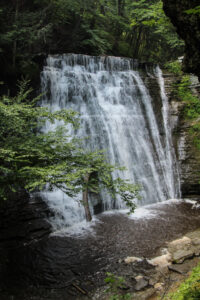
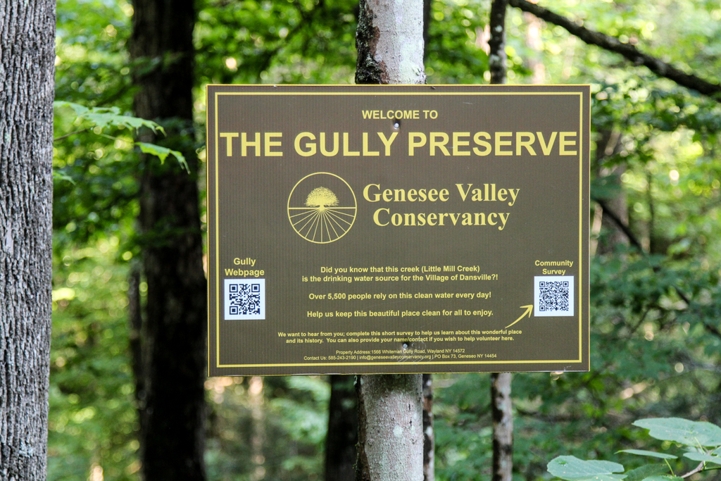
Whiteman Gully is a unique place – a pristine Finger Lakes gully not much touched by any organized hand. It was privately held until a couple of years, when it was bequeathed to the Genesee Valley Nature Conservancy.
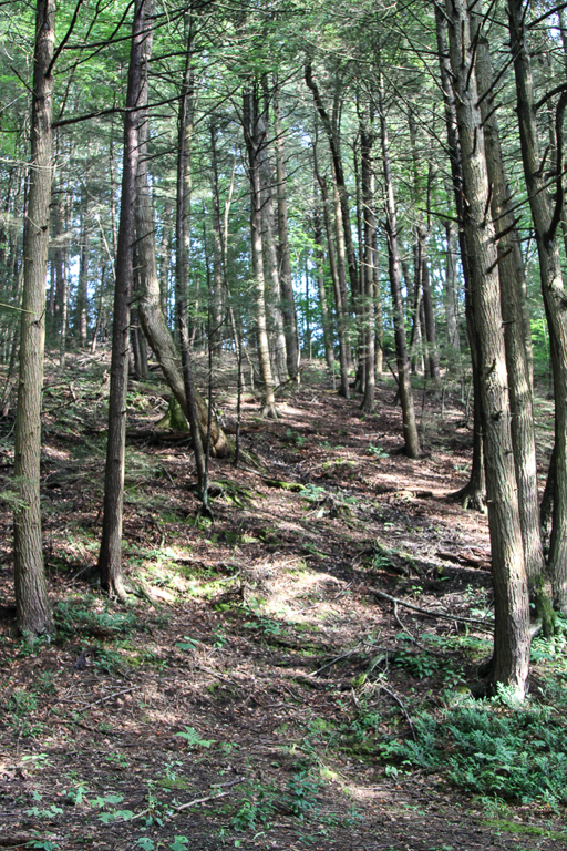
This is a different hike to our usual long walk; it will be a hike of exploration along trails which are not long, but unimproved and requiring care; we will wander around a small but very scenic patch of land. There are 3 trails to explore on both sides of Whiteman Gully Road. There have been few “improvements” to suit casual walkers on this property; if there has been rain recently the paths will be muddy but the waterfalls and the stream more impressive. To get a good view of the waterfall on the south side of the preserve there is a stream crossing on stepping stones to be dealt with, and the section of the trail to get a view of the waterfall is short but steep; this pattern is likely to be repeated on other trails that we explore. There are several waterfalls and a chute on the north side of Whiteman road, and further waterfalls can be seen which are probably beyond the boundary of the preserve.
The gully does not appear to have been farmed or logged and the trees are big and old.
The Meeting Place
We will meet at the point where Whiteman Gully Road in Wayland crosses the stream of the gully (42.55731, -77.65159). There is adequate roadside parking on Whiteman Gully Road. First we will explore the trail to the north west and the gully around the waterfall. We will then return to the meeting point and explore the trail upstream and finally the trail the the north west on the opposite side of the stream to the first trail that we followed.
All hikers will walk in just one group on this hike, and hiking alone is definitely to be avoided given the uncertainty of the trail conditions.
Equipment
Gum boots or high waterproof boots and two walking poles are strongly recommended for the stream crossing, especially if there has been rain, and the poles are generally helpful on muddy and steep ground.
We will bring a rope to help on the steep section of the trail near the waterfall
Directions:
From Naples: Come into Wayland on Rt 21 from the east. Continue through the two traffic lights when the road becomes Rt. 63 to Dansville. Passing the the Wayland school on the left, continue for about 3 miles to Whiteman Gully Road on the right. Turn right and follow the road for about half a mile; the road turns into dirt and drops downhill; the gully is at the bottom of the hill where the stream is marked by barriers along the side of the bridge.
From Springwater: Come into Wayland on Rt 15 and turn west on to Rt. 21, then follow the directions as from Naples.
From Dansville: Drive towards Wayland on Rt 63 and take the second Whiteman Gully Road left – Whiteman Gully Road follows an arc with both ends on Rt. 63 – then follow the road for about half a mile. The road turns into dirt and drops downhill; the gully is at the bottom of the hill where the stream is marked by barriers along the side of the bridge.
The Social
The social will be at the Sunset Family Restaurant in Wayland, NY.
Bee Pollination Tricks of the Trade!
Additional details to follow-please check back. Thank you.
Come join us at Mertensia Park in Farmington to see one of the area’s most reliable spots for enjoying Virginia Bluebells! May is traditionally the peak time to see these blue eyed beauties growing wild in the woods along Mud Creek.
Our hike or bike will begin at 2:00 pm from Mertensia Park (1390-1394 Mertensia Road Farmington, NY 14425). Please plan to arrive by 1:45pm (there is plenty of parking at the park).
Hikers: will explore a lovely trail through the park woods, and then head west along the Auburn Trail toward Victor, turning around to return at their discretion. Mertensia Park Trail is a 2.1 mile (4,500-step) route with an elevation gain of about 173.8 ft and is rated as easy. This is a moderately paced hike on level, well maintained trails.
Bikers: After a brief trip down to the stream to enjoy the Mertensias, the cyclists will head west along the Auburn Trail, through Victor, under the Thruway and on to the trail’s end at Woolston Road, the southwest entrance to Powder Mills Park. Total distance is 18 miles, but there are plenty of spots to turn around if you want a shorter ride. The multi-use trail is wide and a well-maintained stone dust surface, with well-marked road crossings and a few short detours onto the surrounding roads.
Social: After the hike we will gather at Eddie O’Briens Grille and Bar located at 5975 NY-96 Farmington, NY 14425. For more information about the restaurant visit eddieobriensgrille.com
Directions to the site:
From Springwater: Follow Route 15A north to Honeoye Falls, turning right on West Main Street just west of the Village. At the center of Honeoye Falls, turn right at the traffic light on East Street, which becomes Boughton Hill Road. Follow Boughton Hill Road 11.6 miles, passing Ganondagan. After East Victor Road, make a left on Mertensia Road. Mertensia Park is on your left, just over the hill.
From Rochester: Take Route 490 and the NYS Thruway to Exit 44, Farmington. Go 1.4 mile south on Route 332 and turn right on Route 96. In another .4 miles turn left on Mertensia Road. Mertensia Park entrance will be in .6 miles on your right.
From Honeoye or points along Routes 5 & 20 East or West: Head toward Bloomfield and go north on Route 444 toward Victor. At Boughton Hill Road, go right for 2.3 miles and take a left on Mertensia Road. Park will be on your left in .1 mile.