Posted on by

Updated Hike switched to Canadice Lake

Since our thaw has generally eliminated our snow, Rick checked out the conditions at Harriet Hollister Spencer Park today and found the “groomed” trails were now simply ice.  For safety reasons, he has switched our hike to Canadice Lake.

All hikers will meet at the North end of Canadice Lake at the parking area off Purcell Hill Road, Town of Canadice, Ontario County. Google Maps (leaves this website) Click here for directions. Plan to arrive early in case you need to park on Purcell Hill Rd and walk into the parking lot.

Hikers who wish to do a through hike along the lake side trail to the South end should meet at the South entrance by 1:40 to leave cars.  You then can carpool to the North end, leaving at 1:45.

All hikers will head south from the parking lot at 2:00 and will continue for one hour. If cars are available at the south end, hikers may continue south.  Otherwise, turn around and return to the cars at the north end.  NOTE: Do not continue south after 3:10 unless you have confirmed a ride back to your car with a specific driver; a complete loop around the lake will end in the dark.

The Social

Following the hike, please join us at the Tee&Gee restaurant at  6028 Big Tree Rd, Livonia. This is a switch from the Birdhouse because that restaurant it closed for a week.

Posted on by

Fishers Park Hike

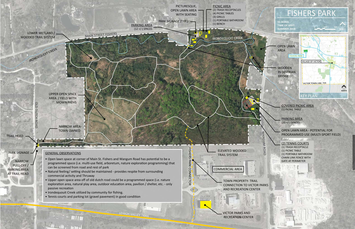
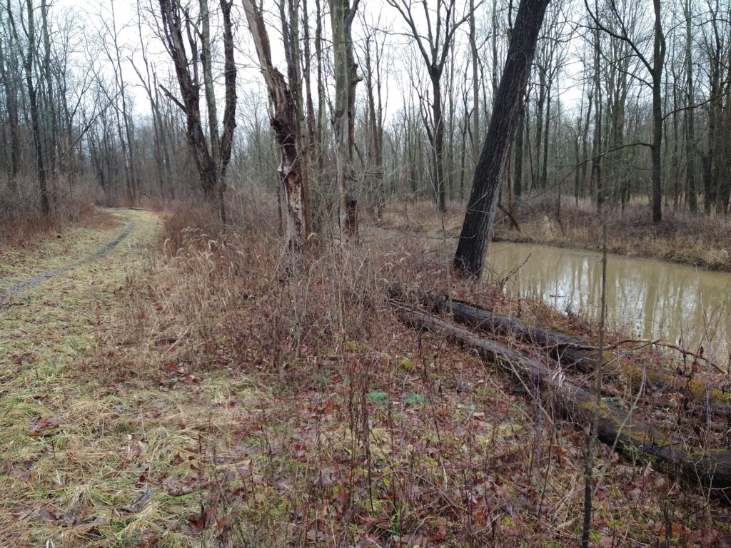
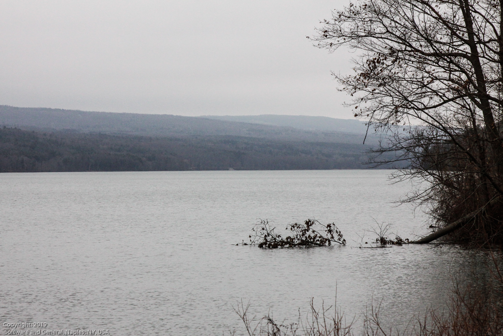
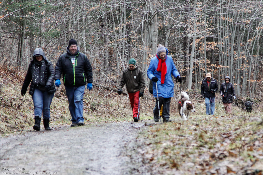
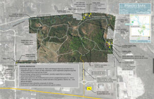
Join us on Sunday February 18th for a hike around Fisher Park . Located in the hamlet of Fishers, this 93 acre park is a diversity of passive and active recreation opportunities. Visitors can see a multitude of wildlife from deer, squirrels, and other woodland creatures to waterfowl and trout that spawn in the spring. Trails meander through the park across wooded ridges, through wetland areas, and along the banks of Irondequoit Creek.

Everyone will meet at the parking area at 7938 Main St, Fishers(Victor),  at 1:45 for a 2PM start.


The Hike:

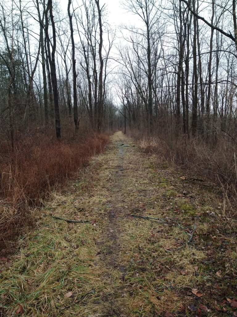
Naturalists will explore mostly the outer perimeter on the White and Red trails. Included will be nice wide trails, a vista at a high point with a beautiful view looking out over the western side of the park, a stroll along Irondequoit Creek, and trail maps every so often showing your present location. Hikers will then loop back to the parking lot.

The hike length is about 1.5miles with an option to add (we will vote on it) some small inner trails to extend hiking time.

Climbers/Tourists will also head out on the White trail but will cover more of the Yellow trails with rolling hills, ending on the Red trail along Irondequoit Creek and then loop back to the parking lot.

Hike length is about 3 miles.


The Social:

The social afterwards is at the Cottage Hotel in Mendon, at the 4 corners in Mendon at 1390 Pittsford Mendon Road.


Directions:

Directions from Springwater and Honeoye:  take County Road 37 north from Route 20A about 7 miles north to Route 5 and 20 in West Bloomfield.   Route 65 begins there.  About a half mile north Route 65 makes a sharp left turn.  Do not go left, go staight onto County Road 35, otherwise known as West Bloomfield Road.  Go about 6 miles up to Route 251 and turn right.  You will come to the traffic light at the 4 corners of Mendon.  Go straight ahead  to Mile Square Road.  There is no road sign at Mile Square Road so look for some bright lime green home made signs on either side of the road in about 1/2mile.  Turn left onto Mile Square Road.  Main Street Fishers will be the third road on your right.  After you pass Old Dutch Road on the right look for a green house at 7937 Main Street.  The sign for the entrance to the Park is right after that house on the right.

Directions from Canandaigua and Farmington:  Take Route 332 north to Route 96. Go north on Route 96 through the village of Victor  all the way to a large intersection with a Valvoline, a Burger King, a car wash and a Chili’s Restaurant at the corners.  Rowley Street goes to the right but turn left onto County Road 42.  Go through the little hamlet of Fishers past the old Firehouse on the left and past Wangum Road on the left where the first entrance for Fishers Park is.  You want the second entrance to the park farther down the road on the left.

Directions from Rochester:  Take Route 495 East all the way to the Victor exit.  It will take you right onto  Route 96 South.  At the first large intersection with Chili’s Restaurant on the right hand corner, turn right.  Drive through the little hamlet of Fishers and after the old fire house on the left you will see a sign for the first entrance to Fishers Park on Wangum Road.  Do not turn there.  Go a little farther until you see the second entrance to the park on your left.

Directions to the Cottage Hotel:

Turn left (west) out of the parking lot of Fishers Park and go all the way to the end of Main Street. Turn left onto Mile Square Road.   Turn right onto Route 251.   Drive to the 4 corners of Mendon to the light.   The Cottage Hotel is on the right.

Posted on by

Hemlock Lake Northwest Corner Hikes

The Bur Oak Trail, Walnut Trail, Beach Walk along Hemlock Lake

When: February 25th, 2024  @2pm-4pm

Please join us on 2/25/24 at the NW corner of Hemlock Lake(42.77772, -77.61891) to hike Bur Oak Trail and the Walnut Trail, both on State land within the Canadice Hemlock State Forest. One section is a snowmobile trail and the other travels thru the woods parallel to the shoreline. For those who enjoy stony beach walking, there will be an opportunity for that too. The Social afterwards will be at the Valley Inn in Honeoye.

Bur Oak Trail – This trail is a well marked 3-mile snowmobile trail winding through the woods, crossing small streams, running alongside the Hemlock Lake outlet stream, then gradually heads uphill to a gate and the upper loop. The loop will take us thru an open field, by a few ponds, a marsh, and then up near the top of Blank road. At that point, you return the way you came. Many side trails just fizzle out so stay on the main trail.

Walnut Trail – This trail follows an old road near the northwestern shore of Hemlock Lake.  You might find the ruins of foundations of the former homes that once were on the lake.  There are a couple of deep ravines the trail traverses. The trail ends at the second deep ravine about 3/4mile in. Just before that ravine, there is a short trail to the left, that leads to an iron plate off of some old equipment.


Meet at 1:45pm at the northwest corner of Hemlock Lake at the Rix Hill Road trailhead parking area just west of the Hemlock Outlet and Hemlock Lake State Park.  There are small parking areas on both sides of the road, and a kiosk on the south side.  Naturalists will first follow the Bur Oak Trail north for about 1/2mile and then return to the start. Then they will cross the road and continue on to follow the Walnut Trail south through the woods for about 1 1/2 mi round trip. This requires some agility in stream crossing. At the end of the trail, we will vote on either returning the way we came or take a path down to the shoreline, walk a bit, then head back to the parking lot.Bring good waterproof winter footwear and poles.  Those wanting a shorter hike will have ample opportunity to bail out as we pass the starting point. At the end of Walnut Trail, there is a very steep climb that some bold hikers take down the ravine to get to the shoreline. It is advisable that if you want to walk the beach, it might be safer to double back the way you came to where a flagged path makes a much safer trip down to the water. There is another flagged path to get back up to the trail, and then back to the parking lot.

Tourists and Climbers will first follow the Bur Oak Trail north all the way up to the grassland loop off Blank Road, and return for a total of about 2.5 miles. We will then cross the road and follow the Walnut Trail south through the woods and back. This requires some agility in stream crossing. At the end of Walnut Trail, there is a very steep climb that some bold hikers take down the ravine to get to the shoreline. It is advisable that if you want to walk the beach, it might be safer to double back the way you came to where a flagged path makes a much safer trip down to the water. There is another flagged path to get back up to the trail, and then back to the parking lot. Bring good waterproof winter footwear and poles.  Those wanting a shorter hike will have ample opportunity to bail out as we pass the starting point.
Directionsfrom Springwater: Head north on NY-15A. At the north end of Hemlock Lake, turn left on Rix Hill Road.  Pass the park entrance on your left and go over the Hemlock Outlet bridge. The parking areas will be on both sides of the road, or park on the shoulder.

Directionsfrom Honeoye and points east: From Honeoye, continue west on Main Street (Route 20A) to Route 15A in Hemlock. Make a left, go a half mile, and take a right on Rix Hill Road. Pass the park entrance on your left and go over the Hemlock Outlet bridge. The parking areas will be on both sides of the road, or park on the shoulder.

Directions from north and west: Take Route 390 south to Exit 8 (Geneseo). Turn left(east) on Route 20A thru Livonia(about 7mi), then turn right onto Route 15A for 3 miles into Hemlock. Turn right onto Rix Hill Road. Pass the park entrance on your left and go over the Hemlock Outlet bridge. The parking areas will be on both sides of the road, or park on the shoulder.
Directions to the Social:  From the parking lots, head east on Rix Hill Rd to Rt 15A. Turn left on Rt 15A  for 3/4mile. Turn right on Rt20A. Stay on Rt20A for 5miles. The Valley Inn will be on your left  (68970 Main St, Honeoye) at the corner of County Rd 37.
Posted on by

First Day Hike – Canadice Lake Trail

WHEN: Monday, January 1, 2024 @ 2:00 pm – 4:00 pm
WHERE: Canadice Lake Parking area off Purcell Hill Road, Town of Canadice, Ontario County
GPS: 42.744292,-77.573654

The Hike:

Start the New Year the way you mean to go on – come for an inspiring hike along Canadice Lake! This is an easy, 1.8-mile each way hike along the shore of the lake; the trail is level and well-maintained and the lake views are lovely. For most hikers it will be a walk along the lake for an hour or so, and then back the same way; more enthusiastic hikers can veer off on Rob’s Trail that leads over the ridge and down to Hemlock Lake – this is a moderate to hard trail with several steep uphill and downhill sections. We’ll take a roll call the day of the hike if anyone wants to walk Rob’s Trail. We’ll arrange for transport back for those who only want to walk one way. Dress appropriately for the weather, carry water and some energy food, and carry a walking pole if it helps. Leashed pets are welcome.

This is not a “routine” Sunday hike – it’s special because the hike is promoted by the NYS DEC, and is part of a larger program of First Day Hikes to encourage people to get out and experience the magnificent Sate of New York that they live in. The DECState Parks, and the Canal Corporation invite New Yorkers to kick off 2023 by participating in one of the many hikes being held at state parks, historic sites, wildlife areas, trails, and public lands across the Empire State. All hikers will leave with a memento of the hike and will be eligible to win an Empire Pass the allows entry to most state parks across the state.

Please note that the First Day hike this year is at 2:00pm Monday, giving everyone a little more time to get over the night before.

The Meet-Up Location

All First Day hikers should meet at the parking area off Purcell Hill Road, Town of Canadice, Ontario County. Google Maps (leaves this website) Click here for directions.

The Social

There won’t be an organized social on this hike.