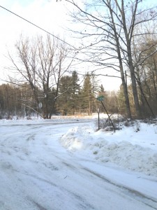
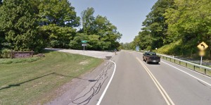
 Schribner and Giles Roads are open from both ends during the summer. The following directions use Giles Rd when comng from the north and west. If you use your GPS, please avoid Schribner Rd from Strutt St. Take Giles instead.
From Springwater: Head south on Rt 15A from the light in Springwater. Take the first left on Marvin Hill Rd. Bear right at the Y onto Strutt St. Continue straight onto Quanz Rd when Strutt St bears right. Quanz Rd is a dirt road. Stay on Quanz Road past Fox Rd. Take the first left turn after Fox Rd onto Giles Rd. (0.7 miles from Strutt St). Follow Giles Rd to the intersection with Schribner Rd. The driveway is on the right about 10 feet past the intersection with Schribner Rd.
From Wayland: From Rt 15, head east on Rt 21 toward North Cohocton for 3 miles. Turn left on Tabors Corners Rd (Steuben Co Rd 37) just before the new bridge. After 2 miles, turn left on Schribner Rd (the second left). The driveway is the 2nd driveway on the left one mile up Schribner Rd and about 10 feet before the intersection with Giles Rd.
From Honeoye: From Rt 20A, head south on Ontario Co Rd 37. At Canadice, turn right to stay on Co Rd 37. Bear left to stay on County Rd 37. Turn left at the stop sign at Canadice Lake Road. Follow Canadice Lake Rd for 2.7 miles to the third stop sign. Turn left onto Marvin Hill Rd. Bear right at the Y onto Strutt St Continue straight onto Quanz Rd when Strutt St bears right. Quanz Rd is a dirt road. Stay on Quanz Road past Fox Rd. Take the first left turn after Fox Rd onto Giles Rd. (0.7 miles from Strutt St). Follow Giles Rd to the intersection with Schribner Rd. The driveway is on the right about 10 feet past the intersection with Giles Rd.
From the East Lake Rd in Honeoye or From Naples: Rather than traveling north to reach 20A or Co Rd 37, hikers from east of Honeoye Lake may go south to Ontario Co Rd 36 and follow Co Rd 36 to Naples. Turn right on Rt 21 south. Turn right to stay on Rt 21 for 4.5 miles to N Cohocton. Turn right to stay on Rt 21 towards Wayland. After 3.8 miles turn right on Tabors Corners Rd (Steuben Co Rd 37). The large sign on Rt 21 says Bowles Corners. After 2 miles, turn left on Schribner Rd (the second left). The driveway is the 2nd driveway on the left one mile up Schribner Rd and about 10 feet before the intersection with Giles Rd. Bear right at the intersection and park.
From Rochester: You may take your choice by going to Wayland, Springwater or Naples and following the directions from there. Rt 15A from South Ave in Rochester to Springwater is very easy, as is I-390 South to Wayland (Turn left when you get off I-390 and follow Rt 21 to Wayland).
From Fairport and Pittsford, we go through W. Bloomfield, picking up Co Rd 37 south of Rt 5 & 20 At Canadice, turn right to stay on Co Rd 37. Bear left to stay on County Rd 37. Turn left at the stop sign at Canadice Lake Road. Follow Canadice Rd for 2.7 miles to the third stop sign. Turn left onto Marvin Hill Rd. Bear right at the Y onto Strutt St Continue straight onto Quanz Rd when Strutt St bears right. Quanz Rd is a dirt road. Stay on Quanz Road past Fox Rd. Take the first left turn after Fox Rd onto Giles Rd. ().7 miles from Strutt St). Follow Giles Rd to the intersection with Schribner Rd. The driveway is on the right about 10 feet past the intersection with Giles Rd.
Finally, for hikers who enjoy maps, it isn’t clear whether Tabors Corners has one or two s’s and if only one where it goes. Google Maps calls the road Tabors Corners Rd in Steuben Co and Tabors Corner Rd in Livingston Co. Bing maps calls it Tabor Corners Rd. everywhere. The Springwater town assessor’s rolls contains all three spellings.
The 1872 county atlas shows P. Scribner living just north of the intersection with Giles Rd. (Of course it is J Guile who lives on Giles Rd)


