About Mark

President of Springwater Trails, Inc

Boughton Park Hike and Kayak – Sunday, August 24, 4:00PM

Boughton Park, located in Bloomfield, has a series of trails around two ponds which used to be the water supply for Fairport. This week, we will explore the park by land and by water.  We will meet at the park entrance on Stirnie Road (42.9377340, -77.4417838).

Kayakers should arrive at 3:45 to allow time to unload boats and carry them to the dock.  Mark will lead the kayakers on the West Pond.  Kayakers interested in exploring the West Pond will head south to check on the pond inlet.  Keep your eyes open for the rope swing on the east side of the pond.  If you are willing to do a short portage, we will head across the pond to the east dock and carry our kayaks about a quarter mile to the East Pond.  We will explore the east pond and then return to the first pond.

Meanwhile, Linda will lead the hikers south around the West Pond.  When they reach the Pond overflow at the north end of the pond, they will cross to the East Pond and circle the second pond, returning to the start point.  The trail is mostly flat, with some steep hills in the south west portion of the park.  Hikers keep the trails open, though poison ivy can be seen on the sides of the trails, so pay attention!

Following the hike, we will have a picnic social at the pavilion at the Stirnie Rd parking area.  Bring a dish to pass and your own beverage (park rules prohibit alcohol and any glass containers – please follow the rules).

Directions:
A self-directed car pool will meet at the Hemlock Lake Park at the north end of Hemlock Lake at 3:00 to leave promptly at 3:15 for Boughton Park.

From Springwater: Follow Rt 15A North to Lima.  Turn right onto Rt 5 & 20 for 7.5 miles.  Turn left onto Cannan Rd.  Continue across Rt 64 onto Bennett Rd.  After 0.5 miles turn right onto CR 39.  At 0.9 miles CR 39 curves to the right.  Bear left onto Boughton Rd, then an immediate left onto Stirnie Rd. The parking area is 0.8 miles on the right.


Schribner and Giles Rd – Summer Directions

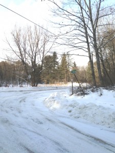
GilesRoadSignSchribner and Giles Roads are open from both ends during the summer.  The following directions use Giles Rd when  comng from the north and west.  If you use your GPS, please avoid Schribner Rd from Strutt St.  Take Giles instead.

From Springwater: Head south on Rt 15A from the light in Springwater.  Take the first left on Marvin Hill Rd. Bear right at the Y onto Strutt St.  Continue straight onto Quanz Rd when Strutt St bears right.  Quanz Rd is a dirt road. Stay on Quanz Road past Fox Rd.  Take the first left turn after Fox Rd onto Giles Rd. (0.7 miles from Strutt St).  Follow Giles Rd to the intersection with Schribner Rd. The driveway is on the right about 10 feet past the intersection with Schribner Rd.

From Wayland: From Rt 15, head east on Rt 21 toward North Cohocton for 3 miles. Turn left on Tabors Corners Rd (Steuben Co Rd 37) just before the new bridge. After 2 miles, turn left on Schribner Rd (the second left).  The driveway is the 2nd driveway on the left one mile up Schribner Rd and about 10 feet before the intersection with Giles Rd.

From Honeoye: From Rt 20A, head south on Ontario Co Rd 37.  At Canadice, turn right to stay on Co Rd 37. Bear left to stay on County Rd 37.  Turn left at the stop sign at Canadice Lake Road.    Follow Canadice Lake Rd for 2.7 miles to the third stop sign.  Turn left onto Marvin Hill Rd. Bear right at the Y onto Strutt St  Continue straight onto Quanz Rd when Strutt St bears right.  Quanz Rd is a dirt road. Stay on Quanz Road past Fox Rd.  Take the first left turn after Fox Rd onto Giles Rd. (0.7 miles from Strutt St).  Follow Giles Rd to the intersection with Schribner Rd. The driveway is on the right about 10 feet past the intersection with Giles Rd.

From the East Lake Rd in Honeoye or From Naples: Rather than traveling north to reach 20A or Co Rd 37, hikers from east of Honeoye Lake may go south to Ontario Co Rd 36 and follow Co Rd 36 to Naples. Turn right on Rt 21 south.  Turn right to stay on Rt 21  for 4.5 miles to N Cohocton.  Turn right to stay on Rt 21 towards Wayland.  After 3.8 miles turn right on Tabors Corners Rd (Steuben Co Rd 37). The large sign on Rt 21 says Bowles Corners.  After 2 miles, turn left on Schribner Rd (the second left).  The driveway is the 2nd driveway on the left one mile up Schribner Rd and about 10 feet before the intersection with Giles Rd. Bear right at the intersection and park.

From Rochester: You may take your choice by going to Wayland, Springwater or Naples and following the directions from there.  Rt 15A from South Ave in Rochester to Springwater is very easy, as is I-390 South to Wayland (Turn left when you get off I-390 and follow Rt 21 to Wayland).

From Fairport and Pittsford, we go through W. Bloomfield, picking up Co Rd 37 south of Rt 5 & 20  At Canadice, turn right to stay on Co Rd 37. Bear left to stay on County Rd 37.  Turn left at the stop sign at Canadice Lake Road.    Follow Canadice Rd for 2.7 miles to the third stop sign.  Turn left onto Marvin Hill Rd. Bear right at the Y onto Strutt St  Continue straight onto Quanz Rd when Strutt St bears right.  Quanz Rd is a dirt road. Stay on Quanz Road past Fox Rd.  Take the first left turn after Fox Rd onto Giles Rd. ().7 miles from Strutt St).  Follow Giles Rd to the intersection with Schribner Rd. The driveway is on the right about 10 feet past the intersection with Giles Rd.

Finally, for hikers who enjoy maps, it isn’t clear whether Tabors Corners has one or two s’s and if only one where it goes.  Google Maps calls the road Tabors Corners Rd in Steuben Co and Tabors Corner Rd in Livingston Co.  Bing maps calls it Tabor Corners Rd. everywhere.  The Springwater town assessor’s rolls contains all three spellings.

The 1872 county atlas shows P. Scribner living just north of the intersection with Giles Rd. (Of course it is J Guile who lives on Giles Rd)

Stid Hill

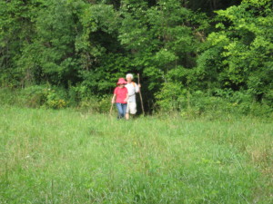
IMG_0680Seven hikers and three dogs climbed Stid Hill on Sunday.  The trail starts through a mowed field and enters forest as the climb begins.  Stid Hill is a steep hill separating Bristol Valley from Canandaigua Lake.

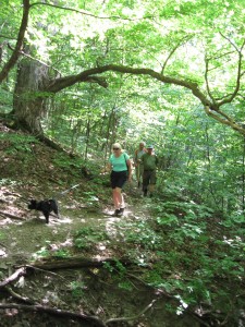
IMG_0673On the way up the hill, the forest was varied and included large oak trees. The ground was quite rocky. As we approached the top, we passed piles of rocks collected at the time that pastures covered the top of the hill. Here the trees were smaller.IMG_0675

The day was warm and hard on the dogs. Fortunately Joan had a water bowl for Skippy and Duffy to share. Still the stream back at the bottom of the hill was a welcome relief for everyone wearing a fur coat.

After the dogs walked through the stream, the hike ended with a bit of acrobatics getting back up onto the bridge.  Burgers were waiting at Lock Stock and Barrel just a mile down the road.

Trail Building at All Western Tree Farm – Sunday July 20 – 4:00PM

Join us on Sunday to build a new trail from the Tree Farm to Liberty Pole Road.  We will use this new trail in September for a hike led by Katherine and Carol exploring possible routes for the Springwater Trail on the west side of town.

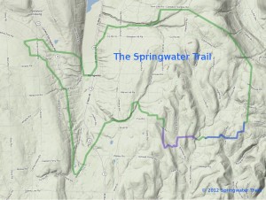
This is a proposed route for the Springwater Trail as envisioned in 2012.  We will be working at the top of the "elephant's trunk".  The final route is subject to change based on landowner interest and physical obstructions.

This is a proposed route for the Springwater Trail as envisioned in 2012. We will be working at the top of the “elephant’s trunk”. The final route is subject to change based on landowner interest and physical obstructions.

Much of the trail is an old farm road used to access the upper part of the farm which has been little used in recent years as additional houses have been built along Liberty Pole Road.  We will do some easy cleanup on the old road including some mowing and weed-wacking.  However, the last 200 yards to the road appears to have never been used as a trail and we will be creating a trail through brush and small trees.  Rick Henchen, our Trail Master, has marked a trail which we will try to follow.

Bring clippers and gloves.  Long pants will be appreciated when you need to get through the brambles.  A weedwacker or power scythe will help clear at ground level.  Big lopper clippers will handle all of the trees we need to tackle. Our goal is to create a trail 18 inches wide at ground level and about 24 inches wide at shoulder height so that walking is easy, but motorized vehicles do not try to use the trail.

We will meet at the farmhouse at 4:00 and split into two groups.  A group of five or six will carpool in a single van up Liberty Pole to the entrance to the trail.  This group will carve out a trail through the brush.  The rest of the group will walk up from the farmhouse to the old road and will clean up the trail with clippers and mowers.  When the two groups meet, we will have a chance to inspect the other groups work before returning to the farmhouse for a cookout.  Please bring your tools, work gloves and beverages and the club will provide the food for the social.

Meet at the All Western Evergreen Nursery and Christmas Tree Farm at 6840 Liberty Pole Rd (42.65101,-77.63767).