
Monthly Archives: May 2014
Sonyea State Forest, 5/4/14
 On Sunday, 5/4/14, 18 energetic hikers showed up at Sonyea State Forest. This was a new location for our group. The sky was partly cloudy and temps in 50s, making for pleasant, almost ideal, hiking conditions. Before hiking, we went, briefly, to a cemetery, across the road from the parking area. During the 19th Century, there was a “home” for epileptic patients, on the site. When a patient died, he was uncerimoniusly buried, with just his patient number to mark his grave. One grave had a stone, with a name, probably put there by the family.
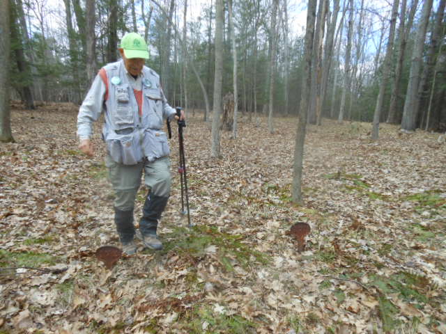
 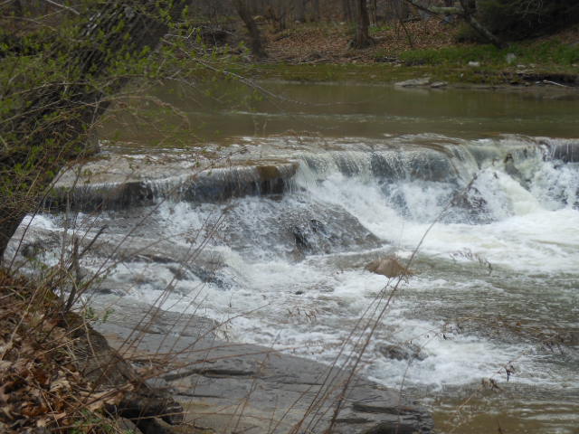 But, we were here to hike. Rick lead the majority of hikers along the west side of the forest, along the Keshequa Creek Gorge, mainly on a trail made from former Pennsylvania Railroad tracks. Scenic rapids and falls in the creek could be seen, as well as canal remnants. Rick deviated slightly from our prehike path, coming out of the gorge, but, all got back well, enjoying a nice Sunday hike, about 4 miles.
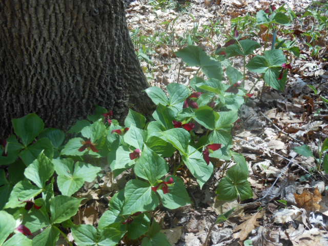
A field of red Trillium
3 of us hung back, starting out slowly, to try to identify the many spring flowers on the trail. Among those in full bloom were hepatica, spring beauty, bloodroot, coltsfoot, blue violets, spring rue, blue cohosh, and both red and white trilliums. Mayapples were identified, but not yet blooming. There were huge expanses of daylilies, not in bloom now, but should be quite a sight in about a month. Spicebushes were in bloom. Too early for mushrooms but many kinds of last year’s polypores were seen. We could have checked out lots more but had to keep moving to complete the 3.7 mile loop before 4 PM.
Our social was a picnic at the parking lot. Turned out to be vegetarian but some very healthy and delicious choices. In our discussion, it was noted how our group uses Sunday afternoons to maintain our health with vigorous exercise, followed by a nutritious and enjoyable meal.
Information on some future events: (keep up to date on our calendar)
Saturday, May 10: We are invited to join the Victor Hiking Group for a hike at scenic Chimney Bluffs on Lake Ontario.
The hike will be 3 to 4 miles on varying terrain. Bring a bag lunch and something to drink. Dress for the weather and wear sturdy hiking boots. Meet in the rear parking lot at Victor Town Hall, 85 East Main Street at 9:00 a.m. to carpool to the trail head. Or meet at the park in the large parking lot off Garner Road at 10:00 a.m. Map
Additional details can be found by calling 585-234-8226.
Sunday, June 1: On our scheduled hike for that day at the north end of Letchworth State Park, co-leader Don has arranged a special tour of the Mt. Morris Dam for our group, at 12:30. A minimum of 20 participants is required. Anyone interested in doing this most informative tour is asked to contact Don at [email protected]. You can also contact Don for information about the hike this Saturday at Chimney Bluffs.
Friday, May 9: Anyone who would like to join Pam, and others, to help clear and work on the Springwater Trail, please come, with loppers and other tools, to the Sugarbush Hollow sugar house at 9 AM.
Someone is still needed to organize the hikes for the summer months of July, August, and September.
Volunteer committees are being organized to maintain the Springwater Trail, and the Letchworth Trail. If you would like to help in any of these endevours, please reply to [email protected].
Mother’s Day Hike – May 11, 2014 1:30 – Springwater Trail
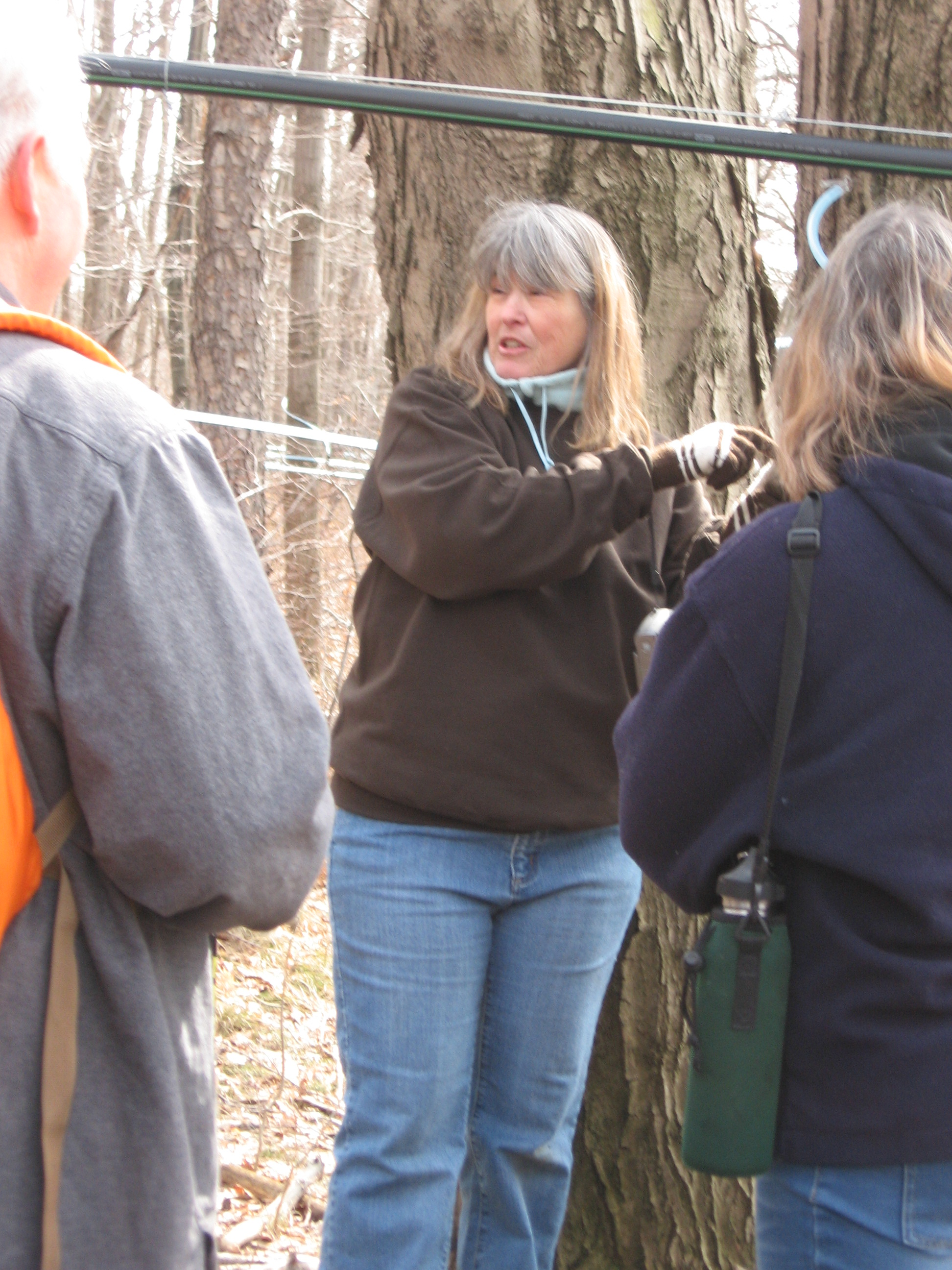
SAP LINES IN SUGARBUSH
It’s Spring and time to revisit the Springwater Trail at Sugarbush Hollow. Bob, Mark, Rick, Ellen and Pam have been busy doing some trail maintenance for our upcoming Mother’s Day Hike on May 11th. We will meet a little earlier at 1:30 at our Springwater trail signs on Pardee Hollow Road, just a little south of the Sugarbush Hollow Sugarhouse and the pond. Springwater Trails, Inc will hold a dedication ceremony honoring two of the founders of Springwater Trail. Howie Harris was the first Chairman of the Springwater Parks and Trails Committee from July 2010 to Dec 2011. Chuck Winship was a member of the committee and was the first land owner to sign a permit allowing the trail to be built through his property. The ceremonial laying of two paving bricks on the trail will be the first of many bricks honoring the supporters of the Springwater Trail.
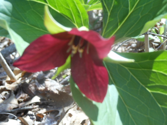
Red Trillium
From Pardee Hollow Road, we will separate into our 3 skill level groups, each taking a separate route to explore sections of the 3.5 mile trail. Colorful Spring woodland wildflowers and wild leeks are prolific, so bring your cameras, and breath mints if you plan on tasting the leeks! New maps of the Springwater Trail at Sugarbush Hollow will be available.
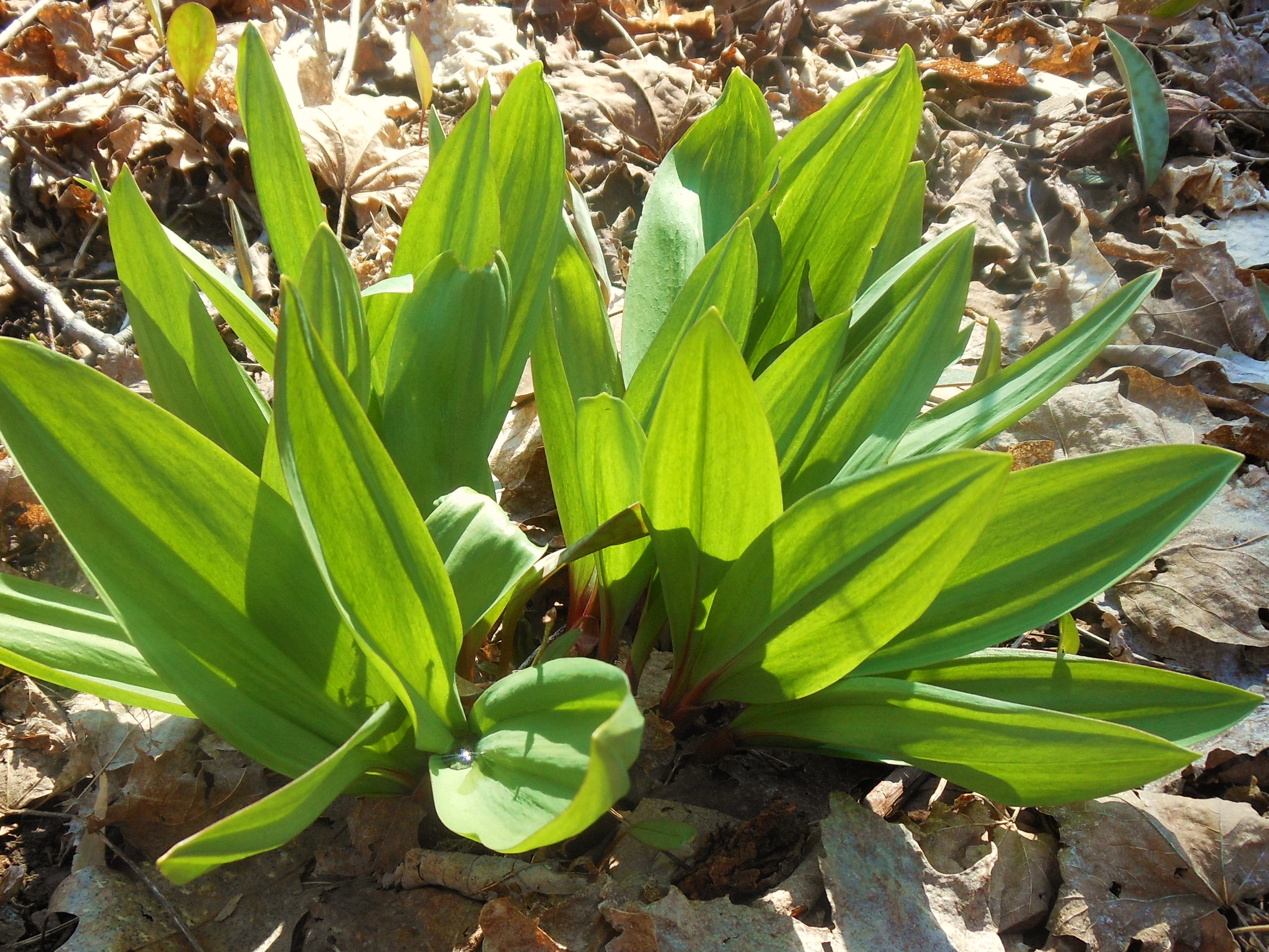
Wild Leeks or Ramps
Naturalists will drive to the top of Coates Road to explore the Trillium Trail, open only from January to September due to the fall deer hunting season. The trail is fairly flat, follows around active farm fields and passes through bordering hedgerows. Many wildflowers at 2000′ elevation will be noted along the way with the highlight of a delightful patch of trillium in the far east section of the trail. Hopefully nature will cooperate this coming week and bring some sunshine to the trillium’s dainty 3 leaves noted this week.
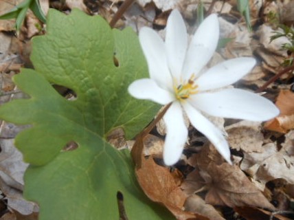
Bloodroot
Tourists will hike the east hill with a rise of 300 ft at the beginning to catch up with the naturalists on the Trillium Trail. The trail will pass through the Sugarbush, noting the rich abundance of wild ramps and spring woodland wildflowers along the way. They will continue down Coates Road to Pardee Hollow Road and if time permits extend their hike up the west hill, and return by climbing another 300, passing through a black cherry and sugar maple plantation planted by Chuck Winship, Bruce Winship, and Pam Masterson in 2005. My, have the trees grown and the cherry trees are in blossom!
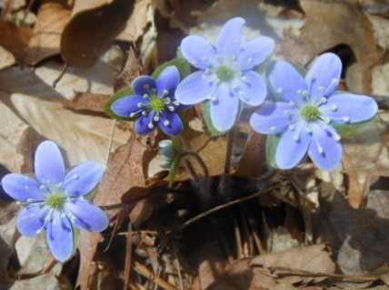
Hepatica
Climbers will hike the entire Springwater Trail at Sugarbush Hollow starting on the west hill by entering the orange farm road trail just across from Coates Road, travel to a pick up point on Tabors Corners Road, then return via the blue trail to the Pardee Hollow Road parking area, picking up the east hill trail, extending to the Trillium Trail and return through the sugarbush to their parked cars on Pardee Hollow. The views at the tops of the hills at 2100′ are breathtaking, farm fields are beginning to be planted, and the forest is alive, fresh and green. Take some time to smell the forest coming alive after a long winter’s nap, note the spring wildflowers, and taste the leeks.
Mothers will be given a break for the social this week after 3 picnic socials in a row. No cooking needed! For especially those female hikers that provide excellent dishes to pass each week, this is a your day off! I thought a minute about having the men cook, but decided a restaurant may be a better idea. We will have our social at 4:30 at the Mountain View in Atlanta where Chicken and Biscuits is their Sunday special if desired. I like their little neck clams.
It’s a good day to hike with your family, so bring your mother, grandmother, children, or grandchildren to share what we are proud to own THE SPRINGWATER TRAIL!
Directions:
From Springwater, take Rt 15A north. Take the first right onto Wheaton Hill Road (Co Rd 16), (sign to Tabors Corners) go to end of road and turn right onto Wetmore Road, go to end of road and turn right onto Tabors Corners Road, turn left on Pardee Hollow road at Punky Hollow lighthouse sign (watch for maple bucket road sign on right), turn right at end of road and follow signs to Sugarbush Hollow, 8447 Pardee Hollow Road. Continue reading
Mt Morris Dam Visitor Center – Directions
The Mt Morris Dam Visitor Center is about 45 minutes from Springwater, so please plan ahead. If you have a GPS, try entering Mt Morris Dam as your destination. Or enter Park Rd or Visitor Center Rd, Mt Morris.
DIRECTIONS:
From Springwater:, Take Rt 15N and then left on Liberty Pole Rd. Stay on that road all the way to Rt63. There, take a left, and a quick right, onto Rt 258. At Rt 36, take a right and proceed to Mt. Morris. Turn left onto NY-408 South.
From Wayland: you can take I-390 north to exit 7. Turn left at the exit on NY-408 S to Mt. Morris. NY-408 goes left at Main St, then right on Chapel St.
From Hemlock and Honeoye: follow 20A West through Livonia and Lakeville to 390S. Exit at exit 7 NY 408 S to Mt Morris. Stay on 408 through Mt Morris.
From Rochester: Take I-390S to Exit 7 NY 408S. Stay on Rt 408 through Mt Morris.
From NY 408 in Mt Morris, Go south on 408 to Visitor Center Rd. Turn right and curve around to the big parking lot at the Dam.