
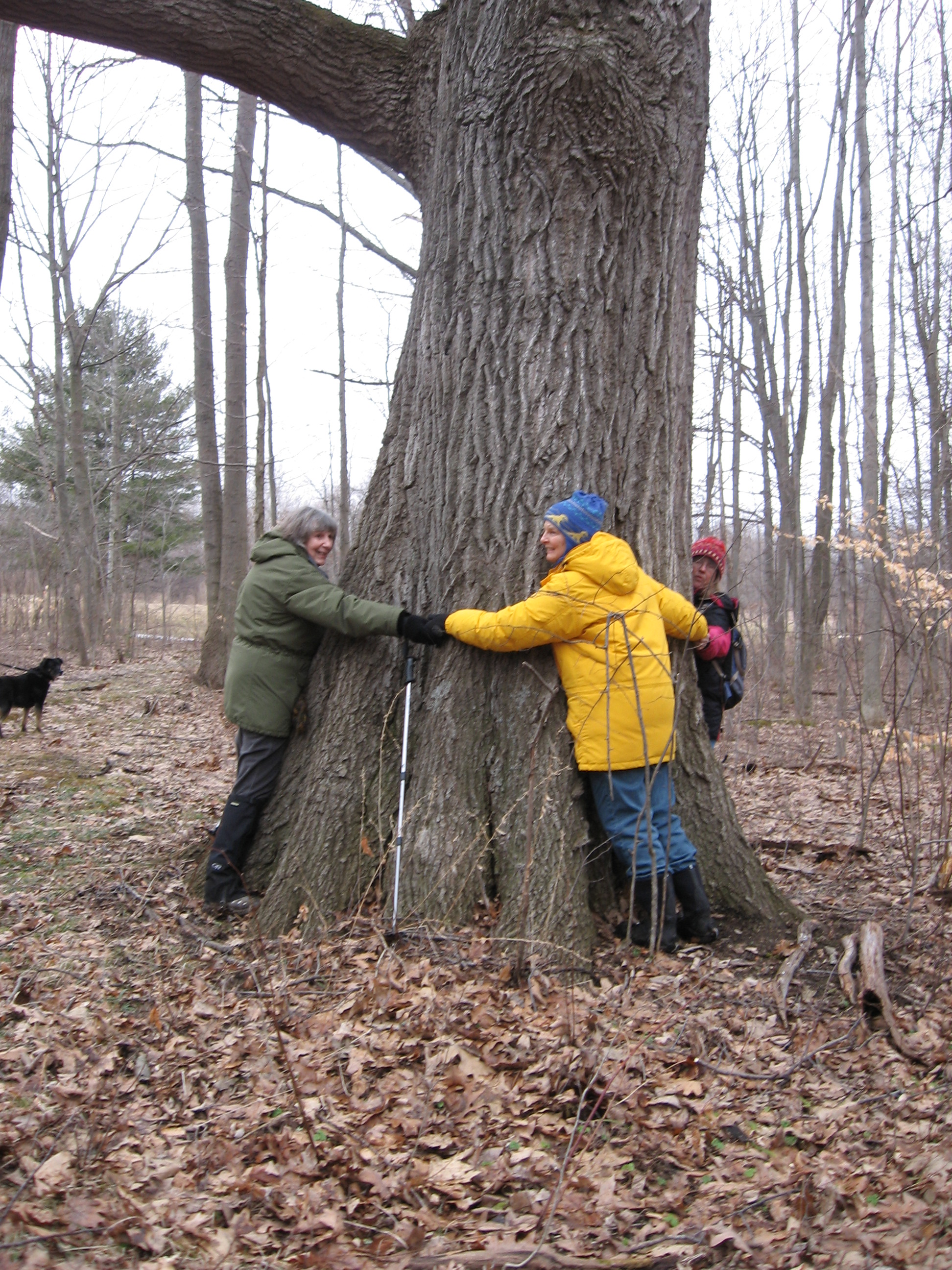
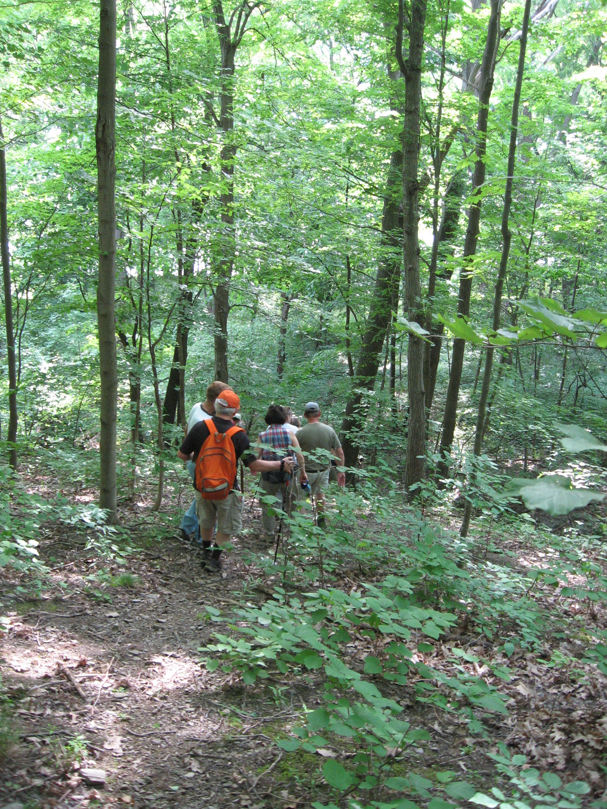
Yesterday (Aug 11, 2013) we had a very good turnout for our hike and kayak. 13 hikers and 12 boaters joined Springwater Trails to enjoy the water and forests of Hemlock Lake. Some hikers walked down the steep Bald Hill from Route 15A to the lake along one of the many gullies that carry the rainwater to the lake. We passed two waterfalls and walked beneath large Hemlock trees. Although the hike required our attention on the steep grades and getting over the logs across our trail, the peacefulness of the woods made for a very good hike. Once we reached the shoreline, we could see the fleet of kayaks and canoes that traveled from the north boat launch along both shores of the lake. The sun was out and the water was clear, making for a nearly perfect day for boating. Meanwhile, the naturalists explored the Hemlock outlet. Gene reports they stopped for a trail-side blackberry snack.
Monthly Archives: August 2013
Stid Hill. Sunday, August 18, 4 PM (42.765404,-77.406227)
Stid Hill WMA is a DEC managed property consisting of two tracts in Bristol and South Bristol. It is another area that was used for pasture and reverted to forest after transportation and refrigeration made it uneconomical for agricultural use, so we will see rock piles and ruins of stone fences and a few large old trees that might have been left in the pastures for shade. 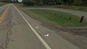 We will hike the North tract and meet at the parking lot on SR64 1.4 miles North of the Bristol Mountain Ski area entrance, or 0.6 mile North of Lock Stock and Barrel. If coming from the North it is a little over three miles south of the Bristol town center which is at the intersection of SR64 and CR32. It’s easy to see, look for the DEC sign on the East side of the road. The parking lot is adequate but not overly large so park with that in mind. There is a Stid Hill South parking lot near the intersection with CR34 which is not where we will be, so don’t go there.
We will hike the North tract and meet at the parking lot on SR64 1.4 miles North of the Bristol Mountain Ski area entrance, or 0.6 mile North of Lock Stock and Barrel. If coming from the North it is a little over three miles south of the Bristol town center which is at the intersection of SR64 and CR32. It’s easy to see, look for the DEC sign on the East side of the road. The parking lot is adequate but not overly large so park with that in mind. There is a Stid Hill South parking lot near the intersection with CR34 which is not where we will be, so don’t go there.As the name implies, it is a hill. The whole trail has roughly a thousand feet of elevation change, but a well designed system of switchbacks was developed by mountain bikers which makes it an easy climb. There is also a part of the trail system that is an old road of some kind, which is steeper. The access trail is not marked by blazes but is clearly defined by use. At the first important fork two colors of blazes appear, Yellow and Blue.
Climbers will hike up the Yellow switchbacks to the intersection of the Yellow trail and the Blue trail, which is an important landmark part way up the hill that I call the Crossroads. They will then take Blue and continue up to the top of the hill and on to a fork where they will turn Left onto Yellow again. After skirting the South and East boundaries of the North tract, Yellow leads back to the Crossroads. Climbers will then turn right onto Blue, go down the steeper and shorter route back to the first fork with Yellow, and take the unmarked fork handle back to the parking lot. This route is about four miles long with close to a thousand feet of elevation, but the mountain bikers have made sure it seems gradual for hikers.
Tourists will go with the Climbers up the switchbacks to the Crossroads, where they have options depending on how much energy they have left. They can take Blue left and back to the parking lot, mostly downhill and the shortest way back. They can retrace the Yellow switchbacks. Or they can stay on Yellow through the Crossroads for a while before backtracking.
Naturalists will have a variety of options including the meadows, Mud Creek, and the relatively flat access trail and lower Blue trail in the woods.
A social will be held at Lock Stock and Barrel, half a mile south.
Directions to Stid Hill are available by clicking here.
Hemlock Lake Hike and Kayak
On Sunday, August 11, Springwater Trails will take advantage of our August weather for a hike or kayak on Hemlock Lake around the North boat launch. Boaters will meet at the North boat launch at 3:30 to unload their boats. Hikers will meet at the Rob’s Trail parking lot at 3:45. An optional social will be at Bob and Joan’s on Old Bald Hill South.
Kayak or Canoe Paddle
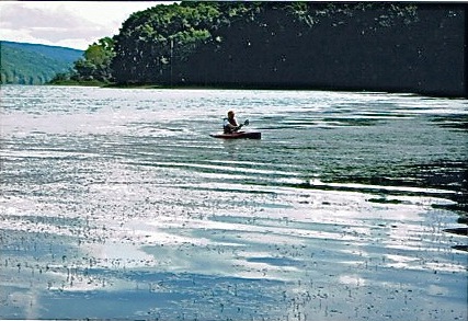 Boaters should meet at Hemlock Lake North Landing at 3:30 to unload the boats. At 4:00, we will paddle south along the eastern shore for an hour then cross to the lake to the western shore and return north until we’re west of the landing then return. We will be meeting the hikers at the landing after the paddle to get them to their cars at Rob’s Trail parking area.
Hikers
All hikers will meet at 3:45 at the Rob’s Trail parking lot at the north end of South Old Bald Hill Rd.
 Naturalist will hike Hemlock Lake Outlet. They will car pool to the Hemlock Lake Park at the north end of the lake where they will start their hike. They will cross Rix Hill Rd to the Hemlock Lake Outlet trail. It should be an easier hike than when we last hiked it in January. Still it will have some hills to cover. The naturalists will return the way they entered.
 Tourist/Climbers will repeat a hike from June, 2012. We will cross 15A from the Rob’s Trail parking lot and follow the Nature Conservancy / Hemlock State Forest boundary down toward the lake. After a few jogs to avoid some gullies, we will descend the ridge of a large gully to the old road along the lake to the North boat launch. Hikers with good memories will recall the first time we did this hike, going up rather than down – it was a tough go, so I’ve heard. Upon reaching the boat launch, the climbers will catch up to the kayakers and canoeists to get a ride back to their cars.
Optional Social
The after hike social will be at Bob and Joan’s on S. Old Bald Hill Rd, just a mile and a half down the street from Rob’s Trail. Bring a dish to pass or donate to the social fund.
Bob and Joan will have a barbecue with turkey burgers, ratatouille and ice cream. Bring your favorite beverage. If you want to drop off a dish before the hike get it to the house by 3:30 so Joan can get to the hike at 3:45.
Directions
Hikers: Click here for directions to Rob’s Trail.
Boaters: Click here for directions to the north boat launch.
Cecropia, a more pleasant moth
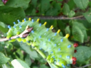
Cecropia Moth caterpillar taken by Pati in Springwater, NY
Here is a picture of a cecropia moth caterpillar, taken by Pati, in her garden. You can tell it’s a caterpillar, as opposed to another kind if insect larva, by the 4 pairs of abdominal prolegs, that it’s using to hold onto the branch. Like all moths, it makes its transformationm from larva to adult inside a silk cocoon. The silk in the cocoon of a certain moth, the silkworm, Bombyx mori, is of high enough quality to make commercial silk.
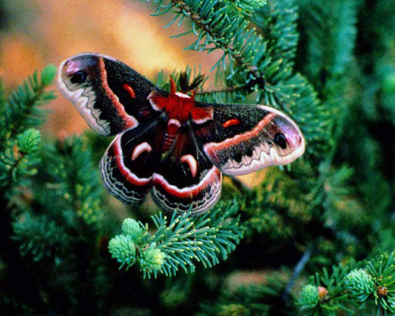 The adult cecropia moth, from the caterpillar in the picture, is quite large and rather nice looking. I have a picture of it in my insect book and can show it to you on a Sunday hike.