Getting to the trail head is kind of tricky. If you are coming from the east (Springwater and Dansville) try Interstate 86 (NY17) to Angelica. If you are coming from the north (Letchworth, Batavia) try Rt 19 south to Caneadea. The turn by turn directions below are from Garrett and Google. Set your GPS for (42.30584,-78.25016) and leave bread crumbs to find your way home.
From Springwater: Take Rt15 south to Wayland. Then right on Rt 63 to Dansville. Turn left on Clara Barton St (Rt 36S) to the carpool spot. Follow the Dansville directions from there.
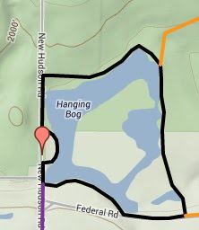
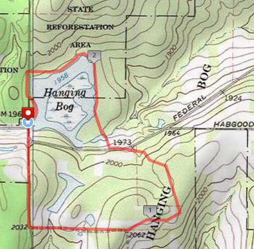
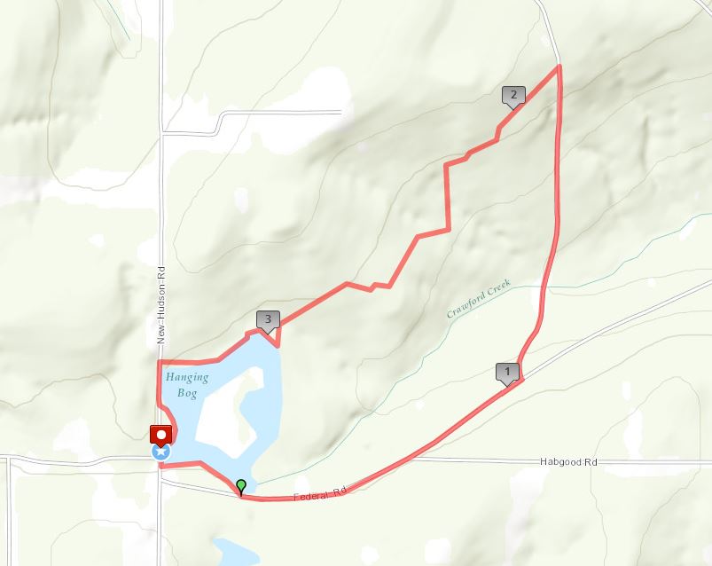
From Dansville: Take Rt36 south under I390 for 13.5 miles to Interstate 86W toward Jamestown. Take exit 31 for Angelica. Turn right (N) on Peacock Hill Rd (0.3mi) then left (W) on Main St. Stay on Main St for 3.8 miles to the end at Rt 19. Turn right (NW) on Rt 19 for 3.1 miles to Rt 305. Follow Rt 305 W for 5.3 miles to Cloverleaf Rd on the right. (If you are on the lookout at mile 3.8, you will see that you cross the Genesee Greenway). Follow Cloverleaf for 1.7 miles, the left on Federal Rd for 2.4 miles, then right on New Hudson Rd. The parking area will be on your right.
Alternate Route From Dansville: Take Rt36 south under I390 for 13.5 miles to Interstate 86W toward Jamestown. Take exit 28 for Cuba. Turn right (N) on 305 (past Murdock’s) for 3.8 miles to New Hudson Rd. The parking area in on your right 2.5 miles north on New Hudson.
From Rochester: Google recommends taking I390 South to Dansville exit 4 Rt 36. Then follow the Dansville directions above.
From Geneseo: The adventurous will follow Google maps to Nunda, then west to 19A and south to Rt 19 and Caneadea. then take a right on Hillcrest Rd. along the South Eastern Shore of Rushford Lake, make a left onto Rush Creek Rd. and follow to New Hudson, turn left (only option) and continue to the parking area and Hanging Bog on the left hand side. If you choose to take I390 to Dansville and join the carpool, it will add about 8 minutes driving time.
Murdock’s Bar and Grill is quite easy to find. Go south on New Hudson Rd for 2.5 miles, then left on Rt 305 for 2.1 miles.