A Hike on the Bristol Hills Branch of the FLT in Naples

The walk this Sunday  will be a hike of our section of the Bristol Hills Branch of the Finger Lakes Trail in Naples. Springwater Trails has signed up with the FLT to maintain this part of the trail.  This segment passes through the West Hill Preserve off Seman Rd and then across private land to Mt Pleasant Street in Naples. The Twisted Branch Trail Run comes over this section later in the year; a couple of hundred runners will be pounding the hill and we want to be sure the trail is safe and fun to run.

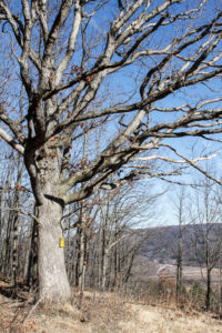
We will walk this stretch of the BHB and cut away any brush and weeds that have overgrown the path. The most useful tools for this are lopers and a small saw. There’s usually several large trees down after the winter; we’ll make a note of these and come back with a chain saw to clear them another day. Be sure to wear good work or gardening gloves. It’s a fairly long hike and steeply downhill at the Naples end of the walk.

The Climbers will walk all the way from Seman Road to the Village of Naples. This is a long walk of about 5 miles and is fairly steep coming down into the village, but the weather looks to be dry this weekend reducing the risk of slippery mud.

The Tourists will hike the section of the trail on Nature Conservancy land, turning around at the FLT sign-in box where the trails moves to private property. This is about 2.5 miles.

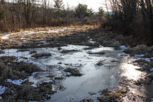
The Naturalists will follow the same trail at least as far as the wetlands, and as much more of the trail as they are comfortable with.
 

We will meet at the entrance to the West Hill Preserve on Seman Road (42.66166, -77.396288). We will shuttle some cars down to the hike end in Naples (42.625950, -77.397304) before we start.


Please note: Dogs are not allowed to hike on the Nature Conservancy property.

Another Note:  When I last looked a couple of weeks ago there were several pieces of heavy equipment blocking the small parking area at the trailhead. If they are still there we’ll have to park along the road. Please park carefully and along one side only – the road is the minimum width a two-lane road can be.


The Social 

The social with be at the Middletown Tavern at 183 S. Main Street in Naples.


Directions to the Hike Meeting Point: 

From Springwater: Head south on NY 15 (for 5.2mi). At the light in Wayland turn left on NY 21N (for 6.7mi). In N Cohocton, turn left to stay on NY 21N (for 4.5mi). In Naples, turn left again to stay on NY 21N (for 1.8mi). On the north side of Naples, turn left on CR12 and head up the hill for 1.9 miles.  Take the first left, Rhine St., to the 4 way  intersection.  Go left onto Seman Rd.  Trailhead is about 1/2 mile, by a big sign on the left. Park along the road.

From Honeoye and Naples: Head south on CR 36 on the west side of Honeoye Lake (it’s 13.6 miles from NY 20A, and 1 mile from French Hill Road). Turn left onto Gulick Rd (for 2 mi), then right on Davis Rd (for 0.7mi). At the end of Davis, turn left on W Hollow Rd (CR 33) for 0.5mi, then right on Seman Rd. The Trailhead is about 1 mile, by a big sign on the right. Park along the road.


Directions to the social: From Seman Road, come down to Route 21 in the Village of Naples and turn right (that’s Main Street going South). The Middletown Tavern is on the left across from the gas station..

High Tor in Early Spring

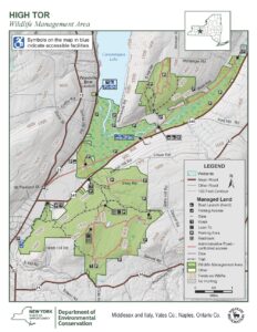
Next Sunday’s hike will take us to this Wildlife Management area run by the DEC Division of Fish and Wildlife for the purposes of conservation and recreation. A “tor” is by definition a hill or mound, therefore not much flatland for hikers. However, I have done my best to accommodate our 3 levels of hikers for this outing.

Meeting Place Large parking area on Basset Rd. Naples. From Rt. 21 in Naples, heading south, bear left on Rt. 53.. In about .75 miles, turn left on County Rd. 21. aka Italy Valley Rd. Basset Rd is a left turn, about 2 miles east. The parking area is on the left, about .5 miles down.

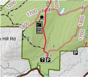
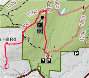
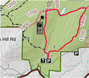
Hiking Groups All hikers will start together on a gravel forest road which leads from the same point in the parking area. We will head north on the gravel road, soon passing through a gate and bear left and pass by two nice ponds, then head uphill on a gradual grade through the woods. When we reach the intersection where the orange trail (the Bristol Hills Branch of the FLT) enters from the left, hikers can split into separate routes.

The Climbers will turn left and follow the orange trail to the first intersection with the blue trail. At that point they will turn to the left to follow the blue trail down to East Hill Rd.  Cars will be waiting to  ferry climbers back to the Basset Rd parking lot.

The Tourists will turn right to follow the gravel road east to a gate, where they will turn right to head back down to the parking lot.

Meanwhile the Naturalists will continue straight on the gravel road. They may continue to the DEC lean to with an overlook of Canandaigua Lake. But the Naturalists should check their watches and turn about to arrive back at the parking lot at around 4:00.

Social Following the hike we will meet at Middletown Tavern on the corner of Main Street (Rt 21) and Clark St. (Co.Rd 36).

Directions: From the intersection of NY 21 and NY 53 at the south end of Main St in Naples, follow NY 53 south for 0.8 miles. Turn left onto Italy Valley Rd (CR 21). In 2.1 miles turn left onto Basset Rd. In 0.3 miles and after the road turns right, the parking lot will be on the left.

Directions to the social: Follow Basset Rd, Italy Valley Rd and NY 53 back to Naples. Continue straight onto NY 21 (Main St). The Middletown Tavern is on the left across from the gas station..
APPRECIATING ENDLESS FORMS

D. Randy Weidner

     March 19, 2023 –  Tomorrow is the vernal equinox, the first day of spring astronomically.  Ecologically, we are still pretty solidly in winter.  We moderns use calendars to mark our way through the year.  Primitive peoples, and those few humans still living indigenous lifestyles, undoubtedly relied on seasonal natural events as well as astronomical observations.  Migrating birds are a natural phenomenon which is readily noticeable, and reflects seasonal change.  With that in mind, I examined one group, the ubiquitous native sparrows, to see what they could tell me about the coming of spring.

     Emberizidae is the scientific term for the family of New World Sparrows, and does not include the introduced House Sparrow (Passer domesticus).  Emberizidae are those little brown birds that are the bane of amateur birders because they are small and blend into brushy backgrounds.  They occupy varied habitats, consuming mainly seeds and insects.  All have the interesting behavior of scratching and hopping backward as they search for food.  Each has a distinctive song.     

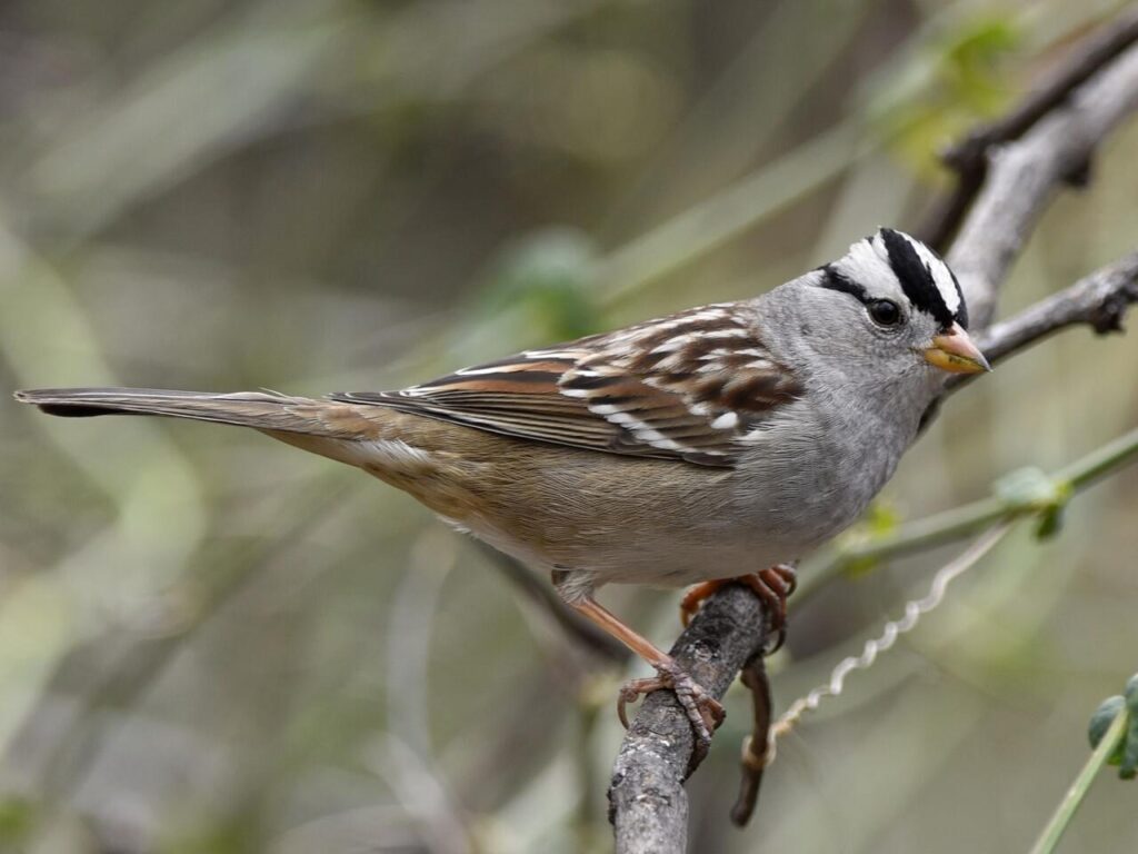
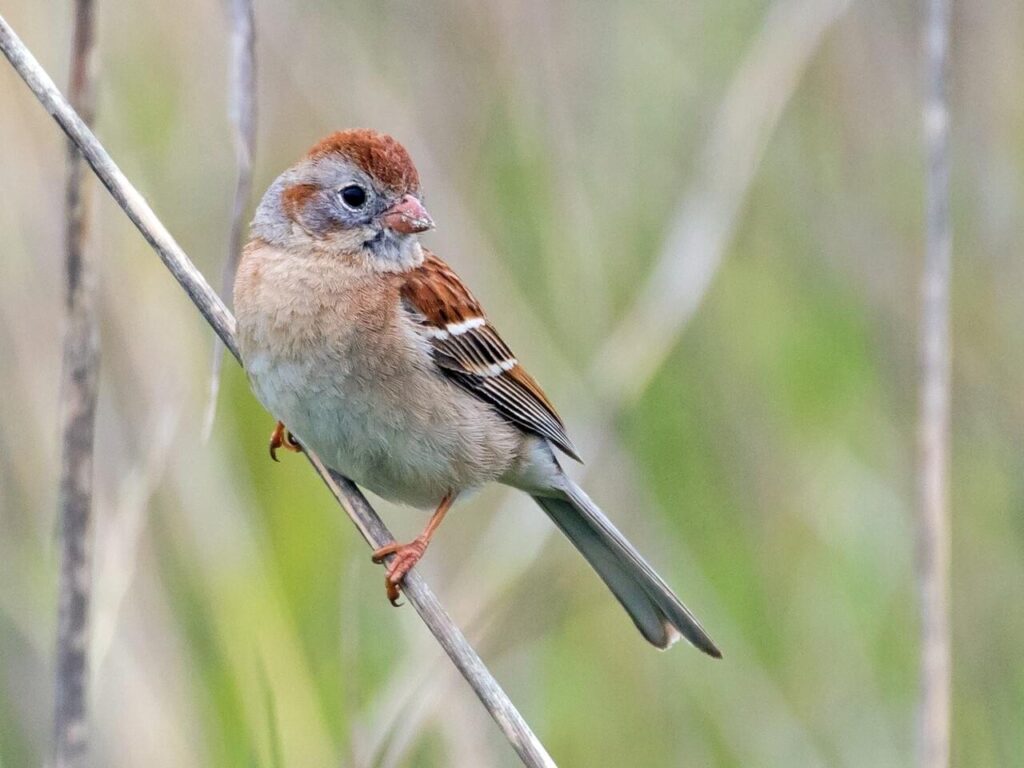
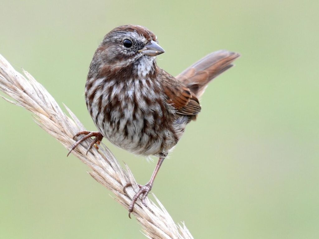
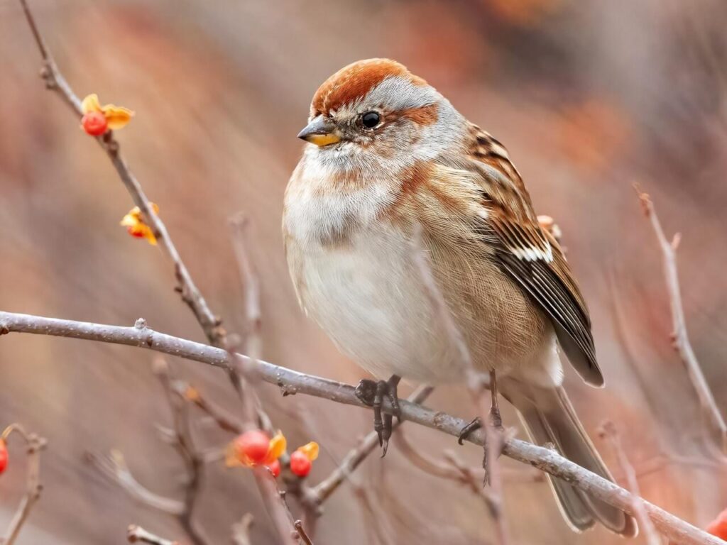
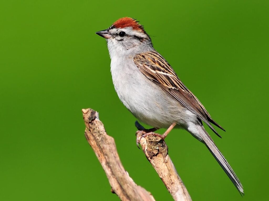
     Here in the Finger Lakes, if you just consider sparrows that come to feeders, there are eight common Emberizidae which are not too difficult to identify visually.  First look at the breast.  If it is streaked, the bird is either a Song Sparrow (Melospiza melodia), or a Fox Sparrow (Passerella iliaca).  Much commoner Song Sparrows usually have a noticeable mid-breast dark spot; while Fox Sparrows are large, distinctly reddish, with gray around the face and head.  If the belly is white, and the rest of the bird gray to black, it is a Dark-eyed Junco (Junco hymenalis).  If the breast is not streaked, but does have a dark central spot, and the upper beak is dark but the lower beak is yellow, it is an American Tree Sparrow (Spizelloides arborea).  If the breast is totally without markings, turn your attention to the head.  If there is a reddish cap, below which is a prominent white streak, and below that a black streak going through the bird’s eye, it is a Chipping Sparrow (Spizella passerine).  If the breast is plain, or even has a tinge of color but not streaked, the head has a reddish cap but the face is gray, and the bill all yellow, it is a Field Sparrow (Spizella pusilla).  If the breast is plain, and there is a white patch beneath the beak, and a spot of yellow between the beak and eye, you have a White-throated Sparrow (Zonotrichia albicollis).  Finally, if the breast is plain, and the head has a thin white cap, bordered by a black streak, below which is a prominent white streak, it is the White-crowned Sparrow (Zonotrichia leucophrys).

     Searching 13 years of my Project Feederwatch data, I found that certain native sparrows reliably reveal spring dates; but others were not helpful.  Dark-eyed Juncos are here all year, so not helpful.  American Tree Sparrows are only around in winter, mostly January and February.  White-throated Sparrows could be here all through feeder season (mid-November through April), and sadly, were more reliably so in the past, but their presence is spottier in the past 3 years.  And Fox Sparrows seem to stop only on migration, either in November or in March, with a rare sighting in January and February.

     However, some other sparrows can signal the month by their arrival.  Song Sparrows only show up at my feeder in March, as they did last week.  The average date was March 14, with the range March 4 to March 28.  Chipping Sparrows arrive in April, the average date being April 10.  That said, I had the very rare sighting of a Chipper in January.  The other April Sparrow is the Field Sparrow, the average arrival date being April 16.  And finally, the White-crowneds always arrive the first week of May; and when they move on, I take down the seed feeders.

     I wonder why these Emberizidae, closely related evolutionarily and in habits, vary in their appearance at my feeders.  Obviously, some have adapted better to winter.  As stated above, these birds eat either seeds or insects.  Regarding those migrators, it would be interesting to discover if the later arrivals are more dependent on insects, which should be more numerous when they arrive.  I would be interested to hear if other feeder watchers had similar observations concerning native sparrows.  Happy birding.   

Greenway RailTrail Hike or Bike, north from Avon

This is a change from the earlier published schedule. The Letchworth Park hike will be rescheduled for a Sunday later in the spring. 

On Sunday the 26th, we will hike or bike on the Genesee Valley Greenway from Route 20 (a.k.a Telephone Road) north to the Erie-Attica Trail and beyond. The Greenway is a level and easy hike, about as well-drained a path as we will find at this time of year, and a new hike for some of us. The Greenway is a public multi-use trail following the route of the 19th century Genesee Valley Canal and the subsequent Pennsylvania Railroad’s Rochester Branch. It currently extends from Rochester to Cuba, NY, with plans for further extension to the south. It generally parallels the Genesee River on the west side. The Erie-Attica is a more recent rail trail including a trestle bridge across the Genesee.

Our meeting place is where the Greenway crosses Route 20, which splits away from Route 5 just west of the Village of Avon. There are Pedestrian Trail crossing signs, and ample parking is available on the north side of the road. All participants will head north, crossing Route 5 and going on to the intersection with the Erie-Attica Trail at 1 mile. Naturalists or anyone desiring a 2-mile hike can return to the start from this point. Tourists or those inclined to a medium length hike can head east on the Erie-Attica Trail for one mile to the Genesee River crossing on the old railroad bridge, then return to the start for a total of 4 miles. Climbers may choose to take in the Erie-Attic and then continue north on the Greenway as far as you choose before returning to the start. Any Cyclists may wish to ride north as far as the bridge and intersection of the Greenway with the Lehigh Valley Trail at 5.6 miles (13.2 miles with return) or all the way to Canawaugus Park in Scottsville and back for a 16.5 mile ride.

Showers are expected on and off for the later part of the week, but the trail is flat and firm, with a new layer of stone dust through most of it. The first mile has a grass and dirt surface.

Social – We will repair for restorative food and beverages at the 3-Legged Pig, 3415 Rochester Road, Lakeville, just north of the main intersection. See food menu at https://www.3leggedpig.com/menu. Beer is also available.

Directions –  From Springwater and points south, take Route 15 north through Livonia and Lakeville to Route 5&20. Go west 3 miles on 5&20 through Avon to the point where Route 20 splits off to the left. Take Route 20 another mile to the Greenway crossing and start of hike. Parking on the north.

From points north and east, take Routes 5&20 heading west to Avon and beyond, forking left where Route 20 splits off from Route 5. In another mile you will come to the trailhead. Parking on the north. If you are coming on Route 390 from Monroe County, get off at Exit 10 and go west toward Avon, then left at the Route 20 split.

To the Social – Head back east on Route 20 and then Route 5&20 through Avon. Take Route 15 south to Lakeville. the 3Legged Pig will be on your left just before the main intersection with Route 20A at Lakeville.