Posted on by

Conklin Gully

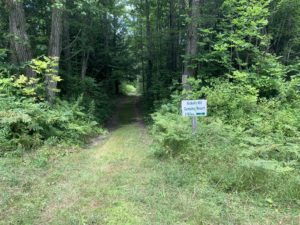
This Sunday, we will meet at the end of Dewolf Rd. Naples, to organize carpooling into HiTor WMA.

GPS 42.617350, -77.321399

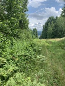
The weather is looking cooler and should be a nice day to see Conklin Gully. Wildflowers are still blooming along the way. 
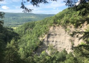
THE CLIMBERS~ Carpool to Parish Hill Rd entrance of HiTor. This is the Blue trail. Continue on the trail to Conklin Gully then bear left uphill to the 4 way intersection and pick up the orange trail, a left turn ending on Brink Hill Rd.The majority of this portion will be a significant climb. Be prepared with hiking poles, water and sturdy boots. After exiting the trail on Brink, turn left, back to Dewolf Rd.

THE TOURISTS~ If we have enough Tourists, you will begin at the Brink Hill Rd entrance to the FLT, a short walk from Dewolf. Dress accordingly for some mud and uneven ground. Poles are a good idea. Follow the Orange trail and at the intersection of the trail and maintenance road, turn right onto the Blue trail and continue mostly downhill bearing right to follow the blue trail to the gully. Continue all the way on the blue trail, over the bridge and out to the Parish Hill parking area.  There will be a car to return you to Dewolf Rd. Simply drive up Parish Hill Rd 1.1 miles, take the curve to the right (DO NOT stay straight, this becomes Lower Rd). At the next intersection, turn left on Shay then right on Brink Rd. Brink runs into Dewolf.

Depending on turnout, we may combine Tourist into Naturalist route.

THE NATURALISTS~ Carpool to Parish Hill Rd entrance of HiTor Blue trail. You will hike to Conklin Gully, enjoy the gully view and creek, then return the same route to the vehicles.

DIRECTIONS~ From Naples, take Main St which becomes Rt 53 South, up the hill. Watch for the Italy Valley sign pointing left. Take Italy Valley Rd  2 miles, turn left at the curve onto Bassett Rd. Proceed 1.6 miles, turn left onto Brink Hill Rd. Continue to the intersection of Dewolf Rd.. Turn right onto the dirt road to the top.

After hike social will be on Dewolf Rd. Please bring a dish to pass or make a $5 donation. Meat provided. Please bring your own drinks.

 

Posted on by

Railroad Bed Trail, Avon

(42.866140, -77.790775)

Join us Sunday for a new venue – an easy stroll with length options from 1.6 to 4 miles on the level and shady Railroad Bed Trail between Avon and Geneseo. The original railroad was built in the 1840’s from Rochester to Nunda as an alternate form of transportation to nearby canals. In 1856 the railroad was purchased by the Genesee Valley Railroad and in 1859 the first train arrived in Geneseo. As gasoline powered vehicles became popular the railroad became unpopular and the last train passed over the line in 1940. Stripped of rails and ties, the land was then sold to adjacent landowners as a trail for recreational use. In 1993, Edward and Jacquelin Harris donated their section of the trail to the Genesee Valley Conservancy to ensure the property would remain a trail for community use.

The GVC Railroad Bed is open daily from sun-up to sun-down for equestrian uses, hiking, running, biking, dog-walking, bird watching, and geocaching. The trail is mostly hard-packed dirt but you may encounter some mud and tall grasses. Please stay on the trail as all other trails you will see running east/west are privately owned. Keep dogs leashed or under voice control and clean up after them.  Don’t forget the usual accessories: bug spray, water, etc. 

The Trail: has three access points. Please park on the side of the road and do not block the trail.

  • Fowlerville Road (Rt 22) – Trailhead sign is approximately 100 ft west of the intersection with Route 39
  • Hogmire Road – Trailhead signs are north and south of the road, approx .5 mile west of the intersection with Route 39
  • South Avon Road* – Trailhead signs are north and south of the road, 1 mile west of the intersection with Route 39

*NOTE: The publicly available portion of the trail ends at a wide grass strip approximately .85 miles south of the South Avon Road crossing. This demarcates an underground pipeline that cuts east/west across the Railroad Bed Trail.

Please do not trespass south of this landmark.


EVERYONE WILL MEET AT 3:45 AT THE SOUTH AVON RD TRAILHEAD, where some of us will then carpool approx 3 miles to the Fowlerville Rd trailhead.

  • CLIMBERS will start out going south and hike as far as the underground pipeline (.85 miles), then backtrack to starting point and continue to the Fowlerville Rd trailhead (2.25 miles) for a total of almost 4 miles.
  • TOURISTS will start from the Fowlerville Rd trailhead and hike to the starting point (2.25 miles) or continue past the South Avon Rd crossing to the southern end at the underground pipeline and back to South Avon Rd for a total of almost 4 miles.
  • NATURALISTS can hike south and back (1.7 miles) or north to Hogmire Rd and back (1.6 miles) or as far as comfortable either direction.

Trail brochure and map:    https://www.geneseevalleyconservancy.org/images/uploads/Railroad%20Bed%20Brochure.pdf

 DIRECTIONS:        

FROM AVON: From Route 20, take Rt. 39 south (Wadsworth Ave) appox 3.6 miles. Turn right onto South Avon Rd and drive approx 1 mile to trailhead.

FROM SPRINGWATER: From intersection of Rts 15A and 15, go west up Rt 15 to Livonia, the left onto Rt 20A to Lakeville. Bear to the right onto Rochester Rd and go approx 1.4 miles and turn left onto Triphammer Rd (Rt 52) until it ends (approx 3 miles). Turn right onto Rt 39 for .6 miles, and then left onto South Avon Rd. Trailhead is about 1 mile ahead.

FROM GENESEO: From intersection of Main, Court, North Streets and Rt 39 (Avon-Geneseo Rd), take Rt 39 north approx 5 miles and turn left onto South Avon Rd. Trailhead is about 1 mile ahead.

SOCIAL: 3 LEGGED PIG BBQ        https://www.3leggedpig.com/menu

3415 Rochester Rd, Lakeville NY 14480 Open Sun 11-8:00 (585) 346-0001

DIRECTIONS TO SOCIAL: From starting point, 1 mile back to Rt 39, then turn right for .6 miles. Turn left onto Triphammer Rd for approx 3 miles. Then turn right onto Rt 256 followed by a quick left at the fork onto Rochester Rd for about 1.4 miles into Lakeville. 3 Legged Pig is on the left just before stoplight.

Posted on by

Hickory Hill – Map 12 – FLT Series #1

The Hickory Hill LeantoThis Sunday we start a series of hikes along the main Finger Lakes Trail between the Bristol Hills Branch and the Letchworth Branch. Previous hikes have followed each of the two branches to the east and to the west of Springwater. This series will connect the two branches along the Main Trail to the south of Springwater.

A word of warning. The trail between the two branches is 78 miles long. With one 4 mile hike each month, we would need 20 hikes to cover every mile, so I expect we will be more selective, planning to explore most of the trail (but not every mile) over the next year.

For this hike, we are offering three routes. The Climbers will start at Access 1 on Sand Pit Rd outside of Bath. They will follow the white blazes for 1.8 miles climbing some 400 feet to the Hickory Hill Lean To, where we will stop for a mid hike social – see below. Following the social, the Climbers will continue north, over Kershener Hill (1820′) to Access 2 where they will use the Tourists cars to return to the start point.(Total 3.1 miles, 550 feet up, 300 feet down)

The Tourists will carpool to Access 2 on Robbins Rd (maybe it is Barrett Rd) and will hike the reverse hike. The trail starts on a farmer’s road which heads up to a large field. Just before the field, the trail goes off to the left. If you get to the field you will see there are no more white blazes, so go back and find the branch. It is a 300′ climb to the top of Kershener Hill. At the LeanTo (1,3 miles from the start) we will stop for a social, meeting the Climbers and exchanging keys. (Total 3.1 miles, 300 feet up, 550 feet down)

It’s very easy to see the start of the side trail down to Hickory Hill Campground.

The Naturalists will start with the Tourists. Following the social, they will continue for 0.2 miles and then will turn right onto a blue blazed trail to follow a pipeline down 0.7 miles to Hickory Hill Campground where they will find a car to return to the start point. (Total 2.2 miles).

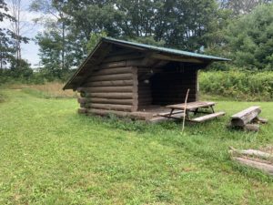
Social. On this hike, we will take advantage of a Leanto and hold our social on the trail. Please bring a sandwich and extra water for yourself. You may also want to carry in some vegetables, chips, fruit or cookies to share – don’t go overboard – you do need to carry your snack in.

Directions:

From Springwater: Take NY-15 south through Wayland to I-390. Turn left to enter I-390 south. In 16 miles, merge onto I-86 East. Take the next exit (Exit 37) for NY-53 Kanona/Prattsburg. Turn right (S) on 53 for 0.6 miles. Turn left onto NY-415 for 1.4 miles. Turn left onto Spaulding Dr, the left onto Harrisburg Hollow Rd. In 0.4 miles turn right onto Sandpit Rd. There is plenty of roadside parking.

The view down to the Hickory Hill CampgroundFrom Naples: There are two routes, either through Cohocton to I-390 or follow NY-53 south:  Head south on Main St in Naples. Just past the Wayside Market, stay straight onto NY-53 for 22.3 miles. After passing under I-86, turn left onto NY-415 for 1.4 miles. Turn left onto Spaulding Dr, the left onto Harrisburg Hollow Rd. In 0.4 miles turn right onto Sandpit Rd. There is plenty of roadside parking. 

From Corning: Take I-86 west to Exit 38 NY-54 Bath/Hammondsport. Turn right onto NY-54 N, then left onto NY-415N for 1 mile. Turn right onto Spaulding Dr, the right onto Harrisburg Hollow Rd. In 0.4 miles turn right onto Sandpit Rd. There is plenty of roadside parking. 

Car Pool from Access 1 to Access 2:Head southeast on Sandpit Rd. At the tee turn right onto Snyder Hill Rd. Continue onto Maple Heights and on down to the stop light at Washington St. At the next light, turn left onto Liberty St. Stay left onto Haverling St toward CR 13. In 2 miles, leave a Naturalist car near the Hickory Hill Campground. Continue north on Mitchellsville Rd for 1.3 miles. Turn left onto Robbins Rd (basically the first left turn). The road makes a right hand turn at the Bath/Wheeler town line.Make a U turn and park on the side of the road. at the start of the trail. The trail is a continuation of Robbins Rd that you came up on.

Posted on by

Hemlock Lake Paddle

Sunday should be another perfect day to be out on the water of Hemlock Lake?  Temperatures in the high seventies and a steady light wind. This week we will meet at the South Boat Launch on Hemlock Lake just miles north of the light in Springwater, and kayak north on the lake.  We will cross the lake and explore the western shore. After an hour of paddling we will recross the lake and follow the eastern shoreline, possibly seeing the hikers. The eagles may even turn out to soar above us.  We will kayak into the inlet until we hit a “tree block”, turn around and come back.  If time we may head north for a bit on the shore of Hemlock Lake.


Attention
: It is highly recommended that you bring sun glassessuntan lotionbug spray and water. It is going to be sunny and there is no shade on the lake!

If kayaking isn’t for you, hikers will enjoy a lovely walk along the lake, heading north from the boat launch. with several opportunities to get down to the lake and enjoy the view of the water and the opposite tree filled shore.  The walk goes along the city’s access road, for about a mile each direction. You will notice many new culverts that have been installed, plus several “fords” where the water is intended to flow directly across the road. The climbers will have the option to continue on along the old road after the end of the maintained road. This involves climbing over fallen trees and possibly one narrow portion before the trail is reduced to about 6 inches wide on the edge of the bank. Total hike about 3.5 miles.

Social: Pot luck social after the hike near the parking lot.  Please bring a dish to pass and your own beverage.

Kayak:  Hemlock Boat Launch:  South end, please arrive around 3:40 to get kayaks in the water

Hike:  Hemlock trail from south end boat launch.

Directions:

From Springwater: Follow 15A North from Springwater for 2.3 miles.  Turn left into the parking area, then an immediate right to head down the access road. In about half a mile, the launch is on the left, and the parking area is on the right. 

From Hemlock or Honeoye:  Follow 15A South for 8.4 miles from the 15A / 20A intersection south of Hemlock.  Turn right into the parking area, then an immediate right to head down the access road. In about half a mile, the launch is on the left, and the parking area is on the right.