Posted on by

FLT Series Hike – Kanakadea

FLT through Kanakadea Park. The FLT (shown in Black) is marked with White blazes on trees, signs or posts.

This Sunday we will follow the Finger Lakes Trail through the Kanakadea County Park west of Hornell.  Last month we hiked south of Howard NY from Hughes Rd to Burleson Rd. The next section of the FLT starting at Spencer Hill Rd and ending on Lain Rd was led by Bill and Pam three years ago, and featured a social at the Cider Creek Cidery. In 2015, Linda led us on the section from Lower Glen Ave to North Hornell. For this FLT Series, we are going to skip to the west of Hornell and enjoy a recent route change for the FLT that takes advantage of park trails through Kanakadea Park. I will leave the previous two sections to leaders who would like to repeat a past hike.

A carpool to this hike will be available from the parking area behind the Firehall in Wayland. The carpool will leave promptly at 1:15.  Following our hike, we will return to Wayland for a Social at the “Belt in the Eye” Diner.

All hikers will meet at the Parking lot in Kanakadea Park.  The Climbers and Tourists will carpool a mile farther down Webbs Crossing Rd to a FLT trail-head parking lot.. We will assign leaders of the Climbers, Tourists and Naturalists at the hike depending on the requested groups.

NOTE: The portion of this hike south of the interstate is fairly flat and would be easy walking in dry conditions. With snow on the soft ground, walking will be slower and more difficult. Traction devices are encouraged, as are walking sticks. The section north of the interstate is a series of steep ups and downs. Special care to avoid slipping will be needed. In addition, the tunnel under the interstate is long and dark. A flashlight or headlamp is recommended for the Tourists and Climbers.  As usual, dress in layers and carry water.

Naturalists will leave directly from the Park lot.

The Naturalists will start from the Park lot and head toward the lake to find white blazes for the FLT. Note that the road goes down to the water, while the trail stays along the edge of the high ground. Follow white blazes through wood and then up and across a field to the park’s Nature Trail. Once on the Nature Trail bear right to stay on the FLT. Once the trail comes out onto a field, hikers may decide to turn around and re-enter the Nature Trail. Following another section of the Nature Trail will return you to the parking area. Based on time, the Naturalists may follow the park road a short distance out of the parking lot, then turn left to continue on the FLT through the campgrounds. Naturalists are encouraged to leave the trail and explore near the lake.

The Tourists will cross Webbs Crossing Rd and follow the FLT within Kanakadea.

The Tourists will carpool to the FLT parking lot on Webbs Crossing. They will start with the Climbers heading out the back of the parking area uphill toward I-86. This will allow the Tourists to see the long tunnel under the highway before turning around and returning to the parking lot and starting to hike toward the Kanakedea Park. Carefully cross Webbs Crossing Rd and follow the white blazes on a mowed path parallel to the road. There is one section that isn’t blazed, but the trail goes to the left and is easy to follow to a gate to the park. (You can first go to the right and walk down to the lake – then return to the intersection and continue). Continue on the park road (there are occasional blazes on posts and the backs of signs). Turn right at the main park road and continue to the cars. As time permits, the Tourists can continue on the Naturalists route to the Nature Trail. [NOTE: If the tourists would prefer more climbing, but a shorter hike than the Climbers, they can follow the Climbers through the tunnel and around the loop, ending their hike at the FLT parking lot. If they do this, be sure to have keys to the cars so you can return to the park after the hike.
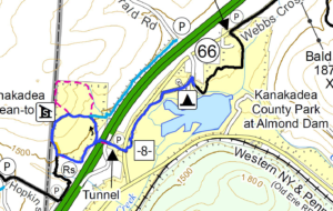
The Climbers will pass through the Tunnel and loop around back the the Tunnel, before following the Tourists through the park.

The Climbers will carpool with the Tourists to the FLT parking lot on Webbs Crossing. They will start uphill through the tunnel to the Senaca County Park on the other side of the highway. At the end of the fences, Climbers will turn right and follow the White blazed FLT. We will pass a Blue spur trail and later the Kanakadea Lean-to each on the right. About 0.3 miles after the Lean-To, we will see large yellow blazes and will leave the FLT when the yellow blazes go off to the left. After returning through the tunnel, we will follow the Tourist route to the Park and the waiting cars.

Directions to Carpool at Wayland Parking (42.568606, -77.590562):

Plan to be at the parking area at 1:00.  We will leave at 1:15 for Hornell.

From Springwater: Head south on NY-15 to the light in Wayland.  Turn right on Rt 63 (W Naples St). In about 150ft, turn right between the Fire House and the Sugar Creek building to get to the parking lot in the center of the block.

From Dansville: Head east on Rt 63 toward Wayland.  Just before the second light in Wayland (at NY-15) turn left between the Fire House and the Sugar Creek building to get to the parking lot in the center of the block.

From Naples and N Cohocton: Head west on NY-21S toward Wayland.  Go through the light at NY-15. In about 150ft, turn left between the Fire House and the Sugar Creek building to get to the parking lot in the center of the block.

Directions to Hike

From Springwater: Head south on NY-15. In Wayland, continue south on NY-21 and stay on 21 for 16.6 miles. Just before Hornell, turn right on CR 66 (Webbs Crossing Rd). (If you miss CR 66, turn right on Airport Rd, or NY-36 N and then take the first left onto CR-66). Continue for 2.5 miles. Turn left into Kanakadea Park. At the fork, stay to the left to the parking lot.

From Dansville: Head south on NY-36 past Stony Brook. In 14.5 miles, pass under I-86 and take the first right onto CR-36. In 2.2 miles, turn left into Kanakadea Park. At the fork, stay to the left to the parking lot.

From Naples and N Cohocton: Head south on NY-21S. In N Cohocton continue straight onto NY-371. At the stop sign in Cohocton, turn right onto Maple Ave. In a half mile, turn left onto Cohocton Loon Lake. Continue straight past the entrance to I-390 where the road becomes CR-121. In 4 miles, turn left onto NY-21. Just before Hornell, turn right on CR 66 (Webbs Crossing Rd). (If you miss CR 66, turn right on Airport Rd, or NY-36 N and then take the first left onto CR-66). Continue for 2.5 miles. Turn left into Kanakadea Park. At the fork, stay to the left to the parking lot.

Directions to Social

Head back toward Hornell on CR-66. Turn left onto NY-21N for 18 miles. In Wayland at the light, turn left on W Naples St, then right onto N Main St. The restaurant is on the right. You can park on Main St, or in the parking area where the carpool started. From the carpool parking, walk out the west entrance to Main St and turn left for the diner.


Posted on by

Wesley Hill Preserve

The hike on Sunday November 10 2019 will be at the Wesley Hill Nature Preserve, a Finger Lakes Land Trust property. The Wesley Hill tract covers 390 acres and includes stands of northern hardwoods, red and white pines, a woodland pond, and the northern edge of Briggs Gully, as well as the Wenrich Cabin, set in an old forest overlooking the gully, deep in the woods. A network of trails through the preserve offers excellent hiking routes of various lengths and levels of difficulty.

The preserve was founded in 1999 by the generous donation of 90 acres by the children of three artists – John Wenrich, James Havens and Colburn Dugan – to the Finger Lakes Land Trust. Since that time, the Land Trust has expanded Wesley Hill to over 390 acres through the purchase or donation of four additional parcels.
We will meet at 1:45 and start our hikes at 2 PM at the Gulick Road parking lot. This access point is on the west side of Gulick Road, 8.2 miles north of the junction with County Road 36 in Naples and 4.6 mile south of the junction with County Road 33 in Richmond.

This hike is being walked in hunting season, and many of the western trails are closed to hikers. Please respect all closure signs – there may be hunters out there and they won’t be expecting hikers in the woods. WEAR BRIGHT COLORS! Hunters can wander off course too; it’s important not to look like a deer!

The Hike:

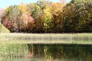
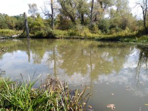
All hikers will start together on the red trail until we reach Anna’s pond (which is pictured above). Then….

NATURALISTS will walk around the pond as far as the trail allows, and then walk back to the start point. This is about 1 mile total.

TOURISTS will walk back to the junction with the green trail where they will turn right. They will follow the green trail about 0.2 miles to a junction of the returning red trail. They will turn left on the trail and walk 0.8 miles to the start point. The whole walk is about 1.6 miles.

CLIMBERS will take the red trail counter-clockwise around the tract. At the Wenrich cabin we will take a short extra walk to the overlook, and then back on the red trail to the start point. This hike as about 2.8 miles. If the weather is fine and we feel like walking a little extra we can turn right on the orange trail not long after we pass Anna’s Pond. This will take us on a loop through the northern parts of the tract until it ends at the yellow trail. Here we MUST turn left and follow the yellow trail back to the red trail to continue the hike. We will rejoin the red trail about 0.6 miles from where we left it. A right turn on the yellow trail would take us into hunting territory. If we take the orange trail then the total hike is about 3.8 miles.


The Social:

Following the hike, the optional social will be at the Neapolitan Pizzeria at 120 N. Main Street in Naples.


Directions to Gulick Road Trail Head:

From Honeoye take route 20A east through Honeoye to East Lake Road (CR-33). Turn right onto East Lake Road. Take first left, staying on CR33, then the first right onto Pinewood Hill which becomes Gulick Road. Travel 4.6 miles. The parking area is on the right.

From Springwater Head north on Rt 15A toward Hemlock. Just before Hemlock turn right on Rt 20A. Follow Rt 20A to Honeoye and the follow directions above.

From Naples From the southern end of Naples at the Middletown Tavern, head north on County Rd 36 (also called Hunt Hollow Road and Clark Street). Follow County Rd 36 for 1.2 miles to the first right turn on Gulick Road. Follow Gulick Rd for 8.2 miles. The parking area is on the left.


Directions to Neapolitan Pizzeria:

From the Gulick Road parking lot turn right and follow Gulick Road downhill until it ends at County Road 36. Turn left on County Road 36 (still going downhill) until this road ends at Naples Main Street (also called NY 21). Turn left. The Neapolitan Pizzeria is about half a mile away on the left hand side of the road, next to Artizan’s gift shop. It a fine Victorian house set back a little from the road.

Posted on by

Stoney Brook State Park

SPRINGWATER TRAILS HIKE FOR 2:00pm (try to arrive at 1:45PM), Nov.3rd , 2019
LOCATION: Stoneybrook State Park

HIKE DISCRIPTION: Hikers will split into three groups but essentially walk the same trail. Each group will walk at thier own pace. Climbers and Tourists will start from the snowmobile trail off RT 36 at the lower park entrance and climb along the eastern trail working thier way up to the upper park and then crossing over StoneyBrook Creek to the west side of the park and continue down to the lower park parking lot.

The Naturalists will car pool to the upper park and walk toward StoneyBrook Creek and cross over to the east trail and work their way down the snowmobile trial that the climbers and tourists climbed up. Once at the bottom, they will walk to the lower parking lot.

Most of the trail is up and down hill at the beginning and end of the hike but, levels off in the upper park. Trails are most likely going to be wet and slippery so poles and traction devices or good treaded hiking boots are recommended.

RECOMMENDATIONS: Dress accordingly, multiple thin layers(synthetic under layer, fleece 2nd layer. light shell 3rd layer; avoid heavy parka’s.

After hike social: Will be the Sunrise Restaurant on the North end of downtown Dansville.

DIRECTIONS : From Downtown Dansville take RT.36 South for about 4 miles. Turn left into Stony Brook State Park. Drive to the main parking lot where we will divide into our three groups.

Posted on by

Patriot Park

We will visit and hike a little-known gem nestled in the town of Bristol – Patriot Park – this Sunday. Patriot Park was acquired as a donation from Ontario County by the town of Bristol. The park spans 12.6 acres and is located on the south side of CR 32, just west of Mud Creek. Due to generous donations of a picnic table, many benches along the way, and much time and labor the park’s trail system is well-equipped and easy to navigate.

There are four small trails winding into each other for a total of just over 2 miles. This is an easy walk – most of it is flat with the exception of the Uplands Trail, which is a gentle slope of about 5 minutes in length.

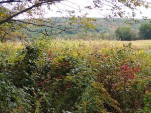
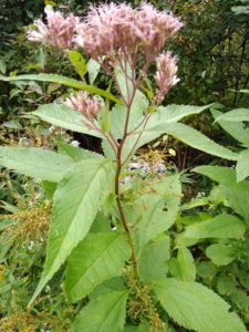
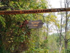
We will all do the same hike, meeting in the parking lot in adjacent Levi Corser Park and walking from there to the 3rd trail entrance to Patriot Park, west of Mud Creek. We will head to the Uplands Trail Loop for a lovely view of an open field on CR 32, then head north, then east, to a small pond. Walking north along the creek we will cross the creek right before the road and enter the Codding Conservation Area on our return. This is a pristine woodlands with no new plantings in the last 50 years. There are many wildflowers, trees, the creek and numerous wildlife including a wide array of songbirds, butterflies and deer.

We will also see some interesting ‘found objects’ art displays and natural benches, in the form of trees, along the way and will exit at the first trailhead for Codding Conservation Area, then head back to the cars.

Anyone wishing to extend the hike can walk the track around Levi Corser Park and then walk on to an old cemetery nearby on the east side of Route 64 and explore that. Depending on the weather we will either have a picnic social at Levi Corser Park or travel to Lock, Stock and Barrel, a few minutes drive down Rte 64. There is a pavilion at Levi Corser Park, with several picnic tables, attached to a building so it is open on three sides. There is one grill for use. There are bathrooms with running water on site.

DIRECTIONS TO HIKE: FROM THE WEST: TAKE RTE 20A EAST TO CR32 (WIZARD OF CLAY ON CORNER). RIGHT ONTO CR32, LEVI CORSER PARK IS ON THE RIGHT SIDE. FROM THE EAST: TAKE CR32/BRISTOL ROAD WEST, CROSS RTE64, LEVI CORSER PARK IS ON THE LEFT. FROM THE NORTH: TAKE RTE 444 SOUTH TO BLOOMFIELD, TURN LEFT ONTO RTS 5&20, TURN LEFT ONTO RTE 64, LEFT ONTO CR32. FROM THE SOUTH: TAKE RTE 21 TO CR 12, LEFT ONTO RTE64N, LEFT ONTO CR32.