Posted on by

Hemlock Lake Beach Hike, Springwater

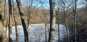
This Sundays will be the first “Springwater Trails” hike of the new year.  We will all meet at the DEC parking lot right off Rt. 15A. This will be a “out and Back” hike along the access road to the south boat launch and continue on along the south trail for about 700 feet at which time the hikers will have a choice to continue along the south drop down to the shoreline and hike the shoreline for 45 minutes at which time hikers can exit back up to  the south trail.  This will bring the hikers back up to the end of the maintained portion of the south trail. Climbers may wish to explore beyond this point. .At this point, hikers can return back to the parking lot along the south trail and boat launch access road.

All three groups can follow the same routes and adjust their hike according to their capabilities. The shoreline hike is fairly easy  with very little obstructions. There are a few small water runoffs along the edge but were manageable at the time of this writing. Hiking poles are recommended and traction devices may only be necessary if the shoreline becomes icy. There are other exit points along the lakeshore for hikers if they wish to terminate the shoreline hike,

DIRECTIONS

;From Rochester: Take  Interstate Rt. 390 South to Avon exit and turn left onto Rt. 5/20.  Drive east for about 4 miles into Lima  and turn right onto Rt. 15A. Continue south on 15A for several miles to the south boat launch DEC Parking lot,

From Naples :      Take Rt, 21 south to North Cohocton and turn right staying on Rt. 21 to Wayland. Turn right at red light and head north on Rt. 15A for about 8 miles. The DEC parking lot will be on your right.

From Dansville :   Take Rt. 63 south to second red light and turn left onto Rt. 15A. Drive about 8 miles. DEC parking lot will be on your left.

Posted on by

Abraham Lincoln Park November 22

Please note this hike will begin at 1:30, as the Park closes at 4:00.

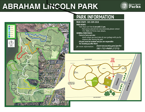
This Sunday’s hike will introduce us to new territory.  Abe Lincoln Park is 182 acres of lovely trees, located along the southeastern shore of Irondequoit Bay, in the town of Penfield.  It is an oasis nestled within a bustling commercial and residential area.  The trails meander through several small glens or gullies and in places afford lovely views of the bay with its resident swans.  It is a very popular destination for families, as there are several play areas for children in the front area.  The hiking trails extend into the woods beyond the playgrounds.  The parking area on Empire Blvd is small, 20 vehicle capacity.  There is another parking area at the north end,]. If needed we could relocate the start of the hike to there.  The trails are rocky in places with some steep sections.  Sturdy hiking shoes/boots  and poles are advised.

Map of trails in Abraham Lincoln ParkAll hikers will begin from the same point of the main trail (white trail) which is well blazed. Depending on the number of folks and ability levels, we will branch out from this trail onto some of the secondary trails. Trail maps will be provided to the leader of each group. Naturalists will want to take a slower pace on a shorter route out to the edge of the bay on the Green Trail, less than 2 miles. Tourists may decide to go the length of the White Trail, at a slower pace than the climbers, 3miles. Climbers will go the full length of the White Trail plus explore some of the Red and Orange Trails, about 4 miles.

Social  For those who wish to gather in the parking area after the hike, please bring your own snacks and  beverages.  Social distancing will be observed and masks should be worn.

Directions Follow 590N  to the Empire Blvd exit.  Go east on Empire Blvd., pass Irondequoit Bay then uphill to Abraham Lincoln Park on the Left near Daytona St.

Posted on by

FL Trail Hike

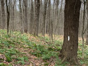
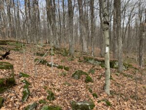
The trail is well blazed, but otherwise hard to distinguish from the rest of the forest.

Last month we hiked the Finger Lakes Trail in Bully Hill State Forest on a blanket of newly fallen fall foliage and enjoyed the beautiful colors.  This month we are moving north to the Klipnocky State Forest, but all the leaves have lost their colors. Yet, the forest is still interesting and it is fun to be able to see through the trees to the ridges across the valley..

Note: Bow season is open, so an orange vest and hat are recommended.

Our hike will be an out and back, partly to avoid car pooling during COVID and partly because the roads inside the state forest aren’t great on you car.  All hikers will meet at the end of Klipnocky Rd where it connects to Bill Morris Rd and Roots Rd. These roads inside the state forest are seasonal and not real good.  Good clearance on your car is recommended.We should be able to park along Bill Morris Rd.

FLT Register at the stream crossing.

We will head west on Roots Rd to where the trail enters the forest on the left side of the road. The trail goes down to a creek and a register. The trail then has a slow climb along a well blazed trail to a dirt road. At this point the Naturalists can turn right and follow the road back to the cars.  The Climbers will continue across the road for 3/4 of a mile where the trail starts down the remnants of an old road that becomes Gas Springs Rd in a half mile. This is a good spot to turn around because the old road is quite rough for walking. When we get back to the real road, the Climbers can either turn right and follow the road to the cars, or continue straight across the way they came.

Following our hike, we will have a simple social by the pond at our parking area.  Please bring a sandwich or snack, and a beverage for you and your family. Also, bring a chair if you would like to rest!

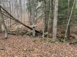
Finger Lakes Trail in Klipnocky State Forest, showing the blazing work.

How many blazes can you see?

Please note that this trail is rocky, so you will find yourself watching your feet most of the time.  Stop occasionally to look around and see the forest.  Also, watch the blazes to stay on the trail.

Directions:

Since many hikers have never been to Klipnocky State Forest in Almond, NY, we will offer a caravan option from the parking lot behind the Firehall in Wayland.  Plan to meet at the parking lot at 1:00. We will leave promptly at 1:10. Because of COVID, we are not encouraging carpooling, but we can follow one another.

Meeting location in Wayland: From the intersection of NY 15, NY 21 and NY 63 in Wayland, head west on NY 63. At the Firehall, turn right the gas station and the Firehall to the public parking lot behind the firehall. From N Main St, you can enter the parking lot along the north side of the Belt in the Eye Diner.

From Wayland and Dansville: Head west on NY 63 from Wayland to Dansville. Turn left onto Clara Barton St (NY-36S). Continue on NY-36 for 7 miles to the light in Arkport.  Turn right on West Ave. after the railroad tracks, turn left on CR 67 (Bishopville Rd), which becomes CR 32 in Allegany Co.  In 2.9 miles from Arkport, Bishopville Rd will turn left, but you should continue straight on CR 32. In another 1.8 miles, turn right on Brown Rd. At the end turn left on Klipnocky Rd.  At the tee, turn right. Park near the next intersection,


Posted on by

Winter Hike on the All Western Evergreen Farm in beautiful Springwater NY

You are invited to hike on private land near the Northwestern corner of Springwater on the 248 acre All Western Evergreen Nursery & Christmas Tree Farm owned by Katherine Humphrey and daughter, Jerrianne Scheiderich.  The entrance to the farm is at 6840 Liberty Pole Road (County Road 38, 1 mile from State Route 15 between Springwater and Webster’s Crossing).  It is well marked and is on the high side of the road.  There is parking to the left of the driveway opposite the Morton Building.  Please follow the orange cones and park facing Liberty Pole Road.  The hike on Sunday, February 14th will begin shortly before 2 PM.  Arrive early for instructions.  Hikers will be divided into Climbers, Tourists, and Naturalists.

Mark will lead the Climbers on skis around the perimeter of the upper field.

Melissa will lead the Tourists on snow shoes or winter boots up to the top of the farm and around the various fields and through the cathedral pines.

Katherine will be leading Naturalists, starting around the back of the house and proceeding up the road to the fields..

On the hike, expect winter conditions. With the snow about 15 inches deep and quite light, skis and snow shoes can be used. There will be a few snow shoes available for hikers who want to try them. Dress warmly and bring water, poles, and snacks, as desired.  Masks and social distancing are requested.  Walk carefully since stones, drifts, woodchuck holes, brush and stumps may lie under the snow.  We will crisscross the farm from behind the residence to Story Road, Swartz Road, and/or Liberty Pole Road.  It is about 1 mile across the farm in either direction; about 4 miles around the perimeter.  The nursery beds and several exotic trees are near the residence.  There is a leisurely incline from 1200 to about 2000 feet and back.  The tree farm was started in 1968, making 2021 the 53rd year of planting trees.  Participants may like to notice the many different species of Christmas trees planted and the animal tracks to ID.  Please stay on trails to avoid trampling seedlings that may not be seen under the snow. You will see hardwoods, a red pine forest (cathedral pines planted over 75 years ago), Christmas tree plantations (some trees up to 35 feet tall), a pond, wet areas and open fields and a gorgeous view from the hill tops toward East Springwater.
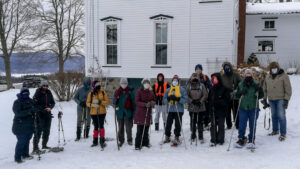
After the hike, a choice of hot, take-out, home-made soups by donation will be available.  Bring a folding chair if you wish to stay and converse outside depending on the vagaries of nature.

Directions: NOTE: If you are following your GPS to today’s hike, check that your directions actually go to Liberty Pole Road. If your route ends on Schwartz Rd, you will find you are a long way from the parking area you are looking for!

From Springwater: Go west from the Springwater light on Rt 15 North.  Just past the top of the hill, turn left on Co Rd  38 (Liberty Pole Rd).  The farm is on the left 1.1 miles from Rt 15 at 6840 Liberty Pole Rd.

From Geneseo: Go south on NY 63. About 6.4 miles after passing Rt 408, turn left on County Road 1 at Groveland.  This road becomes CR 1A at Scottsburg (rt 256) and then Liberty Pole Rd (CR 38).  It is 7.1 miles from Groveland to the All Western Evergreen Tree Farm.

From Honeoye: Take 20A west to Hemlock and 15A south to Springwater.  Then follow the Springwater directions.

From Rochester: Take I390 south to Exit 9 (NY 15 / Lakeville).  Turn left onto NY 15 and follow Rt 15 through Lakeville and Livonia (16.5 miles).  Just past Webster’s Crossing stay straight on CR 60 when Rt 15 bears left.  Take the first right off CR 60 onto Liberty Pole Rd (CR 38). The farm is on the left at 6840 Liberty Pole Rd.