Posted on by

Stony Brook State Park

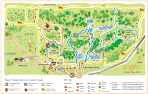
Climbers and Naturalists:  We will meet at the South (Campground) Entrance to the park and split into two groups (Climbers and Naturalists).  Climbers will hike in a loop around the entire park using the East and West Snowmobile Trails.  There are some significant up hills and down hills on this route which is about 3.5 miles total.   Naturalists will hike to the south out and back on a park access trail through the woods and then through the campground and down to the creek for a total of several miles.  There are large oaks, white pines and other impressive trees on this route.   Although it goes without saying – all hikers should carry drinking water.

Trail Closures: Please note that the Gorge Trail and the East and West Rim Trails are currently closed to the public.  According to the Assistant Park Manager the Gorge Trail is not expected to be opened until late May because they need to complete scaling the stone cliffs in the gorge, and the East and West Rim Trails are not expected to be opened until sometime in mid April because they are working on replacing some of the stairs on these trails.

Social: If the weather is favorable and you would like to meet for an outdoor social in the park after the hikes, plan on bringing your own sandwich and drink.  Drive the mile or so to the North Entrance and the first ones there should get a picnic table or two near the Clara Barton Shelter.

Directions:  From the Village of Dansville drive south on NYS Route 36 south towards Hornell and go past the North Entrance to the park.  At the top of the hill take the first left onto Co Rte 47.  In a short distance, take a quick left into the South Entrance.  Park near the Camp Office without blocking the drive.


Posted on by

GCV Nature Sunday Experience

PLEASE NOTE START TIME of 1:30. Since the Museum closes at 4:00, we are going to start earlier to allow time to fully enjoy the grounds without rushing.

Genesee Country Museum is the Largest Living History Museum in New York State.  This Sunday’s hike we will be exploring the Nature area of the Museum.  We will be hiking the Perimeter Trail and the Geology Trail which has guides to the unique geological features of the area.   There are other trails available which may be explored as time and conditions permit.  With rain in the forecast for the morning of both Saturday and Sunday, the possibility of skiing and snowshoeing seems unlikely.  However, you may check the Museum hotline for the latest trail conditions at 585-295-8262.

Walks through the village streets are available.Also available is access to the Village.  Although buildings are not open, you are welcome to walk the streets which are plowed and maintained.

There is a suggested donation of $5 per person which will be covered by the Springwater Trails.  Your membership to the group allows us to cover this cost.  Thank you.

There will be no social this week but may be happening in the near future.

Directions:

From Springwater: Head north on NY 15A to Lima. Turn left at the light onto US 20/NY 5 west. Stay on 5 & 20 though the traffic circle in Avon. After crossing the Genesee River, stay on NY 5 when US 20 turns to the left. At the small traffic circle in Caledonia, continue straight onto NY 36 (this is the 2nd exit from the traffic circle; NY 5 continues at the 3rd exit). In 1.4 miles, turn left onto George St (the street to the right is State St). The road bends to the right and changes its name to Flint Hill Rd. In a total of 1 mile from NY 36, you will see a large sign for the entrance to the Genesee Country Village and Museum on the left. Continue through the main parking lot, following the road as it turns left. Turn right when you see a sign for the Nature Center. There is a circle with parking all around it. We will meet in the parking lot near the walk to the Nature Center.

From Naples: Follow CR 36 (Hunt Hollow Rd) north to NY 20A in Honeoye.  Turn left on 20A to Hemlock. From Hemlock head north on NY-15A to Lima. Turn left at the light onto US 20/NY 5 west. Stay on 5 & 20 though the traffic circle in Avon. After crossing the Genesee River, stay on NY 5 when US 20 turns to the left. At the small traffic circle in Caledonia, continue straight onto NY 36 (this is the 2nd exit from the traffic circle; NY 5 continues at the 3rd exit). In 1.4 miles, turn left onto George St (the street to the right is State St). The road bends to the right and changes its name to Flint Hill Rd. In a total of 1 mile from NY 36, you will see a large sign for the entrance to the Genesee Country Village and Museum on the left. Continue through the main parking lot, following the road as it turns left. Turn right when you see a sign for the Nature Center. There is a circle with parking all around it. We will meet in the parking lot near the walk to the Nature Center.

From Dansville: Take I390 north to Exit 7 NY-408. Turn right on NY 408 and continue straight onto NY-63. In 3.3 miles, before Geneseo, turn left to stay on NY 63. In 17 miles, turn right onto Retsof Rd. In 8.6 miles, at the tee, turn right onto NY 36N. In 8.6 miles at the intersection with NY 5, turn right to stay on NY 36. Take the first left onto Spring St. At the end of Spring St, turn left onto George St. The road bends to the right and changes its name to Flint Hill Rd. In a 0.9 mile from Spring St, you will see a large sign for the entrance to the Genesee Country Village and Museum on the left. Continue through the main parking lot, following the road as it turns left. Turn right when you see a sign for the Nature Center. There is a circle with parking all around it. We will meet in the parking lot near the walk to the Nature Center.

From Canandaigua: Follow US 20 / NY 5 West through Avon. Stay on 5 & 20 though the traffic circle in Avon. After crossing the Genesee River, stay on NY 5 when US 20 turns to the left. At the small traffic circle in Caledonia, continue straight onto NY 36 (this is the 2nd exit from the traffic circle; NY 5 continues at the 3rd exit). In 1.4 miles, turn left onto George St (the street to the right is State St). The road bends to the right and changes its name to Flint Hill Rd. In a total of 1 mile from NY 36, you will see a large sign for the entrance to the Genesee Country Village and Museum on the left. Continue through the main parking lot, following the road as it turns left. Turn right when you see a sign for the Nature Center. There is a circle with parking all around it. We will meet in the parking lot near the walk to the Nature Center.

From Rochester: Take I 490 West to Exit 4.  Turn left on NY 259 south.  In 0.3 miles turn right onto NY 33A. In 3.7 miles, turn left onto Palmer Rd (CR 184). The road changes to Mumford Rd (CR 180). Turn left onto NY 36S (Riga Mumford Rd). Turn right to stay on NY 36. In the Hamlet of Mumford, turn right onto George St (the street to the left is State St). The road bends to the right and changes its name to Flint Hill Rd. In a total of 1 mile from NY 36, you will see a large sign for the entrance to the Genesee Country Village and Museum on the left. Continue through the main parking lot, following the road as it turns left. Turn right when you see a sign for the Nature Center. There is a circle with parking all around it. We will meet in the parking lot near the walk to the Nature Center. (An alternate route follows Scottsville Rd (NY 383S). Stay on 383 until it becomes NY 36. Turn right onto George St and follow the route above.)

Posted on by

Cohocton Hills

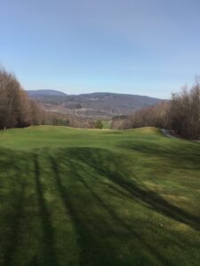
Looking North from the top of the Golf Course.Our hike on Sunday will explore the Reservoir Creek golf course in Naples. The course is closed for golf, but we thank the owners for permission to enjoy a hike with beautiful views, interesting topography and plenty of opportunity for exercise. We have been asked to avoid the greens, especially if we are wearing traction devices, but there is plenty of room to enjoy.

The opportunities for hikes are endless, but we will focus on three. The Climbers will climb to the top of the course along the east side, with up close views of the Reservoir Creek. The will follow down several fairways to the center of the course, then up around an internal woods, and finally down the west side of the course. Hikers should point out interesting topography they would like to see up-close, allowing the leader to adjust the route around the course.

The Tourists will follow the Climbers up the east side of the course at a slightly more leisurely pace, but will be sure to move fast enough to keep all hikers warm. Once they reach the top, the Tourists will make their way back down toward the parking lot, explores areas of interest.

The Naturalists will hike up the center of the course along the first hole. From there the route will head east to the Reservoir Creek the back across holes 8 and 16, below hole 13 to hole 11. After a tour around the 11th hole, the Naturalists will make their way back down to the parking lot.

For the safety of all hikers, we will not be having a social this week.

Directions

From Springwater: Head south on Rte. 15 South to Wayland.   Turn left onto Route 21 North in Wayland at the light. At the intersection of Rte. 21 and 371 in the Town of North Cohocton turn left staying on Rte. 21.  Reservoir Creek Golf Course is on your right in about 4.1 miles.

From Honeoye: Follow W Hollow Rd (County Road 36) to Naples. Turn Right at the Middletown Tavern on to Rte. 21 South, Continue on Rte. 21 South for about half a mile.  Reservoir Creek is on your left.

From Canandaigua: Follow NY 21 south out of town and all the way to Naples. Stay on NY 21 when it turns right (at the start of NY 53). Reservoir Creek is on your left.
From Rochester: Take NY 15A or 15 South to Wayland. At the light in Wayland, turn left on NY 21 North.
    OR take I-390 South to the Wayland Exit..Turn left onto NY 21 N, to the light in Wayland. Turn right to stay on NY 21.
At the intersection of Rte. 21 and 371 in the Town of North Cohocton turn left staying on Rte. 21.  Reservoir Creek Golf Course is on your right in about 4.1 miles.
Posted on by

Finger Lakes Trail Series Hike

Please join us for an early spring hike along the Finger Lakes Trail in Slader Creek State Forest south of Canaseraga. This hike will be an in and out with the opportunity to make it a loop with a bit of off-trail hiking in the Forest.

All hikers with take the same route south from Slader Creek Rd. The hike begins with a nice new stile over the farmers fence, and then a careful walk across the creek and through the cow pasture.  The cows are quite tame and seem more interested in eating than in investigating any hikers.

From the pasture  we will follow the farmers road up the hill. Total elevation change is about 400 feet. There are two additional stiles as we pass through a couple of pastures separated by fences. Be sure to turn around and enjoy the view to the north before we enter the forest.

At about a mile and a quarter, we with reach the FLT sign-in mailbox. At this point, the climbers will have the opportunity to leave the trail and make our way along at route 35° east of north to a road out to Slader Creek Rd and then a road walk back to the cars. Of interest on the road walk is a handsome one room school house on the south side of the road.

Meanwhile the Tourists and Naturalists can continue on the FLT trail for another half mile, or until 3:10 or when the trail crosses onto private land which is currently being logged. Since this is active logging, we will turn around and return on the same trail to the cars.

SOCIAL: If the weather permits, following our hike we will check out the Village Park in Canaseraga for an outdoor social. Bring a sandwich and something to drink. There are picnic tables where we can sit safely and catch up on news we missed on the hike.

Directions:

From Dansville and points east: Head south on NY-36 past Stony Brook. Turn right onto CR 70. At the flashing light in Canaseraga, turn left on S Church St. In 1.3 miles, turn right onto CR 13c (Slader Creek Rd). In three miles, you will see a gate and stile on the left. Park on the north side of the road.

From Mt Morris and points west: Head south on NY 408 through Nunda. In 2.6 miles south of NY 436 (Mill St) in Nunda, turn left onto NY 70. In 11.4 miles at the flashing light in Canaseraga, turn right onto S. Church. In 1.3 miles, turn right onto CR 13c (Slader Creek Rd). In three miles, you will see a gate and stile on the left. Park on the north side of the road.

From Hornell and points south: Head north on NY-36 to Arkport. At the stop light in Arkport, turn left onto West Ave (NY 961F). Stay on NY 961F for 3.8 miles. Turn left onto Tildon Hill Rd for 1.9 miles. At the tee, turn rignt onto CR 13A, then a quick left onto Narrows Rd. In 1.1 miles at the tee, turn left onto CR 13c. In 1.7 miles you will see a gate and stile on the left. Park on the north side of the road.

From Rochester and points north: Head south on I-390. Take exit 4 onto NY 36 S (the second exit in Dansville). Turn right on NY-36 past Stony Brook. In 6 miles, turn right onto CR 70. At the flashing light in Canaseraga, turn left on S Church St. In 1.3 miles, turn right onto CR 13c (Slader Creek Rd). In three miles, you will see a gate and stile on the left. Park on the north side of the road.

Directions back to Canaseraga and the village park: Continue west on Slader Creek Rd.  Turn right onto Friener Rd. In 3 miles, turn right onto NY 70. At the flashing light, turn right onto S Church St. Cross the tracks and take the first right onto Bennett St. The park is at the end of Bennett St.