 This week, Springwater Trails is offering a hike at the highest park in Ontario County and also a bike ride from that highest point down to Canandaigua Lake at Woodville.
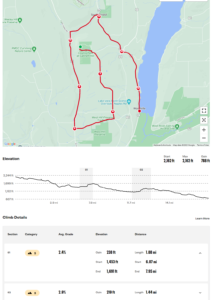
Join us at 4:00 at the entrance to the hiking trails on the west side of Ontario Park. Bikers and hikers will all start from the parking area on the main park loop road. Hikers will follow the brown, yellow and red trails for about 3.5 miles, while the hikers will ride roads around the park loop onto Gannett Hill Rd (South) to Seman Rd and then back north to Bristol Springs and down to Woodville for 17 miles.
Following the hike and bike ride, all are welcome to join us at Brews and Brats for a refreshing social.
Details
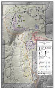
 The Hikers will follow ski trails. These trails are shared with mountain bikers in the summer. The brown trail starts off close to the road. When the brown trail turns south, we will switch to the Park Trail and then join the yellow trail headed for intersection 10. Staying on the yellow trail to the next intersection (12) we turn left and head over to intersection 11. Again, left to head back north staying on yellow. The yellow trail will cross the BHB and intersect with the purple trail before coming to intersection 6 and the red trail. We will turn right onto the red trail and will continue to turn right on intersections within the red trail until it returns to the park road. Crossing the road, we will make our way clockwise around a quarter of the pond and then across the fields (toward the radio towers) to the picnic shelters loop. There are nicely mowed trails through a Warbler nesting area. The path back to the cars branches off the shelters loop at the far corner.
Hikers wishing a shorter hike should stay to the left on the red trail trail until it gets to the road and then cross to the fields and back to the cars.
 Bikers will continue from the parking area along the park road. At the first intersection, we will turn right onto Gannett Hill Rd. The next right turn will be at the stop sign for Seman Rd, where we will ride past the West Hill Preserve. We then turn right onto W Hollow Rd and will make note of the Bristol Branch crossing from the road, and the old Ski Valley ski runs on the left. There is another right onto Egypt Valley Rd, and then right onto NY 64. At mile 14, we will pass through South Bristol. Some bikers may wish to stop at Brews and Brats. Meanwhile, the remaining bikers will continue onto NY-21 and head down to Woodville, where cars will be available to bring riders back to their cars. You may want to bring a bike lock in case we have more room in the cars than for bikes.
Bring water and your own bike if you wish to bike.
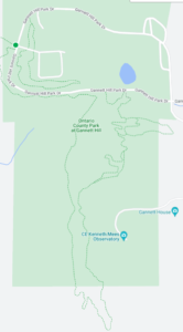
Directions: The easiest route to the park is to take NY 64 to Bristol Springs and turn west on Gannett Hill Rd. There is a sign indicating Ontario County Park. At the top of the hill turn right onto South Gannett Hill Road. The park entrance is straight ahead. Follow the park road for about .5 miles to our meeting place which is the parking area along the park road near the information kiosk at the Finger Lakes Trail trail-head. (Don’t turn off the main road into the camping areas or the picnic shelters).
Details From Springwater, Wayland and Naples: From Springwater, head south on NY-15. At the light in Wayland, turn left and follow NY-21 through Naples. Just past the village, bear left onto CR-12 (Bristol Springs Rd). In 1.9 miles, bear left onto Rhine St. Continue straight (In .6 mi, the name changes to Powell Rd and then in .3 mi to Gannett Hill Rd, and then in 3.2 miles it enters the park). Follow the road around the park for half a mile to our meeting place.
Details from Hemlock and Honeoye: From Hemlock, head south on NY-15A. Just outside of the hamlet, turn left on US-20A. Continue through Honeoye and turn right onto East Lake Road. In 0.6 mi, turn left onto CR 33 (Egypt Valley Rd.). In 6.9 miles, continue straight onto CR 34. In 1.6 miles, turn right onto NY-64. In another 1.9 miles, turn right onto Gannett Hill Rd. In 1.3 miles, turn right into the park. Follow the road around the park for half a mile to our meeting place.
Details from Canandaigua: Take US 20 west out of the city. Turn left onto Parrish St Ex. In 0.9 miles, turn left onto NY-21. Continue for 11.9 miles to the intersection with NY-64. Turn right onto NY-64 N. In 0.4 miles turn left onto Gannett Hill Rd. In 1.3 miles, turn right into the park. Follow the road around the park for half a mile to our meeting place.
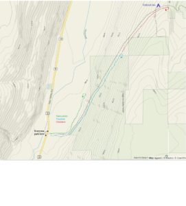
 From Springwater, Wayland and Danville: Take NY-15 south to Wayland. Turn left at the light onto NY 21 N. In 6.7 miles turn left to stay on NY-21. At the stop sign in Naples, turn right on NY 53S. In 1.3 miles, turn left onto Italy Valley Rd. In 7.7 miles, near a white barn on the right, there is a trail head sign and road shoulder parking for the Bristol Hills Branch.


