Posted on by

Fishers Park

We were greeted by Dave Wright of the Victor Hiking Trails group, who gave a brief description of the history and growth of Fishers Park. We filled up the parking area and discussed the only difficult section, and that all members should be able to manage in one group for the 2.8 miles with one steep hill climb.

Irondequoit Creek, Jan 2007

Irondequoit Creek, Jan 2007

Our hike started with a short walk along and across the Irondequoit Creek. followed by a boardwalk path across one of the wetland sections of the park. There are several sections of wetlands due to the many springs emerging from the ground and base of the hills. These springs are the old Genesee river returning to the surface from the gravel that the last glacier left in the river course. The former course of the Genesee came west from Rush and turned north at Fishers, carving the Irondequoit Bay on its way to the lake. After the Wisconsin glacier retreated about 12,000 years ago, the Genesee made a new course to Lake Ontario, but some of the water still flows through the glacial fill, and returns to it’s former course as the Irondequoit creek.

Nightshade

Nightshade

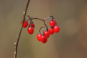
Gene pointed out some nightshade fruits along the boardwalk, and described them to the group. This section of the trail has reeds and cattails with some aspen growing in the swamp.

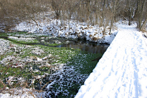
The trail led to one of the many small tributaries of the Irondequoit creek that start in the park. We meet a group with 3 Weimaraner dogs before moving on. We cross a bridge over this stream to see it’s clear fast flow over white sand, with watercress and mint growing in the stream. This stream does not freeze, and the plants stay green through the winter. There are many sections of the park that stay green due to the springwater keeping it near 40F.

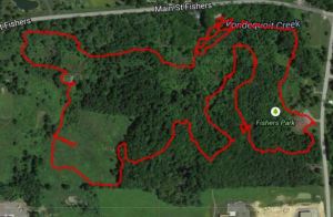
Click for an interactive map of this hike.

Click for an interactive map of this hike.

The trail returns to the Irondequoit creek, to follow upstream for a short stretch. We look for salmon, but do not see any. Newton takes a plunge in the deep pool, and does not stir up any salmon either. The trail brings us to a small pond that is fed by several springs at it’s bottom, seen as deep blue holes. There are often ducks here in the winter, since this pond does not freeze, but we see none today.

Now the trail leads to a grassy meadow with some rolling hills. I describe the Nordic skiing in this section. We gather for a group photo at the iron sculpture of a heron made by artist, Wendy Rust. The trail leads to a small ridge with a bench to sit and enjoy the view over the meadow and the surrounding forest.

I show the group a large cherry tree, which contains a very active beehive, but it is too cold for bee activity today.

Now the trail leads through a mature hardwood forest with several varieties of hickory identified by Georgia. We go off the trail to look down at the wetland below. I describe this kame delta feature to the group. This is where a stream across the glacier carried a variety of sand, gravel and stones and deposited them on a delta formation on the edge of the ice sheet. When the ice sheet retreated, it left this complex of steep ridges and valleys.

We follow a gentle valley back to the wetland edge, and follow a trail to an active spring at the base of the ridge. I had to clear away the beech leaves that were hiding the spring, to reveal some red back salamanders. Char gets a close-up photo. Then we climb the steep face of the ridge. The entire group meets at the top to enjoy the view and recover from the only real challenge in the park.

The trail now leads us through some woods, which we sort of agree may be a very old apple orchard. The trail leads out to a clearing and trailhead near the tennis courts and we regroup for the final section along the creek back to out starting point. We again look for salmon, but do not see any here.



Posted on by

Steege Hill Hike Recap

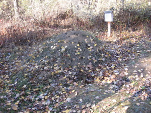
IMG_0763The mound ants and timber rattle snakes were nestled in against the brisk autumn winds, so twelve hikers, plus three dogs, had the woods to themselves. Three vehicles transported the Springwater Trails hikers to the Steege Hill Nature Preserve, just east of Corning. Thanks to everyone for heeding the advice to car pool.

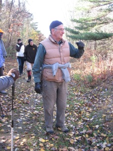
IMG_0764The steward of the preserve, Bob Corneau, was there to greet us all and offer his services as guide. As we strolled the woods, he painted a portrait of how devastated the forest had been 40 years ago and how the land had been rescued from illegal logging practices, via a wealthy donor and the Finger Lakes Land Trust.  Bob has been a volunteer steward on this preserve, mowing, clearing the trails, and monitoring the wildlife for 14 years.  He shared fascinating stories and revealed secrets of the forest that the casual hiker would never notice.  We were so very fortunate to be his students for our two hour tour on Steege Hill.

IMG_0767Our journey began with a steep climb from the parking area up to the top of the hill to access the trails.  We set out in one group on the easiest loop to allow us all to learn about the history of the preserve from our host.  The trail is one of the logging roads that wind through the hillside.  Eroded tracks of bulldozers and numerous tree stumps evidence the destruction of the past.  Several varieties of hardwoods were identified, as well a few fungi,  thanks to Gene and Georgia.  A small pond was a highlight, especially for Newton.  Bob told us of a tornado that had cut across the area recently.  We observed a huge chestnut oak, uprooted by the storm.

IMG_0778Eventually our Climbers set out to experience some of the more challenging terrain, hiking down the hillside, overlooking the Chemung River, then trudging back up to meet the Naturalist group. It was all down hill from there, a noticeable chill in the air as the sun dipped below the trees.

Good food and excellent service awaited us at Tags Restaurant.  Everyone was starving, so this was a welcome conclusion to our afternoon excursion.  The buzz at dinner was that folks were anxious to return to Steege Hill.  I encourage anyone to visit this preserve on their own.  The trails are well marked.  The hospitality is outstanding.

IMG_0779Look for Char’s photos.  Mine did not turn out.

Posted on by

Expanding the Northeast Section of the Springwater Trail – Reynolds Gull Area Road Hike – October 26, 2014

It occurred to me this past week that Springwater Trails could expand the development of our original plan for a 32 mile continuous trail around Springwater.  While being a trail angel for a long distance hiker named Chosen, I had the opportunity to help navigate her trek through the area of Swain on the Finger Lakes Trail and Franklinville on the North Country Trail.  Due to hunting season, obstacles and closures on the trail, I followed her by car around the back roads of Allegany and Cattaraugus County, enabling her to complete a day distance trip of 22 miles on state forest trails and dirt or paved roads without carrying her full backpack.  It’s called “slackpacking,” a benefit that hikers have when they have a trail angel to provide support services.

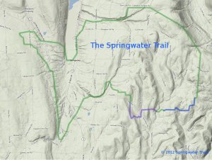
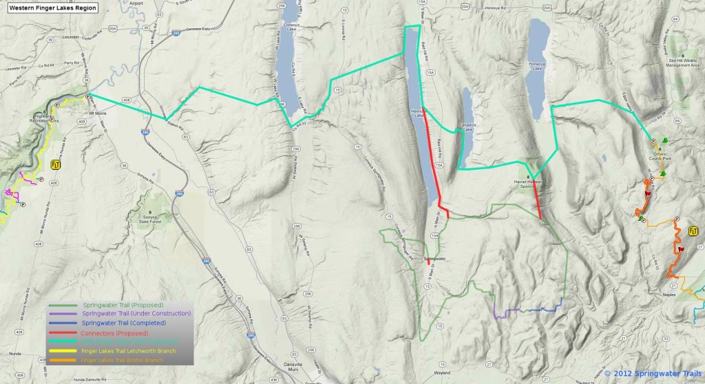
ProposedRoute Fall 2012On the local level, this experience with a long distance hiker expanded my hike planning to taking a look at our original plan of a continuous 32 mile trail around Springwater.  The idea of the trail around Springwater was developed a few years ago by an original committee called Springwater Parks and Trails.  Using this background information, our president Mark designed a large scale map of where the trail could possibly be located. To date we have 4 trail areas in progress, 3 with landowners permission and one on state land.

FLT ConnectionsThe proposed “master plan” in the northeast  section of Springwater accesses Harriet Hollister State Park to the north in Canadice to the newly acquired  state park property on Wetmore Road, following Town Line Road westward near the Nature Conservancy areas to a dirt road called Reynolds Gull Road.  The trail  would then drop unto Canadice Lake Road, hopefully accessing some private property someday and connect with the DEC Hemlock/Canadice State Forest at Johnson Hill. Once reaching the large parking lot Rt. 15A, hikers could continue hiking the south boat launch trail to Hemlock Lake, or access  the Village of Springwater to the south to explore the western part of the town.

13 hikers this past Sunday traveled the proposed route, starting at 2000′ and dropping to 1000′.  Two cars transported 10 hikers and two dogs to the top of Reynolds Gull Road while 3 hikers leisurely enjoyed hiking the Johnson Hill Trail, crossing the top of a dry waterfall.  Long distance hikers completed 6 miles in 2 hours exactly.  They picked up speed as they walked paved and dirt roads, accessing a DEC grassy trail off Johnson Hill Road which provided scenic views of fall trees, Hemlock Lake, steep gullies and waterfalls.  Reynolds Gull Road alone is a beautiful road to walk and the waterfall on the Johnson Hill trail is spectacular most of the year, especially in the winter and spring.

After the hike we warmed ourselves by the campfire at Pati and Jim’s, where a delicious roasted ham was prepared by Jim, healthy meals by others, and even 3 desserts! Thanks go to Pati and Jim for hosting our social and to Chosen for her inspiration and education.

Posted on by

The Missing Sneaker – Hiking the Canadice Lake Shoreline – October 5, 2014

007

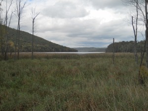
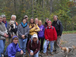
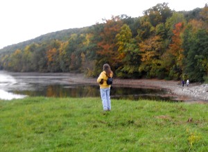
Don was right…you can’t walk the entire shoreline of Canadice Lake.   Wetlands at the southeast end of the lake prevented a hiker from continuing along the east shoreline when he was sucked into the mud and couldn’t get out.   Luckily he managed to escape, leaving his sneaker someplace behind for a artifact to be found someday.  006In the meantime, on the other side of the lake, 13 hikers followed the grassy trail around the south end of the lake, dropping down onto the shoreline past the marshy area. 4 hikers completed the hike all around the lake, sometimes accessing the road for a break from the stones or marshy areas, traveling  at least 3/4  of the shoreline area for a total of 8 miles. Others hiked almost 6 miles of shoreline for pick up at the boat launch.

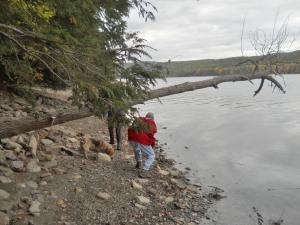
013Tourists walked half way down the lake on the rocky west shoreline, making a unanimous decison to pick up speed on the upper grassy trail.  While Pati entertained us with stories of an old indian village buried 80 feet under the lake, others navigated the shoreline stones, occasionally climbing over downed logs. Climbers continued on the entire west shoreline and both groups met up at the spillway area about the same time.

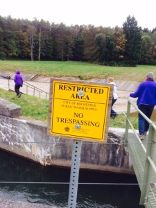
photo 2Thanks go out to the City of Rochester for allowing us to access the restricted area at the north end of the lake.   Without water overflowing into the spillway, the dam area felt like some sort of  terrain park or play land for skateboarders or trick bicyles.   Crossing the bridge, we observed the waters from Canadice Lake being passed through the gate into the Canadice Outlet which eventually flows into Hemlock Lake 4 miles downstream.  Many mills were built on the outlet area in the mid 1800’s to take advantage of the power these waters created, dropping 200′ from Canadice to Hemlock Lake with no dam to control the outflow.

After hike social was full of surprises, including our usual healthy food, lasagna and dehydrated apples.  A surprise guest from Kentucky joined us for our hike as he was traveling through the area. 018 Bill Cooke, former CPA for the Environmental Protection Agency presented a slide presentation on his book Shades of Gray, Splashes of Color – A Thru-hike of the Colorado Trail.  Thanks Bill for sharing your 482-mile backpack journey with us and also for the pictures provided for this hike.  Bill may be hiking the entire Finger Lakes Trail next year and possibly we can join him someplace on the way.  Start your Christmas shopping list:  good hiking boots, carrying pack, light weight tent, sleeping bag and pad, small cooking equipment, and dehydrated foods.  Men usually carry about 40 lbs on their back, women 20 lbs.  Anyone want to train?