Posted on by

Hanging Bog – New Hudson Rd, Black Creek, NY 14714 – Directions

Getting to the trail head is kind of tricky. If you are coming from the east (Springwater and Dansville) try Interstate 86 (NY17) to Angelica.  If you are coming from the north (Letchworth, Batavia) try Rt 19 south to Caneadea.  The turn by turn directions below are from Garrett and Google.  Set your GPS for (42.30584,-78.25016) and leave bread crumbs to find your way home.

From Springwater:  Take Rt15 south to Wayland.  Then right on Rt 63 to Dansville.  Turn left on Clara Barton St (Rt 36S) to the carpool spot.  Follow the Dansville directions from there.

From Dansville: Take Rt36 south under I390 for 13.5 miles to Interstate 86W toward Jamestown.  Take exit 31 for Angelica.  Turn right (N) on Peacock Hill Rd (0.3mi) then left (W) on Main St. Stay on Main St for 3.8 miles to the end at Rt 19. Turn right (NW) on Rt 19 for 3.1 miles to Rt 305.  Follow Rt 305 W for 5.3 miles to Cloverleaf Rd on the right.  (If you are on the lookout at mile 3.8, you will see that you cross the Genesee Greenway). Follow Cloverleaf for 1.7 miles, the left on Federal Rd for 2.4 miles, then right on New Hudson Rd.  The parking area will be on your right.

Alternate Route From Dansville: Take Rt36 south under I390 for 13.5 miles to Interstate 86W toward Jamestown.  Take exit 28 for Cuba.  Turn right (N) on 305 (past Murdock’s) for 3.8 miles to New Hudson Rd.  The parking area in on your right 2.5 miles north on New Hudson.

From Rochester:  Google recommends taking I390 South to Dansville exit 4 Rt 36.  Then follow the Dansville directions above.

From Geneseo:  The adventurous will follow Google maps to Nunda, then west to 19A and south to Rt 19 and Caneadea.  then take a right on Hillcrest Rd. along the South Eastern Shore of Rushford Lake, make a left onto Rush Creek Rd. and follow to New Hudson, turn left (only option) and continue to the parking area and Hanging Bog on the left hand side.  If you choose to take I390 to Dansville and join the carpool, it will add about 8 minutes driving time.

Murdock’s Bar and Grill is quite easy to find.  Go south on New Hudson Rd for 2.5 miles, then left on Rt 305 for 2.1 miles.

Posted on by

Indian Hill Trail Head – Directions

The Indian Hill trail head is located at (43.06881, -77.42591) on the south side of Rt 31 east of Turk Hill Rd. The directions below are to the trailhead on Rt 31.

Heading east on Rt31 past Turk Hill, the road switches to two lanes at the second left Quailbush.  There are 4 or 5 houses on the right side of Rt 31 after it becomes 2 lanes.  Immediately past the last house, turn right into the parking area.  It does come up fast and it is before Rt 31 curves to the right.

From Rochester: Take I490 East to Rt 31 (Pittsford Palmyra Rd)  (Do not exit at Rt 31F Fairport).  Turn right from the exit onto Rt 31 and go 3.2 miles through 7 lights.  You will pass Wegmans on the left between lights 3 and 4.  Light 7 is Turk Hill Rd.  Just past Turk Hill, the road switches to two lanes at Quailbush.  There are 4 or 5 houses on the right side of Rt 31 after it becomes 2 lanes.  Turn into the parking area on the right just past the last house.

Honeoye and Sandy Bottom Park: Turn right coming out of the park on County Rd 36 north.  Turn left at the light on US 20A.  Turn right onto Co Rd 37 north.  At West Bloomfield this road becomes Rt 65.  Just north of W Bloomfield, stay straight on W Bloomfield Rd (CR 35) as Rt 65 curves to the left.  6.5 miles north of W Bloomfield, turn right on Rt 251 (Rush Mendon Rd).  After 3.4 mi, turn left on Philips Rd.  This is a sharp left just as the main road curves to the right.  At the light turn right on Main St Fishers.  Turn left on Rt 96, past the entrance to the thruway and by the East View Mall parking lots. Turn right on Turk Hill Rd.  Turn right on Rt 31 (Pittsford Palmyra Rd) at the second light.  The trailhead is 0.3miles down Rt 31 on the right.

From Springwater: From the flashing light, head north on Rt 15A for 21.7 miles.  About 2.8 miles north of Lima, bear a slight right toward Honeoye Falls.  Curve to the right and continue onto W Main St.  In Honeoye Falls, this road joins Rt 65 North.  About 4 miles north of Honeoye Falls at the traffic circle take the first exit onto Rush Mendon Rd (Rt 251).  Stay on 251 through Mendon Center (a flashing light).  2,5 mi past Mendon Center, turn left on Philips Rd.  This is a sharp left just as the main road curves to the right.  At the light turn right on Main St Fishers.  Turn left on Rt 96, past the entrance to the thruway and by the East View Mall parking lots. Turn right on Turk Hill Rd.  Turn right on Rt 31 (Pittsford Palmyra Rd) at the second light.  The trailhead is 0.3miles down Rt 31 on the right.

From Dansville and Geneseo: Take I-390 North to Exit 15 and I-590.  Take exit 2 for Rt 31 toward Pittsford. Follow Rt 31 for 7.3 miles past a couple of Wegmans stores and across the canal three times, past Turk Hill Rd to the Trail Head on the right.

Posted on by

DEC Parking Lot – Mission Trails (42.758,-77.6305) – Directions

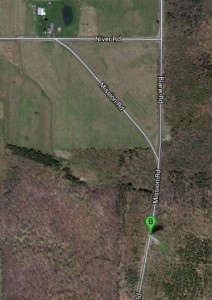
DEC on Mission RdThe DEC Hemlock-Canadice Forest parking area is on Mission Road just a tenth of a mile south of the intersection with Blank Road and about 0.4 miles south of Niver Road. You can reach this area from the North by going through Hemlock Park at the end of Hemlock Lake, up Rix Hill and taking a left at the top of the hill onto Blank Road. Follow Blank Road until it becomes a dirt road. Blank Rd ends at the paved Mission Rd. Continue straight ahead. The parking area is on the left (lake) side.

From Wayland and Springwater: take 15A N to the North end of Hemlock Lake. Go Left on Rix Hill Rd through the park. Take a sharp left on Blank Rd at the top of the hill. Continue south past Niver Road and onto Mission Rd. The parking lot is on the left just after you get onto the paved Mission Rd. Look for the wooden DEC sign.

From Websters Crossing: take 15N past Sliker Hill Rd and Cole Rd. Turn Right on Niver Rd. Follow Niver for 1.9 miles. Just before the end, bear right onto Mission Rd. (if you miss it, turn right on Blank Rd at the end of Niver). The parking lot is on the left just south of the intersection of Mission and Blank roads (a half mile from Niver).

From Livonia: take 15S 4.2miles and turn Left on Niver Rd. Just before the end, bear right onto Mission Rd. (if you miss it, turn right on Blank Rd at the end of Niver). The parking lot is on the left just south of the intersection of Mission and Blank roads.

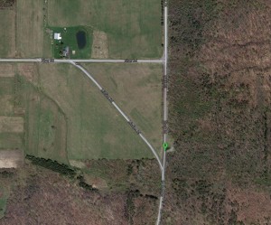
MissionTrail DEC LotNOTE: These directions have been updated from the June 9, 2013 hike to point to the more southern parking area.  There are also trails off the parking area at 42.76067,-77.62992 which was originally indicated in the picture to the right.

Posted on by

Dansville Car Pool Area – Home Video – Directions

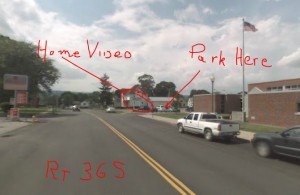
Dansville Parking S of MainThe “Home Video” parking lot in Dansville is a good spot to start a car pool for hikes south of Dansville.  We will use this location for the Rattlesnake Hill hike on May 19th to avoid interference with the Dogwood festival.

From Springwater and Wayland: Head west from the center of Wayland on NY 63 N toward Dansville. In Dansville, turn left on Clara Barton Street (Route 36 South). Then take a right turn just past the Town Hall/Police Station near the ‘Home Video” sign and park near the sign pole.

From Rochester and Geneseo: Take I390 South to Dansville.  Use Exit 4 for NY 36 (this is the third exit for NY36 and the second one in Dansville). Turn left onto NY 36N (Clara Barton St).  The parking is on the left 1.1 miles north of I390 just before Main St.  Park near the “Home Video” sign.