Posted on by

Richards Rd at Pardee Hollow Rd – 42.594002, -77.502889

Directions to the Richards Rd intersection with Pardee Hollow Rd.

From Springwater: go North of 15A for .8mi from the light. Turn right on Wheaton Hill Rd (see the maple sign). At the tee, at the top of the hill, turn right onto Wetmore Rd. Bear right on Tabors Corner Rd. After 1.8 miles, turn left on Pardee Hollow Rd . Turn right at the tee to stay on Pardee Hollow Rd. Continue south for 1.9 miles.  Park on the west (right) side of Pardee Hollow Rd near Richards Rd (the second left off of Pardee Hollow.

From Wayland: take Rt 21N for 5.6 miles. Turn left on Co Rd 38  (Garling House Rd AKA Rowe Rd). Take the first left onto Pardee Hollow Rd and continue for 1.9 miles. Park on the west side (left) of Pardee Hollow Rd near Richards Rd.

From Honeoye: take W Lake Rd south. Turn right onto French Hill Rd. At the tee (at Dug Rd) turn right to stay on French Hill Rd. Take the first left on Garlinghouse/Atlanta Rd. Go Right on Pardee Hollow Rd and continue for 1.9 miles. Park on the west side (left) of Pardee Hollow Rd near Richards Rd.

Posted on by

Boughton Park – East Bloomfield, NY

Boughton Park consists of 330 acres and 5 miles of designated trails. The area has some rolling hills with perhaps 50-100 foot max elevation change.  The park is reserved for residents of the three towns and their guests.

From Honeoye and the Sandy Bottom Park:
Turn right after the Bloomfield park

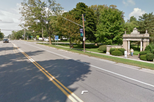
Turn right onto South Ave after the Bloomfield park

– From Sandy Bottom, head north on West Lake Rd.
– Take Rt 20A east to jct with Rt 64
– Turn left onto Rt 64 and travel to Rts 5&20
– Turn left onto Rts 5&20 and travel 2.5 miles.
– Turn right onto South Ave (See picture to the left)
– Turn left onto Main St.
– Take the first right (immediate) onto Michigan St and continue onto CR 39 for 2.4 miles
– Turn right onto Boughton Rd (CR 39 will continue to the left)
– Take the first left onto Stirnie Rd.  The parking area is 0.8 miles ahead on the right. (past a curve to the right, and a curve to the left)

From Springwater and the Town Hall – Carpool location:

-Take Rt 15A north from the flashing light in Springwater.
-Turn right onto Rt 20A toward Honeoye. After 4.0 miles
– Turn left on CR 37 go north to West Bloomfield.
– Turn right onto Rts 5&20 east at the West Bloomfield Congregational Church.
– Turn left onto Rt 64, and an immediate right onto Main St.
– Take the 2nd left onto Michigan St. and continue onto CR 39 for 2.4 miles
– Turn right onto Boughton Rd (CR 39 will continue to the left)
– Take the first left onto Stirnie Rd. (It’s a VERY VERY short travel on Boughton Rd) The parking area is 0.8 miles ahead on the right. (past a curve to the right, and a curve to the left)

 From Rochester area: 

– Take I490 East to the Victor Exit 29.
– Merge onto Rt 96 S into Victor.
– Turn right onto Maple Ave (Rt 444) (follow the sign to Bristol Mt).
– At the flashing light turn right onto Boughton Hill Rd (CR 41) (At Ganondagan)

A Public Service Announcement  Remember, there are two roads, Boughton Hill Road and Boughton Road. These are different roads with Boughton Road south of the park. We are not parking in that parking lot, thus this routing uses Boughton Hill Rd which is north of, but not touching, the park.

– Take the 1st left onto Murray Rd.
– At the T, turn right onto Town Line Rd.
– Take the 1st left onto Stirnie Rd.  The parking is on the left after 0.4 miles.

Posted on by

Stony Brook State Park – 42.526417,-77.696533

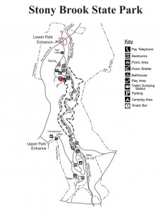
Stony BrookStony Brook Park is located south of Dansville, NY on Rt 36. There are two entrances. The main entrance is to the north, with the campground entrance on the south end of the park. Hikes starting at the bottom of the gorge will meet at the parking lot about 0.5 miles inside of the northern entrance off of Rt 36.

From Dansville:  Take Rt 36 South from Main St for 2.5 miles and turn left  into the Lower Park Entrance. Drive into the park and meet in the main parking lot.

From Springwater: Take Rt 15 south through Wayland. Turn right onto I390 N and go to the next exit (Exit 4). At the exit, turn right on Rt 36S. The park is on the left, 1.9 miles south. Follow the park road to the parking lot.

From Rochester and Geneseo: Take I390 South to Dansville.  Exit at Exit 4 (the second Rt 36 exit). Turn right on Rt 36S. The park is on the left, 1.4 miles south. Follow the park road to the parking lot.

Posted on by

Harriett Hollister Spencer State Recreation Area (42.694424, -77.525795)

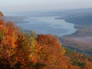
The Harriett Hollister Spencer State Recreation Area is located at the South end of Honeoye Lake. On a clear day, you can see the Xerox Tower.  The park is a favorite spot for cross country skiers because it often has more snow than other spots around Rochester.

P1000365

Directions:

From Springwater: Head north on 15A for 0.8 miles from the intersection with 15. Turn right on Wheaton Hill Rd (CR 16) to  the top of the hill.  Turn left on Wetmore Rd which becomes Canadice Hill Rd at Town Line Rd.  Continue on Canadice Hill Rd for 1.6 miles.  The parking lot in on the right.

From Honeoye:  Head south on CR 37 from Rt 20A.  At the church, where CR 37 turns right, continue straight on Canadice Hill Rd.  When Ross Rd bears to the right, continue straight on Canadice Hill Rd to Harriett Hollister Spencer.  The parking lot in on the left (total of 6.9 miles from Rt 20A).

From Rochester: Take I390 South to Exit 11 (Rush).  Turn left onto NY 15 S, then left onto NY 251 E toward Rush.  Turn right onto 15A and follow 15A for 15 miles through Hemlock.  Turn left on US 20A.  After several hills, turn right onto CR 37.  After 3.7 miles CR 37 turns right, but you should continue straight ahead on Canadice Hill Rd. After 2.4 miles, Ross Rd bears to the right, but again, you should continue straight ahead on Canadice Hill Rd toward Harriett Hollister. The parking lot is on the left about 0.6 miles from the intersection.

From Naples: Take Clark St, CR 36 north from Rt 21.  Follow CR 36 for 12.3 miles. Turn left on Jersey Hill Rd.  At the top of the hill, turn left on CR 37.  Continue straight ahead for 4.2 miles.  The parking lot is on the left.