Posted on by

Harriet Hollister Spencer State Recreation Area – Directions

GPS Warning: Harriet Hollister Spencer Park is located on a dirt road.  South of the park, this road (Canadice Hill Rd) often has bad ruts.  Therefore, these directions avoid that section of the road.  If you choose to follow your GPS routing, please drive slowly over the ruts.

FROM HONEOYE:  From 20A turn south onto County Route 37 and go about 4 miles to the County Route 37/Canadice Hill Road split.  Continue south on Canadice Hill Road about 3 miles.  Harriett Hollister Spencer Park will be on your left.

FROM SPRINGWATER:  Take Route 15A north out of Springwater for one mile and turn right on Wheaton Hill Road. Take the 1st left onto Canadice Rd.  Turn right to stay on Canadice Rd. At the county line continue onto Co Rd 37 for 2.0 miles. Turn right onto Luckenbach Hill Rd. At the top, turn left onto Ross Rd.  At the stop sign, take a sharp right onto Canadice Hill Rd. Harriett Hollister Spencer Park will be on your left.

FROM NAPLES: From Rt 21 next to Middletown Tavern, take Clark St west to become Co Rd 36. After about 12.2 miles, turn left onto Jersey Hill Rd. At the top (0.7mi) turn left onto Co Rd 37.  At 1.1 miles, continue straight past the white church in Canadice onto Canadice Hill Rd. In 2.4 miles, Ross Rd bears to the right, but you want to continue straight on Canadice Hill Rd for another 0.9 miles.  The park is on the left.

Posted on by

Directions to Stoney Ridge Farms in Farmington, NY

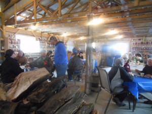
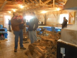
maple weekend 123Stoney Ridge Farms is located at 625 County Road 28 in the Town of Farmington (PO Palmyra) New York.

Directions (43.0088, -77.2764)

From the South

From Route 332 in Canandaigua, turn right on County Road 28. Go 7.6 miles. Stoney Ridge Farms is 1 mile past thruway overpass on right. Turn right on Rushmore Road and park.

From Honeoye, Follow US 20A E for 7 miles.  Turn left on NY 64 for 3.7miles.  At the light, turn right on US 20. After 2.9 miles, bear left onto Buffalo St Extension.  In 2.6 miles, turn left on Rt 332 (N Main St).  In a half mile, turn right on North St (CR 28) for 3.7 miles.  Turn right on Rushmore Rd and immediately into the Sugar House parking area.

maple weekend 113From the East

From Thruway Exit in Manchester, take Route 21S in Manchester to Rt. 96N. Go 3 miles, turn right on County Road 28, go 2 miles to Stoney Ridge Farms, turn right onto Rushmore Road and park.

From the West

From 490E, take last exit to Rt. 96S in Victor. Follow Rt. 96S, 8 miles to County Road 28, turn left. Go 2 miles to Stoney Ridge Farms on right. Turn right on Rushmore Road and park.

From the North

From Fairport and Palmyra take Rt. 31. Turn on to County Road 28 (Macedon Rd.) Follow to Rushmore Road, turn left and park.

Posted on by

Mendon Ponds – Hopkins Point Lodge – Directions

Note: As of Monday afternoon (1/12/2015) Hopkins Point Rd is not plowed from Rt 65 to the lodge access.  These directions get you to the lodge from Canfield Rd.

Easiest access to the lodge is from NY 65 on the west side of the park.  Enter the park on Canfield Rd.  Take the first right onto Hopkins Point Rd and follow to the lodge on the right.

From Springwater: Head north on Rt 15A for 23.5 miles.  Turn right onto Sibley Rd (On 15A, you will go through Lima, then past Honeoye Falls 6 Rd and Honeoye Falls Five Points Rd.  Sibley Rd is the next right after Honeoye Falls Five Points Rd).  At the end of Sibley Rd (1.4 miles) turn left onto Rt 65N (Clover St). Continue on 65N through the traffic circle. 3.5 miles north of the traffic circle, turn right onto Canfield Rd.  Take the first right onto Hopkins Point Rd. Then left on Pond View Rd.  The lodge is on the right above the parking lot.

A Map of Mendon Ponds Park is available at http://www2.monroecounty.gov/files/parks/Maps/MendonPark.pdf.  If you are coming from the east, you can enter the park on Canfield Rd or Pond Rd.  Check the map for details.

Posted on by

Canadice Lake west side trail South Trailhead – Directions

There is a service road along the west side of Canadice Lake which is a favorite spot for walks and hikes.  The trail has a trail-head at the north west corner of the lake on Purcell Hill Rd and another trail-head at the south end of the lake on Canadice Lake Rd.  These directions are for the southern trail-head.

NOTE: The southern trail-head is south of the entire lake, and should not be confused with the canoe/kayak boat launch.

From Springwater: Purcell Hill access: Go North on 15A for 7.6 miles.  Turn right on Purcell Hill.  At the end of Purcell Hill Rd, turn right onto Canadice Lake Rd on the east side of the lake.  The Trail-head is 3.6 miles south.

From Springwater: Johnson Hill access: Go North on 15A for 2.7 miles. Bear right on Old Bald Hill Rd S and then an immediate right on Johnson Hill Rd. Take the first left onto Canadice Lake Rd. The Trail-head is 1.1 miles north of Johnson Hill Rd.

From Honeoye: Take Co Rd 37 South from 20A, Turn right after 3.7mi to stay on Co Rd 37. Stay straight onto Burch Hill Rd. At the lake, turn left onto Canadice Lake Rd. The Trail-head is 2.8 miles south of Burch Hill Rd.

From Hemlock and Rochester: Take NY Rt 15A south from Rochester through Lima and Hemlock.  Just past Hemlock, Rt 20A  goes left.  Continue straight on 15A for 3.2 miles after 20A.  Turn left on Purcell Hill.  At the end of Purcell Hill Rd, turn right onto Canadice Lake Rd on the east side of the lake.  The Trail-head is 3.6 miles south.