About Mark

President of Springwater Trails, Inc

Schribner Rd Hike and Holiday Social – Dec 15, 2013 at 2:00PM (42.605,-77.541513)

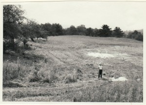
1952 or 53. Note the apple tree at a slant in the upper left.

Future pond site – 1952 or 53.
Note the apple tree at a slant in the upper left.

Please come and enjoy hiking the hills and valleys of East Springwater.  Following the hike, join us for the Springwater Trails Annual Holiday Social.  Linda will cook a ham. Please bring a dish to pass and your own beverage (or contribute to the social fund).  Everyone is welcome to hike and socialize with Springwater Trails, although you may have to listen to some announcements from the Executive Board of Springwater Trails Inc.

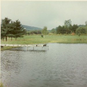
Pond looking west, Labor Day, 1971.

Pond looking west, Labor Day, 1971.

Sixty one years ago, my father purchased land on Schribner Rd and taught his six kids how to enjoy and care for the land.  Our hike this Sunday will explore the private land in this area with specific focus on the impact of man and nature on the property.

Linda will lead the Climbers across the valley and up the hill to the Potato fields at the top.  You will enjoy the views to the south and see the contours the farmers have followed since the 30’s.  Also, take some time to see the number of stones farmers have pulled out of the fields over the years.  After coming back down through the hardwood forest, there will be see the pines planted in the 30’s, the 50’s and finally in the 60’s after which we learned that the fields were disappearing and needed to be preserved for their own sake.

Pond looking south, 1970s.

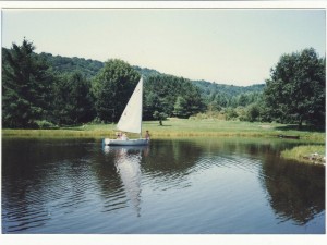
Pond looking west, 1980s.

Mark will lead the Tourists and Naturalists around the three ponds on the property, up the stream to the old pine woods and then back through the fields to enjoy longer views.  This hike may involve some bushwacking, depending on the weather, but will avoid long uphill hikes.

Please check the weather prior to the hike and dress in layers.  If there is snow on the ground, snowshoes will be very beneficial.

The hike will start at the intersection of Giles and Schribner Roads.  Both roads are seasonal north of the hike, so please make sure you come up Schribner Rd from Tabors Corners.  Please park on Schribner Rd or near the barn if the driveway is clear.  We will meet at the red ranch house behind the garage. You may bring your dish for the social into the house prior to the hike.

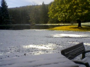
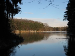
Pond, October 28, 2011

Pond, October 28, 2011

From Wayland: From Rt 15, head east on Rt 21 toward North Cohocton for 3 miles. Turn left on Tabors Corners Rd (Steuben Co Rd 37).  After 2 miles, turn left on Schribner Rd (the second left).  The driveway is on the left one mile up Schribner Rd and about 10 feet before the intersection with Giles Rd. Bear right at the intersection, turn around and park along the road. Or come into the driveway and park between the garage and the barn. Hint: In case it is getting dark when you leave, you may find it easier to back into a parking space at 2:00.

Detailed directions from other locations are available here.

Allow readers to learn more – add a link to your post

It will make your post more interesting to read if you include links to additional information.  For example, if you mention that Poison Ivy has been seen on the trail, you may want to allow your readers to learn more about Poison Ivy.  Pick a web page you find interesting and link it to the word Poison Ivy.  I like to link to the webpage of the park where we are hiking in the first couple of sentences.

  1. Write your sentence introducing the location of the hike.
  2. Highlight (or select) an appropriate word to make a link.
  3. Then click on the icon of a chain to add the address of the new page.
    1. Enter the URL of the page you want to go to from the Address bar of your browser.
    2. If you want to link to a Springwater Trails post, click on the “Or link to existing content” and search for the page you want.
    3. Click Update to save the link.
  4. If you decide you don’t want the link, put the cursor on the word that links, and click the broken chain.

Remember, readers will appreciate a link that goes to an informative page.  This may not be the first page that Google provides – I would tend to avoid pages with ads.

Trail Inspection – Wheaton Hill Trail – Dec 8, 2013 – 2:00 PM (42.6552,-77.591)

This Sunday, we return to the Wheaton Hill trails to view the results of our summer war of the roses and to tag a route from the Red Bud Trail to 15A.

We will meet at the Wheaton Hill Rd entrance to the trails (42.6552,-77.591).  Park on the west side of the road headed downhill.

Today is warm but Sunday is supposed to be chilly.Click for Springwater, New York Forecast As ususal, please check the weather and dress in layers before coming. Socks and boots are important in this weather.

Come prepared for an interesting hike with some trailblazing.  We will break into two groups, both starting on the east side of the road.

The Climbers will head south to the rosebud trail and take the loop clockwise around to the lowest point. Bring clippers so we can clear some of the roses from this area that we have not yet attacked.  At the low point, we will leave the trail and head south west to Rt 15A and the north edge of the village.  We will tag the route and remove any old tags that are misplaced.  At the road, we turn around and retrace our steps.  On the way out the climbers will follow the Spruce trail back to the entrance. Across the road, we will follow the skid and pine trails for a complete coverage of these trails.

The Tourists and Naturalists will start to the left around Spruce Trail and then will follow Red Bud.  After crossing the road, they will take the Pine loop and return to the cars.

DSC_4945What to bring:

  • Short handled clippers for any roses we decide to attack.
  • Good gloves for handling  roses. These gloves must be washed following the hike to remove any Poison Ivy you may have touched.
  • A plastic bag – use this to transport your gloves during and after the hike.  You do not want to spread any Poison Ivy.

DSC_4958_smallPlease park headed down hill on the right hand side of the road.  Pull off the road as far as possible.  We will place the Springwater Trails sign above the curve to warn drivers.  If you prefer, parking is available at the South Hemlock Access parking area and you can car pool from there.  In any case, be on the alert for cars on Wheaton Hill Rd!  Directions are available to the Wheaton Hill trailhead and to the South Hemlock Access parking area

After the trail work, we will take advantage of Pam’s grill for hot dogs and baked beans.  Please bring something to drink – Springwater Trails will provide the food.

Boughton Park – November 24, 2013

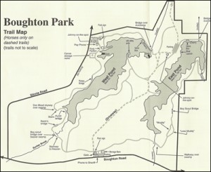
On many Sunday afternoons, you can find the hikers of Springwater Trails taking advantage of the beautiful Little Finger Lakes of Hemlock and Canadice.  These two lakes and their surrounding water sheds provide a water supply for the City of Rochester, with the three reservoirs at  Rush, Cobbs Hill and Highland Park receiving and then dispersing the water to areas of the City. We often traverse the hiking trails around the Hemlock & Canadice Lakes and watersheds and sometimes paddle them as well.  Boughton Park But this week we hiked a different water supply, the former Fairport Reservoirs which are now known as Boughton Park located in the Town of East Bloomfield & lying just south of the Town of Victor. This early winter hike was made possible by Don, Ebets, Pete and Naomi, all of whom have our thanks this Thanksgiving week!

Starting in the early/mid 1920s the Village of Fairport purchased land in the Town of East Bloomfield and progressed to create two reservoirs by damming up two creeks which created two finger shaped West Pondreservoirs for the purpose of supplying Fairport residents with their water needs, and in essence created a water shed area as well.  Fast forward to 20+ years ago (~1989) and Fairport essentially decommissioned its municipal water supply reservoirs and started to utilize the Monroe County Water Authority as its water supply source.   boughtonpark_smFairport then looked to sell the land and water resources – reservoirs/water shed, … and the purchasers, in a joint cooperative to create a park for their respective residents, were the Towns of Victor, East Bloomfield and West Bloomfield.  The three town cooperative formed the independent Boughton Park Commission which oversees and manages Boughton Park aka the former Fairport Reservoirs.

An additional historical note – The Town of East Bloomfield is where the Northern Spy Apple was originated by Oliver Chapin on Boughton Road in 1800.

Boughton Park consists of 330 acres of which 56 acres is ponds, and approx. 5 miles of designated trails.  Most of the trails are fairly level with some rolling hills. The south end of the West Pond demonstrates some glacial terrain with a few steep hills requiring care on slippery ice and snow. IMG_0436_WebThe Seneca Trail, part of  the Victor Hiking Trails network of trails, is a trail that heads north out of Boughton Park and continues several miles northward thru private lands that have allowed the trail.

Parking in Boughton Park’s two gravel/dirt parking lots is by permit, available only to residents of the three town cooperative of the Boughton Park Commission.  With the kind assistance of two friends of Springwater Trails, the hikers were able to obtain guest permits for this hike.

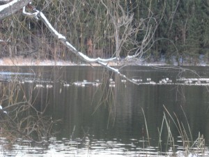
IMG_0434_WebAll hikers gathered in the Boughton Park – Stirnie Road parking lot (off the east side of Stirnie Rd).  The Stirnie Rd parking lot overlooks the west side of the west reservoir (near the reservoir’s northwest corner) with a clear view of the reservoir, levy/retaining dam and spillway threshold with a crossing bridge, truly picturesque!  A scenic point (peninsula) extends into the west reservoir and the picnic pavilion is situate between the parking lot and the tip of the point. (Fishing is allowed with NYS fishing license.)  Hikers were rewarded with an open view of the reservoir with no cars obstructing the view.

Boughton Park maintains a year-round no hunting policy, resulting in a popular locale for hiking and walking of dogs, in spite of the 20° weather.

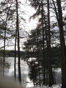
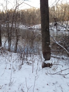
IMG_0899The many vista points gave Char good opportunities to record our hike. Boughton Park Commission seeks to maintain the park in as near natural state as possible and likely as low budget as possible, and therefore there are not the “improvements” or amenities found in some other parks.  One benefit we saw were trees left standing by beavers which appear to have departed from the area several years ago.