About Mark

President of Springwater Trails, Inc

Eagle Crest Winery Hike and Social – October 12, 2014 at 2:00PM

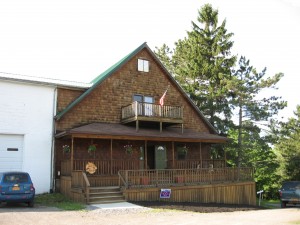
IMG_0235Our annual autumn hike at the Eagle Crest Winery will take place Sunday, October 12.  Joan and Bob are planning a hike to explore the DEC and Nature Conservancy land around the Winery with an emphasis on an up close view of the working vineyard.  With a bit of help from the sun, we also expect to enjoy the fall colors around Hemlock Lake. The hike will be followed by wine tasting and a potluck social at the winery.  Come try the “No Frackin’ Way” Wines and take home a bottle at the special hikers price. Please bring a dish to pass for the outdoor social.
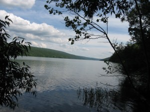
IMG_0227We will meet at the Eagle Crest Winery parking lot off of Mission Rd. (42.739874,-77.622831).

The Naturalists will carpool to Rix Road and the Hemlock outlet. If you would prefer to avoid the hill climbs, please come 10 minutes early so that the carpool can be organized.

The Tourists and Climbers will explore the Nature Conservancy land that surrounds the Winery, and the vineyard itself.  Some hikers will climb to the lake and explore the narrow strip of land that is part of the Hemlock Canadice State Forest.
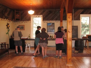
IMG_0094WFollowing the hike, we will meet at the tent outside the winery for an optional social. Please bring a dish to pass or make a contribution to the social fund.

Directions:

From Springwater: Take Rt 15N from the intersection with 15A for 8.2 miles. Stay straight onto CR 56 (Federal Rd) when Rt 15 bears to the left. Take the first right onto Durkee Rd, then left at the tee onto Partridge Corners Rd, the first right onto Bishop Rd, and the second left on Mission Rd and then right onto Vineyard Rd.  The parking lot is 0.2 miles down Vineyard Rd.

From Hemlock: Take Rt 15A south for 0.7 miles past the intersection with 20A from Honeoye. Turn right on Rix Hill Rd at the north end of Hemlock Lake.  Go up the hill and turn a sharp left onto Blank Rd.  Stay on Blank Rd when it becomes a dirt road and then becomes Mission Rd (which is paved).  Vineyard Rd is on the left 1.4 miles from the dirt road, and within sight of the end of Mission Rd. The parking lot is 0.2 miles down Vineyard Rd.

Canadice Lake west side trail South Trailhead – Directions

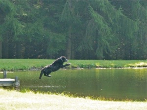
There is a service road along the west side of Canadice Lake which is a favorite spot for walks and hikes.  The trail has a trail-head at the north west corner of the lake on Purcell Hill Rd and another trail-head at the south end of the lake on Canadice Lake Rd.  These directions are for the southern trail-head.

NOTE: The southern trail-head is south of the entire lake, and should not be confused with the canoe/kayak boat launch.

From Springwater: Purcell Hill access: Go North on 15A for 7.6 miles.  Turn right on Purcell Hill.  At the end of Purcell Hill Rd, turn right onto Canadice Lake Rd on the east side of the lake.  The Trail-head is 3.6 miles south.

From Springwater: Johnson Hill access: Go North on 15A for 2.7 miles. Bear right on Old Bald Hill Rd S and then an immediate right on Johnson Hill Rd. Take the first left onto Canadice Lake Rd. The Trail-head is 1.1 miles north of Johnson Hill Rd.

From Honeoye: Take Co Rd 37 South from 20A, Turn right after 3.7mi to stay on Co Rd 37. Stay straight onto Burch Hill Rd. At the lake, turn left onto Canadice Lake Rd. The Trail-head is 2.8 miles south of Burch Hill Rd.

From Hemlock and Rochester: Take NY Rt 15A south from Rochester through Lima and Hemlock.  Just past Hemlock, Rt 20A  goes left.  Continue straight on 15A for 3.2 miles after 20A.  Turn left on Purcell Hill.  At the end of Purcell Hill Rd, turn right onto Canadice Lake Rd on the east side of the lake.  The Trail-head is 3.6 miles south.

Schribner Trail Building

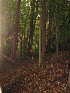
image001We set up a big challenge for Sunday, with almost a mile of new trail to be cleared and two hundred feet of trail to be leveled. The entire trail was through the woods with very little undergrowth needing to be cleared.  However, there are always branches and small trees to be removed to make are clear trail  And we fully expected the portion that needed leveling to be littered with rocks and roots which could easily require more tools than we had.

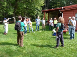
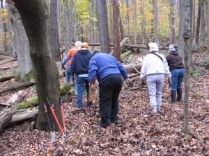
image002Twelve volunteers came Sunday at 2:00.  The sun was out with lots of blue sky and we knew we could get lots done.  Two groups were formed – Linda’s Loppers ready to climb the hill and create a new trail, and Ricks Rakers who wanted to see what could be done to level the existing trail.

Before

Before

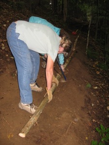
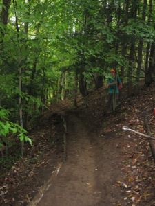
Rick’s Rakers got right to work. Rakers first removed the leaves and sticks and stones on the trail.  Then, using a small power cultivator, Rick loosened the ground. IMG_0708WStraight logs were found and placed on the down-hill side of the trail and then the soil was raked flat.

After

After

Now, some gravel or mulch will protect the soil and make a very pleasant trail.

Meanwhile the loppers headed toward the top of the hill to work on the new portion of the trail.  As they approached the new trail, the front came through and the rain started.  Rather than move farther from safety as the rain seemed to be strengthening, the loppers turned around to work on the older portion of the trail.  The rock bridge across the creek was improved and extended across the swampy area near the creek.  When the group connected with the rakers, they pitched right in to complete that task.

IMG_1355WSo, the trail leveling was very successful but the trail extension will need to wait for better weather.  Thanks to everyone who helped, the Springwater Trail continues to be developed. Gene says that’s worth celebrating!

Trail Building – Schribner Rd – Sunday September 21 – 2:00PM

Building a trail - October, 2013

Building a trail – October, 2013

Rick and I got together today to plan our extension to the Springwater Trail.  We have been investigating paths around the Schribner valley and last year we started a trail west from Schribner.  This Sunday, we will work to improve that trail and extend it across the top of the hill.

February, 2011

February, 2011

We have two tasks on Sunday.  One portion of the trail built last year is built on a slant that is difficult to hike across.  We will work to flatten the trail to make it easier and safer. Please bring a shovel or rake to help Rick with this portion of the trail.

The rest of us will go to the end of the trail we worked on last year.  From the top of the hill we will follow the orange flags through the wood.  The work is primarily removing fallen branches and some trimming of the trees.  Work gloves and loppers and good hiking boots are the appropriate tools for this team.

October, 2011

October, 2011

After two hours of trail work, come join us for grilled chicken. Please bring a dish to pass.

Directions: (42.605,-77.541513)

Schribner and Giles Roads are open from both ends during the summer.  However, if you use your GPS, please avoid Schribner Rd from Strutt St.  Take Giles instead.

From Springwater: Head south on Rt 15A from the light in Springwater.  Take the first left on Marvin Hill Rd. Bear right at the Y onto Strutt St.  Continue straight onto Quanz Rd when Strutt St bears right.  Quanz Rd is a steep dirt road. Stay on Quanz Road past Fox Rd.  Take the first left turn after Fox Rd onto Giles Rd. (0.7 miles from Strutt St) (there is no street sign on Giles).  Follow Giles Rd to the intersection with Schribner Rd. The driveway is on the right about 10 feet past the intersection with Giles Rd. Park next to the barn.

From Wayland: From Rt 15, head east on Rt 21 toward North Cohocton for 3 miles. At Bowles Corners, turn left onto Tabors Corners Rd (Steuben Co Rd 37).  After 2 miles, turn left on Schribner Rd (the second left).  The driveway is the 2nd driveway on the left one mile up Schribner Rd and about 10 feet before the intersection with Giles Rd. Park next to the barn.

From Honeoye: From Rt 20A, head south on Ontario Co Rd 37.  At Canadice, turn right to stay on Co Rd 37. Bear left to stay on County Rd 37.  Turn left at the stop sign at Canadice Lake Road.    Follow Canadice Lake Rd for 2.7 miles to the third stop sign.  Turn left onto Marvin Hill Rd. Bear right at the Y onto Strutt St  Continue straight onto Quanz Rd when Strutt St bears right.  Quanz Rd is a steep dirt road. Stay on Quanz Road past Fox Rd.  Take the first left turn after Fox Rd onto Giles Rd. (0.7 miles from Strutt St) (there is no street sign on Giles).  Follow Giles Rd to the intersection with Schribner Rd. The driveway is on the right about 10 feet past the intersection. Park next to the barn.

From the East Lake Rd in Honeoye or From Naples: Rather than traveling north to reach 20A or Co Rd 37, hikers from east of Honeoye Lake may go south to Ontario Co Rd 36 and follow Co Rd 36 to Naples. Turn right on Rt 21 south.  Turn right to stay on Rt 21  for 4.5 miles to N Cohocton.  Turn right to stay on Rt 21 towards Wayland.  After 3.8 miles turn right at Boles Corners onto Tabors Corners Rd (Steuben Co Rd 37).  After 2 miles, turn left on Schribner Rd (the second left).  The driveway is the 2nd driveway on the left one mile up Schribner Rd and about 10 feet before the intersection with Giles Rd. Park next to the barn.