About Mark

President of Springwater Trails, Inc

Pardee Hollow and Coates Rd – Directions

Directions to the Corner of Coates Rd on Pardee Hollow Rd.

From Springwater: go North of 15A for .8mi from the light. Turn right on Wheaton Hill Rd (see the maple sign  ). At the tee, at the top of the hill, turn right onto Wetmore Rd. Bear right on Tabors Corner Rd. After 1.8 miles, turn left on Pardee Hollow Rd . Turn right at the tee to stay on Pardee Hollow Rd. Park on the west (right) side of Pardee Hollow Rd across from Coates Rd.
From Wayland: take Rt 21N for 5.6 miles. Turn left on Co Rd 38 (Garling House Rd AKA Rowe Rd). Take the first left onto Pardee Hollow Rd and continue for 3.3 miles. Park on the west side (left) of Pardee Hollow Rd across from Coates Rd.
From Honeoye: take W Lake Rd south. Turn right onto French Hill Rd. At the tee (at Dug Rd) turn right to stay on French Hill Rd. Take the first left on Garlinghouse/Atlanta Rd. Go Right on Pardee Hollow Rd and continue for 3.3 miles. Park on the west side (left) of Pardee Hollow Rd across from Coates Rd.

Erie-Attica and the Finger Lakes Trail

Since I have Char’s pictures from the last two hikes today, you will get two hike reports in one – sort of a two for one sale!

On Oct 18th, 15 hikers enjoyed the Erie-Attica trail and the Genesee Valley Greenway near Avon. It turned out to be a nice day with a dry trail.

The day started with a presentation sponsored by the Avon Historical Society, discussing the renovation of the Opera Block building on the circle in Avon by the Town Government.  They now are assessing the community interest in renovating the third floor stage and multi-purpose room of that building for community events.

Lower Glen HikeOn October 25, sixteen hikers met at the Wayland parking lot to car pool to the Finger Lakes Trail north east of Hornell. Thanks to volunteer drivers and careful attention by everyone, we were able to carpool in six cars.  Two were left at the end points of the hike (C and D) and the others transported everyone to  the start points (A and B).

The Climbers and Tourists started up hill through a Hemlock woods and then a Red Pine plantation. The Red pines were a very clean woods, with almost nothing growing at ground level.  The occasional tree making it way certainly stood out.

IMG_1070 IMG_1069 Red pines

The naturalists started at the top of the hill for a road walk.  The rest of the hikers caught up to them and enjoyed the views across the valley.

We re-entered woods to follow an abandoned town road past an old barn and down the Katherine’s waiting car which transported the Naturalists and Tourists back to cars parked at the start of the hike and then to the Country Kitchen for our social.

Meanwhile, the climbers crossed CR 70A and continued over one more hill to the Hornell Water Filtration plant.  John’s car was a two small for all of the climbers, so Char and Linda and one dirty dog walked to the social.

Total Lunar Eclipse – Sept 27, 2015

IMG_1825We had a Lunar Eclipse party last night with 10 guests from Springwater, Wayland and Rochester.  This was the first eclipse party I had been to, and it turned out to be a great way to watch the moon disappear.  We definitely benefited from the clear skies, the pleasant temperatures and the timing of the eclipse which started just after 9:00 pm and was total from 10:11 to 11:23.  I remember getting our boys up at 3:00AM to look at a previous eclipse – yesterday’s was much more convenient.

For most of our guests, the evening began with a drive to Schribner Rd and a beautiful view of the moon rising in the east.  This evening coincided with the moon being at its closes point to the earth.  Since the moon’s orbit is elliptical, rather than perfectly circular, the distance to the full moon is different each month.  Since this moon was closer than usual, the moon appeared larger and brighter than usual. This may be one reason everyone mentioned how big the moon looked – however, I also suspect that the clear sky also contributed to this comment.  At any rate, according to Wikipedia, the moon appears about 14% larger when it is at the closest point, compared to the farthest point of the orbit.  The common name for when a full moon occurs on the closest point is a Super Moon, although astronomers appear to prefer the term perigee-syzygy, a combination of two words most of us will only see in a crossword puzzle or on the scrabble board.

The next total eclipse visible in Springwater will occur on January 21, 2019 and will be totally in the shadow at  11:41, an hour and a half later than last nights eclipse and probably multiple degrees colder! This will not be a Super Moon eclipse, but if the weather cooperates again, it will be worth watching.  If you do, you may notice that the top of the moon will remain nearly white throughout the totality because the moon is crossing the upper part of the earths shadow.  Anyway, it’s not too early to plan your eclipse party!

Thanks to Pati for sharing the picture of the eclipse soon after the start of being totally in shadow.


The Springwater Fiddler’s Fair and American Crafts Show at Punky Hollow Farm – Driving Directions

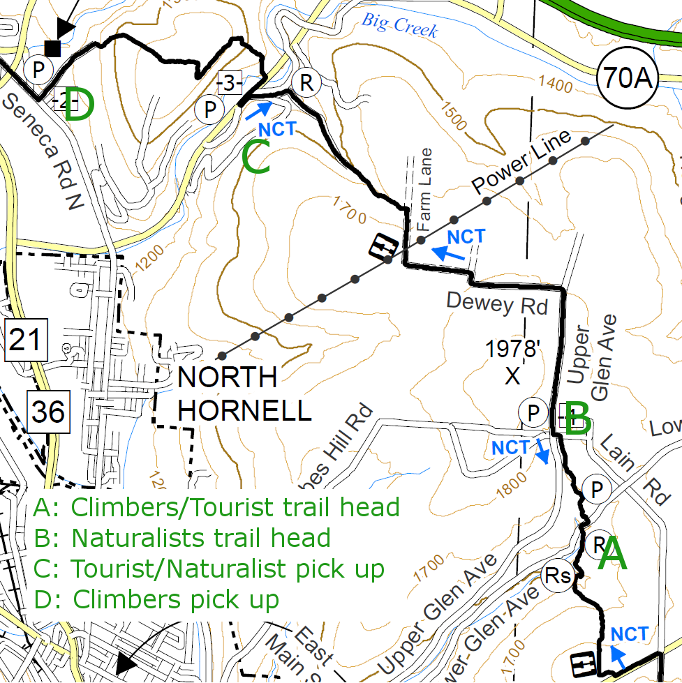
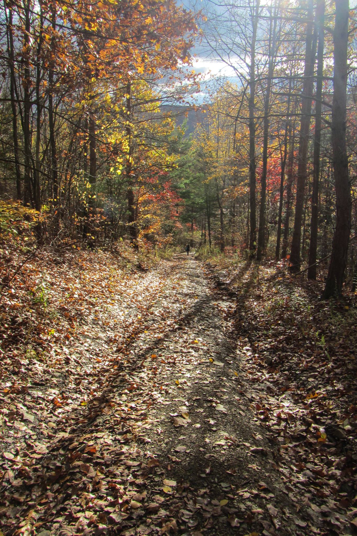
Directions to the Fiddler’s Fair Parking lot: (Bus transportation is available to Punky Hollow during the fair)

Notice: GPS is notoriously bad in this area.  You want to avoid the following roads: Liddiard Rd, Coates Rd, Richards Rd and Peglow Rd as they are seasonal, which many people will interpret as closed and abandoned.  Also please avoid Pardee Hollow Rd between Tabors Corners Rd and Dutch Hollow because of foot traffic for the fair. If you need GPS, select Dutch Hollow and Tabors Corners Rd, Wayland, NY and follow Dutch Hollow Rd to the other end.  From the South East, select Pardee Hollow and Garlinghouse Rd, N Cohocton, NY and follow Pardee Hollow to Dutch Hollow and the parking lot.

From Rochester: Follow Rt 15A south through Lima and Hemlock. From the intersection with Rt20A south of Hemlock, continue on Rt 15A for 9.9 miles and take a sharp left turn on Wheaton Hill Rd (CR 16). At the tee, at the top of the hill, turn left onto Wetmore Rd and take the first right onto Tabors Corner Rd. After 0.4 miles, take a slight left onto Dutch Hollow Rd. After 3.6 miles, the parking area is on the left at the intersection with Pardee Hollow Rd.

From Springwater: go North on 15A for .8mi from the light. Turn right on Wheaton Hill Rd. At the tee, at the top of the hill, turn left onto Wetmore Rd and take the first right onto Tabors Corner Rd. After 0.4 miles, take a slight left onto Dutch Hollow Rd. After 3.6 miles, the parking area is on the left at the intersection with Pardee Hollow Rd.

From Wayland: take Rt 21N for 5.6 miles. Turn left on Co Rd 38 (Garling House Rd AKA Rowe Rd). Take the first left onto Pardee Hollow Rd and continue for 3.8 miles. The parking area is on the right at the intersection with Dutch Hollow Rd.

From Honeoye: take W Lake Rd south. Turn right onto French Hill Rd. At the tee (at Dug Rd) turn right to stay on French Hill Rd. Take the first left on Garlinghouse/Atlanta Rd. Go Right on Pardee Hollow Rd and continue for 3.8 miles. The parking area is on the right at the intersection with Dutch Hollow Rd.