About Mark

President of Springwater Trails, Inc

Bicentennial Cemetery Hike

IMG_1251 
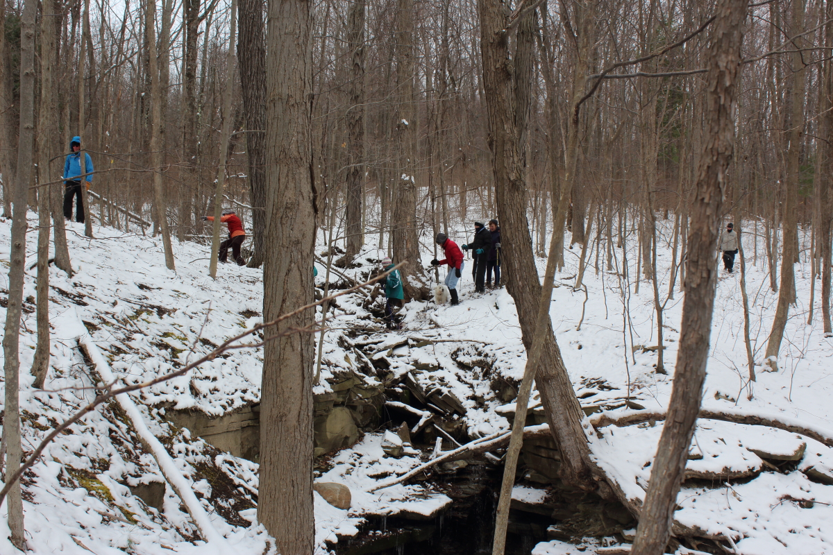
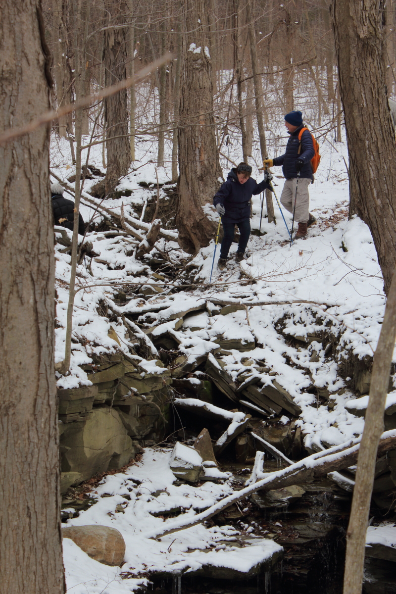
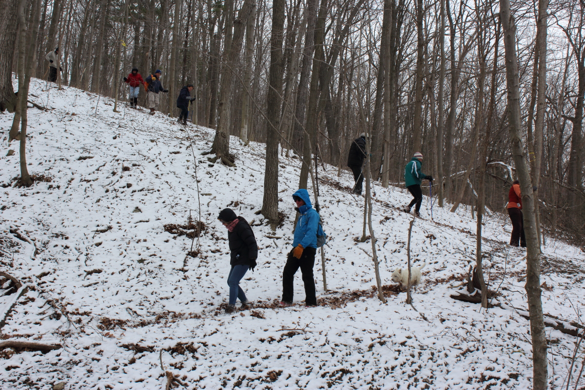
Nine sturdy hikers braved hail, snow and high winds on Sunday, May 15, for the second Springwater Trails Bicentennial Hike. Snow in May is not unheard of, but it is unexpected, especially given a March with a high of 75 and average temperatures of 50 degrees.

IMG_1252
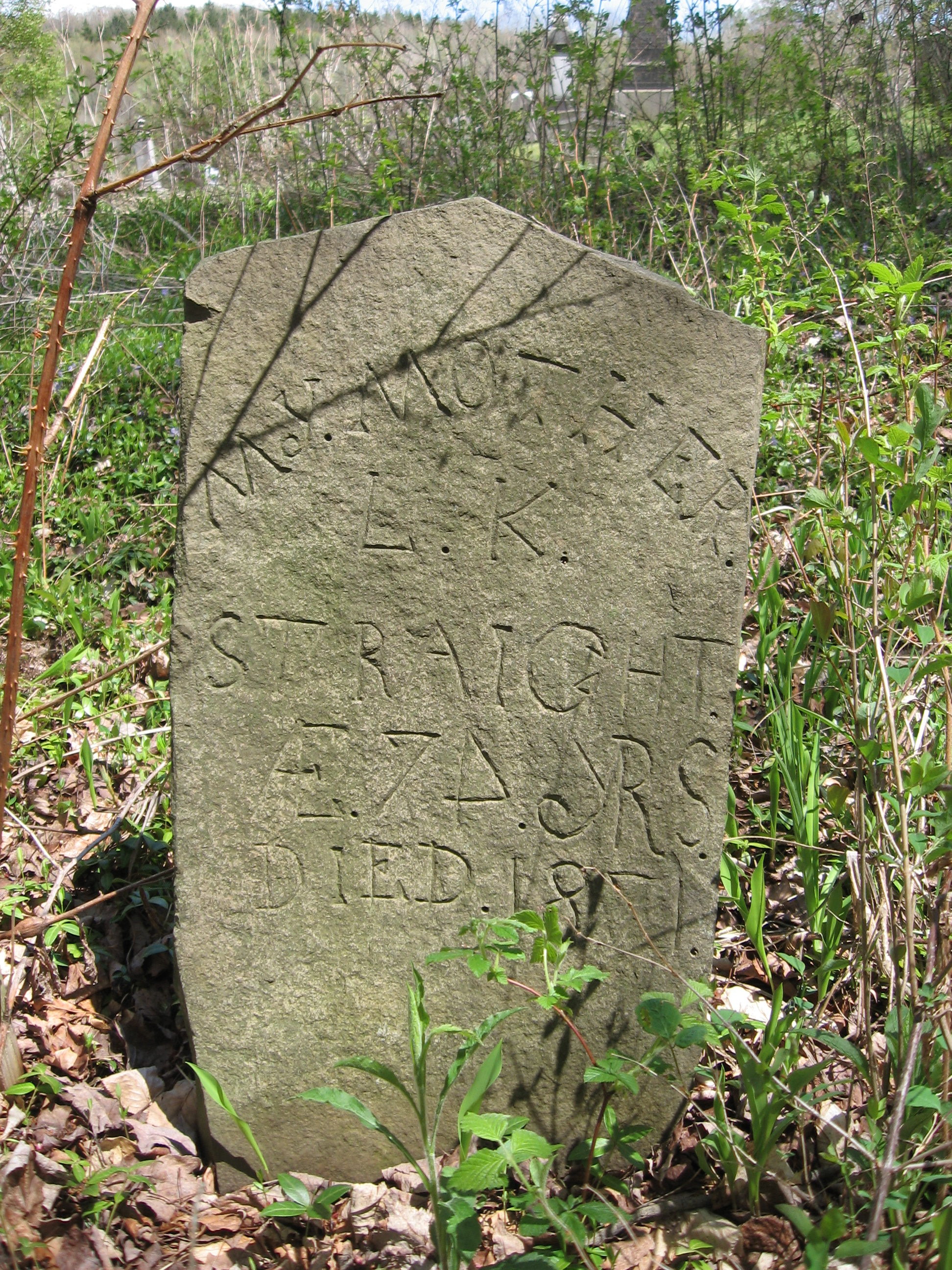
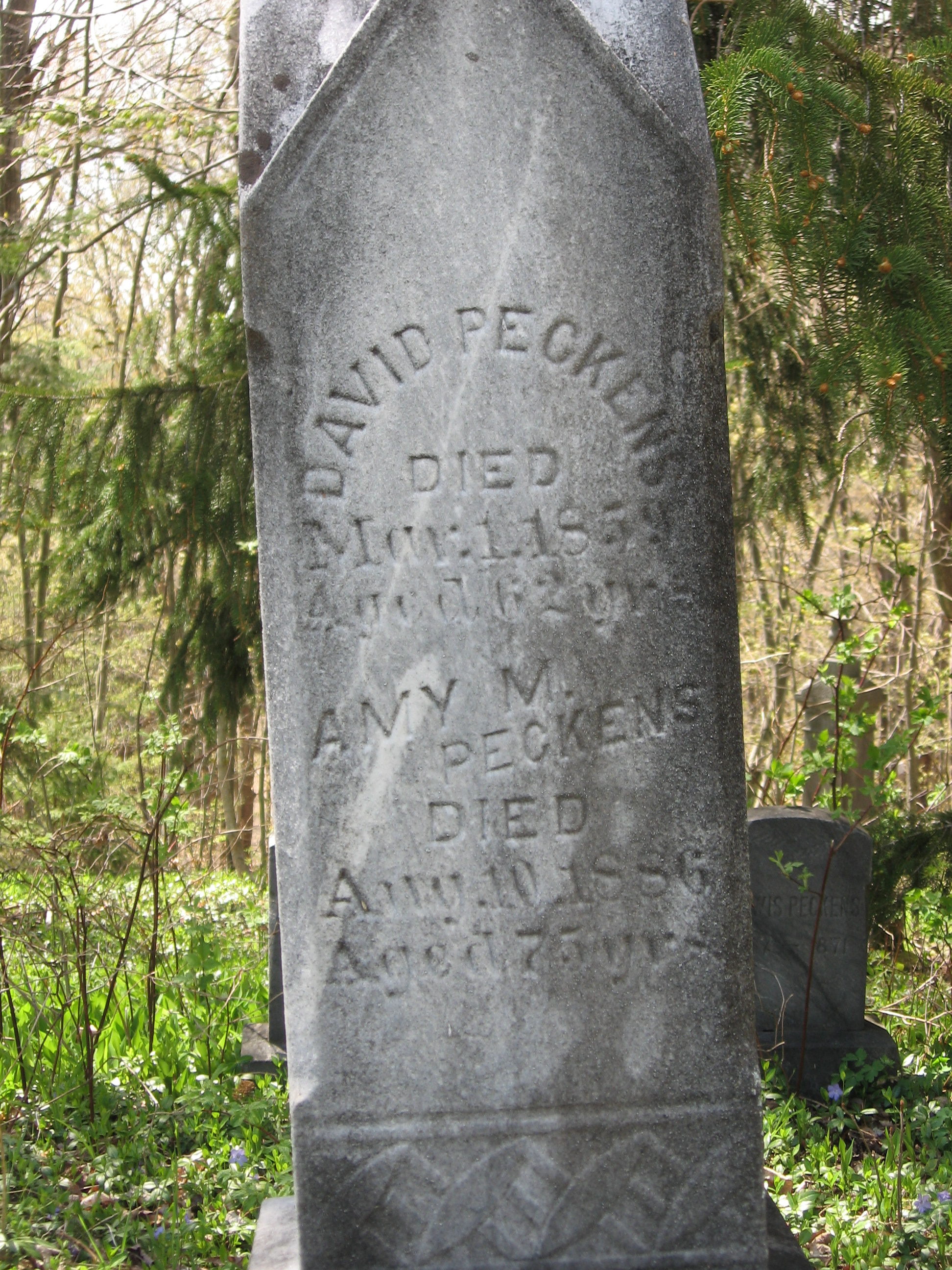
We all gathered at the corner of Giles and Schribner Roads, and then carpools to the East Springwater cemetery on Tabors Corners Road. This well maintained cemetery contains grave stones for both Scribners and Guiles plus other familiar names now attached to roads in town.

IMG_1255
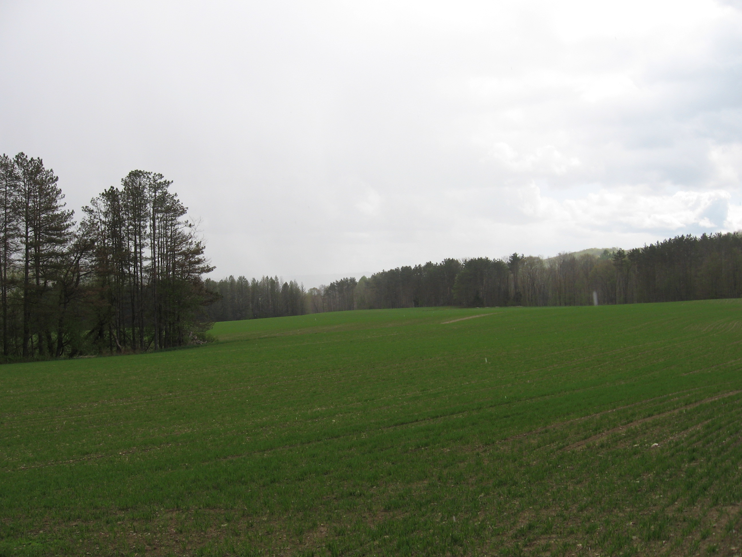
After about 20 minutes of exploring, we headed south on Tabors Corners and then headed down toward the Cohocton River. On the other side, we climbed up to several fields planted with a grain (maybe oats).  Across the field, we entered a working tree farm and followed logging roads around the hill.  Our final leg of the hike crossed through fields and woods up Gilles Rd to a private family cemetery from the mid 1800s.

On the way back to the cars, Wendy tried to get a picture of us all in the snowstorm, but it didn’t last long enough to herd even six hikers into a group.

IMG_1258
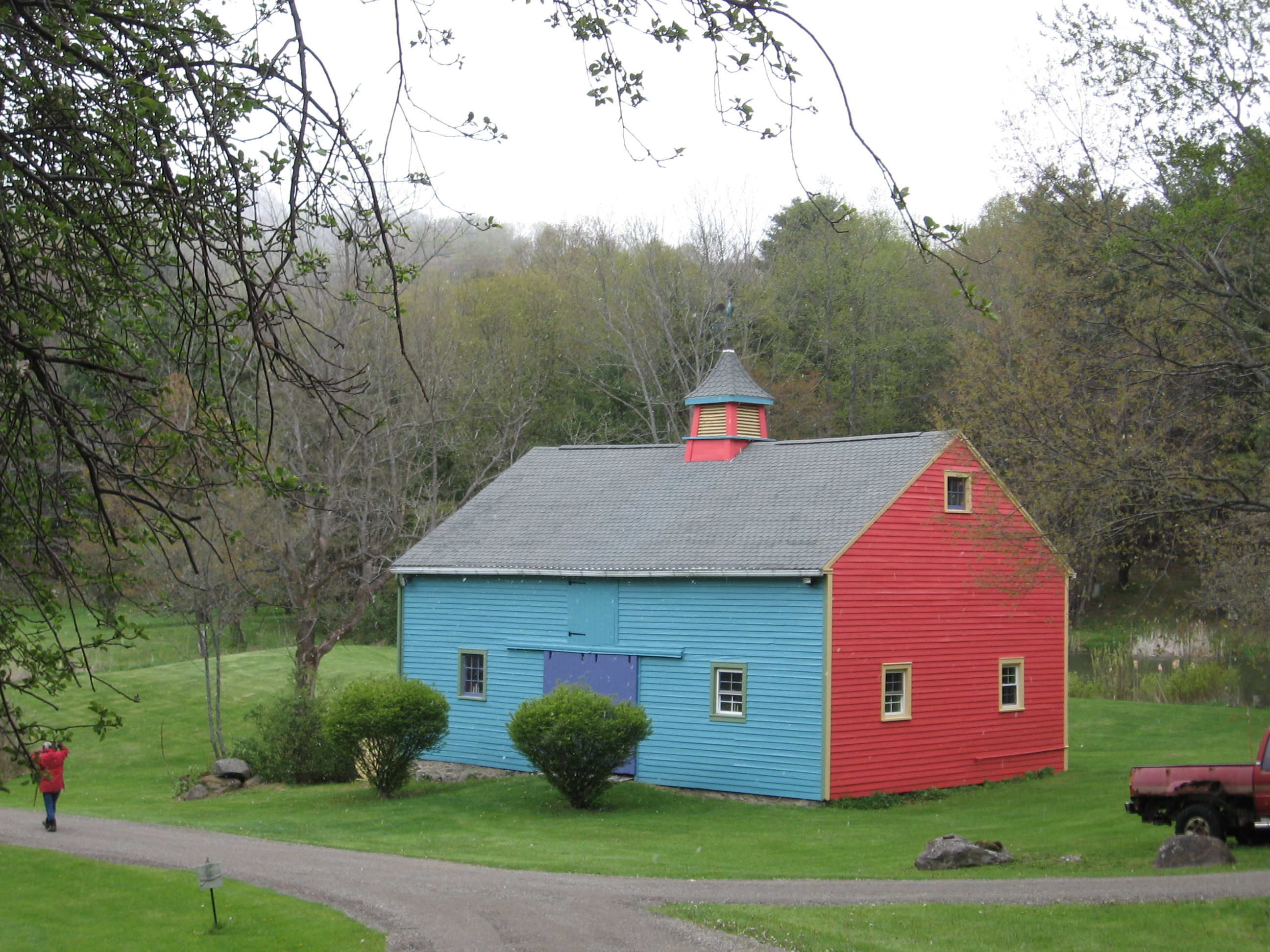
So, even with the hail and snow, it was an good hike will some fun exploring.  Most of the dishes at our social were hot, allowing for an enjoyable time out of the cold. We now think winter is officially over, so join us for our spring hike next week at Mossy Bank Park. Our thanks to Andy Hamilton, Sue Conge and Roy Gibson for allowing this special hike on private land.

Congratulations Katherine

Seniorama 2016On May 7th, Livingston County is celebrating Seniorama 2016. And they are celebrating Katherine Humphrey as Senior of the Year in Springwater. Hurray.

York Central School
2578 Genesee Street
Piffard , NY  14539
(585) 243-1730

Driving Directions:

From Springwater: Take NY 15 North for 7.5 miles.  Turn left onto Sliker Hill Rd (CR 33). At the end of Sliker Hill Rd, turn right onto NY 256N for 1.1 miles. Take the 2nd left onto CR 45 (Maple Beach Rd). 324_farm In 2.3 miles, turn right on Groveland Rd. In Geneseo, turn left onto South St (NY 20A). Take a right at the traffic light onto Main St. Take a left at the flashing traffic light onto Court St. Take a right onto Route 63 (the school is about 5 miles ahead on your left)

From Wayland: Take I-390 North to Exit 7. Turn right onto NY 408 which becomes NY 63 North almost immediately. In 3.3 miles,turn left to stay on NY 63. In 5.7 miles (you will cross the Genesee River and pass through Piffard), the school will be on the left.

From Rochester: Take Interstate 390 – Exit 8 (Geneseo). Head west on Route 20A into the village of Geneseo (approx. 5 miles). Take a right at the traffic light onto Main St. Take a left at the flashing traffic light onto Court St. Take a right onto Route 63 (the school is about 5 miles ahead on your left)


Avon Greenway Hike – April 24, 2016

Directions to the 23 Genesee St in Avon NY for the Avon Preservation and Historical Society presentation at 2:00PM

AvonOperaBlockFrom Springwater: Take NY-15A North to Lima.  Turn left on NY-5 and US-20. In 6.9 miles at the traffic circle in Avon, take the 3rd exit onto Genesee St.  Park anywhere available. The Opera Block Town Hall is on the right side of Genesee St.

From Springwater via NY 15: Take NY-15 North through Livonia and Lakeville. Turn left onto Rts 5&20 and cross over I-390. In 3.3 miles at the traffic circle in Avon, take the 3rd exit onto Genesee St.  Park anywhere available. The Opera Block Town Hall is on the right side of Genesee St.

From Rochester: Take I-390 South to Exit 10.  Turn right onto Rts 5 & 20. In 2.5 miles at the traffic circle in Avon, take the 3rd exit onto Genesee St.  Park anywhere available. The Opera Block Town Hall is on the right side of Genesee St.

Directions to Berry’s Park for the Hike Meetup at 3:15PM

Berrys Park Avon

From Springwater: Take NY-15A North to Lima.  Turn left on NY-5 and US-20. In 6.9 miles at the traffic circle in Avon, take the 2nd exit to stay on 5&20.  In 0.7 miles, just before the Genesee River, the parking area is on the left.

From Springwater via NY 15: Take NY-15 North through Livonia and Lakeville. Turn left onto Rts 5&20 and cross over I-390. In 3.3 miles at the traffic circle in Avon, take the 2nd exit to stay on 5&20.  In 0.7 miles, just before the Genesee River, the parking area is on the left.

From Rochester: Take I-390 South to Exit 10.  Turn right onto Rts 5 & 20. In 2.5 miles at the traffic circle in Avon, take the 2nd exit to stay on 5&20.  In 0.7 miles, just before the Genesee River, the parking area is on the left.

From Genesee St: Get back onto the traffic circle (follow road signs) and go all the way around the circle and exit onto W Main St, Rts 5 & 20.  In 0.7 miles, just before the Genesee River, the parking area is on the left.

To Avon Driving Park at the west end of Spring St in Avon for the After Hike pot luck at 5:45pm

Avon Driving Park

From Berry’s Park: Turn right (East) on Rts 5&20. Take the first right onto River St. In 0.7 miles, turn right onto Spring St.  The park is at the end of Spring St.

From I-390 Exit 10: Head west on Rts 5 & 20. In 2.5 miles at the traffic circle in Avon, take the 2nd exit to stay on 5&20.  In 0.3 miles, turn left onto Wadsworth Ave.  In 0.6 miles, turn right onto Spring St.  The park is at the end of Spring St.

Exploring the new side of Rob’s Trail

Rob's trail 1Today we enjoyed a hike down from Rob’s Trail on RT 15A to Hemlock Lake. The trail started on Nature Conservancy land.  The Conservancy has chosen to preserve land that joins the Hemlock Canadice State Forest over the top of Bald Hill, and now they are creating a hiking trail to allow the public to enjoy these unique Finger Lakes.

Rob's trail 4Last summer, the Conservancy started clearing the trail.  One crew started from the top on Rt 15A.  We started on that trail, until we came to the end of the built portion.  At this point there is a major gully that the Conservancy wants to cross on a bridge that will give a grand view of the waterfall.  Rob's trail 8The NY Department of Environmental Conservation, which manages the state forest must approve this construction.  While this approval is pending, another construction crew worked on extending the trail along the lake. After a bit of confusion over the various temporary trail markers, we reached the lake and finished the hike with a stroll along the old lake road to the north boat launch.  Gene and Katherine, who had hiked the upper portion of the trail, pciked us up and drove back to the parking lot at Rob’s Trail.