The Crescent Trail recently started a new project to improve the blazing of the Crescent Trail in Perinton. As we continue to build and blaze the Springwater Trail, I thought the Trail Committee should keep up with other organizations and how they blaze the trails. The article below is copied exactly from a PDF posted on the Crescent Trail Yahoo Group.
By the way. If you would like to be a member of the Springwater Trails Trail Committee, working with our Trail Master (Rick Henchen) to plan and build the Springwater Trail, please contact any board member or send an email to [email protected].
New Way Finding Signs on the Crescent Trail
December 3, 2014
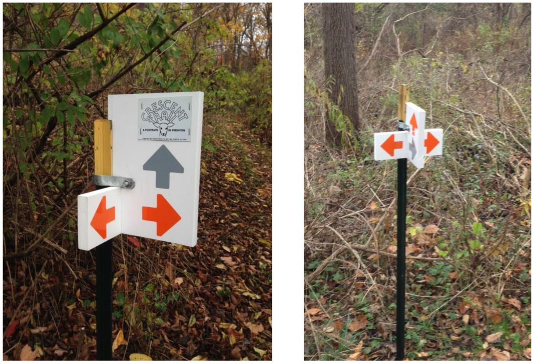
The Crescent Trail Association is beginning to install way finding signs on some sections of the trail system to help hikers keep on their intended paths. At this time we are producing signs that are simply colored arrows to point the direction of CTA trails at junctions and other locations where a hiker might wonder which way to go. Signs near access points to the trail system will have the Crescent Trail logo attached for identification. Dave Schaeffer came up with the concept and design of these new signs.
About 250 potential sites for signs on our 38+ mile system have been identified, so this will be a long term project. Signs at the more prominent locations, e.g. at trail parking lots, will be initiated by the Perinton Parks Department. CTA will concentrate on the way finding signs within the system.
The Horizon Hill area between Garnsey Road and Woodcliff Drive has several branches of the Crescent Trail system and many others, which have been the source of confusion for many first –time and even regular users, so our first priority for sign installation is there. As of this date, twelve signs have been installed in that area, with several more to come as weather permits.
Here are examples of some of the new signs:
 Jim Unckless, CTA Board Member