[formidable id=8 description=true]
Monthly Archives: August 2013
Canadice Lake West Side
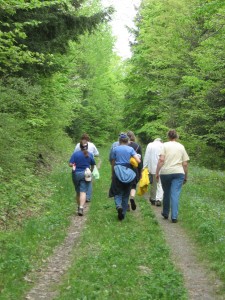
This Sunday, September 1, Springwater Trails is hosting a hike for the Genesee Valley Hiking Club. The hike will start at the north west end of Canadice and will cover one of our standard hikes along the west side of Canadice and up to Rob’s trail and back. I know the highlight of the hike will be the new friends we make from GVHC.
Pati has volunteered to lead the Naturalists from the north parking area to the south gate. We will need a few cars staged at the south end to bring hikers back to the cars and social.
I will lead the Climbers from the north end along the west side of Canadice, and then up the trail to Rob’s Trail. We will loop around Rob’s Trail and then back down to the Canadice Trail and back to the north end.
The Tourists will hike with the Climbers but will break off at the top of Rob’s Trail and exit at the parking lot. We will stage a few cars in the parking lot to carry hikers back to the start point.
Because this is a joint hike, we will adapt our pet policy to match the GVHC policy of no pets on the hike. Please don’t tell Mac and Duff that we will be leaving them at home.
Following the hike, we will grill sausage and hamburgers. Please bring a dish to pass and a your own beverage or make a small donation to the social fund and relax with us.
GVHC members who wish to carpool, will meet at the I-390 exit 11 Park & Ride (off Rt 15 just north of Rt 251 Rush Scottsville Rd) (GPS 43.003933,-77.666893) at 1:00PM. We will carpool to Canadice, planning to arrive at 1:45PM.
Hikers wishing to drive directly to Canadice, please plan to arrive by 1:45 so we can be organized and ready to start promptly at 2:00PM. Click here for directions.
If you wish to hike with the tourists or naturalists, please contact Mark to help arrange staging of cars at the end of the hikes.
Northwest parking – Canadice Lake (42.7394625,-77.5418878) – Directions
The northwest parking area for Canadice Lake is off Purcell Hill Road west of Canadice Lake Road. Please note that this is not a boat launch.
From Rochester and the I390 Exit 11 Park and Ride: From Rochester, take I390 south to Exit 11. Turn left (south) on Rt 15. The park and ride is on the right side. From the park and ride, turn right onto Rt 15 and then an immediate left onto Rt 251 toward Rush. After 1.3 miles, bear right onto 15A. Follow 15A through Rush, Lima and Hemlock for 18.5 miles. Turn left on Purcell Hill Road for 1.2 miles. At the bottom of the hill, the parking area is on the right before you cross the Canadice outlet.
From Springwater: Take 15A north from the Rt15 intersection for 7.6 miles. Turn right on Purcell Hill Road for 1.2 miles. At the bottom of the hill, the parking area is on the right before you cross the Canadice outlet.
From Honeoye: From Rt 20A, turn south on CR 37. After 3.7 miles turn right at the white church in Canadice. Stay straight onto Burch Hill Rd when CR37 bears to the left. Follow Burch Hill Rd down to Canadice Lake Rd. Turn right (north) on Canadice Rd for 0.7 miles, then left on Purcell Hill. The parking area is on the left in 0.2 miles.
From Canandaigua: Take Rts 5&20 west out of the City of Canandaigua. About 4 miles out of the city, turn left onto US-20A and NY-64 S. In 3.7 miles, turn right to stay on 20A toward Honeoye. Continue with the directions above from Honeoye.
From Pen Yann and Naples: Take NY-364 W for 12 miles to Middlesex where 364 joins NY 245. Continue straight on NY-245 for 9 miles. At the end of 245, turn left onto N Main St (NY 21 S). In 1.2 miles, at the south end of Naples, turn right onto Clark St which becomes CR 36. In 12 miles, turn left onto Jersey Hill Rd (Gratsley Hill Rd is not recommended, especially in the winter when it isn’t plowed). At the end of Jersey Hill Rd, turn left onto CR 37. After 1.1 miles turn right at the white church in Canadice. Stay straight onto Burch Hill Rd when CR37 bears to the left. Follow Burch Hill Rd down to Canadice Lake Rd. Turn right (north) on Canadice Rd for 0.7 miles, then left on Purcell Hill. The parking area is on the left in 0.2 miles.
The Springwater Trail at Sugarbush Hollow – Maintenance – August 25 at 4:00
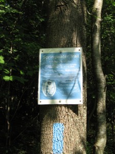
Let’s spruce up the Springwater Trail prior to the Fiddler’s Fair. Come join us at 4:00 on August 25th at the Sugar House to hike the trail and ensure that it is clear of debris and that all of the blazes are visible.
 We will meet at the Sugar House at 4:00 and split into work details for the east side and the west side of Pardee Hollow. Bring clippers and gloves. Saws will be available. A couple of weed wackers would be appreciated.
We will provide hotdogs and drinks afterwards. Click here for directions to Sugarbush Hollow.


