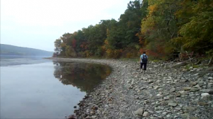
 I just got back from the hike at Katherine Humphrey’s Tree Farm. This hike also included a special research project. Twenty-five hikers from the Springwater Trails hiking group and from the Rochester Mushroom Club RAMA hiked in three separate groups.
The climbers hike to the labyrinth
I joined Char’s Climber group that walked south across Katherine’s, enjoyed the views from Swartz Rd (the colors would definitely have been  brilliant with the sun out), and traversed the labyrinth at the Kerr’s house on Carney Hollow Rd. John and Colleen created a labyrinth through the spruce trees behind their house, obtaining in one spot a hiking trail and a perfect spot for meditation and reflection. By the way, you may be interested in reading about the definitions of labyrinth and maze (they aren’t the same!)
The research project
Prior to the hike, Gene Binder explained the special research project. Since tree roots can not, by themselves, take up enough water and minerals from the soil to meet the requirements of a tall tree, fungi, in the soil, attach themselves to the roots, spread out hundreds of feet in all directions, take these products from the soil and transfer them to the tree roots. These products then go from the roots, up the trunk, and into the branches, leaves, flowers and seeds.
Since fungi lack chlorophyll, they are unable to convert water and carbon dioxide into the sugar and organic compounds they need to survive. This process (photosynthesis) is done in the tree leaves. These products are transferred down the trunk and into the roots, where they are taken by the attached fungi. The 2 organisms thereby form a dependent relationship, where one is unable to survive without the other.
This is a specific relationship. Specific trees have specific mycorhyzal fungi, and can not survive without them. When Katherine purchased her Western stock from a nursery in the Western part of the US, the fungi that were mycorhyzal on those species may have come with them so, as well as Western trees, Western fungi may also be thriving on her farm.
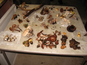
After hiking the Tree Farm, members of RAMA returned to the farm house and displayed the mushrooms they had collected.
Eight members of the Rochester Area Mycological Association (RAMA) and four Springwater Trails hikers, collected several dozen different species of mushrooms from Katherine’s nursery and woodlands. The mushrooms collected were displayed on tables and the the great variety collected on the farm, in 2 hours, was impressive.
Dr. Randy Weidner of Bath and RAMA club president Dave Wolf of Rochester shared their extensive knowledge of mushrooms and identified many of the species collected. Of special interest were the beautiful fly agarics, Amanita muscaria. Two varieties are known, one golden yellow and the other bright red. The former occurs commonly in the East, especially around here. The red variety is, likewise, very common in the West, but quite rare in the East, and was collected in the nursery. Also, of similar interest, were some specimens of the genus Inocybe (fiberhead). Although definite determination to species is quite involved, in this genus, it didn’t look like any species previously collected or known to exist in this area. Randy and others are conducting closer microscopic examinations.
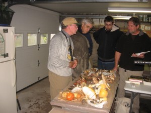
After hikers collected mushrooms all around the tree farm, experts identified most of the mushrooms and mentioned which ones were poisonous, which appeared only in the fall, and which were unusual to the Eastern US.
Our thanks
On behalf of Springwater Trails, we express our appreciation to Katherine Humphrey, for her usual wonderful hospitality (and delicious home made soups) and the members of RAMA for sharing their expertise with us and providing us this experience with the fascinating world of fungi.
And of course, special thanks to Gene who provided the mushroom information in this post, and to Char who took the pictures.


