Mendon Ponds Park Hike

This Sunday’s hike will take us back to an old favorite, Mendon Ponds Park, with well-marked trails and much to see in every season. We will meet outside the Nature Center/Wild Wings at 1:45PM. Wild Wings is open 10AM-2PM if you want to arrive early and walk through before our hike. There are also restrooms at the center.

The weather on Sunday is expected to be a nice 40 degrees but the rain on Saturday could make our hike a bit muddy. Please be prepared and bring your pole(s) if you use them.

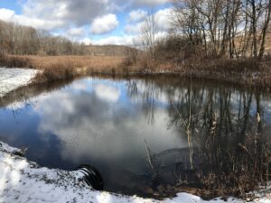
We’ll split into just two groups for this hike. The Naturalists and Tourists will hike the area of the Grasslands and West Esker trails with an overlook of the Devil’s Bathtub, for about 2+ miles. The Climbers will do a combination hike of the Nature Trail/Birdsong and the Quaker Pond loop for a longer (and quicker paced) hike of about 5 miles, with an enjoyable view of Quaker Pond. See attached map with trail descriptions.

Park Map:       https://www.monroecounty.gov/files/parks/jan%2015%20mpp%20map.pdf

For the social afterwards, interested members can head to Flaherty’s in Honeoye Falls at 60 W Main St..

Directions:

From Springwater: Head north on 15A for 21.6 miles through Hemlock and Lima. Take a right at the exit to Honeoye Falls. Stay on W Main St into the village where you will pass the Flaherty’s on the right. Continue straight onto NY 65 for 4.4 mi. (At 2 miles, you will go around a traffic circle. Stay on NY 65.) Turn right onto Pond Rd at the park entrance. The Nature Center parking area is immediately on the right.

From Honeoye, take US 20A west and head north on CR 37 for 8.2 miles to W Bloomfield. Continue straight on NY 65 for about 3 miles, and make a right on Quaker Meeting House Road just before you come into Honeoye Falls. When Quaker Meeting House Road ends at Route 251 (Rush-Mendon Road), go left and then right on Route 65/Clover Street. The Pond Road entrance to the park is about 2 miles to the north, on the right. The Nature Center parking area is immediately on the right.

From Rochester: Exit I 590 at Monroe Ave toward Pittsford. Turn right (south) onto NY 65 (Clover St). In about 6.7 you will come to the Canfield Road entrance to the park – this is not the one you want. Continue another 1.5 miles, then turn left onto Pond Rd, the second entrance into the park. The Nature Center parking area is immediately on the right.


Canandaigua Vista – New FLLT Nature Preserve

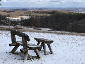
Join us Sunday afternoon to explore the latest Nature Preserve of the Finger Lakes Land Trust – Canandaigua Vista, overlooking the Canandaigua Valley and points east. This preserve, on a 90-acre parcel that was once a dairy farm, includes a combination of meadow and woodlands, with trails circling the property and abutting parts of Barnes Gully and a farm pond. This is a shorter hike than our usual, but there’s a lot to see. If folks finish early and there is interest, we can visit another nearby Canandaigua overlook afterwards – Quiet Meadows on Barnes Road.

Hiking is on mostly dry rolling hills, with some moderate climbs. The Land Trust permits fall hiking while also issuing a limited number of private bow hunting permits on the property in the interest of deer control; all permitted hunters have been advised of our event. WEAR SOME BLAZE ORANGE OUTERWEAR AS A PRECAUTION. Poles and mud-suitable boots also advised. Binoculars are also recommended if you have them – great for identifying landmarks way off across the lake.

Meet at 1:45 at the new trailhead parking lot near the top of Jones Road, a dead end off Route 21, about 2 miles south of Cheshire. Park in the generous off-road lot, not on the road. The whole group will take the White Trail around the perimeter of the preserve, stopping at various overlook points to take in the sights. At the end of the loop after about 1.25 miles, Naturalists and Tourists will return to their cars to adjourn to Quiet Meadows (see directions below), and Climbers may retrace the full loop back to the start, seeing the sights from the other direction for a total of about 2.5 miles, or adjourn to Quiet Meadows or nearby Onanda Park, where we can hike another 3 miles in a woods with its own Canandaigua Vistas.

Optional Social:   Join us afterwards for refreshments at Brews and Brats, 6461 Route 64. Check out the menu here.:

DIRECTIONS:

From Springwater, Wayland, Naples: Go east to North Cohocton and Naples and Route 21, then continue north through Woodville to the intersection of Route 21 and Route 64. Bear right at the fork and follow Route 21 north for 6.8 miles, to just past the Scenic Overlook. Make a left on Jones Road, and go up the hill about a half mile. The Trailhead parking area will be on the left. There is a big sign.

From Honeoye: Take Route 20A east to County Road 32 (Wizard of Clay), then make a right and proceed to the Bristol Valley. At the Route 64 intersection, go straight and up the hill, making a right on Montanye Road (later Goodale Road) This road ends in Cheshire . Make a right on Route 21, and go about 2 miles south. Make a right on Jones Road, just after the Seneca point Road intersection. Go 12 mile p the hill to the trailhead parking on the left.

From 5&20 and Canandaigua: Take Route 21 south to Cheshire and continue south another 2 miles to Jones Road, just after the Seneca point Road intersection. Go 12 mile p the hill to the trailhead parking on the left.

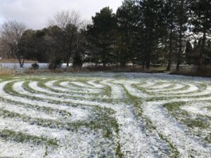
Directions to Quiet Meadows and Onanda Park: Return to Route 21 and make a left, then an immediate right on Seneca Point Road. In about .9 miles, turn left on Barnes Road. The first building on the right is a red barn. Park in front of the barn and go through the hedge row opening to the grassy labyrinth. Walk the labyrinth paths for a meditative experience, or navigate the mowed paths to the left around the 5 acres of hills and lake vistas. For Onanda Park, Barnes Road entrance, proceed another quarter mile down Barnes Road. After the road curves to the right, look for a dirt road entering the woods on your left (no sign) There is a trailhead and parking for about 8 cars in there.
Brews and Brats: From Canandaigua Vista, go down Jones Road and right on Route 21. In 6.8 miles, turn right on Route 64 and go a sort distance around the curve to the right. Brews and Brats is behind Arbor Hill at 6461 Route 64.

Fairport Historical Museum and Erie Canal Hike

This Sunday we will enjoy the beautiful downtown Fairport NY, with some history of the Erie Canal and a walk along the banks of the Canal.

Our hike will start with a tour of the Fairport Historical Museum. Vicki Profitt,  the Museum Director & Pres. of the Historical Society will be our tour guide.  It is a very small museum & it will be open @ 2:00, so people are welcome to come in anytime after that but probably around 2:15-2:30 is ideal.  The tour will be approximately 1/2 hr. Parking is available in the municipal lot across the street from the museum.

After the tour, we will have two hikes. The longer hike will cross the canal on the Lift Bridge and follow the canal path east. In about a mile, we will cross the canal and continue east on a wooded path. At the next bridge (Lyndon Rd), we will cross back over the canal and continue back to the village. Hikers wishing some refreshment will leave the canal, crossing a parking lot to Mulconry’s Irish Pub. The rest of the group will cross the Lift Bridge, taking the stair up beside the library to the parking lot and our cars. This hike is approximately 5 miles.

For a shorter hike we will stay on the canal path for about 1 and a half miles, returning the way we came.

Following the hikes, everyone is invited to Mulconry’s Pub at 17 Liftbridge Ln E, Fairport, NY 14450. You can find a description of Bangers and Mash plus other food on their menu. This pub is a very short walk from the Village Landing, so cars can stay parked there at the Landing. We will be making a reservation for 10 people & we can increase it if need be.

Directions: The Museum is  in on Perrin St, one street west of Main St in Fairport. Parking is across the street – plenty of parking by the Dollar Store in Fairport Village Landing.

From Springwater: Head north on NY 15A. In 2.7 miles from the flashing light, take a slight right onto Old Bald Hill Rd South, then an immediate right onto Johnson Hill Rd.  At the top end of Johnson Hill Rd, turn left onto CR 37. In Canadice, turn left to stay on CR 37 for 11 miles. At the light in W Bloomfield, continue straight onto NY 65. Continue straight onto CR 35 when NY-65 curves to the left. In Monroe County, the road changes name to W Bloomfield Rd but continue straight. After crossing the Thruway, Thornell Rd is 1.4 miles. Turn right on Thornell Rd. At the end of Thornell Rd, turn right onto NY 96.  At the second light, turn left onto Kreag Rd. At the end of Kreag Rd, turn right onto Ayrault Rd. At the first light, turn left onto Moseley Rd (NY 250). In 0.9 miles, turn left into the Fairport Village Landing parking lot. Park on the far side of the parking lot, across the street from the Museum.

From Canandaigua: Tak3 NY 332 north to the Thruway.  Head west on the Thruway to exit 45. Take the first exit off I-490 onto NY 96. Pass Eastview Mall and turn right onto Moseley Rd (NY 250). In 0.9 miles, turn left into the Fairport Village Landing parking lot. Park on the far side of the parking lot, across the street from the Museum.

From Rochester: Take I-490 east to Exit 25 – NY31F Fairport. In 3.6 miles you will be in the village of Fairport. Turn left onto Perrin St (the last street before the light). Go past the Museum on the left and turn into the parking lot on the right.  Park across the street from the Museum.

Genesee Valley Greenway Hike from Fowlerville

The Genesee Valley Greenway State Park is a 90-mile open space corridor that follows the route of the Genesee Valley Canal (1840-1878) and the Pennsylvania Railroad Rochester Branch (1882-1963) from the Erie Canalway Trail in Rochester’s Genesee Valley Park to the Village of Cuba in Allegany County. The Greenway will eventually extend to Hinsdale in Cattaraugus County. This Sunday’s hike will start at Fowlersville Rd parking area in the town of  Caledonia and will follow the Greenway north to US-20 and then to NY-5 and finally will follow the Erie-Attica Trail out to a parking area. on Farmers Rd in Avon.

There are three options for this hike.
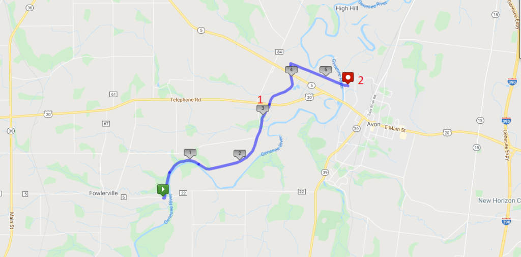
  1. The Tourists will do an out-and-back two hour hike.  This is a good option for any hikers who would prefer to avoid car-pooling during the pandemic. The Greenway starts by following the Genesee River, crossing a couple of streams that cross under the trail through a deep culvert to get to the river. At about the 1.2 mile point, the river wonders through loops to the east, we nice big fields visible between the trail and the river. , The Tourist group should watch the time and turn around  at 3:00 for a two hour out-and-back hike of less than 5 miles. Don’t go past Rt 20 – at that point the out and back will be over 6 miles. For safety sake, slower hikers should always stay in a group of at least 2 hikers and turn around at the same time.
  2. The Naturalists will do a through hike to US Route 20 (Pickup point #1 on the map). There will be a car available at Route 20, to return hikers to their cars.  This option is 3.2 miles and will be limited by the size of the pickup car.
  3. The Climbers will continue on the Greenway past Route 20, and across NY 5. About a tenth of a mile past NY 5, the Climbers will turn right just past two bridge abutments onto the Erie Attica Trail. These abutments carried the Erie-Attica Railroad over the Pennsylvania Railroad. Interested hikers may find the planning study report for the Erie-Attica Trail of interest. This hike is 5.4 miles ending at pickup point 2 and will take slightly more than 2 hours if hikers maintain a 25 minute mile pace. If necessary, hikers can stop at the Route 20 crossing or return to that crossing prior to reaching the Erie Attica turnoff. Hikers who complete the hike to cross the Genesee River at Farmers Rd will have a couple of cars to carry them back to Fowlersville Rd. These cars should plan to stop at Rt 20 to pick up any stragglers.

Following the hike, join us for a social hour at either Tom Wahls in Avon or at the Rising Storm Brewery in South Lima.

NOTE: Carpool drivers should plan to arrive at 1:30 at their pickup point. It is about 10 minutes back to the Fowlerville Rd meetup point.

Directions: To the Fowlerville Rd parking area (the Green start point on the map).

From Springwater: Head west on NY-15 from the light in Springwater. Continue on route 15 through Livonia and Lakeville. At 1.5 miles north of Lakeville, turn left onto Triphammer Rd. In 3 miles at the end of Triphammer Rd, turn right onto NY-39. In 2.5 miles, turn left onto Fowlerville Rd. In 2.9 miles, cross over the Genesee River and the parking area is on the left. After parking, you will cross the road to hike north on the Greenway.

From Naples: Head west from Naples on CR 36 to Honeoye.  Turn left on 20A for 1.5 miles. Turn right onto Big Tree Rd, across 15A  and 15 for 7 miles. At the end of Big Tree Rd, turn left on US 20A into Lakeville. Take a slight right to stay on NY-15. At 1.5 miles north of Lakeville, turn left onto Triphammer Rd. In 3 miles at the end of Triphammer Rd, turn right onto NY-39. In 2.5 miles, turn left onto Fowlerville Rd. In 2.9 miles, cross over the Genesee River and the parking area is on the left. After parking, you will cross the road to hike north on the Greenway.

From Canandaigua: Head west on US 20 through Lima to Avon.  At the traffic circle, take the 2nd exit to stay on Route 20. In 0.3 miles, turn left onto NY-39 (Wadsworth Ave). In 1.7 miles, turn right onto Fowlerville Rd. In 2.9 miles, cross over the Genesee River and the parking area is on the left. After parking, you will cross the road to hike north on the Greenway.

From Geneseo: Head north on NY-39 toward Avon. In 7 miles, turn left onto Fowlerville Rd. In 2.9 miles, cross over the Genesee River and the parking area is on the left. After parking, you will cross the road to hike north on the Greenway.

Directions to the Route 20/Greenway pickup point 1 (Drivers wanting to hike the 3 miles and willing to leave their cars at the parking area on Rt 20).

From Springwater: Follow NY 15 north through Livonia and Lakeville to Route 5 & 20.  Turn left and follow 5&20 around the traffic circle in Avon. In 1.2 miles past the traffic circle, turn left to stay on US-20 as NY-5 continues straight. The Greenway is 1.1 miles ahead with parking on the right.

Directions to the Farmers Rd pickup point 2 (Drivers wanting to hike the full 5.4 miles and willing to leave their cars at the end.)

From Lima: (I assume you can find Lima!) Follow 5 & 20 west for 8 miles, around the traffic circle in Avon. Just before the Genesee River, turn right into Farmers Rd.  Follow the road for half a mile, passing through the underpass under the trail. The underpass may have a pool of water under it. The parking area is on the north side of the underpass.

Directions From Farmers Rd to Fowlerville Rd: Turn right on 5&20. In 0.4 miles, turn left to stay on US-20. (Stop at the Greenway to pick up any drivers who have parked at the Rt 20 parking area.) In 3.5 miles, turn left onto Casey Rd.  At the end of Casey Rd, turn left onto Fowlerville Rd. The parking lot is on the right in 1 mile.