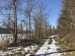
Ganondagan Hike

Weather Update, Sunday March 20:  Looks like there will likely be steady rain this afternoon. We’ll be hiking if any hardy souls show up, but please bring rain gear, traction footwear, poles and gaiters, as it’s likely to be muddy and maybe slippery. Hike may be shortened if that’s the group consensus. 

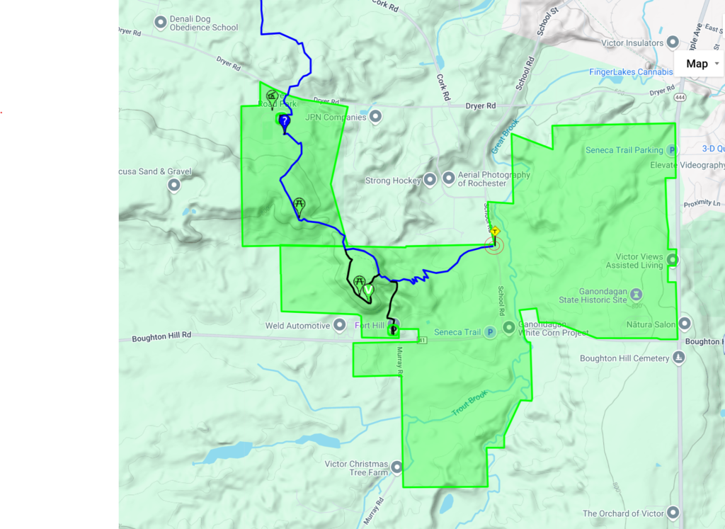
Our hike this Sunday will be at the Ganondagan State Historic Site, 7000 County Road 41 (Boughton Hill Road) in Victor.  Ganondagan is the site of a large 17th century Seneca town, and offers  hiking trails with interpretive markers illustrating the history and traditions of the Seneca people. The trails will take us through wooded rolling hills and meadows just south of the Village of Victor. Highlights will include the Granary Trail, where the Seneca protected and distributed their corn supplies on a palisaded mesa, and the Earth is Our Mother Trail, where interpretive markers describe local plants and their particular roles in Seneca life.   See   https://ganondagan.org/Visit/Hiking-Trails   for more on Ganondagan and its interpretive trails. 

We will meet at 1:45 at the Seneca Art and Culture Center parking lot, about .2 miles west of the intersection of Route 444 and Boughton Hill Road. All hikers will proceed past the Longhouse and around the Great Meadow to the Seneca Trail and then follow the Earth is Our Mother Trail along Great Brook.  After about 2 miles, we will divide into two groups, with the Tourists and Naturalists returning to the Longhouse and parking area via the Great Oak Trail for a total hike of about 2.5 miles. The Climbers will cross School Street and proceed up the hill by the Eagle Trail to the Granary, where we can stop for a long view to the south over the Bristol Hills and Bare Hill, then return to School Street and the starting point via the rest of the Earth is Our Mother Trail. Total hike for the Climbers will be about 4.5 miles.  Trails are well maintained and gently rolling hills, with switchbacks up steeper areas. In case of mud, poles and traction devices are advised. 

Social – Will be at Cheap Charlie’s Restaurant, 8 Elm Street, Bloomfield (on Route 444, left side, as you enter Holcomb)

Directions:  From Springwater/Honeoye area: Go north to Honeoye and then east on 20A to Route 64.  Go north on 64 for 3.7 miles to the 5 and 20 intersection. Go west on 5 and 20 for 1.25 miles and make a right on Route 444 (Maple Ave.).  Proceed 5.3 miles to Boughton Hill Road (County Rd. 41).  Turn left at Boughton Hill Road (flashing light), proceed .2 mile down the hill. The Seneca Art and Culture Center is the white and glass contemporary building on your right, with a large parking lot in front. 

From points east:  Take 5 and 20 west toward Bloomfield. Go right at the Route 444 intersection, and proceed 5.3 miles north to Boughton Hill Road (County Rd. 41) (flashing light).  Turn left at Boughton Hill Road, proceed .2 mile down the hill. The Seneca Art and Culture Center (a.k.a. Interpretive Center) is the white and glass contemporary building on your right, with a large parking lot in front. 

From Thruway:  Take Exit 45, and follow Route 96 east to the Village of Victor. In the village center, turn right on Route 444 (Maple Avenue). Go 1.5 miles to the top of Boughton Hill (flashing light). Turn right on Boughton Hill Road. Proceed .2 mile down the hill. The Seneca Art and Culture Center (a.k.a. Interpretive Center) is the white and glass contemporary building on your right, with a large parking lot in front. 

To the Social: From the site, go east on Boughton Hill Road. Make a right at the flashing light and follow Route 444 to Holcomb, about 4 miles. Cheap Charlie’s is on the left at 8 Elm Street.

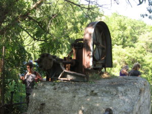
The Keuka Outlet Trail


This Sunday we will hike the western half of the Keuka Lake Outlet Trail starting at Seneca Mill and walking west to Penn Yan. The whole trail follows Keuka Lake’s outlet to Seneca Lake, starting in Penn Yan and going approximately 7 miles to Dresden, dropping 275′ along the way. The first destination will be Cherry Street (about 3.5 miles) where we’ll have cars waiting to take us back to Seneca Mill. If there is still some walking time we can continue the trail into Penn Yan. Since it’s getting on for spring then mud is likely so poles and shoe gripping devices or good boots will help.

This trail runs along the stream in a wooded ravine; it was formerly a canal towpath and later a railroad bed. It crosses the original Preemption Line and passes near the area of the first permanent white settlement of ‘The Universal Friend Jemima Wilkinson’, alongside waterfalls and the ruins of mills, factories and canal locks”.

Click to see a larger trail map


The Meeting Place

Everyone will meet at the Seneca Mill Access parking area on Outlet Road at 2:00 PM.  We will divide into two or three groups depending on how far people choose to hike in the two hours that they have. All hikers will walk west from Seneca Mill (that is towards Penn Yan); the climbers will walk to the Cherry Street access point in Penn Yan, while the naturalist and Tourists will hike for an hour and then turn back.

With the spring thaw under way the outlet should be flowing in spate, so it will be worth walking slowly and taking lots of photographs.

Some maps of the outlet trail will be available at the beginning of the hike: you can print your own map from The Friends of the Keuka Outlet Trail website here.

The Laurentide Inn, Penn Yan
The Social

The social will be a share-a-dish affair at the Laurentide Brewing Company at 12 Maiden Lane, Penn Yan, NY 14527. This brewing company is in a barn behind the Laurentide Inn which faces Main Street in downtown Penn Yann, across from the Post Office. The Laurentide Inn is an imposing yellow civil war era building with four huge columns holding up a portico. The brewery does not serve food but we are welcome to bring anything we want with us and just buy their beer. We can gather inside if the weather is harsh, or there is a small garden with tables that we can use if it’s warm enough. There is some parking behind the inn and plenty of street parking in front of it.


Directions:

From Springwater, Wayland and Naples. Head south from Springwater on NY-15 south to Wayland, then turn left NY-21. Follow NY-21 for 12.7 miles through N Cohocton and Naples. Turn right on NY 245N across from Bob Ruth’s. Follow NY-245 for 8.9 miles to Middlesex and take a slight right turn onto NY 364E. In the Village of Penn Yan, turn right onto Liberty St., turn left onto Clinton St (State Route 54 North) and follow it 2 miles, turn right onto Bentley Rd (which becomes Bell Road) and go for 1 mile, turn left onto Outlet Road and go for .3.5 miles,; the parking area is on right. Don’t park at the rail on the left – that is set aside for horses and buggies.

Rob’s Trail at Hemlock Lake Shore

This Sunday we will enjoy a leisurely stroll along the Hemlock Lake shore on the northwest section of Rob’s Trail.  Temperatures are expected to rise this week, so we’re not expecting much snow cover. The lake level is high, probably still iced over, and walking on the beach is not an option, but the trail offers a good flat and mostly well-drained surface. Here and there we will encounter a minor stream to cross by either wading or jumping, so waterproof footwear and poles are advised. Just in case of lingering ice, spikes or yaktrax are a good idea too.   
Meet at the north boat launch, at the end of the old east lake road, a sharp left after you first enter Rix Hill Road from Route 15A.  This will be an out and back hike; Naturalists and Tourists may return at any point. At about 1.75 miles we will encounter a more substantial stream across the trail, probably too large to leap over. Any Climber wishing to proceed on Rob’s Trail past this point is advised to bring wading boots. Turning around at this point will give you a hike of 3.5 miles and a little under 2 hours. 

Optional Social: Please join us at the Birdhouse Brewing Company in Honeoye – 8716 Main Street, just east of the traffic light, for craft beer and pub food. 

Directions: From Springwater: proceed north on Route 15A 19 miles, then make a left on Rix Hill Road and an immediate left on Old East Lake Road, a.k.a Boat Launch Road. 

From Honeoye and points east:  Take Route 20A west from the Bristol Valley and Honeoye. When 20A meets Route 15A, make a left and go about .6 miles to Rix Hill Road. Make a right and then an immediate left on the dead end road to the boat launch parking area in one mile. 

From Rochester and points west: Take Route 15 south from Henrietta or Route 15A south from Honeoye Falls, or Route 390 south to the Lakeville-Livonia exit, then go south on Route 15 and then east on Route 20A  through Hemlock. When Route 20A turns east toward Honeoye, go straight another .6 miles and make a right on Rix Hill Road. Then make an immediate left onto the boat launch road and go to the end, 1 mile. 

To the Social: From the Boat Launch parking area, return to Rix Hill Road, make a right and then a left on Route 15A. Go .6 miles and make a right on Route 20A. In about 4.75 miles you will reach the traffic light in Honeoye. A few buildings beyond the light is Birdhouse Brewing on the left at #8716.

Test Calendar

Sun Mon Tue Wed Thu Fri Sat
1
2
3
Hemlock Lakeshore / Rob’s Trail Hike 2:00 pm
Hemlock Lakeshore / Rob’s Trail Hike @ Hemlock Lake North Boat Launch
Nov 3 @ 2:00 pm – 4:00 pm
The water in Hemlock Lake is very low at the moment and a wide swath of beach is exposed. We will take advantage of the unusual conditions to walk a few miles to the south and back on this Sunday … Continue reading
4
5
6
7
8
9
10
Sandy Bottom Hike/Honeoye Area Ride 2:00 pm
Sandy Bottom Hike/Honeoye Area Ride
Nov 10 @ 2:00 pm – 4:00 pm
PLEASE NOTE – CHANGE OF HIKE MEETING PLACE,  BIKE RIDE CANCELLED Come join us for a hike in Sandy Bottom Park, starting from the East Lake Road Trailhead. The bridge and boardwalk linking the two sides of Sandy Bottom Park … Continue reading
11
12
13
14
15
16
17
Ganondagan Hike 2:00 pm
Ganondagan Hike @ Ganondagan School St Lot
Nov 17 @ 2:00 pm – 4:00 pm
Ganondagan Hike @ Ganondagan School St Lot
Springwater Trails started as the Springwater Parks and Trails Committee around 2010 with initial funding from the Fiddler’s Fair. This committee was modeled after the Crescent Trail Association, a non-profit, incorporated organization active since 1980 with the full support of … Continue reading
18
19
20
21
22
23
24
Powder Mills Park 2:00 pm
Powder Mills Park @ Rand Lodge Parking Lot
Nov 24 @ 2:00 pm – 4:00 pm
Powder Mills Park @ Rand Lodge Parking Lot | New York | United States
Powder Mills Park, off Route 96 in the Town of Perinton (just west of Eastview Mall), is one of Monroe County’s outstanding hunting-free hiking parks, with a nice group of wooded glacial ridges and lowlands on a 380-acre property with … Continue reading
25
26
27
28
29
30

This is a test of at All-In-One Calendar