Clark’s Gully Hike

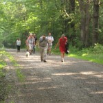
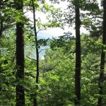
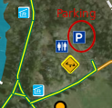
This Sunday we will be hiking in Clark’s Gully just north of where Sunnyside Rd crosses the West River outside of Naples. We will plan on meeting at the DEC parking lot. Try to be there a little earlier, at 1:45pm.
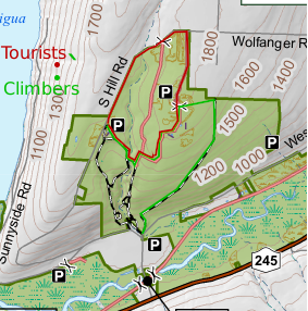
Climbers will start across the street from the parking lot. They will start up the main trail and then turn right where the trail splits. They will follow the logging road for about 1.5 miles until they reach the north end of the DEC border at which point the trail dead ends at the property line heavily marked with posted signs. They will turn left up the hill while staying on the DEC property. They will come out to a field on top and a DEC access road with a parking loop that comes in from north end of the DEC property off South Hill Road. There will be 2 choices to get over to the South Hill DEC parking area where the Tourist would have started their hike from. They can choose to either walk South Hill Road back to the South Hill parking area or take the ” yellow gated” access trail at the North end off South Hill back down to the waterfall and cross over the creek and up to the South Hill Parking area. They will be car pooled back to the DEC parking area off Sunnyside.

The tourists will drive up to the top of the park and start at the DEC parking area off of South Hill Road. They will follow the trail down to the creek and cross over following the trail up to access trail that comes in from the “yellow gate” at the north end of the park off South Hill  Road. They can return back to the Dec parking lot off South Hill Road, where they started or continue to the DEC  loop access road to the east  of the yellow gate off South Hill Road and take the logging trail back down to the DEC parking area off of Sunnyside Drive.

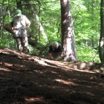
The Naturalists can drive to the top of South Hill Parking lot and walk into the same trail as the tourists without crossing the creek. The woods is dotted with pines and is a pleasant walk or they may choose to walk South Hill road taking in the various wild flowers along the roadside.

Those that wish can meet back to the DEC parking area off Sunnyside Drive for a social. Bring a sandwich and a drink.

Note: It is tick and mosquito season so dress for prevention and bring bug spray and plenty of water.

Directions: From Route 21 north of the village of Naples, turn onto Route 245 north. Continue  north for about 5 miles. You will pass the West River boat launch on the left.  Just pass the launch about 1/2 mile, turn left onto Sunnyside Drive and the Clark’s Gully DEC parking lot will be on your right about 1/2 mile down.

 

.

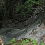
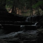
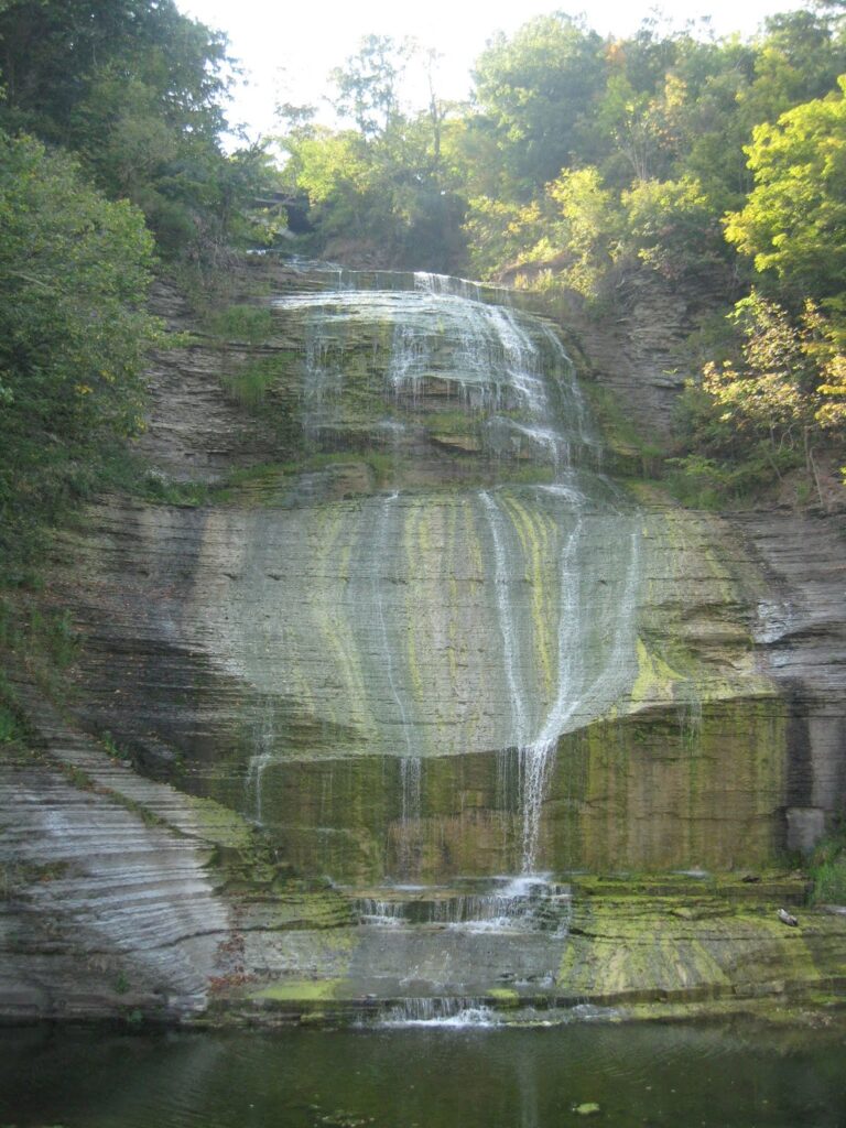
There was time to explore the waterfall while the mushroom hunters caught up.

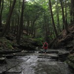
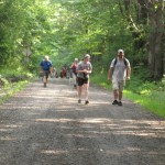
Next we had a creek walk up to the “campground”.

Mt Morris Hike/Bike

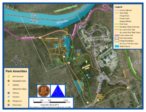
Since our last hike through the Al Lorenz County Park above Mt Morris, the county has made many improvements to the park, including new trails and beautiful bridges across the streams feeding the large pond. In honor of the opening of the summer season at the park, this Sunday’s hike will provide all hikers an opportunity to see more the park in person.

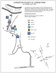
All hikers and bikers will meet at the parking lot behind Pavilions 4 and the playground (click on the map to the left for details). Following the hike and bike ride (around 4:30), we will meet at Pavilions 3 at the end of the Pond for a dish to pass social (at that time we can move cars to the pavilion parking area).

Our hikers will follow the Letchworth branch of the Finger Lakes Trail along the gorge to the Mt Morris Dam, and then will return to the Park. The Climbers will stay on the Letchworth Branch (Yellow blazes) past the FLTC Office, the Dam Visitors Center to the overlook of the dam. Given time, they will continue on to enjoy addition views of the Letchworth gorge until the trail jogs left away from the river. Turning around at that point will result in a round trip hike of about 3.4 miles.

The Naturalists hike will also follow the Branch trail up to a field before the Dam area. This field contains a Wildlife Loop. Based on the condition of the wildlife loop and the time, the Naturalists will choose whether to hike around the loop or continue on to the Dam overlook.  Turning around at the Dam overlook will be a 2.8 mile hike.

Bikers will head west within the park and climb a steep hill to the Livingston County Campus, and then will descend a curving road to the Genesee Valley Greenway. From there, we will follow the Greenway north to NY-20A. We will turn around and ride the Greenway (or possibly River Rd) back to Mt Morris, to Grove St, where we will turn south, following Grove St and Parker Rd. After turning right on Al Lorenz Dr, we will re-enter the park.  If time permits, we will ride some of the park trails back to the Pavilion 3.

Al Lorenz Park Trail MapWhen hikers return to the Al Lorenz park, they should take some time to explore the trails around the pond. Between 4:30 and 5:00, gather at Pavilion 3 for a Dish to Pass social. Please bring a dish to share and your own beverage, or bring a sandwich if you are more comfortable not sharing. A contribution to support the social supplies of $5 is appropriate if you forget or can’t bring your food contribution.

All hikers and Bikers will meet at the parking lot behind Pavilions # 4 and the playground. Please be ready to start the hike or ride at 2:00.

Directions

From Springwater and Wayland: (Note that Liberty Pole Rd is under construction. These directions avoid Liberty Pole Rd). Head south on NY-15 through Wayland. Turn right onto I-390 past the Dansville exits to Exit 6 (16.3 mi) for NY 36, Mt. Morris. Turn left on NY-36N for 5.4 miles. At the third left following the lights at NY-408 turn onto Grove St. In 0.2 miles turn right onto Murray Hill Rd. At the top of the hill, turn left on Al Lorenz Dr. In about 0.1 mile, enter the Al Lorenz Park.  Turn right in about 0.3 miles to get to the parking lot behind Pavilion #4.

From Rochester: Take I-390 S to Exit 7 for NY 408 Mt Morris. Turn left (south-west) on NY 408. At the Main St light, turn right. At the third left on Main St, turn onto Grove St. In 0.2 miles turn right onto Murray Hill Rd. At the top of the hill, turn left on Al Lorenz Dr. In about 0.1 mile, enter the Al Lorenz Park.  Turn right in about 0.3 miles to get to the parking lot behind Pavilion #4.


Stid Hill Multiple Use Area in Bristol, NY

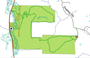
Stid Hill North DEC Map


The Stid Hill Multiple Use Area is a 847 acre tract of land situated in the townships of Bristol and South Bristol in Ontario County. It is bounded by Route 64 on the west and Dugway Road on the north. Ganargua Creek, better known as Mud Creek, flows along Route 64. At one time, Stid Hill was productive sheep and cattle grazing land. Today the grazing has been eliminated. The mixture of steep hills, ravines, gullies, gorges, woods, and open areas create scenic vistas and also provide varied wildlife habitats.

We will meet at the Stid Hill MUA parking area on Rt. 64 at 1:45pm.  Once we determine how many would like to hike the trail from top to bottom, we will leave some cars in this parking area.  We will then carpool and proceed to drive up to the parking area on Dugway Rd.  At this point the climbers will set out to hike back down to Rt. 64.  The Tourists and Naturalists will follow the trails up at the top of the hill.  The ground is uneven so you may want to bring poles.  There are also very wet and muddy spots along the trail so waterproof hiking shoes or boots would be recommended.  Rt. 64 runs north and south.  If you are coming from the north starting at 5&20 head south, past Bristol Center and CR32, the parking area will be on your left.  If you reach Bristol Mountain Ski Area, you have gone too far.  From the south head up Rt. 64 past Bristol Mountain Ski Area, and the big wooden sign that says Stid Hill, you will see the parking area on your right.

Though the trails were well marked at one time, there hasn’t been much trail maintenance recently. The trail markers are difficult to follow and sometimes deceptive, and they disappear completely over the crown of the hill. The going will be very wet in places over the crown.


The Meeting Place

We will meet at the Stid Hill MUA parking area on Rt. 64 at 1:45pm.


Getting There

Route 64 runs north-south, so there are only two direction of approach.

From the north, (Honeoye and Bloomfield) starting at Route 5 & 20 in Bloomfield, come down Route 64. 3.0 miles south of Rt 20A and 1.4 miles past Bristol Center (and CR 32), turn left on Dugway Road. If you come to a Stid Hill MUA parking area, you’ve come too far south – turn around and try again.

From the south, starting at Bristol Springs for 6.4 miles, come up Route 64 past both Stid Hill parking areas, then turn right on Dugway Road. If you come to Bristol Center you’ve come too far north.

From Springwater, Google Maps recommends heading north to 20A through Honeoye, then south on 64.

From Wayland, the recommendation is to take Rt 21 through Naples to the east end of Dugway Rd (4.5 miles north of the intersection with NY 64). The trail head is 1.2 miles west on Dugway, (Dugway is paved to the Bristol/Canandaigua town line).

Dugway Road is a good dirt road. The trail head is exactly 2.0 miles from the Route 64 junction. It’s easy to miss – it’s just a widening of the road after a sharp left turn. The trail head is on the right of the road and marked with a discreet sign a little too far from the road. Please park carefully. There isn’t much parking space to be had.


The Social

We’ll go to Lock Stock and Barrel on Route 64 just north of Bristol Mountain for the social after the hike.

Catharine Valley Trail Hike/Bike

Historical Sign for Queen Catharine

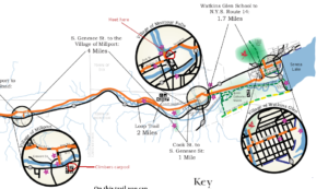
Click image for more detail.

Catharine Valley Trail is a state park and recreation trail which is located in Schuyler and Chemung Counties. It runs for 12 miles between Watkins Glen State Park and Mark Twain State Park and uses the abandoned Chemung/Northern Central Railroad and the old Chemung Canal.  The trail is named for Queen Catharine Montour, a prominent Seneca leader of Native American and French ancestry who lived in a village called She-O-Qua-Gah near present day Montour Falls.  The village was one of the many destroyed by Sullivan’s Army in 1779.  Catharine Creek, Seneca Lake’s inlet, is a popular Rainbow Trout fishing stream and runs parallel to the trail.

Meeting Place

We will all meet at the S Genesee Street parking area south of the Village of Montour Falls to explore part of the trail.  Bikers will go south for an out and back of about 8-10 miles (hybrid or mountain bikes recommended); climbers will carpool to Millport and walk north the 4 miles back to the S Genesee Street parking area; the tourists/naturalists will walk south from the parking area to complete a 2 mile loop along the old canal.

Historical Sign for the Chumung Canal

Social

The social will be at an area restaurant in Watkins Glen.  Location TBD.

Directions

From Watkins Glen (or Rochester and Exit 42 on the Thruway and Geneva): Take NY 14 south from the thruway, through Geneva and Watkins Glen. South of Watkins Glen, stay on NY 14 until it curves to the left. In the middle of the curve, turn right onto S. Genesee St.  The parking lot is on the left in 1.7 miles.

From Horseheads and I-86 Exit 52B: Turn left onto NY-14. In 10.8 miles, turn left onto S Genesee St.  The parking area will be on the right, just past the bridge over Catherine Creek.

Sketch of She-Qua-Ga Falls by Louis PhillippeFrom Springwater: take NY Route 15 south to Route 390.  Take I-390/ south to I-86 east and get off at EXIT 40 – Savona.  Turn left onto NY-226 and follow it 13.22 miles to where you will turn right onto County Road 23.   Go 8.03 miles then take a slight right onto County Road 28.  Go 1.16 miles and take a slight left onto NY-409. Go 0.54 miles and at the stop light in the Village of Watkins Glen turn right onto NY-14. Historical Sign for She-Qua-GaContinue on NY-14 for 4.40 miles then turn right onto S Genesee Street.  In a short distance go over the bridge for Catherine Creek and the parking area will be on the right.  According to MapQuest this route is 61.8 miles and the estimated driving time is 1 hour 12 minutes.

People may want to arrive early and budget extra time to stop at Shequaga Falls Park in Montour Falls, do some shopping at Famous Brands in Watkins Glen, or go birding along the Queen Catharine Marsh Trail.

More Information

https://parks.ny.gov/parks/80/details.aspx