Annual Mushroom Hike

Welcome to the ninth Annual Mushroom Foray [thanks to both Springwater Trails and the Rochester Area Mycological Association] at the All Western Evergreen Farm.  Three hiking groups are planned, all starting and ending at the parking area at the farm.  The three groups will explore much of the farm, with many opportunities to find mycological specimens.

Please plan to arrive early (1:45 PM) to sign in and to sign the RAMA liability forms.

Maps of the farm, paper bags and paper plates for collecting and displaying mushrooms will be provided.  Those who want to learn how to collect mushrooms will be instructed by Gene and Georgia, and any other Rochester Area Mycological Association members who will be our guests.

The Climbers will follow the driveway up to the fields, turning to the left at the top. We will circle the pond on the southern portion of the farm and the spruce forest along the edge of the Christmas tree plantations. Heading west through the Cathedral Pines will take us to wet spots in the woods. We will return along the edge of several more Christmas tree plantations (Douglas-fir, Nordmann fir, Grand fir, Concolor fir, Canaan fir, Alaska yellow cedar, Norway Spruce, Meyer Spruce).

The Tourists will follow the driveway up through the woods, stopping occasionally to explore for mushrooms.  When reaching saleable size Christmas trees (Lot Z), head to the right around or through the Christmas tree plantation.  At the corner where the small Southwestern White Pine tree row ends and the tall Concolor fir are, follow the trail into the woods and back to the field and head west along the north field road to a hidden corner of the field with some spectacular 35 foot green and blue Concolor fir Christmas trees live, the size seen during Christmas season in a large mall.  If there is still time, follow the north field road next to the hedge row up to Story Road. We will return through the tillable fields, visiting smaller collections of trees and back down through the woods.

The Naturalists will start exploring under and behind the Western red cedars (thuja plicata or giant arborvitae) by the parking area and south to the Alaska yellow cedar, large Concolor fir and spruce, then back up through the woods to the right of the trail up to the main fields.  These are likely full of mushrooms, but you will find some swampy areas, so don’t get lost behind people’s homes along Liberty Pole.

All hikers should check their watches and return to the parking area by 4:00 PM to have their collections identified.  A portapotty with a sink is nearby.

Mushroom Identification

Once again we expect to have several RAMA members with us to identify the mushrooms collected between 4 and 5 PM.  After the mushrooms are identified please join us for a dish-to-pass social (5:00 – 6:30 PM) hosted by Katherine outside the house next to the Furnace Building. Please bring a lawn chair and your own beverage, plus a dish to share or a $5 contribution to the social fund.

We will begin all the hikes at 6840 Liberty Pole Road where there is ample parking at the Christmas tree loading area between the tall Western red cedar and Morton Building and Nursery beds. Follow the parking signs.  When we return from our foray, the mushrooms will be displayed for identification on paper plates on the tables outdoors.  Please dress for the weather, rain gear as needed.  Social distancing and masks are recommended when close together.

Directions:

From Springwater: Go west from the Springwater light on NY-15 North.  Just past the top of the hill and after rounding the tight curve, turn left on CR 38 (Liberty Pole Road).  The farm is on the left (the high side) 1.1 miles from NY-15 at 6840 Liberty Pole Road after you cross Carney Hollow Rd. There is a sign for the All Western Evergreen Nursery & Christmas Tree Farm.  Follow the orange cones to the parking area and park facing the house.

From Geneseo: Go south on NY-63.  About 6.4 miles after passing NY-408, turn left on CR-1 (Groveland Scottsburg Rd) at Groveland Station.  This road becomes CR 1A (Springwater Scottsburg Rd) at Scottsburg (Route 256) and then Liberty Pole Road after you cross Stagecoach Road (CR 71), and finally CR-38 (still Liberty Pole Rd) after crossing Reeds Corners Rd (CR-29).  It is 7.1 miles from Groveland Station to All Western Evergreen Farm.  The farm is on the right (the high side).  Follow the orange cones to the parking area and park facing the house.

From Honeoye: Take 20A west to Hemlock and 15A south to Springwater.  Then follow the Springwater directions above.

From Rochester: Take I-390S from Rochester. Use Exit 9 for NY-15 Lakeville. Turn left onto NY-15. Stay on NY-15 for 16.5 miles, through Lakeville, Livonia, Conesus and Webster Crossing.  When NY-15 curves to the left at the south end of Webster Crossing, continue straight onto CR-60 (Carney Hollow Rd) and take the first right onto Liberty Pole Rd.  The farm is on the left (the high side) at 6840 Liberty Pole Rd.  Follow the orange cones to the parking area and park facing the house.


If using GPS, use the map directions on the www.allwesterntrees.com website and make sure you are on Liberty Pole Road and not being directed to the center of the farm from Swartz Road or Story Road.  Follow the orange cones to the parking area and park facing the house.

The FLT Through Mitchellsville Creek Gully

A hike through the Mitchellsville Gorge.

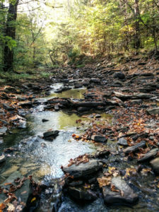
The hike on Sunday 7th August 2022 will follow a section of the main path of the Finger Lakes Trail in Urbana, just south of Hammondsport. It’s an easy hike of about 3.5 miles, and it follows the rim of a deep gully cut by the Mitchellsville Creek. This section slopes gently downhill from north to south with just a few short steep sections. The northern two thirds passes through a dense hemlock wood, and the path is a soft bed of hemlock needles; there are views of the deep gully along the way. There are two ‘beauty spots’ along the route; about a third of the way from the top there’s a short side track that juts out over the gorge giving good views from a height, and about two thirds of the way down there is a pretty creek. Unfortunately, we can’t get too close to either spot; this section of the trail is on private land and we can’t wander off it. The gorge overlook is crumbling and is dangerous, and access to the creek is specifically denied by the land owner.

A hike through the Mitchellsville Gorge.

We will meet at the FLT trail head on Route 54 in Urbana, by the Pleasant Valley Inn (42.388729, -77.260357) at 4:00pm.

The Climbers will shuttle to the high point of the hike at FLT access point 5 on Mitchellsville Road (42.404269, -77.290893), and then walk down the FLT back to the meeting point.

The Tourists and Naturalists will start at the meeting point and walk up the trail. They will walk a short distance north on Rt. 88 (it is Hammondsport-Pleasant Valley Road) and then go left on the FLT through a vineyard. At the end of the vineyard the trail crosses a stream and then rises up through the gully to a pretty spot by the creek. There are no steep sections on this stretch. Those who want to can carry on up the trail can do so, but there are some short but more difficult sections to navigate.

The Social

We’ll have a social at the Pleasant Valley Inn, next to where we meet for the hike.

Directions

From Honeoye: Follow W Hollow Rd (County Road 36) to Naples. Turn Right at the Middletown Tavern on to Rt. 21 South, and then bear left on to NY-53 South. Continue for 17.1 miles through Prattsburg and then turn left to County Rd 13/Mitchellsville Rd in Wheeler. Continue along Mitchellsville Road until you see the white church in Mitchellsville and then turn left in front of the church on to County Road 89. Turn right when this road ends and follow this road (County Road 88) to its junction with route 54.  The parking area and trail head is on the left.

From Naples: Take NY-21 South, and then bear left on to NY-53 South. Continue for 17.1 miles through Prattsburg and then turn left to County Rd 13/Mitchellsville Rd in Wheeler.  Continue along Mitchellsville Road until you see the white church in Mitchellsville and then turn left in front of the church on to County Road 89. Turn right when this road ends and follow this road (County Road 88) to its junction with route 54.  The parking area and trail head is on the left.

From Rochester: Take NY 15 south to the I-390, and then I-390 South to the NY 54 / Bath exit, then follow NY54 north to the Pleasant Valley Inn. The parking area and trail head is on the left.

From Springwater and Wayland: Take 390 South to the NY 54 / Bath exit, then follow NY54 north to the Pleasant Valley Inn. The parking area and trail head is on the left.

Wesley Hill Preserve

This Sunday we’ll return to an old favorite, a walk in the woods at the Wesley Hill Preserve in Canadice/South Bristol, with a social afterwards at the Birdhouse Brewery in Honeoye.

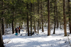
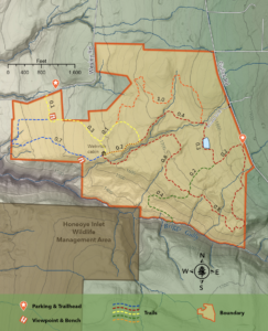
Meet at the Wesley Road parking area at 3:45 for a 4pm start. The Climbers will make the full perimeter loop of the property on the Yellow, Blue, Red and Orange Trails for a total of about 5 miles.   The Tourists and Naturalists will follow a shorter loop of around 3 miles. The weather is expected to be warm, but the woods should keep us comfortable and we’ll adjust the hike lengths as the weather dictates and stop for an occasional frolic in the stream. Bring plenty of water.

Wesley Hill is a Finger Lakes Land Trust property of 390 acres on the hill east of Honeoye Lake.  including stands of northern hardwoods, red and white pines, hemlocks, a woodland pond, and the northern edge of Briggs Gully, as well as the Wenrich Cabin, set in an old forest overlooking the gully, deep in the woods.  The preserve was established in 1999 by the generous donation of 90 acres by the children of three artists – John Wenrich, James Havens and Colburn Dugan – to the Finger Lakes Land Trust. Since that time, the Land Trust has expanded Wesley Hill through the purchase or donation of four additional parcels. For more on the Preserve, see     fllt.org/preserves/wesley-hill-nature-preserve/

Following the hike, our social will be at Birdhouse Brewing, 8716 Main Street, Honeoye.

DIRECTIONS: From Honeoye: take route 20A east through Honeoye to East Lake Road (CR 33). Turn right onto East Lake Road. (If coming from Bristol or points east, it’s a left onto East Lake Road).  Take the first left, staying on CR 33, then the first right onto Pinewood Hill which becomes Gulick Road. Once on Gulick Road, travel about 2.5 miles to a right on Wesley Road, then another mile to the Wesley Road parking lot, on your right.

From Springwater: Take your favorite route to Naples and proceed north on County Road 36 toward Honeoye. In 1.5 miles, make a right on Gulick Road, then a left on Wesley Road after about 8 miles (pass Camp Cutler and Cumming Nature Center). Go one mile down the hill to the Wesley Road parking lot and trailhead.

Directions to the Social from the trailhead:

Via East Lake Road:  Turn right out of the parking area on Wesley Road. Go down the hill about 1 mile to East Lake Road and make a right. Go north about 4.5 miles to Route 20A, and make a left. Birdhouse Brewing is on your right, just over the bridge and before the traffic light.

Canandaigua Lake Paddle/Hike

The Kayaking today is CANCELLED! The weather is threatening. We will still hike if the storms haven’t reached the pier in Canandaigua yet


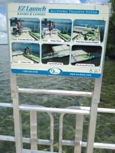
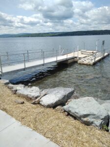
Kayak or Hike Canandaigua Lake Sunday June 26 from 4-6PM. Paddlers will launch from Ontario County Beach Park on East Lake Road while walkers will gather at the city Pier for a self-guided stroll. Boat launch is free with plenty of parking and no portaging needed. Boaters will travel south on the east side of the lake passing by Deep Run Park, the historic Thendara restaurant and Boathouse which are now part of a Mcmansion housing development, and numerous other stately beach homes. After passing Crystal Beach Park, if time permits, we will continue further south where 364 and East Lake Road split and there are some of the small older cottages visible along the lakeshore.
Hikers will walk a 3-mile loop starting from the City Pier, where the boathouses are,then head up to Lakeshore Drive, turn right and head into Kershaw Park and follow the trail along the lake. At Twisted Rail head back up to the road and cross over to Lagoon Park which has a figure 8 loop; there are several board maps in the park. Retrace your steps back to the pier.

SOCIAL will be at Twisted Rail.

DIRECTIONS FOR BOATERS: Ontario County Beach Park is located on the right side of East Lake Road aka Rte 364 and is 2.7 miles south of the intersection of 364 and Lakeshore Drive. If coming from the south it’s on your left, just under a mile north of Deep Run Park and the intersection of CR 1.

DIRECTIONS FOR WALKERS: At intersection of Rte 332 aka South Main Street, 5&20, and Lakeshore Drive turn right onto Lakeshore Drive bearing right and park at the Pier. If coming from the east turn left at the intersection.