Huckleberry Bog Hike, Prattsburgh

Please note: This Sunday is the Naples Grape Festival from 10-5, with its notorious traffic jams. 
We advise avoiding Naples when you plan your trip to Prattsburgh.
This hike will be on a section of the Bristol Hills Branch of the Finger Lakes Trail  (Map B3) and include the Bog Nature Trail Loop.  Most of the hike is in Urbana State Forest, Steuben County. The Nature Trail has been well documented in a 2003 Guide Book full of information on site history and unusual plants to be found here at different times of year. Read or download the guidebook or map (p. 3)  at:
https://fingerlakestrail.org/plan-hikes-finger-lakes-trail/special-places/huckleberry-bog/

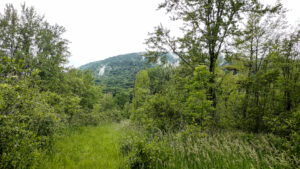
We will start from the trailhead on Bean Station Road, meeting at 1:45 for a 2 PM start.  Following the orange blazes, we will head south past the restored Covell Cemetery and the Evangeline Shelter then climb steadily uphill through a hemlock and oak woods to the state forest and onto the top of the plateau.  Tourists and Naturalists will go as far as the bog observation deck and then back track to Bean Station Road (~3miles total).  Climbers will continue on past the overlook and follow the Bog Nature Trail Loop clockwise returning to Bean Station Road by way of the blue blazed side trail and then the main trail (~4.5 miles total).

Social – Will be held at 70 N Main Street, Prattsburgh, Kelly’s family home.  Follow Bean Station Rd back to Route 53 and head North on Route 53 back to Prattsburgh.  At the blinking light in Prattsburgh, Chapel St, turn right.  Follow to stop sign and turn left onto North Main Street.   The house is a 2 story blue/grey colonial with a large red barn out back.  We will meet on the covered patio for a dish to pass (left side of the house behind fencing).
As a bonus you may have a tour of the horse carriage collection in the barn and/or the restored vintage Farmall Tractors!

Directions to Meeting Location   

From Springwater: Head south on NY 15 to Wayland. Turn left onto NY 21, Turn left in N Cohocton to stay on 21 into Naples. Turn right onto NY- 53. Stay on NY-53  through Prattsburgh. Follow the directions below.

From Prattsburgh, take NY- 53 South for 2.6 miles to Bean Station Road.  Turn east on Bean Station Road at the site of a large white warehouse for onions. Go 2.6 miles to the yellow trailhead sign on the right (south) side of the road at a little footbridge over the roadside ditch.  Park on the north side of the road – this is important as this is a narrow road and parking on both sides could cause a traffic hazard. 

From Geneseo and Dansville: Take I-390 South to I-86East. In 1 mile, take exit 37 for NY-53. Turn left onto NY-53 and head north for 8.9 miles. Turn right onto Bean Station Road. Continue with the directions From Prattsburgh.

Huckleberry Bog Hike, Prattsburgh

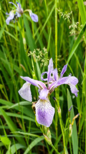
Exploring the Bog Nature Trail in it’s Spring Glory! 

We are revisiting this trail in search of spring wildflowers! This hike will be on a section of the Bristol Hills Branch of the Finger Lakes Trail  (Map B3) and include the Bog Nature Trail Loop.  Most of the hike is in Urbana State Forest, Steuben County. The Nature Trail has been well documented in a 2003 Guide Book full of information on site history and unusual plants to be found here at different times of year. Read or download the guidebook or map (p. 3)  at Huckleberry Bog.

We will start from the trailhead on Bean Station Road, meeting at 1:45 for a 2 PM start.  Following the orange blazes, we will head south past the restored Covell Cemetery and the Evangeline Shelter then climb steadily uphill through a hemlock and oak woods to the state forest and onto the top of the plateau.  Tourists and Naturalists will go as far as the bog observation deck and then back track to Bean Station Road (~3miles total).  Climbers will continue on past the overlook and follow the Bog Nature Trail Loop clockwise returning to Bean Station Road by way of the blue blazed side trail and then the main trail (~4.5 miles total).

Social – Will be held at 70 N Main Street, Prattsburgh, Kelly’s family home.  Follow Bean Station Rd back to Route 53 and head North on Route 53 back to Prattsburgh.  At the blinking light in Prattsburgh, Chapel St, turn right.  Follow to stop sign and turn left onto North Main Street.   The house is a 2 story blue/grey colonial with a large red barn out back.  We will meet on the covered patio for a dish to pass (left side of the house behind fencing).

As a bonus you may have a tour of the horse carriage collection in the barn and/or the restored vintage Farmall Tractors!

Directions to Meeting Location   

From Springwater: Head south on NY 15 to Wayland. Turn left onto NY 21, Turn left in N Cohocton to stay on 21 into Naples. Turn right onto NY- 53. Stay on NY-53  through Prattsburgh. Follow the directions below.

From Prattsburgh, take NY- 53 South for 2.6 miles to Bean Station Road.  Turn east on Bean Station Road at the site of a large white warehouse for onions. Go 2.6 miles to the yellow trailhead sign on the right (south) side of the road at a little footbridge over the roadside ditch.  Park on the north side of the road – this is important as this is a narrow road and parking on both sides could cause a traffic hazard. 

From Geneseo and Dansville: Take I-390 South to I-86East. In 1 mile, take exit 37 for NY-53. Turn left onto NY-53 and head north for 8.9 miles. Turn right onto Bean Station Road. Continue with the directions From Prattsburgh.

Hike and Paddle the Honeoye Inlet and the Muller Field Station (42.71266, -77.51203)

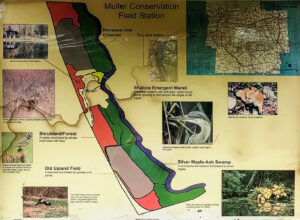
The Muller family land at the south end of Honoeye Lake is now owned by the Finger Lakes Community College (FLCC) and it has expanded into a substantial research and conservation facility. It adjoins DEC land encompassing the rest of the south end of Honoeye Lake, and the FLCC and DEC have restored the water flow through the property and into the lake  to salvage the ecology of the area. Springwater Trails has permission to kayak the inlet stream and to hike along it too.

We will do both on Sunday September 17th, 2023.  Meet and park in the lot at 1:45 at the Muller Field Station, 6455 County Road 36, Honeoye for a 2pm hike/paddle start. Come earlier if you want to use one of the Field Station’s boats, which are first come first served. 

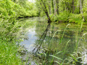
Beavers have done their work to adjust the property to their liking, and signs of beaver activity are plentiful. Tall invasive grasses dominate the trail borders and seasonal wildflowers are plentiful. Snakes are common and harmless to humans.


For Hikers:

The hikers will follow the single trail following the inlet south  in an out-and-back hike with each group turning back when they feel they should. The site director, Ally Esposito, will accompany the hikers and talk about the flora, fauna and the ecology of the property. There is a gate separating FLCC land from DEC land that can be walked around.The trail on FLCC land is mowed, but the DEC land tends to be more wild but sill very passable. In principle the trail goes all the way around the south end of the lake to the south boat launch on the east side but this hasn’t been tested yet.


For Kayakers:

The Muller Field Station and the Honoeye Inlet

The kayakers will put in at the luxurious boat launch close to the station complex. They will explore the inlet south as far as a very low bridge that effectively blocks passage by water, and will then turn back to see what’s downstream as far as the lake proper.

The FLCC has kayaks and canoes that are available to be borrowed; Please bring your own PFD if you want to take advantage of this.


Directions:

We will all meet at the Muller Field Station, 6455 Co Rd 36, Honeoye, NY 14471

From Rochester: Take Rt. 65 south to West Bloomfield, then crossing Rt. 20 take Rt. 37 south to Honoeye. At the junction with Rt. 20A turn left, then right at the lights in Honoeye on to Rt. 36 which is West Lake Road. Continue south on Rt. 36 for 5.6 miles; the Muller Field Station is through some imposing gates on the left side of the road. The gates are recessed and angled to the south so they are easy to miss from the north.

From Springwater: Take Rt. 15A south to Wayland, then turn left on to Rt. 21 to Naples. In Naples turn left (north) at the Middletown Tavern on to Rt. 36, also called Hunt Hollow Road. Continue north on Rt. 36 for 10 miles; the Muller Field Station is through some imposing gates on the right side of the road.

By GPS: Program in (42.71266, -77.51203) and follow directions.


The Social

The social will be a pot luck picnic at the Muller Field Station.

Directions:  The Field Station is at #6455 on the east side of County Road 36, a.k.a West Lake Road in Honeoye. From Honeoye, it’s 5.8 miles south from the traffic light at Route 20A in Honeoye.  From Naples, it’s 9 miles north from Main Street; turn at the Middletown Tavern.

Hike or Paddle at Sugar Creek, Branchport

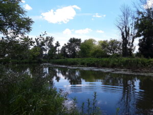
Please join us for kayaking or canoeing on Sugar Creek and Keuka Lake or a hike through the marsh preserve to the lake.  Our starting point will be the Finger Lakes Museum creekside site, accessible from Guyanoga Road or from Route 54, both close to the flashing light at the center of Branchport.  The Finger Lakes Museum is on the site of a former elementary school, now being replaced by a new structure for a regional museum.  They have an active boat launch site at the rear bordering Sugar Creek, the main tributary into the west branch of Keuka Lake.
Boaters should arrive by 3:30-3:45 to unload your boat and launch from the floating dock. Hikers, who will follow the wetlands along the river, should arrive by 3:45 for a 4 PM start. Parking is in the field adjacent to the FLM Creekside Center and rest room.

After launching, kayakers will head upstream in Sugar Creek through a woodland waterway. Based on time and conditions we then will turn around and head back past the dock to the lake.  Once on the lake we will spread out, with some heading west toward the adjacent marshland owned by the Isaak Walton League. Cattails, water lilies and waterfowl are abundant in the marsh waterways, with the marinas of Branchport beyond. In the other direction, at the northeast corner of the west branch is Keuka Lake State Park. Boaters will return to the start by about 6 PM.

Hikers will hike to Keuka Lake along the museum paths, stopping at the Museum’s lakefront pavilion. After enjoying the lake views, we will return to the museum and explore its grounds with interpretive markers about the Finger Lakes and extensive native plantings.
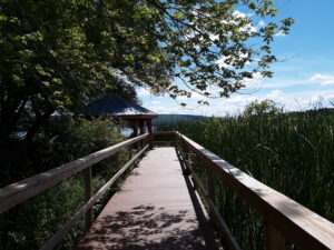
Social:  Bring your own beverage and a dish to pass for our Social on the porch of the Museum’s Creekside Center. Or contribute $5 to the social fund and snack from the dishes available. Tables, chairs and rest rooms are provided by FLM.

Directions:

From Springwater and Wayland – Take Route 15 south and then Route 21 north to Naples. Coming into Naples, go right on Route 53 toward Prattsburgh. In 1.2 miles make a left on Italy Valley Road. You will remain on Italy Valley  Road for about 8.7 miles, although the county road number changes from 21 to 18 to 34 en route. At the end of Italy Valley Road, go left for .3 miles on Italy Hill Road (CR 35), then follow Itlaly Hill Road as it curves to the right and becomes CR32. In another 4.7 miles you will be at the flashing light in the center of Branchport.  Go straight on Route 54A toward Penn Yan for .2 miles, and turn left into the Finger Lakes Museum across from the Library, and before the Fire Station. Look for the driveway toward the new barn on your right.

From Canandaigua and 5&20:  Take East Lake Road south to County Road 1, or Route 247 from Reed’s Corners into Rushville. Continue South through Rushville toward Penn Yan. Route 247 will become Route 364 shortly before Potter. Continue for 4.5 miles past Potter and make a right on Guyanoga Road (CR 29). Go another 6.5 miles to Branchport. Turn left into the Finger Lakes Museum at 3369 Guyanoga Road, or if you miss it, go left at the flashing light and then left into the FLM drive. If you come in from Guyanoga Road, go to the right around the building and parking lot, and follow the signs to the Creekside Center (a new barn). Park on the grass near the boat rack. If you take the side entrance in from Route 54A heading east toward Penn Yan, turn in to the left, across from the library, and then right into the Creekside Center.