Hike at Fishers Park, Victor

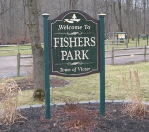
Join us on Sunday February 2nd for a hike around Fisher Park! Located in the hamlet of Fishers, this 93-acre park has a diversity of passive and active recreation opportunities. Visitors can see a multitude of wildlife from deer, squirrels, and other woodland creatures to waterfowl and trout that spawn in the spring. Trails meander through the park across wooded ridges, through wetland areas, and along the banks of Irondequoit Creek.

Everyone will meet at the parking area at 7938 Main St, Fishers (Victor), at 1:45pm for a 2:00pm start. Please dress appropriately for the weather. 

The Hike:

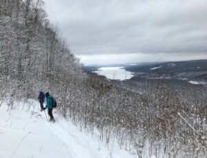
Naturalists will explore mostly the outer perimeter on the White and Red trails. Included will be nice wide trails, a vista at a high point with a beautiful view looking out over the western side of the park, a stroll along Irondequoit Creek, and trail maps every so often showing your present location. Hikers will then loop back to the parking lot.  The hike length is about 1.5miles with an option to add (we will vote on it) some small inner trails to extend hiking time.

Climbers/Tourists will also head out on the White trail but will cover more of the Yellow trails with rolling hills, ending on the Red trail along Irondequoit Creek and then loop back to the parking lot. Hike length is about 3 miles.


The Social:

The social afterwards is at the Cottage Hotel in Mendon (http://cottagehotelmendon.com) at the 4 corners in Mendon at 1390 Pittsford Mendon Road. 


Directions:

Directions from Springwater and Honeoye:  take County Road 37 north from Route 20A about 7 miles north to Route 5 and 20 in West Bloomfield.   Route 65 begins there.  About a half mile north Route 65 makes a sharp left turn.  Do not go left, go straight onto County Road 35, otherwise known as West Bloomfield Road.  Go about 6 miles up to Route 251 and turn right.  You will come to the traffic light at the 4 corners of Mendon.  Go straight ahead  to Mile Square Road.  There is no road sign at Mile Square Road so look for some bright lime green home made signs on either side of the road in about 1/2 mile.  Turn left onto Mile Square Road.  Main Street Fishers will be the third road on your right.  After you pass Old Dutch Road on the right look for a green house at 7937 Main Street.  The sign for the entrance to the Park is right after that house on the right.

Directions from Canandaigua and Farmington:  Take Route 332 north to Route 96. Go north on Route 96 through the village of Victor  all the way to a large intersection with a Valvoline, a Burger King, a car wash and a Chili’s Restaurant at the corners.  Rowley Street goes to the right but turn left onto County Road 42.  Go through the little hamlet of Fishers past the old Firehouse on the left and past Wangum Road on the left where the first entrance for Fishers Park is.  You want the second entrance to the park farther down the road on the left.

Directions from Rochester:  Take Route 490 East all the way to the Victor exit.  It will take you right onto Route 96 South.  At the first large intersection with Chili’s Restaurant on the right hand corner, turn right.  Drive through the little hamlet of Fishers and after the old fire house on the left you will see a sign for the first entrance to Fishers Park on Wangum Road.  Do not turn there.  Go a little farther until you see the second entrance to the park on your left.

 Directions to the Cottage Hotel:

Turn left (west) out of the parking lot of Fishers Park and go all the way to the end of Main Street. Turn left onto Mile Square Road.   Turn right onto Route 251.   Drive to the 4 corners of Mendon to the light.   The Cottage Hotel is on the right.


Cross-County Ski, Snowshoe or Hike at Harriet Hollister Spencer State Recreation Area

Our Sunday event will be a cross-country ski or snowshoe excursion on the groomed trails of the Finger Lakes State Park Region’s Harriet Hollister Spencer State Recreation Area.  Because of the high elevation (over 2000 feet), the Park has been well used over the past few weeks of cold, snowy weather, and the groomers have kept the trails in great condition for both fast and slower skiers and for those on snowshoes.


Meet at 6775 Canadice Hill Road in the Town of Canadice, Ontario County. Park in the main lot near the road and gather near the kiosk at 1:45pm for a 2:00pm start. Rest rooms are available next to the lot. We will divide into groups depending on desired activity and distance.

  • Cross Country Ski – A good easy run for skiers is the Overlook Road to the Raccoon Run trail and back.
  • Snowshoe – A good route for those on snowshoes is an out and back on the Overlook and Bear Cub trails.
  • Naturalist’s Hike – Hiking in the winter is limited because the trails are groomed for use by skiers and those on snowshoes. However, the Overlook Road is wide enough that hikers can go out and back (for a total of about 2 miles) without having to worry about colliding with skiers or post- holing the tracks. Poles and traction devices are recommended.


Trail Map 

The trails are not well marked so it is recommended that you take a photo of the trail map at the kiosk or print a trail map using this link –https://parks.ny.gov/documents/parks/HarrietHollisterTrailMapWinter.pdf


Directions to Harriett Hollister Spencer State Recreation Area 

From Springwater take East Avenue up the hill and then a left on Canadice Road (CR42). Make a right on Town Line Road (aka Tibbals). At the end, make a left on Canadice Hill Road. Go about 1.7 miles to the park entrance on your right.

From Honeoye/Hemlock take Route 20A east from Hemlock or west from Honeoye to the intersection with County Route 37. Go south approximately 3.7 miles to the point where County Route 37 curves to the right; go straight here on Canadice Hill Road. In about 3.2 miles the park entrance and parking area will be on your left.


Social 

The social afterwards will be at Tee & Gee Bar and Grill, 6028 Big Tree Road, Lakeville, NY 14480 (585) 346-7387

Directions to Tee and Gee: From the park entrance go right on Canadice Hill Road for 3.2 miles to where it intersects County Route 37.  Head straight (north) on County Route 37 for 3.7 miles.  Turn left onto US-20A W / Honeoye Rd. (4 miles.)  Turn right to stay on US-20A W / NY-15A / Main St (2.1 miles.)  Keep left to stay on US-20A W / Richmond Mills Rd (proceed 4.5 miles.)  You made it!  Arrive at US-20A W / NY-15 / Big Tree Rd.  The last intersection before Tee & Gee is Junior Crescent.  If you reach Camp Run Dr, you’ve gone too far.  Turn around and come back. Don’t worry, we’ll save you a seat!

December 1 Hike at Wesley Hill Preserve

Wesley Hill Nature Preserve

Although we have visited this preserve numerous times over the years, it is good to pause and reflect on the history of this gem of the Finger Lakes.  Over one hundred years ago, after the sawmills of the Bristol Hills fell silent, white pine, hemlock, and oak seedlings began to sprout along the northern rim of Briggs Gully, one of the largest gorges in the Finger Lakes. The peaceful beauty of the forested glens and groves inspired three artists–John Wenrich, James Havens, and Colburn Dugan–in 1926, to purchase a 90 acre parcel which forms part of the preserve.  They built the cabin, which we will visit on our route, as a retreat. Their children, who inherited this small paradise, entrusted its care to the Finger Lakes Land Trust, who purchased it and additional parcels in 1999, then added a land grant from Chris White to create what is now the 390 acre Wesley Hill Preserve.

Hike Description

At this time bowhunting is permitted on 2 of the trails (Blue and Yellow) thus they are closed to hiking.  Please respect this. Our hikers will be traversing the Red, Orange, and Green Trails.

All hikers will meet at the Gulick Road Parking area.  Please be ready to hike at 2:00 PM.  Hiking boots and poles are highly recommended as the terrain is uneven and slippery in places.  To begin, all groups will head west on the Red Trail, around the pond and into the woods.

Naturalists will follow the Red Trail downhill toward the cabin along a lovely gully.  The cabin is in poor condition, but provides a glimpse into the past. There is a guest book and some interesting artifacts on the porch.  Hikers may be able to proceed a short way past the cabin on the Yellow Trail to a terrific overlook of Briggs Gully and Harriet Hollister Recreation area in the distance. If there is a closed sign, then they will need to head back up hill on the Red Trail to the pond and Parking area. Hike distance about 2 miles.

Tourists Shortly after the pond this group will turn right onto the Orange blazed trail.  They will follow this trail for1.2 miles to an intersection with the Yellow Trail. Turning left on Yellow will lead for .1 miles through the woods to the Red Trail .  At this point they can turn right downhill and walk to the cabin and Briggs Gully overlook.  They will then turn back up hill on the Red and follow it back to the pond and parking area.  Total Distance about 3 miles.

Climbers Be prepared for some climbing.  Following the Red Trail downhill from the pond, at the cabin turn left on Red down into a lovely gully and stream.  There is a steep uphill from the stream, up some rock steps with a railing and rope to help you climb.  Please use caution.  The Red Trail continues uphill along the gully, then flattens out at .7 miles where it reaches the Green Trail intersection.  The plan is to turn right and proceed downhill for .4miles into the famed Briggs Gully.  It is a steep rocky trail, but worth the trip.  If folks are not up for it, we can simply continue on the Red Trail which leads back to the parking area.  Total trip about 4 miles.

Driving Directions

From Honeoye: take route 20A east through Honeoye to East Lake Road (CR 33). Turn right onto East Lake Road. (If coming from Bristol or points east, it’s a left onto East Lake Road).  Take the first left, staying on CR 33, then the first right onto Pinewood Hill which becomes Gulick Road. Travel about 5 miles to Wesley Hill Parking Area on the right side. Parking lot can fit about 16 vehicles; any late comers can park on the side of the road.

From Springwater: Head north on Rte. 15A toward Hemlock.  Just before Hemlock, turn right on Rte. 20A.  Follow Rt 20A to Honeoye and then follow the directions above.

From Naples: From the southern end of Naples, head west on Co Rd 36. Follow Co Rd 36 for 1.2 miles to the first right turn on Gulick Rd.  Follow Gulick for about 7 miles, past Cumming Nature Center.  The parking area is on the left.

The trail map for Wesley Hill is here: Wesley Hill Preserve

Post Hike Social

After taking a head count to make sure that no one has been left behind, We will gather at The Birdhouse Brewery on Main Street(RT.20A) in Honeoye for food and beverages.

The Holiday Market (local artisans) will be there as well as musical entertainment by Stephen Morrell.