Posted on by

The Finger Lakes of New Zealand’s South Island

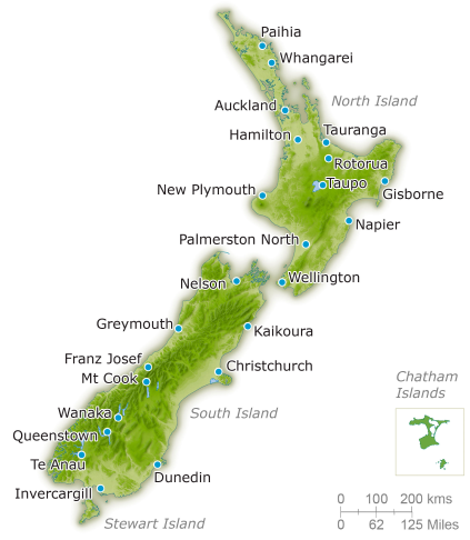
My Kiwi friends live in Queenstown, in the Otago Region of New Zealand’s South Island. While using google maps to get oriented to the vicinity, I ran across this view.
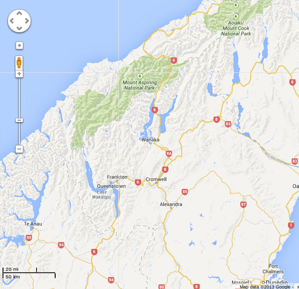
NZ finger lakes

NZ finger lakes

Something looked strangely familiar. The chain of long skinny lakes on the map were formed by glaciers just like the Finger Lakes in Western New York.
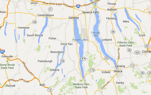
nyfingerlakes

NY finger lakes

Queenstown is located on the shores of Lake Wakatipu in the southern part of the chain. The lake is shaped like a stylized lightening bolt, a reversed “N” shape. From the Dart River flowing into the northern end, the lake runs south for 30 kilometres (19 mi) before turning abruptly to the east. Twenty kilometres (12.4 mi) further along it turns sharply to the south, reaching its southern end 30 kilometres (19 mi) further south. Compared to Seneca Lake it’s a bit longer (50 vs. 38 mi.) and more than half again as large in terms of surface area (112 vs. 67 sq.mi.).
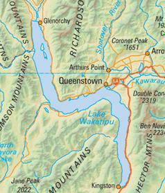
Lake Wakatipu

Lake Wakatipu

Lake Wakatipu is deep, with a maximum depth of 380 metres (1,250 ft). It’s at an altitude of 310 metres (1,020 ft), which locates the bottom of the lake below sea level, as is the case with Seneca and Cayuga Lakes here in NY. While our Finger Lakes are surrounded by rolling hills, though, Lake Wakatipu and the other NZ finger lakes are surrounded by snow capped mountains.

wakatipumts2

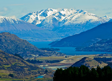
Queenstown is located near the second bend of Lake Wakatipu, where it turns south. The Remarkables mountain range, lying along the southeastern edge of the lake, is a popular venue for adventure tourism, with skifields, paragliding, bungy jumping and tramping tracks within easy reach.

queenstownlake

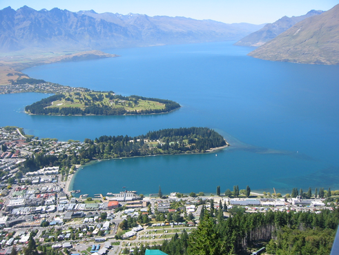
Queenstown and The Remarkables

It is here that the fun will begin in early February. Next up: units, or how to convert liters/100km to miles/gallon

Posted on by

An Introduction to New Zealand

New Zealand is made up of two main islands and a number of smaller islands in the South Pacific, near the centre of the water hemisphere, the half of the planet’s surface with the most water and the least land. In the image below you can see New Zealand to the right of Australia and above Antarctica. Hawaii is at the top edge just right of center, and the west coast of the USA is just over the horizon at about two o’clock. Because of its remoteness, NZ was one of the last lands to become settled by humans.

waterhemi

The Water Hemisphere

New Zealand is about a thousand miles long along its (mostly) vertical axis, with an area about equal to New York State and Pennsylvania combined. Texas is more than twice as large in area. The population is about 4.5M, roughly a quarter as many people as live in New York State. The population density is about 45 people per square mile, about half that of the USA, but four times more dense than Australia or Canada.

NZmap

New Zealand

The North Island has about 40% of the land area of New Zealand, and about 77% of the population. The larger South Island is dominated by the Southern Alps range of mountains extending 450 km north to south. The tallest peak is Mount Cook, the highest point in New Zealand at 3,754 metres (12,316 ft) and there are sixteen other points in the range that exceed 3,000 metres (9,800 ft) in height.

mtCook

Mt Cook


New Zealand owes its existence to tectonic uplift and volcanos. Lake Taupo on the North Island, sits in the caldera of a supervolcano which last erupted 1,800 years ago. This eruption is estimated to have been the most violent on earth for the past 5000 years. There is much geothermal activity, especially on the North Island, similar to that found in the vicinity of our own Yellowstone caldera.

Next up: the Finger Lakes of New Zealand