Posted on by

Canadice Lake (South End) Hike, Bike or Paddle

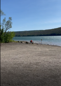
Image result for canadice lake

Notice: Rain appears to be likely this afternoon. Bring rain gear. We will move the social to the pavilion in Hemlock Park in the case of actual rain.

We will explore the south end of Canadice Lake and its surrounding terrain with the travel method of your choice (hike, bike or paddle), starting at the Canoe Launch (the southernmost lake access point) on Canadice Lake Road (southeast corner of the lake). Meet at 3:45pm and park on the road shoulder near the kiosk.  If you are bringing a boat or a bike, allow extra time for unloading.  Note: event time change.

Hikers:  Those interested in a gentler walk may head south along Canadice Lake Road to the southern end of the Canadice Lake Trail and follow it as long as you like, then return. The side trail through the ponds south of Canadice Lake is a nice addition to this route. The terrain is flat with a well-worn mulched trail.

Paddlers:  Put in at the south launch site and paddle the shores as far as you’d like, then return.

Cyclists:  Starting at the southeast corner of Canadice Lake, head north along the Canadice Lake Road, west on Purcell Hill Road and back to the start on the Canadice Lake Trail for a total of about 7.8 miles. The Lake Trail is fairly level and a decent surface for road bikes with medium tires, better for hybrid or mountain bikes.  For those who prefer road riding, continue north on Canadice Lake Road to loop back on Canadice Hollow Road and Purcell Hill Road, returning to the start for a total of about 9 miles. If that’s not enough, riders can pick up another 4 miles by heading south to the intersection with County Road 37 and back.

Optional Social: Bring a dish to pass or your own food and we will have a picnic at the south boat launch.


DIRECTIONSFrom Springwater: Head north on 15A and cut over to Canadice Lake Road. via Wheaton Hill or Johnson Hill Road. The south access area will be on the left. 

From Canandaigua, Honeoye and Hemlock: Take Route 20A to the Canadice Lake Road intersection. Go south 6.5 miles to the southernmost lake access area, on your right.

From Rochester: Take Route 390 south to the 5&20 exit, go east to Lima, then south on Route 15A. After Hemlock, turn left on Route 20A and right on Canadice Lake Road. The southernmost access area is 6.5 miles down, on your right.


Posted on by

The Gully Preserve in Wayland-Hike


Whiteman Gully is a unique place – a pristine Finger Lakes gully not much touched by any organized hand. It was privately held until a couple of years, when it was bequeathed to the Genesee Valley Nature Conservancy.

This is a different hike to our usual long walk; it will be a hike of exploration along trails which are not long, but unimproved and requiring care; we will wander around a small but very scenic patch of land. There are 3 trails to explore on both sides of Whiteman Gully Road. There have been few “improvements” to suit casual walkers on this property; if there has been rain recently the paths will be muddy but the waterfalls and the stream more impressive. To get a good view of the waterfall on the south side of the preserve  there is a stream crossing on stepping stones to be dealt with, and the section of the trail to get a view of the waterfall is short but steep; this pattern is likely to be repeated on other trails that we explore. There are several waterfalls and a chute on the north side of Whiteman road, and further waterfalls can be seen which are probably beyond the boundary of the preserve.

The gully does not appear to have been farmed or logged and the trees are big and old.


The Meeting Place

We will meet at the point where Whiteman Gully Road in Wayland crosses the stream of the gully (42.55731, -77.65159). There is adequate roadside parking on Whiteman Gully Road. First we will explore the trail to the north west and the gully around the waterfall. We will then return to the meeting point and explore the trail upstream and finally the trail the the north west on the opposite side of the stream to the first trail that we followed.

All hikers will walk in just one group on this hike, and hiking alone is definitely to be avoided given the uncertainty of the trail conditions.


Equipment

Gum boots or high waterproof boots and two walking poles are strongly recommended for the stream crossing, especially if there has been rain, and the poles are generally helpful on muddy and steep ground.

We will bring a rope to help on the steep section of the trail near the waterfall


Directions:

From Naples:  Come into Wayland on Rt 21 from the east. Continue through the two traffic lights when the road becomes Rt. 63 to Dansville. Passing the the Wayland school on the left, continue for about 3 miles to Whiteman Gully Road on the right. Turn right and follow the road for about half a mile; the road turns into dirt and drops downhill; the gully is at the bottom of the hill where the stream is marked by barriers along the side of the bridge.

From Springwater: Come into Wayland on Rt 15 and turn west on to Rt. 21, then follow the directions as from Naples.

From Dansville:  Drive towards Wayland on Rt 63 and take the second Whiteman Gully Road left  – Whiteman Gully Road follows an arc with both ends on Rt. 63 – then follow the road for about half a mile. The road turns into dirt and drops downhill; the gully is at the bottom of the hill where the stream is marked by barriers along the side of the bridge.


The Social

The social will be at the Sunrise Family Restaurant in Dansville, NY.

Posted on by

Durand Eastman Park Hike, Irondequoit

Provided by nyfalls.com

Bee Pollination Tricks of the Trade!

This Sunday, we will have the opportunity to enjoy the unique arboretum at Durand-Eastman Park.  Included in their rhododendron collection, are a few trees called mountain laurels, which are common in the Appalachian hills. The mountain laurel is in bloom at this time. It has a unique trick for getting bees to transfer their pollen, which we will attempt to demonstrate.

We will meet in the circle at the end of Log Cabin Rd. at 3:45pm. Note hike time change. We will then hike the trail, at the south end of the park, to the junction of Zoo and Pine Valley Rds., enter the arboretum at Pine Valley, and walk to the mountain laurels for the attempted demonstration. Afterwards, hikers seeking a more vigorous walk are welcome to enjoy some of the park’s nice hiking trails and return to the Log Cabin Rd.

Directions:

From the Springwater area, go north to I-390. In Monroe County, use the right lanes to get on I-590 north. At junction with 490, stay on 590 north.  Get in middle lane, avoid 104 exits, and stay left to go toward Sea Breeze. At the fourth roundabout (you’ll see a bunch of flags), go ¾ of the way around and keep going straight west on Durand Blvd, which turns into Sweet Fern Road, and then Pine Valley Rd and then (at Zoo Rd) into Lakeshore Blvd. DO NOT turn on Zoo Rd, or you will have to walk from Zoo Rd to Log Cabin Rd because that section of Log Cabin Rd is closed to cars. Instead, take the next left on Log Cabin Rd. (past Zoo Road), go to the circle at the end and park in the circle.

Hikers wishing to carpool from Springwater should meet at 2:30 at the Springwater Town Hall and plan to leave promptly at 2:40. Be sure to ask the driver if they are staying for the social. This is a self-organizing car pool, so be sure to be on time.

From Naples or Canandaigua, head north to the Thruway and I-490 west. Stay right to exit onto 590 north. Get in middle lane, avoid 104 exits, and stay left to go toward Sea Breeze. At the fourth roundabout (you’ll see a bunch of flags), go ¾ of the way around and keep going straight west on Durand Blvd, which turns into Sweet Fern Road, and then Pine Valley Rd and then (at Zoo Rd) into Lakeshore Blvd. DO NOT turn on Zoo Rd, or you will have to walk from Zoo Rd to Log Cabin Rd because that section of Log Cabin Rd is closed to cars. Instead, take the next left on Log Cabin Rd. (past Zoo Road), go to the circle at the end and park in the circle.

From Honeoye, there are several ways to get to 590 north. Google maps is suggesting Clover St to Monroe Ave and then get on I-590, but it depends on traffic.  So, I am going to leave it to each driver to find their way to I-590 or I-490 and then follow the directions above.

From Penn Yan, head north to the thruway – either at Manchester or north from Canandaigua – Google says the difference is only 2 minutes and the tolls. These directions go through Canandaigua: Go north on 14A for about 6.6 miles. Turn left on Ferguson Corners Rd, which becomes CR 2 and then CR 29. In Gorham, turn left on NY-245 S for 0.4 miles. Turn right onto CR 18. Turn north on NY 247 for 1.9 miles, then turn left on US-20. In Canandaigua turn right on S. Main Street NY-332N to the Thruway heading left to Rochester and Buffalo. Take the next exit 45 onto I-490 into Rochester. In 11 miles, use the right lane for 590 North. Follow the directions above from Canandaigua to Log Cabin Rd.

Finally, Happy Father’s Day to all my fellow dads!

Social:

 Circle back at 6:00pm for our after-hike social. There are 4 shelters in this area so, in case one of them is unoccupied, perhaps we can appropriate it. If not, we’ll just use the lawn (and hope it isn’t raining). Bring a food item to share or make a $5.00 donation. Also bring lawn chairs. I have a folding table but, we might be able to use more, if you have and would like to bring one.

Posted on by

Mertensia Park Hike or Bike – Bluebells!

Hike in the Bluebells and Auburn Trail | Springwater Trails

Come join us at Mertensia Park in Farmington to see one of the area’s most reliable spots for enjoying Virginia Bluebells!  May is traditionally the peak time to see these blue eyed beauties growing wild in the woods along Mud Creek.

Our hike or bike will begin at 2:00 pm from Mertensia Park (1390-1394 Mertensia Road Farmington, NY 14425).  Please plan to arrive by 1:45pm (there is plenty of parking at the park).


Hikers: will explore a lovely trail through the park woods, and then head west along the Auburn Trail toward Victor, turning around to return at their discretion. Mertensia Park Trail is a 2.1 mile (4,500-step) route with an elevation gain of about 173.8 ft and is rated as easy.  This is a moderately paced hike on level, well maintained trails.

Bikers:  After a brief trip down to the stream to enjoy the Mertensias, the cyclists will head west along the Auburn Trail, through Victor, under the Thruway and on to the trail’s end at Woolston Road, the southwest entrance to Powder Mills Park. Total distance is 18 miles, but there are plenty of spots to turn around if you want a shorter ride. The multi-use trail is wide and a well-maintained stone dust surface, with well-marked road crossings and a few short detours onto the surrounding roads.

Social: After the hike we will gather at Eddie O’Briens Grille and Bar located at 5975 NY-96 Farmington, NY  14425.  For more information about the restaurant visit eddieobriensgrille.com


Directions to the site:

From Springwater:   Follow Route 15A north to Honeoye Falls, turning right on West Main Street just west of the Village.  At the center of Honeoye Falls, turn right at the traffic light on East Street, which becomes Boughton Hill Road.  Follow Boughton Hill Road 11.6 miles, passing Ganondagan.  After East Victor Road, make a left on Mertensia Road.  Mertensia Park is on your left, just over the hill.

From Rochester: Take Route 490 and the NYS Thruway to Exit 44, Farmington. Go 1.4 mile south on Route 332 and turn right on Route 96.  In another .4 miles turn left on Mertensia Road.  Mertensia Park entrance will be in .6 miles on your right.

From Honeoye or points along Routes 5 & 20 East or West:  Head toward Bloomfield and go north on Route 444 toward Victor. At Boughton Hill Road, go right for 2.3 miles and take a left on Mertensia Road.  Park will be on your left in .1 mile.