Posted on by

Harriet Hollister Spencer Park

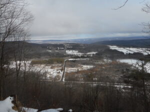
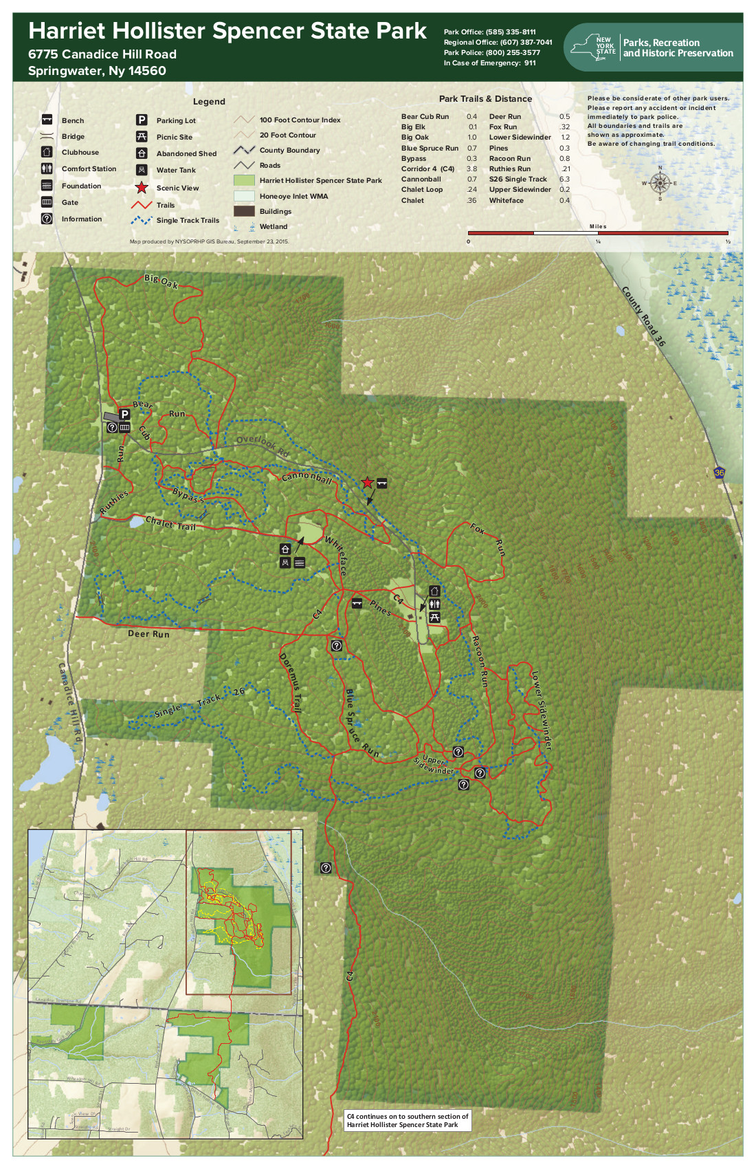
Harriet Hollister Summer Trail MapWe will meet at the parking area at 2:00PM. All the snow has melted, so it might be muddy – be prepared! At this point, the prospect of snow shoeing or skiing is hopeless. It will be old-fashioned walking.

Hikers may want to bring traction devices. All of the trails will be available and we will adjust the hike based on conditions.

We will break into groups based on the interests of the participants.Bring water and snacks and dress appropriately for the weather with layers that are easy to add or subtract.  Having your own map is always a good idea – here is a link to a winter trail map.

We will select a location for the after hike social at the time of the hike.

Directions:

NOTE: We do not recommend approaching HHS from the south on Canadice Hill Rd.  It is muddy and full of ruts.

FROM HONEOYE: From 20A turn south onto County Route 37 and go about 4 miles to the County Route 37/Canadice Hill Road split. Continue south on Canadice Hill Road about 3 miles. Harriett Hollister Spencer Park will be on your left.

FROM SPRINGWATER: Take Route 15A north out of Springwater for one mile and turn right on Wheaton Hill Road. Take the 1st left onto Canadice Rd. Turn right to stay on Canadice Rd. At the county line continue onto Co Rd 37 for 2.0 miles. Turn right onto Luckenbach Hill Rd. At the top, turn left onto Ross Rd. At the stop sign, take a sharp right onto Canadice Hill Rd. Harriett Hollister Spencer Park will be on your left.

FROM NAPLES: Please check your route before you leave. Google Maps will send you up Garlinghouse, which is a seasonal road and impassible in the winter. From Main St in Naples, turn north west on Clark St and continue onto CR 36 (Hunt Hollow Rd) for 11.9 miles. Turn left onto Jersey Hill Rd (Note Cratsley Rd is also seasonal). At the top, turn left onto CR 37. Continue straight through Canadice onto Canadice Hill Rd, and stay straight on Canadice Hill Rd when it turns to a dirt road. The Park will be on your left.

Posted on by

Camp Cutler Trails

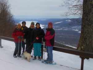
This Sunday we will explore the trails on the west side of Cleveland Hill, starting from the Gulick Road entrance to Camp Cutler, about 4 miles south of the Wesley Hill Nature Preserve parking lot.  Also known as the J. Warren Cutler Scout Reservation, Camp Cutler is a 1,200 acre year-round property dedicated to Boy Scout camping, and the home of the Cub Scout Adventure program of the Seneca Waterways Council. The camp is named for J. Warren Cutler, a Rochester businessman and an avid supporter of scouting. It has been in operation since 1966. It has an extensive network of hiking and mountain bike trails, some of which overlap with the Bristol Hills Branch of the Finger Lakes Trail which links Clement Road and West Hollow Road.  The Camp Cutler Trails up the west side have a gentler ascent to the top of Cleveland Hill than those we have seen coming from the north or the south.
Trail condition update:  Trail condition varies a good deal – some areas are snow-covered and/or icy, some are wet and muddy, and some are open woods. Waterproof footwear is a must, traction devices are a good idea, and poles  are recommended if you are used to hiking with them. Also rain gear if the forecast calls for showers between 2 and 4. 

We will convene at 1:45 and start our hikes at 2 PM at the Gulick Road parking lot.  All hikers will start out as a group along the Red, Purple and Blue Trails, following Whispering Creek in the northern section of the camp.  Naturalists will turn back at whatever point they choose. After about 2 miles, the Tourists will head back to the starting point on the Green Trail, an easy downhill past several lean-tos and cabins, for a total of about 3 miles.  Climbers will continue on the Blue Trail to the top of Cleveland Hill,  joining the Bristol Hill Branch for the overlooks to the east and southeast before turning back on the White and Red Trails to the starting point. Total estimated distance for the Climbers is 4.7 miles.  See link here for a trail map:  /…019/11/Camp-Cutler-Trails-annotated.pdf

Social – Following the hike, please join us for holiday cheer at the The Neapolitan Brick Oven Pizzeria at 120 N. Main Street, Naples.

Directions to Gulick Road Trail Head:

DIRECTIONS:

From Springwater/Dansville/Wayland: Take Rt 21N into Naples, turn left on Clark St. (at Middletown Tavern) and drive 1.2 miles to the Gulick Road intersection on your right.  Follow Guliick Road north for 4.2 miles to the camp entry on your right. The parking lot is near the entrance, on your left.

From Honeoye and Route 20A: Take East Lake Road south from Route 20A for 1/2 mile. Make a left on County Road 34 and then a right on Pinewood Hill Road. In one mile Pinewood Hill Road becomes Gulick Road as you bear right. Follow Gulick Road south for 7.3 miles, past Wesley Hill and Cummings Nature Center. The Camp Cutler entrance will be on your left.

From Route 64 north or south: Follow Route 64 to the intersection with County Road 34, about 2 miles north of Bristol Springs and about 1.2 miles south of Bristol Mountain. Turn west on County Road 33 for 1.6 miles, and then south on County Road 34 (a.k.a. West Hollow Road) for 4 miles. Make a right on Clement Road, and then a right on Gulick Road.  The camp entrance will be about 1 mile ahead on your right.  The parking lot is near the entrance, on your left.

Directions to The Neapolitan:

From Camp Cutler, go left (south) on Gulick Road to the end (4.2 miles) and then left on County Road 36 (a.k.a. Hunt Hollow Road) into Naples. Turn left on Main Street The Neapolitan is at 120 N. Main Street, just past the center of town.

Posted on by

Genesee Valley Greenway

This Sunday’s outing will be on the section of the Genesee Valley Greenway that is between Cuylerville and Piffard in the towns of Leicester and York in Livingston County.  This section has farmland, large ponds, woodlands, pastures, old oak trees, and in several places runs alongside the Genesee River. All groups will meet at the Greenway Parking and Kiosk Area on the north side of Rt 20A in Cuylerville.  Be prepared to cross-country ski, snowshoe, or hike depending on conditions.  Dress in layers and pack water and a snack.

Information on the Genesee Valley Greenway can be found on the NYS Parks, Recreation and Historic Preservation website at: http://nysparks.com/parks/189/details.aspx .

Hiking Groups

We will divide into several groups depending on people’s interests and abilities.  All groups will head north for about one hour and then return back to the parking area by the same route.  Distances may range from several miles up to 8 miles for those that go to Piffard and back.  Naturalists may want to bring binoculars and spend time looking for winter birds, animal tracks and other interesting things along the trail.

Social   

An after hike social will be at the National Hotel, 2927 Cuylerville Road, Leicester, NY 14481.  The hotel has a tavern and a restaurant with a nice dinner menu. It is within walking distance of the Greenway Parking area.

Directions to Meeting Place

From Springwater: Take NY-15N west from the flashing light for 1.5 miles.  Turn left on Liberty Pole Rd (CR 38).  This road changes names and numbers (CR 1A and then CR 1) but continue for 8 miles. Turn right onto NY-63N for 9.4 miles. Take a sharp left turn onto US-20A W (NY 39 also). The parking area is on the right in 2.4 miles just before US-20A turns a sharp left in Cuylerville.


Posted on by

Steege Hill Nature Preserve


This hike is CANCELLED!!!!! The freezing rain across the region is too dangerous for both driving and walking!


Description

  • This 800 acre preserve is a sanctuary for hikers during hunting season.  It was acquired by the Finger Lakes Land Trust in 2001 with generous help from an anonymous donor.  A stipulation of this gift was that the preserve would be patrolled during hunting seasons to protect against trespassers.  Our hikers will contribute to this effort.

The hilltop preserve looks down upon the Chemung River between Corning and Elmira.  At one time this area was nearly ruined by heavy logging, but the town of Big Flats stepped in to halt the destruction.  The original forest has made an impressive recovery through natural regeneration of many tree species.  On some of the steep slopes, original hardwoods and conifers remain.

Some forest residents are worth noting, although in December they are not likely to be visible.  Timber rattlesnakes are long time residents here.  Allegheny mound ants have also carved a niche.  Black bears have been sighted in recent years.  For additional information and history go to  http://fllt.org/preserves/steege-hill-preserve

  Special Note:  Although no hunters have been spotted here in all these years, please make yourself visible by wearing blaze orange.  Conditions in December are unpredictable.  It is advisable to bring hiking poles and traction devices for your boots.

The 6 miles of trails are largely old logging roads, well marked and maintained.  All hikers will gather at the new and improved parking area on Steege Hill Rd, which has been recently repaved.  It is still a small area so carpooling is encouraged.  Meet at Springwater Town Hall on Rt. 15 at 12:45 to share a ride for the 1 hour drive to Big Flats.

Hiking Groups  There is a moderate half mile climb from the parking area to the various trailheads.

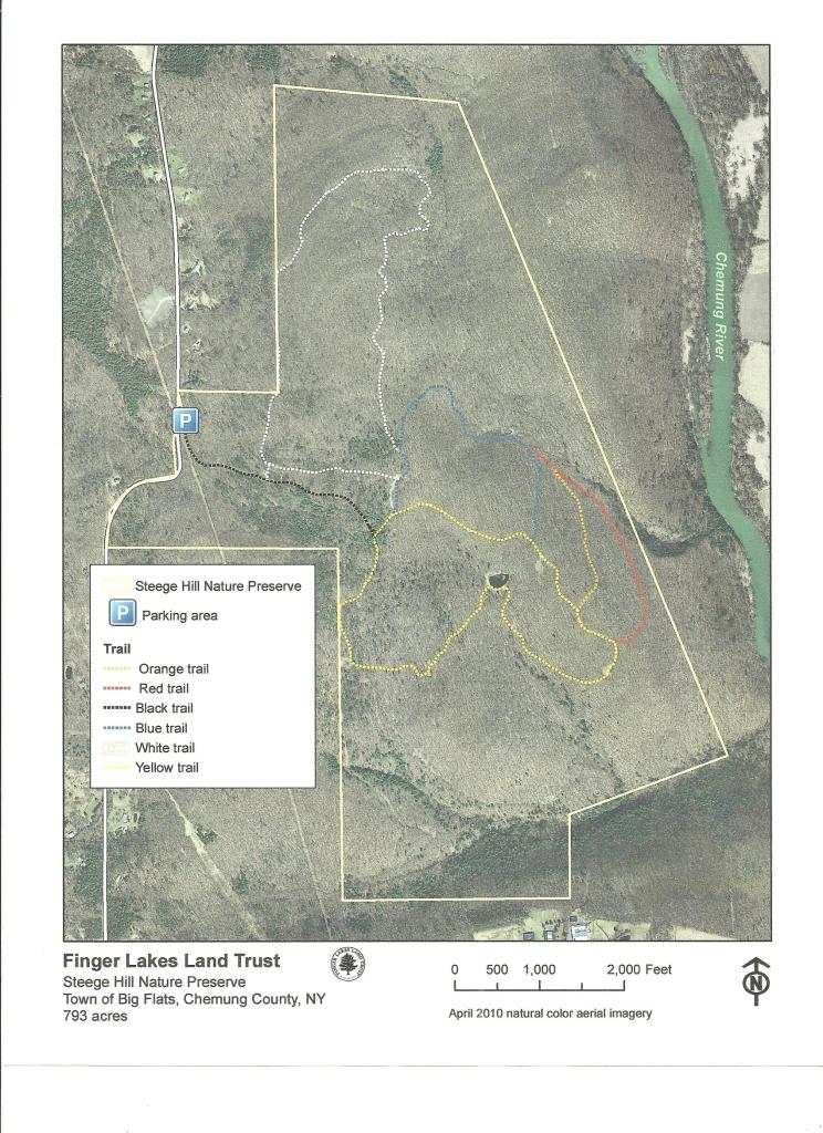
Naturalists  will enjoy meandering for about 2 miles along the yellow trail with its gentle slopes and a scenic pond.  A hike leader will be needed for this group.  Trail map will be provided.

Tourists will traverse the blue and orange loops for about 3.5 miles, enjoying a variety of terrain and some nice views.  Uphills are moderate.  A volunteer hike leader is needed for this group.

Climbers  will tackle the red, white, and blue trails for a distance of about 4.5 miles with some up and downhill challenges.Directions  Take 390 South to I86E.

Follow I 86 E to exit 48.

Take 353 E for 1.5 miles

Turn right on South Corning road and go .7 miles.

Cross Chemung River and turn left on Steege Hill Rd.

After 1 mile look for preserve sign on left.

After Hike Social  will be at Tags Restaurant, 3037 Rt. 352 in Big Flats.  We have enjoyed dinner here several times. See menu at http://www.tagsrestaurant.com