Posted on by

Kayak and hike on the Marrow Beds

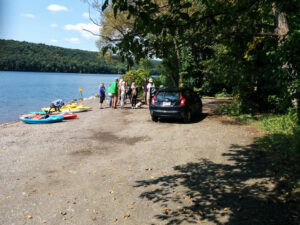
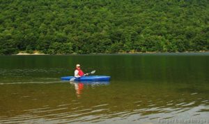
This Sundays hike will include a 3 mile easy hike and (or)  kayak in the wetland pond known to locals as ” The Marrow Beds”. This pond was excavated during the late 1800”s and was reported to be as deep as 45 feet. the pond has silted in over time and the deepest spot is about 4 feet. The morrow was loaded on a small set of railroad tracks and sent across town to the cement works.
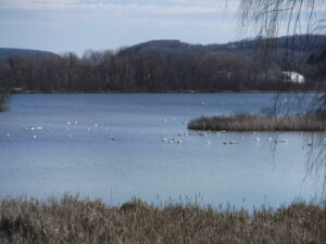
An picture of the pond where we will be kayaking.
There is an abundance of wild life (water birds of various kinds, turtles,beavers and occasional eagle sightings).

We will have a Social in the yard, practicing “social distancing”.  Bring a snack with you also.

Directions

From Wayland: From the intersection of Rt 15 and 21, head west on NY-63 (Naples St) for 1.2 miles. Turn left onto Dieter Rd. Dieter Rd will make a 90° right turn, and then you should immediately turn left toward the Rod and Gun Club.  Rick is the home on the left.

From Dansville: Head southeast on NY-63 S/Main St toward Wayland for 4.5 miles. Turn right onto Deiter Rd.  Continue past the Transfer Station for 0.6 miles. Just before Dieter Rd will makes a 90° left turn, turn right toward the Rod and Gun Club.  Rick is the home on the left.

REMEMBER 
Social Distancing is still important for all of us. Please carry masks for the times when we do gather to talk as a group and gloves when you touch other’s equipment.
Posted on by

Boating and Hiking at Hemlock Lake

As the COVID-10 pandemic recedes and New York opens up Springwater Trails will resume hiking on May 24th – Memorial Day. We want to encourage prudent social separation until the governor recommends otherwise so we’ll be planning on plenty of boating and bicycling over the next few months as a natural way of operating as a group and keeping well separated. We would like our hikers to carry masks for the times when we do gather to talk as a group, but doing anything strenuous while wearing a mask isn’t going to work. Our hikes during the pandemic will be “in-and-out” hikes, and we will avoid car sharing and the shuttling of cars to pick up at the far end of a one way hike.


Kayaking on Hemlock Lake

The Memorial Day hike will be at Hemlock Lake. We will meet at the parking area near the north boat launch at 4:00. For those who choose to walk there’s Rob’s Trail running south along the shore of the lake; paddlers are asked to arrive about 20 minutes early to have time to ready their boats for a 4:00 launch.Rob’s Trail isn’t suitable for normal bicycling, though dedicated mountain bikers are welcome to try it.

Boaters will head south along the eastern shore from the launch for 2-3 miles, depending on the conditions and the speed of the paddlers. After 1 hour they will turn back to the launch along the western or eastern shore.

Hikers will all walk south on Rob’s Trail as far as they as comfortable with, and then turn back.


The Social

We will have a social at the end of the hike. We won’t share food as we usually do, but we can gather at the picnic tables at the north end of the lake and each hiker can deal with his or her own lunch box.


Directions

From NY15A south of Hemlock, NY turn  west onto Rix Hill Rd. then immediately left onto Boat Launch Rd.  The launch and parking area are 1.1 miles south.

Posted on by

Hemlock Inlet Paddle with Johnson Hill Hike

This Sunday we will celebrate Father’s Day with a return to Hemlock Lake to Kayak from the South End. We will explore the Springwater Creek Inlet and the west side of the lake.

Meanwhile, hikers will go to the Johnson Hill Trail and will enjoy a walk in the woods, above two waterfalls. This trail is appropriate for all skill levels, but if we have more then 10 hikers, we will split into two groups, with one group following the old lake road north along Hemlock Lake.

Fathers are welcome to bring children and grandchildren (and other family members!).

Following the hike everyone is invited to gather for a socially distanced picnic at the boat launch. Bring your own food and beverage and a chair if you wish.

Kayakers will meet at the South Boat Launch. Come early to unload your boat(s) so we are ready to push off at 4:00.

Hikers will meet at the parking area at the entrance to the South Boat launch. From there they will drive to the Johnson Hill Trail or drive or walk the road to the boat launch and then continue on the trail past the boat launch.

Directions to the Hiker’s meeting area are available here. The boaters should follow these directions.

PS. For those of you expecting a Conesus Inlet paddle and hike, the Inlet Trail has not been mowed this year.  However, the trail south from the bridge on Sliker Rd is mowed and has two nice views of the inlet pond.

Posted on by

South Canadice Lake Hike, Paddle, or Ride

We will explore Canadice Lake and its surrounding terrain with the travel method of your choice, starting at the Canoe Launch (the southernmost lake access point) on Canadice Lake Road (southeast corner of the lake). Meet at 3:45 and park on the road shoulder near the kiosk.  If you are bringing a boat or a bike, allow extra time for unloading.

Hikers: Local resident Jim Kersting will lead the hiking group on a rambling loop up and down the hillside and gullies to the east of Canadice Lake.  Bring poles and good boots, as there will be some climbs and shallow water crossings. Those interested in a gentler walk may head south along Canadice Lake Road to the southern end of the Canadice Lake Trail and follow it as long as you like, then return. The side trail through the ponds south of Canadice Lake is a nice addition to this route.

Paddlers:  Put in at the south launch site and paddle the shores as far as you’d like, then return.

Cyclists:  Starting at the southeast corner of Canadice Lake, head north along the Canadice Lake Road, west on Purcell Hill Road and back to the start on the Canadice Lake Trail for a total of about 7.8 miles. It that’s too short, do it twice, or extend the loop by going north to Canadice Hollow Road, adding another 2 miles to the loop. The Lake Trail is fairly level and a decent surface for road bikes with medium tires, better for hybrid or mountain bikes.

Optional Social:  Bring your own food, drinks, masks and lawn chairs for a social-distance guided gathering at the south lake access area after the event.   No sharing of food, but sharing of stories is fine.


DIRECTIONSFrom Springwater: Head north on 15A and cut over to Canadice Lake Road. via Wheaton Hill or Johnson Hill Road. The south access area will be on the left. 

From Canandaigua, Honeoye and Hemlock: Take Route 20A to the Canadice Lake Road intersection. Go south 6.5 miles to the southernmost lake access area, on your right.

From Rochester: Take Route 390 south to the 5&20 exit, go east to Lima, then south on Route 15A. After Hemlock, turn left on Route 20A and right on Canadice Lake Road. The southernmost access area is 6.5 miles down, on your right.