Posted on by

Ski/Snowshoe at Rochester Folk Art Guild, Middlesex

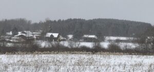
On Sunday Feb. 21st we’ll return to East Hill Farm, home of the Rochester Folk Art Guild, to ski and snowshoe the trails of their 350-acre hilltop farm and woodlot. The Guild is a community of craftspeople, producing fine quality handmade products in wood, pottery, fabrics, paper, toys, books and more. For more information about the Guild see:   https://www.folkartguild.org/about-us/ee .  

Please arrive by 1:45 to get your equipment organized for a 2 PM start.  Come into the driveway at 1445 Upper Hill Road, Middlesex (directions below) and bear left to park behind the Gallery Shop or by the Boat Shop. We will convene in front of the Boat Shop, the first building on the right as you come in the driveway.

Note on conditions: The snow is over a foot deep with some drifting and a light crust on top, but there are ski/snowshoe tracks to follow, which will make for a fine outing. Trails have a moderate slope, nothing very steep, but these trails are not groomed, so be prepared for an uneven surface. We recommend skis or snowshoes to keep you in the upper part of the snow pack; hiking just in boots will make for a very strenuous afternoon. 

Skiers will head south through the Guild’s farm and neighboring properties, past a pond and sauna, through a spruce grove, and looping through woods and mowed fields, passing an eclectic array of residential buildings, workplaces and gathering places, designed and built by community members over their 50 years of occupancy at the East Hill Farm.  Total distance will be about 2-3 miles, depending on the conditions and energy levels; we may be breaking new trail in some sections.  Snowshoers will start out on the same path, but make a shorter loop through the woods and fields, about 2 miles.

Social:  There is no planned social gathering due to the pandemic guidelines, but the Pottery Studio will be open after the hike (no more than 10 people at a time) if you would like to tour or shop. A rest room will be available in the Gallery building. 

Directionsfrom Springwater/Naples: Take Route 15 south to Wayland and Route 21 east/north to Naples. Turn right on Route 245 opposite Bob’s and Ruth’s Restaurant, at the north end of the village. Follow Route 245 north to Middlesex, about 8.75 miles.  Turn right on Route 364 and go up the hill, one mile. Take the second right turn on Upper Hill Road and go 1.5 miles.  East Hill Farm will be on your left, at #1445. Come in the driveway, past the Gallery building, and bear left to park behind the Gallery Shop or to the front or rear of the Boat Shop. 

From Rochester and points north: Head to Routes 5 and 20 via Bloomfield or Canandaigua. At the east edge of the City of Canandaigua (first light after Wegmans/Post Office), turn south on Route NYS Route 364 (a.k.a. East Lake Road).  Follow Route 364 south 12.5 miles to Middlesex, where 364 turns to the east and you will make a left onto Route 245/364 and then an immediate right to continue on 364.  Go up the hill, one mile. Take the second right turn on Upper Hill Road and go 1.5 miles.  East Hill Farm will be on your left, at #1445. Come in the driveway, past the Gallery building, and bear left to park behind the Gallery Shop or to the front or rear of the Boat Shop. 
Posted on by

Bur Oak Trail, Walnut Trail and Beach Walk, Hemlock Lake NW

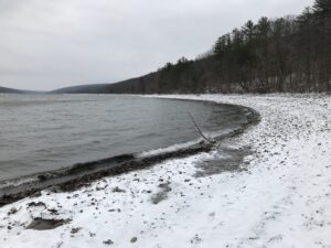
 Now that we’ve seen the southeast corner of Hemlock Lake from the beachfront, on Sunday January 10 we will explore the opposite corner of Hemlock on the Bur Oak Trail and the Walnut Trail, both on State land within the Canadice Hemlock State Forest. One section is a snowmobile trail, and the other follows in the woods parallel to the shoreline. For those who enjoy stony beach walking, there will be an opportunity for that too.
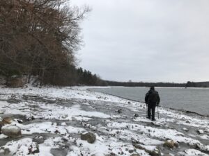
 

Meet at 1:45 at the northwest corner of Hemlock Lake at the Rix Hill Road trailhead parking area just west of the Hemlock Outlet and Hemlock Lake State Park.  There are small parking areas on both sides of the road, and a kiosk on the south side. All hikers will first follow the Bur Oak Trail north along the Hemlock Outlet to a grassland loop off Blank Road, and return for a total of about 2.5 miles – this is a snowmobile trail. We will then cross the road and follow the Walnut Trail south through the woods for about .75 miles and back; this requires some agility in stream crossing. The final leg will be a walk down the Hemlock shoreline and back, fording small streams as we pass them. Bring good waterproof winter footwear and poles.  Those wanting a shorter hike will have ample opportunity to bail out as we pass the starting point twice.

No social due to Covid guidelines.

Directionsfrom Springwater: Head north on NY-15A. At the end of Hemlock Lake, turn left on Rix Hill Road.  Pass the park entrance on your left and go over the Hemlock Outlet bridge. The parking areas will be on both sides of the road, or park on the shoulder.

Directionsfrom Canandaigua, Honeoye and points east: From Honeoye, continue west on Main Street (Route 21A) to Route 15A in Hemlock. Make a left, go a half mile, and take a right on Rix Hill Road. Pass the park entrance on your left and go over the Hemlock Outlet bridge. The parking areas will be on both sides of the road, or park on the shoulder.

Directions from north and west: Take Route 390 south to Exit 9 (Lakeville-Livonia). Go south on Route 15 into Livonia, the southeast on 20 A. Make a right after 3.9 miles on County Road 56 (Federal Road),  then a left on Adams Road after .6 miles. Take the second right on Blank Road. In a mile, fork left at Rix Hill Road and go down the hill to lake level. The parking lots will be at the foot of the hill, just before you come to the lake.

Posted on by

Ontario County Park Hike/Snowshoe

NOTICE: At a prehike on Wednesday, we were met with 18 inches of snow at the park. The FLT trail and the Yellow trail were well used giving an easy base for hiking most places. Skiers and Snow shoers will be able to go off trail on a solid crust which hikers would break through. So, we expect a good trek for all.

Ontario County Park provides hiking, biking, cross country skiing, fishing (no hunting), and camping or picnicking opportunities depending on the season. The park contains the highest point in Ontario County, and as a result it often has long lasting snow cover. So bring your skis, your snowshoes and your hiking boots and we will take advantage of our winter weather!

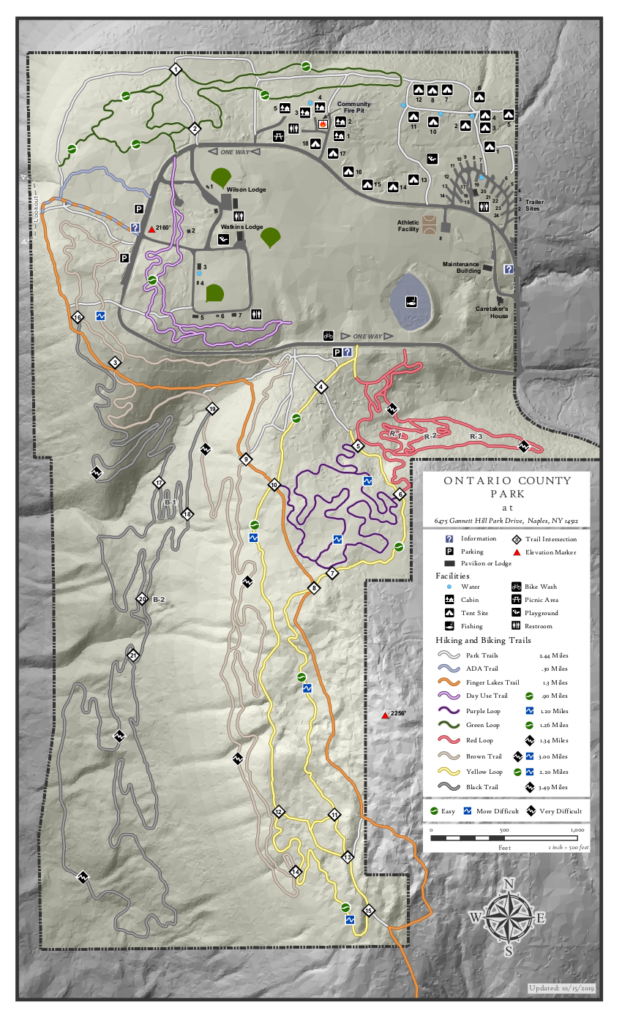
Please join us at the west parking along the main park road near the start of the Bristol Branch of the Finger Lakes Trail. Come early enough to get your equipment ready.  We will start the hike at 2:00PM.

There are many trails within the park, although the bike trails are difficult to follow in the winter. The following planned hikes may change based on the weather and the snow cover on Sunday.

The Climbers will follow the Bristol Hills Branch of the FLT out to the overlook and then around to the south to the FLT sign-in box. At that point, we will turn around, and follow the yellow trail back through intersections 13, 11, 8, 7, 6, 5 and 4 to the park road.  Crossing the road, we will cross the fields to the purple trail back to the cars. Climbers are invited on snow shoes and hiking boots. Poles will be helpful at slippery locations.

The Naturalists will also follow the Bristol Hills Branch past intersection 10  to intersection 8. Then turn left to follow the yellow trail through intersections 7. At intersection 6, the group has the choice between staying on the yellow trail or exploring the upper sections of the red trail.  Back at the road, the brown trail on the left of the road, or the purple on the right will be followed back to the cars.

Meanwhile Skiers will also head out to the overlook, but will turn north to follow the park trail though intersection 1 and on to the campgrounds. From there, we will cross the field to the pond, check out the red trail and head back to the cars on the brown trail or back across the fields.  Conditions may dictate changes to this route.

There will be no planned social following this hike. If you are hungry, Brews and Brats, and Hollerhorn Distilling plan to be open Sunday according to their Facebook pages.

Directions: The easiest route to the park is to take NY 64 to Bristol Springs and turn west on Gannett Hill Rd.  There is a sign indicating Ontario County Park.  At the top of the hill turn right onto  South Gannett Hill Road.  The  park entrance is straight ahead.    Follow the park road for about .5 miles to our meeting place which is the parking area along the park road near the information kiosk at the Finger Lakes Trail trail-head.

Posted on by

H. H. Spencer Park – Ski-Snowshoe-Hike

NOTE: Daylight Savings Time starts today.  Please check your clocks!

Our Sunday event originally planned a ski or snowshoe excursion on the groomed trails of Harriet Hollister Spencer State Park. The Park has been well used over the past few weeks of snowy weather, and the groomers keep the trails in great condition for both fast and slower skiers and for those on snowshoes. Since we’re not sure what effect the recent warming will have on the snow, it is highly unlikely that skiing or snowshoeing will be possible.  

Meet at 6775 Canadice Hill Road in Canadice.  Park in the main lot near the road. Restrooms are available next to the lot.   We will divide into groups depending on desired activity and distance.

 Naturalist: Good easy trails for hiking are the main road past the overlook and the inner service area, looping back on Raccoon Run.    For a detailed look at the routes and difficulty, see winter trails map for the options:

Tourists:  Starting from the parking lot heading out on Ruthies Trail and connecting with Chalet trail, makes for a pleasant hike. Head up Whiteface to Blue spruce and connect with Racoon Run or Sidewinder.

Climbers: Climbers can also head out Ruthie’s Trail and connect with the Chalet trail and take the snowmobile trail C4 out of the main park, out to the junction of Townline and Canadice Road. Best guess; returning back to the park along Canadice Hill Road may not be a good option. The road may be very muddy. Heading back on C4 into the main park might be a better choice.

Hiking conditions caused by weather changes, will try to be updated as hike day nears.