Posted on by

Paddle/Hike at Finger Lakes Museum, Branchport

Please join us for kayaking on Sugar Creek and Keuka Lake or a hike through the marsh preserve to the lake.  Our starting point will be the Finger Lakes Museum site, accessible from Guyanoga Road or from Route 54, both close to the flashing light at the center of Branchport.  The Finger Lakes Museum is a former elementary school which is being gradually converted to a regional museum.  They have an active boat launch site at the rear bordering Sugar Creek, the main tributary into the west branch of Keuka Lake.

Checking the weather, expect a very warm day with scattered showers.
Kayakers should arrive by 3:40 to unload your boat and launch from their floating dock. Hikers, who will follow the trail along the river, and kayakers will leave at 4:00.

After launching, kayakers will head upstream in Sugar Creek through a woodland waterway. Based on time and conditions we then will turn around and head back past the dock to the lake.  Once on the lake we will start heading west and enter the adjacent marshland owned by the Isaak Walton League. Cattails, water lilies and waterfowl are abundant in the marsh waterways.  Back on the lake we will continue west to the marinas of Branchport. Another U-turn will take us toward Keuka Lake State Park. Finally, we will return to the river and up to the takeout at the Museum’s dock.

Hikers will hike to Keuka Lake along the museum paths, stopping at an observation platform overlooking the marsh and at the Museum’s lakefront pavilion.: After enjoying the lake views, we will return to the museum and explore the museum grounds.

Social:  Bring your own snack or a dish to pass at the Museum’s pavilion. Or contribute $5 to the social fund and snack from the dishes available.

Directions:

From Springwater and Wayland – Take Route 15 south and then Route 21 north to Naples. Coming into Naples, go right on Route 53 toward Prattsburgh. In 1.2 miles make a left on Italy Valley Road. You will remain on Italy Valley  Road for about 8.7 miles, although the county road number changes from 21 to 18 to 34 en route. At the end of Italy Valley Road, go left for .3 miles on Italy Hill Road (CR 35), then follow Itlaly Hill Road as it curves to the right and becomes CR32. In another 4.7 miles you will be at the flashing light in the center of Branchport.  Go straight on Route 54A toward Penn Yan for .2 miles, and turn left into the Finger Lakes Museum across from the Library, and before the Fire Station. Look for the driveway toward the new barn on your right.

From Canandaigua and 5&20:  Take East Lake Road south to County Road 1, or Route 247 from Reed’s Corners into Rushville. Continue South through Rushville toward Penn Yan. Route 247 will become Route 364 shortly before Potter. Continue for 4.5 miles past Potter and make a right on Guyanoga Road (CR 29). Go another 6.5 miles to Branchport. Turn left into the Finger Lakes Museum at 3369 Guyanoga Road, or if you miss it, go left at the flashing light and then left into the FLM drive. If you come in from Guyanoga Road, go to the right around the building and parking lot, and follow the signs to the Creekside Center (a new barn). Park on the grass near the boat rack. If you take the side entrance in from Route 54A heading east toward Penn Yan, turn in to the left, across from the library, and then right into the Creekside Center.

Posted on by

Genesee County Park & Forest, E. Bethany

History: Genesee County Park is the oldest county forest in New York State. It has 431 acres of forested rolling hills, five ponds, and a 4-acre wetland, located in Black Creek Watershed. The park has 10 miles of trails for hiking, exploring and mountain biking.  

All hikers will start out in a single group from the Interpretive Nature Center to explore the center section of the park, including stands of hardwood and softwood trees and wetlands. When we reach the park perimeter, Climbers will follow the Boundary Trail around the park for a total hike of about 5 miles. Tourists and Naturalists will complete a shorter hike back to the start. Maps of entire park will be available at start of hike. 

 The Interpretive Nature Center is open Sunday 12-4 pm. Those wanting to visit the Center will need to arrive prior to 4 pm.

All hikers should meet at 3:45 in the large parking area in front of Interpretive Center, to get organized for a 4 pm. start.

Social – We will reconvene at the Interpretive Center at 5:45 for an optional social gathering on the grounds. Bring a lawn chair and your own beverage and meal or snacks, or bring a dish to share. Dessert will be provided. 


Directions:

From the Thruway – Take exit 47 off Thruway (LeRoy/Route 19). Take Route 19 south through LeRoy to Route 20, make a right and go west for 5.6 miles. Turn right onto Old Telephone Road and then left onto Bethany Center Road (County  Road 15). Turn left into the Park entrance onto Memory Lane and continue 1/4 mile to the Interpretive Center.

From the East: Go north to Route 20. Take Rt. 20 West past Avon, Route 19 and Route 63. Turn right onto Old Telephone Road and then left onto Bethany Center Road (County  Road 15). Turn left into the Park entrance onto Memory Lane and continue 1/4 mile to the Interpretive Center.

From Springwater and points south – Get yourself to Geneseo area to pick up Rt. 63 North, either where it intersects with Rt. 36 North in village of Greigsville or in Geneseo. Follow 63 North to Route 20, go west 3.5 miles to Old Telephone Road/Bethany Center Road. Turn left into the Park entrance onto Memory Lane and continue 1/4 mile to the Interpretive Center.

Posted on by Posted on by

Mill Creek Conservancy Hike

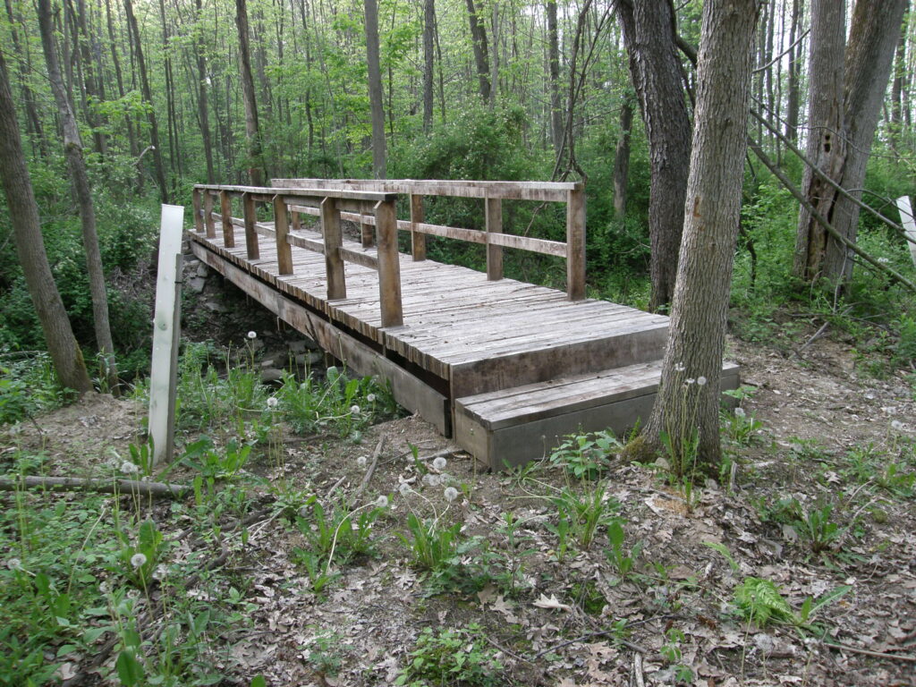
The Mill Creek Bridge

This Sunday’s hike will be on a newly acquired piece of property by the ” Genesee Valley Conservancy”. Mill Creek Nature Preserve attributes its name based on two streams that come together to form Mill Creek. The creek is located in the upper reaches of  naturalized brown and native brook trout habitat. The preserve is comprised 47 acres of wooded area with ongoing work to re-establish the natural beauty through conservation effort including controlling invasive species and replacing ash trees being lost to the emerald ash borer.

The hiking trails are a “work in progress” but are fairly cleaned up and are marked. Please stay out of the creek. The trails are normally dry,  but if it has rained recently, expect parts of the uphill trail to be a  little slick. Long pants and bug spray may be desirable. The lower sections of the trail are  relatively flat with some uphill climbs toward the back trail.

After the hike, come warm up at Laf a Lot on Loon Lake.

There is a small parking area in the woods big enough for about 6 cars.

Directions: Mill Creek Preserve is 1.7 miles south of I-390 on NY 21. You will see a short guard rail protecting a culvert, and the driveway to the preserve is immediately after the guard rail on the right side of the road. Park up the driveway or on the shoulder of NY 21.

FROM NAPLES– Head south on Route 21 toward Wayland. Turn left at the first red light. Continue on 21 South about 3.6 miles. Mile Creek Preserve will be on your right.

FROM SPRINGWATER– Head south on Route 15 toward Wayland. In Wayland, go straight through red light and drive another 3.6 miles on Route 21. Mill Creek Preserve will be on your right.

FROM ROCHESTER–    Get on 390 south and drive to the Wayland exit . Turn right on Route 21 south for 1.6 miles. Mill Creek Preserve is on your right.