Posted on by

Annual Mushroom Hike at All Western Evergreen Tree Farm, Springwater

Welcome to the eighth Annual Mushroom Foray [thanks to both Springwater Trails and the Rochester Area Mycological Association] at the All Western Evergreen Farm.  Three hiking groups are planned, all starting and ending at the parking area at the farm.  The three groups will explore much of the farm, with many opportunities to find mycological specimens.

Please plan to arrive early (1:45 PM) to sign in and to sign the RAMA liability forms.

Maps of the farm, paper bags and paper plates for collecting and displaying mushrooms will be provided.  Those who want to learn how to collect mushrooms will be instructed by Gene and Georgia, and any other Rochester Area Mycological Association members who will be our guests.

The Climbers will follow the driveway up to the fields, turning to the left at the top. We will circle the pond on the southern portion of the farm and the spruce forest along the edge of the Christmas tree plantations. Heading west through the Cathedral Pines will take us to wet spots in the woods. We will return along the edge of several more Christmas tree plantations (Douglas-fir, Nordmann fir, Grand fir, Concolor fir, Canaan fir, Alaska yellow cedar, Norway Spruce, Meyer Spruce).

The Tourists will follow the driveway up through the woods, stopping occasionally to explore for mushrooms.  When reaching saleable size Christmas trees (Lot Z), head to the right around or through the Christmas tree plantation.  At the corner where the small Southwestern White Pine tree row ends and the tall Concolor fir are, follow the trail into the woods and back to the field and head west along the north field road to a hidden corner of the field with some spectacular 35 foot green and blue Concolor fir Christmas trees live, the size seen during Christmas season in a large mall.  If there is still time, follow the north field road next to the hedge row up to Story Road. We will return through the tillable fields, visiting smaller collections of trees and back down through the woods.

The Naturalists will start exploring under and behind the Western red cedars (thuja plicata or giant arborvitae) by the parking area and south to the Alaska yellow cedar, large Concolor fir and spruce, then back up through the woods to the right of the trail up to the main fields.  These are likely full of mushrooms, but you will find some swampy areas, so don’t get lost behind people’s homes along Liberty Pole.

All hikers should check their watches and return to the parking area by 4:00 PM to have their collections identified.  A portapotty with a sink is nearby.

Mushroom Identification

Once again we are fortunate to have several RAMA members (Randy Weidner, Don Tuminelli, Eugene & Georgia Binder) with us who have volunteered to identify the mushrooms collected between 4 and 5 PM.  After the mushrooms are identified please join us for a social (5:00 – 6:30 PM) hosted by Katherine outside the house next to the Furnace Building. Please bring a lawn chair and your own bag lunch and beverage.

We will begin all the hikes at 6840 Liberty Pole Road where there is ample parking at the Christmas tree loading area between the tall Western redcedar and Morton Building and Nursery beds. Follow the parking signs.  When we return from our foray, the mushrooms will be displayed for identification on paper plates on the tables outdoors.  Please dress for the weather, rain gear as needed.  Social distancing and masks are recommended when close together.

Directions:

From Springwater: Go west from the Springwater light on NY-15 North.  Just past the top of the hill and after rounding the tight curve, turn left on CR 38 (Liberty Pole Road).  The farm is on the left (the high side) 1.1 miles from NY-15 at 6840 Liberty Pole Road after you cross Carney Hollow Rd. There is a sign for the All Western Evergreen Nursery & Christmas Tree Farm.  Follow the orange cones to the parking area and park facing the house.

From Geneseo: Go south on NY-63.  About 6.4 miles after passing NY-408, turn left on CR-1 (Groveland Scottsburg Rd) at Groveland Station.  This road becomes CR 1A (Springwater Scottsburg Rd) at Scottsburg (Route 256) and then Liberty Pole Road after you cross Stagecoach Road (CR 71), and finally CR-38 (still Liberty Pole Rd) after crossing Reeds Corners Rd (CR-29).  It is 7.1 miles from Groveland Station to All Western Evergreen Farm.  The farm is on the right (the high side).  Follow the orange cones to the parking area and park facing the house.

From Honeoye: Take 20A west to Hemlock and 15A south to Springwater.  Then follow the Springwater directions above.

From Rochester: Take I-390S from Rochester. Use Exit 9 for NY-15 Lakeville. Turn left onto NY-15. Stay on NY-15 for 16.5 miles, through Lakeville, Livonia, Conesus and Webster Crossing.  When NY-15 curves to the left at the south end of Webster Crossing, continue straight onto CR-60 (Carney Hollow Rd) and take the first right onto Liberty Pole Rd.  The farm is on the left (the high side) at 6840 Liberty Pole Rd.  Follow the orange cones to the parking area and park facing the house.


If using GPS, use the map directions on the www.allwesterntrees.com website and make sure you are on Liberty Pole Road and not being directed to the center of the farm from Swartz Road or Story Road.  Follow the orange cones to the parking area and park facing the house.

Posted on by

Highland Park Arboretum Hike, Rochester

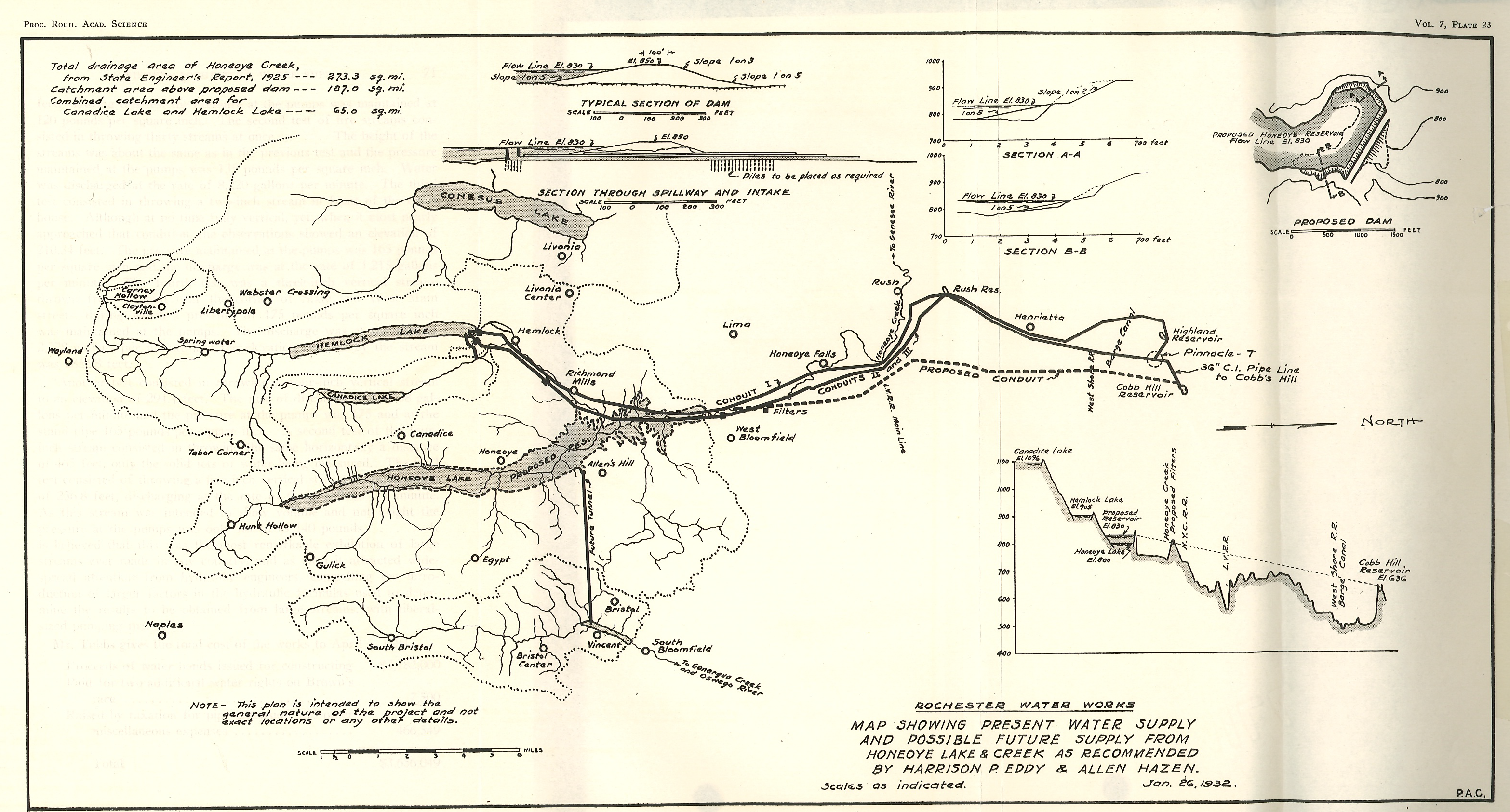
A map showing the 1932 city water supply system and a proposed addition of Honeoye Lake as an additional reservoir.

The City of Rochester started construction in 1873 of a gravity water system connecting Hemlock Lake to a reservoir in the city. The current Reservoir in Highland Park was completed in 1876. In 1887, George Ellwanger and Patrick Barry donated 20 acres of land adjoining the reservoir for the beginning of the public park system in Rochester. Over the years the original donation has grown to the 150 acre Highland Park, and to the 12,000 acre Monroe County Parks system consisting of 22 separate parks. The Ellwanger/Barry gift specified that the city would hire a landscape engineer to establish a first class arboretum with numerous trees donated from the Ellwanger/Barry Mt. Hope Nurseries. The city hired Frederick Law Olmsted Sr and Sons to design the park. Olmsted took advantage of the glacial topography of the park and in 1890 built the Children’s Pavilion on the high point of the park just east of the reservoir.

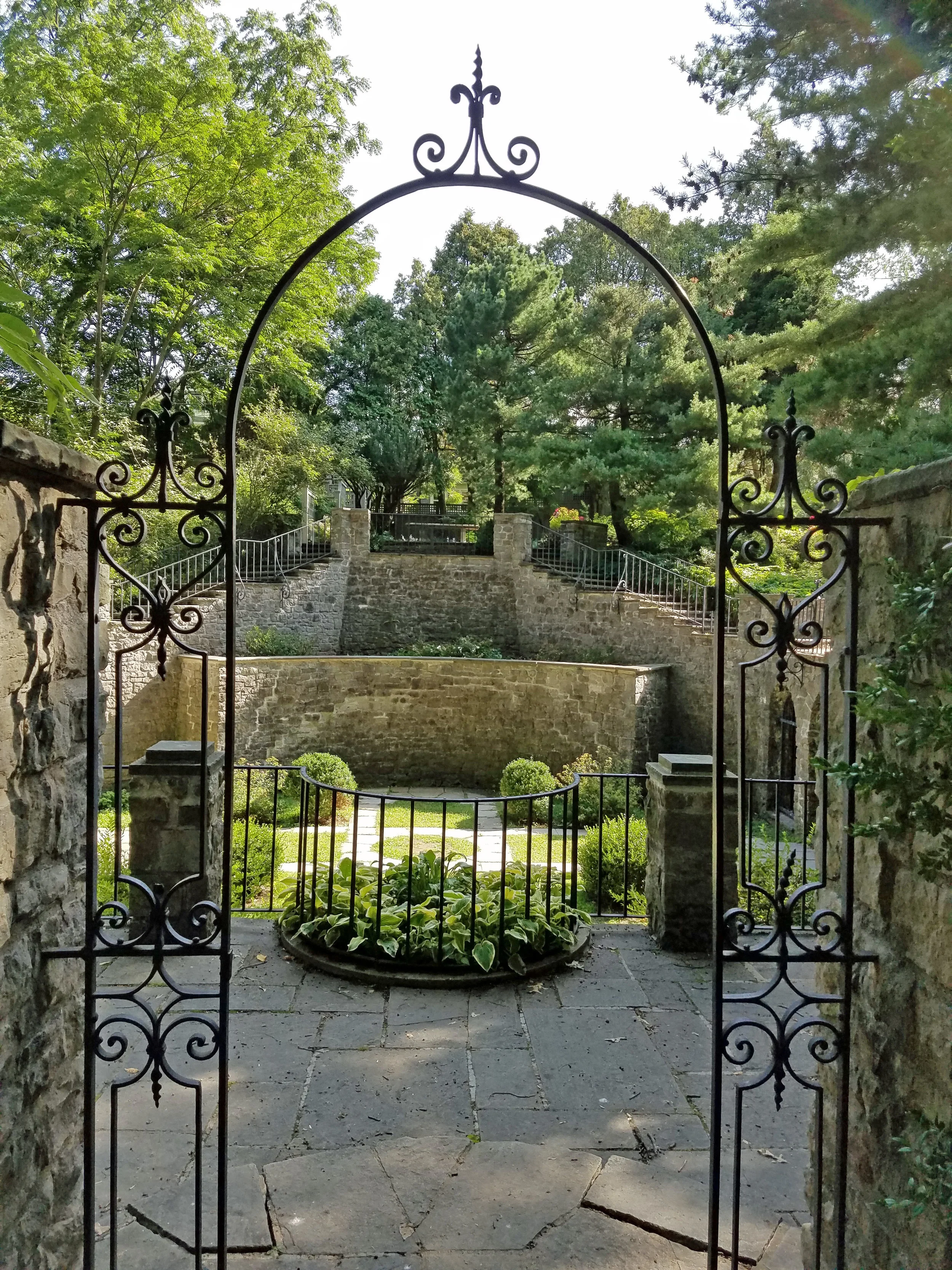
This Sunday’s hike will explore Highland Park with an emphasis on seven rare trees identified by the park department and the Sunken Gardens behind the Warner Castle.

All hikers will meet at the front of the Lamberton Conservatory on Reservoir Ave just east of South Ave. Following the hike, join us for a social at the Distillery Restaurant south of the park on Mt Hope Ave.

Directions:

From Springwater: Take NY 15A north from Springwater through Lima and Rush. (At last check, I390 was being repaved from Avon to NY 251 and is a single lane). Stay on NY 15A into the city. Cross Westfall Rd and stay to the right onto South Ave.  In 1.1 miles, turn right onto Reservoir Ave. The Conservatory is on the left and parking is available on Reservoir Ave.

From Honeoye: Take US 20A west to Hemlock. Turn right onto NY 15A and follow the directions above.

From Dansville and Geneseo: Take I-390N to Rochester. Use exit 16B for NY 15A. Cross Westfall Rd and stay to the right onto South Ave.  In 1.1 miles, turn right onto Reservoir Ave. The Conservatory is on the left and parking is available on Reservoir Ave.

From Naples: Take NY 21N out of Naples. Bear left onto CR 12.  In 5.6 miles, turn left onto NY 64N. In 13 miles, turn left on 5 & 20. Turn right on NY 444N toward Victor. In 7 miles, turn left onto NY 96N. In 2.8 miles, use the right lane to merge onto I-490W to Rochester. Stay on I-490 into the city. Take the right exit 17 to Goodman St. Turn left onto Goodman St for 0.8 miles. Turn right onto Pinetum Dr. Stay to the left onto Reservoir Ave then right to stay on Reservoir Ave. The Conservatory is on the right and parking is available along Reservoir Ave.

From Canandaigua: To NY-332 N to the Thruway. Keep to the left at the entrance for I-90 West toward Rochester and Buffalo. Take the first exit 45 for I-490 W to Rochester. Take Exit 17 to Goodman St. Turn left onto Goodman St for 0.8 miles. Turn right onto Pinetum Dr. Stay to the left onto Reservoir Ave then right to stay on Reservoir Ave. The Conservatory is on the right and parking is available along Reservoir Ave.

Directions to the Social: Head west of Reservoir Ave across South Ave to Mt Hope Ave. Turn left onto Mt Hope Ave. In 0.3 miles, turn left onto Stewart St. The Distillery is on the right.

Posted on by

Wheaton Hill Hike, 3 PM start (Bike Ride Postponed)

 CHANGE OF PLAN – The proposed bike ride has been postponed because of questionable weather and hazardous road conditions, as several roads on the intended route have had oil and stone applied this week.   Please join us for the Wheaton Hill hike, which will proceed as planned.  NOTE THE START TIME OF 3 PM FOR THE HIKE.

 Hikers will meet at 3 PM at the Wheaton Hill Road trailhead, on the northwest side of the road and will divide into groups for a Climber hike and a Tourist/Naturalist hike.    As usual, bring water, good footwear and poles if you use them. The trails are rugged in places. Long pants are advised.

Social:   After completing the hike around 4:30 to 5:00 please join us for a dish-to-pass social at the  United Methodist Church in Webster Crossing church  (see directions below). Bring your own beverage and favorite goodies. Dishes, utensils, condiments etc will be provided. Or just bring a beverage and a $5 donation and help yourself to snacks. A bathroom, kitchen, fridge and dining room are available for our use.

DIRECTIONS TO HIKE START:   Trailheads for Wheaton Hill trails are a half mile up from the west end of Wheaton Hill Road where it meets Route 15A in Springwater, just past the south end of Hemlock Lake.

From the north, go to Hemlock, then proceed south on Route 15A. About a mile and a half past the South Hemlock Boat Launch, turn left on Wheaton Hill Road. Proceed a half mile up the hill and park on the road shoulder near the curve.

From the south, go north on Route 15 to Springwater, continuing straight at the light.  Make a right on Wheaton Hill Road in about .9 miles. Proceed a half mile up the hill and park on the road shoulder near the curve.

DIRECTIONS TO THE SOCIAL:  From the end of the hike go west on Wheaton Hill Road and then south on Route 15A into Springwater. At the light, make a right onto Route 15 North. Go up the long hill to Webster Crossing, about 4.6 miles. The United Methodist Church will be on your left at #7230, opposite the beginning of May Road. Park at the rear of the building.


Posted on by

Keuka Park and Bluff Point Hike/Bike — CANCELED

CANCELED – Due to thunderstorms predicted for 3:00 today, our hike is canceled.

This Sunday we will return to Keuka Lake for a hike through the State Park and a bike ride across the top of the land between the Y and back along the West Bluff Rd. Following the bike/hike we will all meet in the park picnic area to relax and socialize.  Bring your own beverage and sandwich and perhaps a snack to pass.

The park has a $7 day use fee so we will all meet at the parking lot at the Finger Lakes Museum and then car pool into the park. See the directions below.

The bike ride is about two and a half hours long, so we will meet an hour early at 3:00 to allow for the extra time. Bicyclists may want to carpool back to their cars prior to the social – we don’t think there is a fee after 5:00.

Click map for a printable version.

Hikers: The White Trail starts across the main road from the Picnic Parking area. All hikers will head up the white trail past an historic cemetery. This trail starts steep but it seems that all hikers will be able to regroup at the cemetery.  From there, the trail continues up through woods to Campground Rd. Turn right onto the road, the left at the Tee and continue up to the end of the road (about a quarter mile). The Green Trail continues straight from the end of the road. At the first trail intersection, turn left to head back down toward the campground. There is a second intersection, but hikers will continue straight. The Green Trail comes out into the Twin Fawns campsite circle at site 76. Turn left on the road and head down to campsite 66 to join the purple trail under the large willow tree. Please be respectful of campers if the sites are in use.

Click on map for a full size image.

Just a few feet down the purple trail, turn right onto the yellow trail. This trail follows a gully down to the lower parking area. At our prehike, the day after the big rain, the stream at the bottom of the gully was beautiful.  The original parking is about half a mile up the road, or hikers can follow the shoreline back to the picnic area. This hike is slightly less than 4 miles.

Bikers: Our bikers will head uphill, out of the park to Pepper Rd. Turning right on Pepper Rd will take us along the edge of the park. We will continue past W Bluff Rd to the tee at Skyline Dr. Again, turn right and continue the climb to the open fields at the top with some nice views of the lake. Our total climb is 700 ft over 6 miles. Skyline Dr will turn left as we pass the Seasonal Road sign and head down hill. We will stop at the Garrett Memorial Chapel. Continuing down Skyline Dr, we will turn right on W Bluff Dr. By the time we reach the cottages on the lake, we will have descended 700 ft in 1.2 miles (check your brakes before you start!). The final 5.5 miles along the shore line is a relaxing drive by many nice cottages. At the north end we will stay to the left, go around the gate and continue back to the cars in the park.

Directions: The following directions are to the meeting spot up by the brick museum building on the west side of the grounds.

From Springwater, (Wayland and Naples):  take NY 15 south to Wayland. Turn left on NY 21 N through N. Cohocton to Naples. Turn right on NY 53 south. Turn Left on Italy Valley Rd (CR 21). Turn right onto Italy Hill Turnpike (CR 34). At the top, turn left onto Italy Hill Rd (CR 32) and follow that road to Branchport.  Continue straight onto NY 54A and take the first left onto School St. Stay to the left up the hill, in front of the old school building and around to the left to the first parking lot.

From Canandaigua: There are many equally good ways to get to Branchport from Canandaigua.  Here are the simplest directions I could find. Head east on 5&20. Turn right onto NY 247S. In 6 miles, at the intersection with NY 245, bear left toward NY 245N, but then turn right to cross 245 onto Blodgett Rd. In 5.2 miles, turn left onto NY 364. In 4.5 miles, turn riht onto Guyonoga Rd (CR 29). Continue into Branchport. Turn left onto NY 54A and take the first left onto School St. Stay to the left up the hill, in front of the old school building and around to the left to the first parking lot.

Directions from the Museum to the Park: Follow School St back out to 54A. Turn left and follow 54A past Esperanza Mansion on the left to Pepper Rd. Turn right on Pepper Rd, then the next right into the park. The day-use fee is paid at the entrance. Then turn right toward the lake and beaches. We will park at the second parking lot near the picnic area.