Posted on by

Canadice Lake Paddle, Hike and Bike

We will explore Canadice Lake and its surrounding terrain with the travel method of your choice, starting at the Canoe Launch (the southernmost lake access point) on Canadice Lake Road (southeast corner of the lake). Meet at 3:45 and park on the road shoulder near the kiosk.  If you are bringing a boat or a bike, allow extra time for unloading.
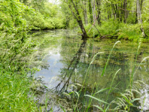
Hikers:  Those interested in a gentler walk may head south along Canadice Lake Road to the southern end of the Canadice Lake Trail and follow it as long as you like, then return. The side trail through the ponds south of Canadice Lake is a nice addition to this route.

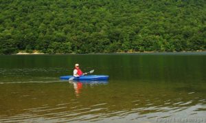
Paddlers:  Put in at the south launch site and paddle the shores as far as you’d like, then return.

Cyclists:  Starting at the southeast corner of Canadice Lake, head north along the Canadice Lake Road, west on Purcell Hill Road and back to the start on the Canadice Lake Trail for a total of about 7.8 miles. It that’s too short, do it twice, or extend the loop by going north to Canadice Hollow Road, adding another 2 miles to the loop. The Lake Trail is fairly level and a decent surface for road bikes with medium tires, better for hybrid or mountain bikes.

Optional Social:  Bring a dish to pass or your own food and we will have a picnic at the south boat launch.


DIRECTIONSFrom Springwater: Head north on 15A and cut over to Canadice Lake Road. via Wheaton Hill or Johnson Hill Road. The south access area will be on the left. 

From Canandaigua, Honeoye and Hemlock: Take Route 20A to the Canadice Lake Road intersection. Go south 6.5 miles to the southernmost lake access area, on your right.

From Rochester: Take Route 390 south to the 5&20 exit, go east to Lima, then south on Route 15A. After Hemlock, turn left on Route 20A and right on Canadice Lake Road. The southernmost access area is 6.5 miles down, on your right.

Posted on by

Huckleberry Bog Hike, Prattsburgh

Please note: This Sunday is the Naples Grape Festival from 10-5, with its notorious traffic jams. 
We advise avoiding Naples when you plan your trip to Prattsburgh.
This hike will be on a section of the Bristol Hills Branch of the Finger Lakes Trail  (Map B3) and include the Bog Nature Trail Loop.  Most of the hike is in Urbana State Forest, Steuben County. The Nature Trail has been well documented in a 2003 Guide Book full of information on site history and unusual plants to be found here at different times of year. Read or download the guidebook or map (p. 3)  at:
https://fingerlakestrail.org/plan-hikes-finger-lakes-trail/special-places/huckleberry-bog/

We will start from the trailhead on Bean Station Road, meeting at 1:45 for a 2 PM start.  Following the orange blazes, we will head south past the restored Covell Cemetery and the Evangeline Shelter then climb steadily uphill through a hemlock and oak woods to the state forest and onto the top of the plateau.  Tourists and Naturalists will go as far as the bog observation deck and then back track to Bean Station Road (~3miles total).  Climbers will continue on past the overlook and follow the Bog Nature Trail Loop clockwise returning to Bean Station Road by way of the blue blazed side trail and then the main trail (~4.5 miles total).

Social – Will be held at 70 N Main Street, Prattsburgh, Kelly’s family home.  Follow Bean Station Rd back to Route 53 and head North on Route 53 back to Prattsburgh.  At the blinking light in Prattsburgh, Chapel St, turn right.  Follow to stop sign and turn left onto North Main Street.   The house is a 2 story blue/grey colonial with a large red barn out back.  We will meet on the covered patio for a dish to pass (left side of the house behind fencing).
As a bonus you may have a tour of the horse carriage collection in the barn and/or the restored vintage Farmall Tractors!

Directions to Meeting Location   

From Springwater: Head south on NY 15 to Wayland. Turn left onto NY 21, Turn left in N Cohocton to stay on 21 into Naples. Turn right onto NY- 53. Stay on NY-53  through Prattsburgh. Follow the directions below.

From Prattsburgh, take NY- 53 South for 2.6 miles to Bean Station Road.  Turn east on Bean Station Road at the site of a large white warehouse for onions. Go 2.6 miles to the yellow trailhead sign on the right (south) side of the road at a little footbridge over the roadside ditch.  Park on the north side of the road – this is important as this is a narrow road and parking on both sides could cause a traffic hazard. 

From Geneseo and Dansville: Take I-390 South to I-86East. In 1 mile, take exit 37 for NY-53. Turn left onto NY-53 and head north for 8.9 miles. Turn right onto Bean Station Road. Continue with the directions From Prattsburgh.

Posted on by

Huckleberry Bog Hike, Prattsburgh

Exploring the Bog Nature Trail in it’s Spring Glory! 

We are revisiting this trail in search of spring wildflowers! This hike will be on a section of the Bristol Hills Branch of the Finger Lakes Trail  (Map B3) and include the Bog Nature Trail Loop.  Most of the hike is in Urbana State Forest, Steuben County. The Nature Trail has been well documented in a 2003 Guide Book full of information on site history and unusual plants to be found here at different times of year. Read or download the guidebook or map (p. 3)  at Huckleberry Bog.

We will start from the trailhead on Bean Station Road, meeting at 1:45 for a 2 PM start.  Following the orange blazes, we will head south past the restored Covell Cemetery and the Evangeline Shelter then climb steadily uphill through a hemlock and oak woods to the state forest and onto the top of the plateau.  Tourists and Naturalists will go as far as the bog observation deck and then back track to Bean Station Road (~3miles total).  Climbers will continue on past the overlook and follow the Bog Nature Trail Loop clockwise returning to Bean Station Road by way of the blue blazed side trail and then the main trail (~4.5 miles total).

Social – Will be held at 70 N Main Street, Prattsburgh, Kelly’s family home.  Follow Bean Station Rd back to Route 53 and head North on Route 53 back to Prattsburgh.  At the blinking light in Prattsburgh, Chapel St, turn right.  Follow to stop sign and turn left onto North Main Street.   The house is a 2 story blue/grey colonial with a large red barn out back.  We will meet on the covered patio for a dish to pass (left side of the house behind fencing).

As a bonus you may have a tour of the horse carriage collection in the barn and/or the restored vintage Farmall Tractors!

Directions to Meeting Location   

From Springwater: Head south on NY 15 to Wayland. Turn left onto NY 21, Turn left in N Cohocton to stay on 21 into Naples. Turn right onto NY- 53. Stay on NY-53  through Prattsburgh. Follow the directions below.

From Prattsburgh, take NY- 53 South for 2.6 miles to Bean Station Road.  Turn east on Bean Station Road at the site of a large white warehouse for onions. Go 2.6 miles to the yellow trailhead sign on the right (south) side of the road at a little footbridge over the roadside ditch.  Park on the north side of the road – this is important as this is a narrow road and parking on both sides could cause a traffic hazard. 

From Geneseo and Dansville: Take I-390 South to I-86East. In 1 mile, take exit 37 for NY-53. Turn left onto NY-53 and head north for 8.9 miles. Turn right onto Bean Station Road. Continue with the directions From Prattsburgh.

Posted on by

Hike and Paddle the Honeoye Inlet and the Muller Field Station (42.71266, -77.51203)

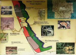
The Muller family land at the south end of Honoeye Lake is now owned by the Finger Lakes Community College (FLCC) and it has expanded into a substantial research and conservation facility. It adjoins DEC land encompassing the rest of the south end of Honoeye Lake, and the FLCC and DEC have restored the water flow through the property and into the lake  to salvage the ecology of the area. Springwater Trails has permission to kayak the inlet stream and to hike along it too.

We will do both on Sunday September 17th, 2023.  Meet and park in the lot at 1:45 at the Muller Field Station, 6455 County Road 36, Honeoye for a 2pm hike/paddle start. Come earlier if you want to use one of the Field Station’s boats, which are first come first served. 

Beavers have done their work to adjust the property to their liking, and signs of beaver activity are plentiful. Tall invasive grasses dominate the trail borders and seasonal wildflowers are plentiful. Snakes are common and harmless to humans.


For Hikers:

The hikers will follow the single trail following the inlet south  in an out-and-back hike with each group turning back when they feel they should. The site director, Ally Esposito, will accompany the hikers and talk about the flora, fauna and the ecology of the property. There is a gate separating FLCC land from DEC land that can be walked around.The trail on FLCC land is mowed, but the DEC land tends to be more wild but sill very passable. In principle the trail goes all the way around the south end of the lake to the south boat launch on the east side but this hasn’t been tested yet.


For Kayakers:

The Muller Field Station and the Honoeye Inlet

The kayakers will put in at the luxurious boat launch close to the station complex. They will explore the inlet south as far as a very low bridge that effectively blocks passage by water, and will then turn back to see what’s downstream as far as the lake proper.

The FLCC has kayaks and canoes that are available to be borrowed; Please bring your own PFD if you want to take advantage of this.


Directions:

We will all meet at the Muller Field Station, 6455 Co Rd 36, Honeoye, NY 14471

From Rochester: Take Rt. 65 south to West Bloomfield, then crossing Rt. 20 take Rt. 37 south to Honoeye. At the junction with Rt. 20A turn left, then right at the lights in Honoeye on to Rt. 36 which is West Lake Road. Continue south on Rt. 36 for 5.6 miles; the Muller Field Station is through some imposing gates on the left side of the road. The gates are recessed and angled to the south so they are easy to miss from the north.

From Springwater: Take Rt. 15A south to Wayland, then turn left on to Rt. 21 to Naples. In Naples turn left (north) at the Middletown Tavern on to Rt. 36, also called Hunt Hollow Road. Continue north on Rt. 36 for 10 miles; the Muller Field Station is through some imposing gates on the right side of the road.

By GPS: Program in (42.71266, -77.51203) and follow directions.


The Social

The social will be a pot luck picnic at the Muller Field Station.

Directions:  The Field Station is at #6455 on the east side of County Road 36, a.k.a West Lake Road in Honeoye. From Honeoye, it’s 5.8 miles south from the traffic light at Route 20A in Honeoye.  From Naples, it’s 9 miles north from Main Street; turn at the Middletown Tavern.