Posted on by

Mount Morris Dam Hike


This Sunday we will hike the Finger Lakes Trail (FLT) starting at the Mt. Morris Dam and Visitors Center Parking Lot, as well as the Wildlife Loop Trail within the Dam property.  We expect to enjoy the height of summer colors and, as we follow the east rim of the Letch worth Gorge, the spectacular views of the gorge and Genesee River below.

The Wildlife Loop trail within the dam property is beautiful in its own right, with forest and grassy fields.

Three levels of hiking are planned – “Climbers”, “Tourist, and Naturalists”.

The Tourists will hike south on the yellow blazed (FLT) trail along the rim of the gorge, jogging east slightly away from the river across a boardwalk through a small wet area, stop at Hogsback Overlook to view the Hogsback formation of the river gorge, continue on the trail and after hiking 1 hour, turning around to head back.  On the way back, we will follow the same yellow blazes but take the alternate orange blazed trail along the rim of the gorge which joins back up with the yellow trail, back to the parking lot.  Total hike is 3.25 miles. Tourists may wish to walk the “Wildlife Loop”, once back to the parking lot.

The Naturalists may wish to walk the “Wildlife Loop” that starts to the right of the visitors center.  (blue trail)

The Climbers who want a longer hike can hike from the Visitors Center following the yellow blaze Finger Lakes trail down to Lorenz Park in the village and return back on the Finger Lakes Trail. Climbers can continue along the Finger Lakes Trail south  following the yellow blaze markers  along gorge trail to complete the 2 hour hike.

 The Hike Assembly Point:

The Visitors Center should be open with bathrooms, however, if closed,  there is a bathroom adjacent to the parking lot that may be open on the day of the hike.  All hikers will begin the hike at the Mt. Morris Dam Visitor Center Parking Lot.  The trail access is at the west end of the parking lot (to your left as you face the gorge).

Social:

After the hike, all are welcome to gather at the larger pavilion located adjacent to the parking lot.  Bring a dish to pass or a donation to the club fund would be appreciated, drink, and a chair.

Directions:

The Mt Morris Dam Visitor Center is about 45 minutes from Springwater, so please plan ahead. If you have a GPS, try entering Mt Morris Dam as your destination. Or enter Damsite Rd or 6103 Visitor Center Rd, Mt Morris.

From Springwater: Take Rt 15N and then left on Liberty Pole Rd.  Stay on that road all the way to Rt63. There, take a left, and a quick right, onto Rt 258. At Rt 36, take a right and proceed to Mt. Morris. Turn left onto NY-408 South.

From Wayland: you can take I-390 north to exit 7. Turn left at the exit on NY-408 S to Mt. Morris. NY-408 goes left at Main St, then right on Chapel St.

From Hemlock and Honeoye: follow 20A West through Livonia and Lakeville to 390S. Exit at exit 7 NY 408 S to Mt Morris. Stay on 408 through Mt Morris.

From Rochester: Take I-390S to Exit 7 NY 408S.  Stay on Rt 408 through Mt Morris.

From NY 408 in Mt Morris: Go south on 408 for 1.8 miles to Visitor Center Rd. Turn right at the Visitor Center Road and follow the road all the way to the Dam and Visitor Center Parking lot.

ional details about this hike are coming soon.  Please check back.

Posted on by

Gosnell Big Woods Hike, Webster

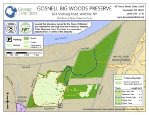
The hike on Sunday, August 25 will be at the Gosnell Big Woods, a Town of Webster-owned nature preserve near Lake Ontario, including majestic old-growth forest, an open field, and a small meadow. Maintained by Friends of Webster Trails, a variety of trails offer beautiful views of meadows, wildflowers, and spectacular old-growth trees. Hikers may see butterflies, dragonflies, deer, and a variety of birds. Meet at 3:45 for a 4 PM hike start.

Naturalists will explore the Big Field and Meadow Trails, a total of 1.7 miles. They will start in the Big Field and Meadow Trails and continue onto Pellet Road, onto Ridge trail, join Big Woods trail, and head back to the car park on Big Field Trail, about 2.2 miles. If we want more we can divert into Whiting Woods Preserve off Pellet Road and make it 3 to 4 miles.

The picture below contains a link to the Gosnell Woods web page. If a click doesn’t take you straight there, press and hold the control key while clicking the image.


Parking: Meet at the Gosnell Big Woods Preserve Parking lot. 674 Vosburg Road, Webster. The car park is situated on the corner of Vosburg Road and Drumm Road.


Directions:

From Rochester and points south; Take Route 490 or 390 to Route 590 North. At 3.7 miles north of the 490/590 intersection, take Route 104 East across Irondequoit Bay, then north on Bay Road (1.1 miles), right on Klem Road (.8 miles), left on Drumm Road (.6 miles), and enter the car park where the road turns left at the junction of Drumm and Vosburg Roads.


Social:  After the hike we will adjourn to a lovely pub, specifics to be determined.

Posted on by

Hemlock Lake Paddle/Rob’s Trail Hike

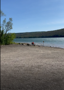
Hemlock Lake and the Hemlock-Canadice State Forest remains a favorite location for Springwater Trails. This Sunday we will return to the North Boat Launch for Kayaking on the lake and Hiking on Rob’s Trail.

All boaters and hikers will meet at the north boat launch at 3:45. Following the hike we will enjoy a pot luck social at the Hemlock Park at the north end of the lake. Boaters must bring their PFDs and hikers will want to bring walking poles.

There are four options available for this hike.

Boaters: We will unload our boats at the boat launch. It is recommended that boaters meet at 3:30 to give a bit of extra time in case the launch is crowded. Once we have a picture of all of the boaters, we will head south along the the east side of the lake. We may get as far of the Rob’s Trail beach. Adventurous boaters will then head across the lake and return to the launch along the west side of the lake.

Naturalists Hikers who prefer a level hike will head south of the old lake road. Hikers should check their watches and turn around at 5:00. That may mean turning around at the bench overlooking the lake, or possibly at the Rob’s Trail beach.

Tourists: Hikers who enjoy hiking down hill, will carpool up to the Rob’s Trail parking area on the west side of NY 15A.  From there, the trail heads across fields and then enter the forest. The trail is well marked and crosses a nice bridge above a falls, and down to the lake, at which time hikers will turn right (north) and follow the old lake road.  They may meet the Naturalists on the way to the boat launch.

Climbers: If any hikers would prefer to climb up to 15A, It will be easiest if they could trade keys with the Tourist drivers, and use those cars to return to the boat launch. Otherwise the Climbers will need to take a couple of cars to the top before the hike. If two climbers would like to leave their cars at the top, please call Mark at 259-4505 and we will meet you at 3:30 at the Parking lot off 15-A.

Following our hiking everyone is invited to a pavilion at Hemlock Lake Park at the north end of the lake for a pot luck social.  Bring a dish to pass (or donate $5 to the social fund) and your own beverage. From the boat launch, head out to Rix Hill Rd. Take a sharp left on Rix Hill Rd and turn in at the 3rd driveway to the left. At the circle, we will find an available table for our social.

Directions

From Springwater: Head north on 15A for 10.1 miles. Turn left on Rix Hill Rd and an immediate left on East Lake Rd. Follow this road to the boat launch.

From Hemlock: Head south on 15A. At 0.7miles past the intersection with 20A, take the first right onto Rix Hill Rd into the Hemlock Lake Park. Take the first left and follow the east lake road to the boat launch.

From Honeoye: Head west on 20A toward Hemlock. At the intersection with 15A, turn left onto 15A South. In 0.7miles  take the first right onto Rix Hill Rd into the Hemlock Lake Park. Take the immediate left and follow the east lake road to the boat launch.

From Penn Yan: Take 54A across the north end of Keuka Lake to Branchport. Continue straight onto Italy Hill Rd (CR32). In 4.9 miles, turn left to stay on Italy Hill Rd and take the 2nd right onto Italy Hill Turnpike (CR34). At the bottom of the hill (3 miles) stay to the left onto Italy Valley Rd (CR18). On entering Ontario County, Italy Valley Rd becomes CR21. Continue to the T and turn right onto NY 53 into Naples. Continue straight onto NY 21 North past the Wayside Market and turn left onto Clark St (CR 36). Continue for about 15 miles along Honeoye Lake. Turn left at the light onto US 20A. In 4.8 miles, turn At 0.7miles past the intersection with 20A, take the first right onto Rix Hill Rd into the Hemlock Lake Park. Take the first left and follow the east lake road to the boat launch.


Posted on by

Stid Hill Hike, Bristol

Please join us for a Stid Hill hike on Sunday Aug 4th at the 6405 Dugway Road trail head. Meet at 3:45 for a 4pm start time.  The Stid Hill Multiple Use Area is a 847 acre tract of land situated in the townships of Bristol and South Bristol in Ontario County. It is bounded by Route 64 on the west and Dugway Road on the north. Mud Creek, flows along Route 64. At one time, Stid Hill was productive sheep and cattle grazing land. Today the grazing has been eliminated. The mixture of steep hills, ravines, gullies, gorges, woods, and open areas create scenic vistas and also provide varied wildlife habitats.


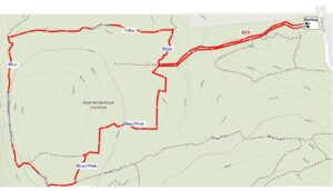
Tourists and Naturalists:   For the Tourists and Naturalists, they will do a 2.5mile loop from the Red trail to the Blue and Yellow trails, then back to where they started from on the Red trail. There is one steep climb towards the beginning (just take your time). This hike takes us through mostly woods, various types of plants, right by a lonely rock and of course, the famous old truck.  Poles are a good idea.
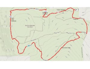
Climbers:  The Climbers will hike about 4 miles in a larger loop starting off with the Naturalists, then down around Lower Blue, hitting several steep areas and finally back up to where they started. Poles might come in handy.
The Social:   We’ll go to Lock Stock and Barrel on Route 64 just north of Bristol Mountain (5436 State Route 64) for the social after the hike.
Directions:
From the north, (Honeoye and Bloomfield) starting at Route 5 & 20 in Bloomfield, come down Route 64. 3.0 miles south of Rt 20A and 1.4 miles past Bristol Center (and CR 32), turn left on Dugway Road. The Stid Hill MUA parking area will be about 2 miles up on the right.

From the south, starting at Bristol Springs for 6.4 miles, come up Route 64 past both Stid Hill parking areas, then turn right on Dugway Road. If you come to Bristol Center you’ve come too far north.

From Springwater, Head north to 20A through Honeoye, then south on 64(see north directions above).

From Wayland, the recommendation is to take Rt 21 through Naples to the east end of Dugway Rd (4.5 miles north of the intersection with NY 64). The trail head is 1.2 miles west on Dugway, (Dugway is paved to the Bristol/Canandaigua town line).

Trail Maps:

NATURALISTS

CLIMBERS