Posted on by

The Erie Canal at Macedon

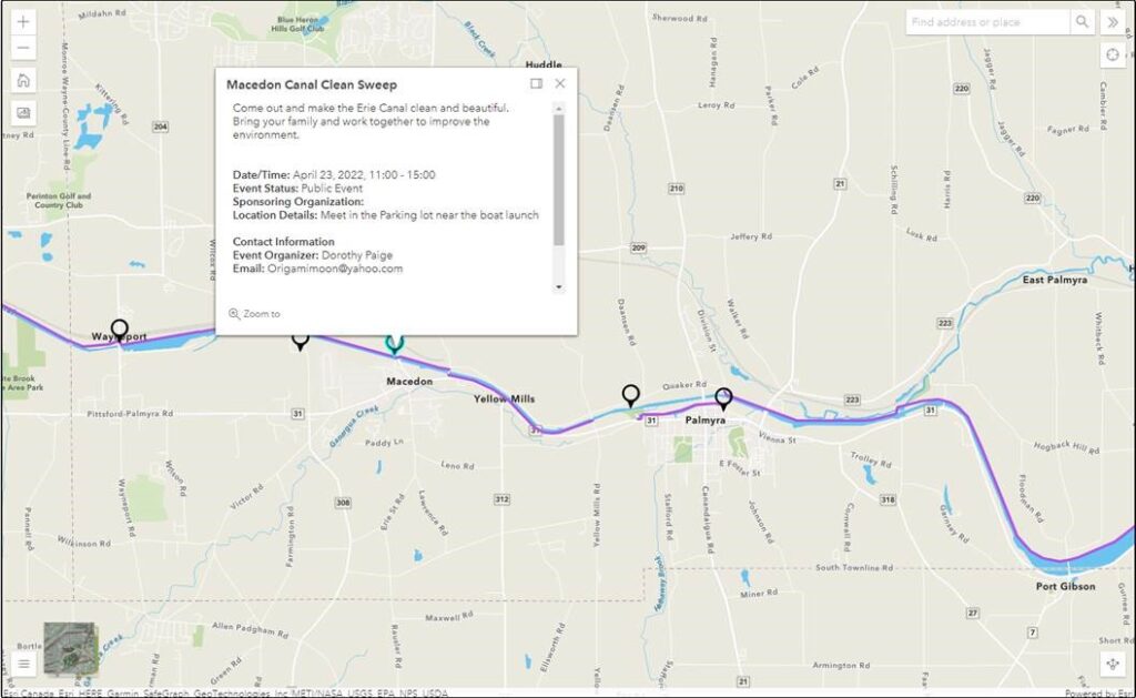
The Sunday hike this week will be on Saturday 23rd April, and we will be participating in an Erie Canal Clean Sweep event in Macedon. This event is organized by someone other than Springwater Trails, so we will be joining them at the earlier time of 11:00am to walk a section of the Erie Canal in Macedon, pick up all the trash we can find and generally tidy up the towpath. We’ll limit our time at the event to something close to our usual 2 hour hike.

We’ll meet at the parking lot near the boat launch in Macedon – See the map provided by the event organizer.

Please bring trash bags, secateurs and work gloves.

The Social: We’ll organize a social during the event.

Directions. NY 31 follows the canal east from Pittsford to Macedon. In Macedon turn north on 31F – Ontario Center Rd. In 0.2 miles, just before the canal, turn left into the park. Meet at the boat launch or in the parking lot.

Posted on by

“Love My Park” Day at Wheaton Hill

NOTE: Please note the change of time to 3:00PM EDT. We plan to work until about 5:30.

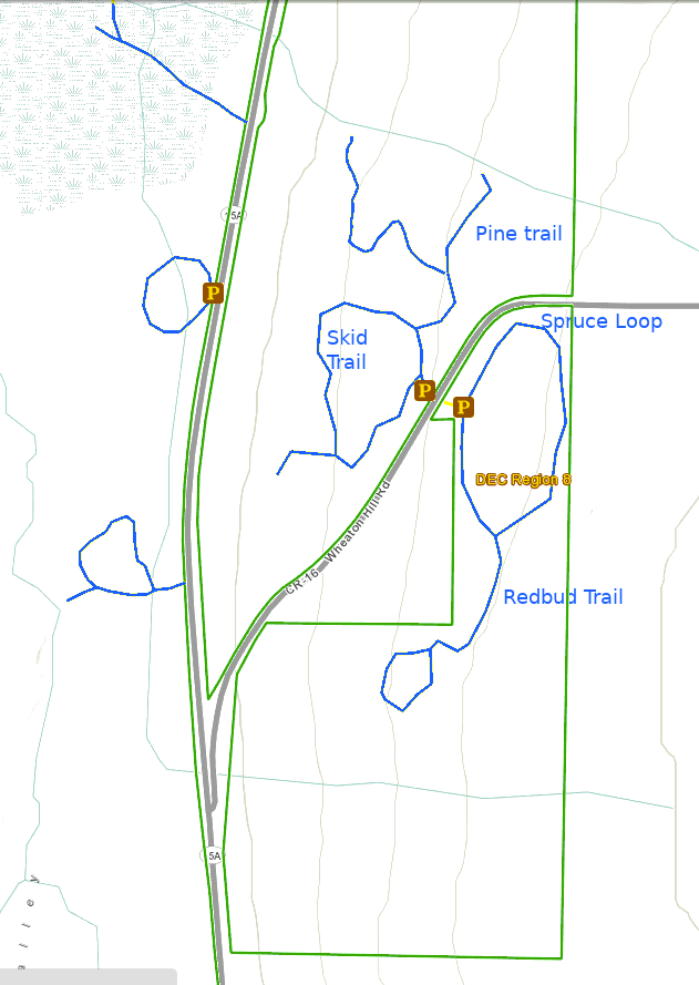
This Sunday’s hike will be a joint event with NYS Department of Environmental Conservation, Parks & Trails New York, and the NYS Parks and Recreation. It will be part of a state-wide network of events celebrating I Love My Park Day  to honor New York’s state parks and state forests. Our effort will focus on making one of our closest patches of state land – Wheaton Hill in Springwater (42.657417, -77.564875) – cleaner and more hikable for visitors. The trails at Wheaton Hill are a small part of the Hemlock Canadice State Forest, a lovely patch of land in the hills of the Finger Lakes and is well worth a little TLC. We will split into several teams depending on how many people show up, with each team being assigned a route through the forest and tasks such as cutting grass, picking up trail debris, picking up trash, and general cleaning up the trails.

Please bring gloves to protect your hands, loppers or small clippers to cut branches and the ever present Multiflora roses. Other useful tools, if you have them, include a small saw for branches that are too large for the loppers, and a small shovel if you want to help direct some of the water on the path. If you want to do some serious damage, then bring a weed whacker and have at it. We will also have a sawyer at the event should there be fallen trees across a path. If you do plan to use power tools, PLEASE BRING EYE PROTECTION! These devices can kick up a lot of dust and small stones. Finally, a backpack may be useful to carry your water and saw while you use loppers to cut roses.

We will work on the Pine, Skid, Spruce and Redbud trails. Most of our work will be clearing fallen sticks off of the path and cutting back the roses and other growths. This organic debris will be moved off the trail, but left in the woods. Some garden duty trash bags will be available for carrying out any trash that has found its way into the forest..

The Social

We’ll have a picnic social if the weather if fine, otherwise we’ll just quit at the end of the day. All workers are invited to bring a sandwich or snack and beverage and a chair in case you wish to rest.

Directions: Wheaton Hill is the first right turn north of the intersection of Rt 15 and Rt 15A in Springwater (0.9 mile north of the intersection).  The trail head is 0.5 miles up Wheaton Hill just before the road turns straight east and heads up the main hill.  More details are on the directions page. Please park on the left side of the road as you come up the hill. There is a short entrance to the trails on the right side you can use to turn around.

What to bring:

  • Gloves and clippers – hand clippers or long handled loppers for larger branches.
  • Water to keep hydrated.
  • A picnic dinner
  • Solid boots to protect your feet
  • Rain coat or poncho if the forecast changes

If you wish, bring one of the following

  • A weed whacker if you want to cut grass, with gas mixture and extra string.
  • Eye protection
  • Small bow saw.
  • Small shovel that is easy to carry
  • Plastic grocery bags in case you find any litter.
Posted on by

Springwater West Hill – Sunday 27th March at 2:00pm EDT

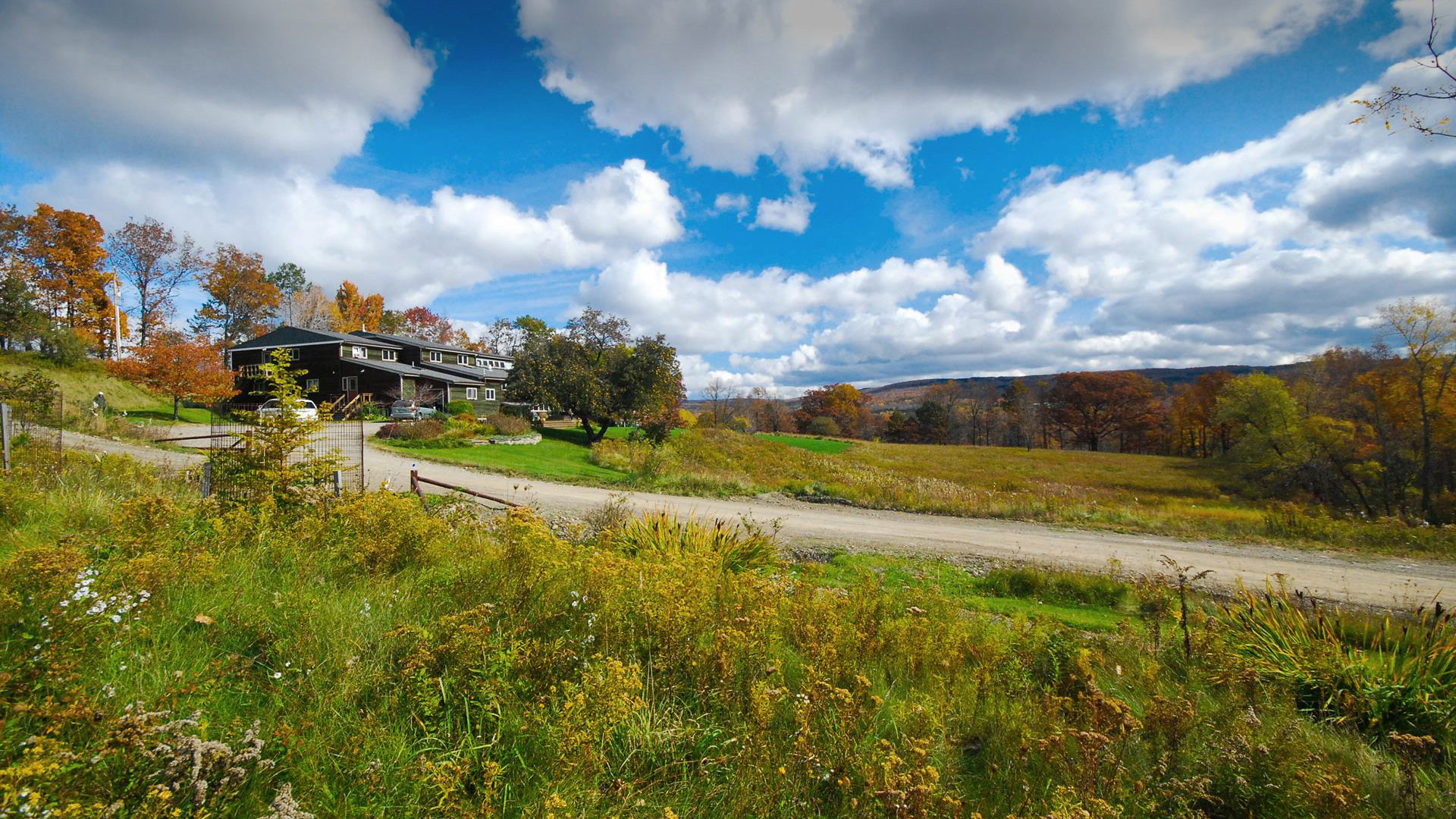
The view of the Center and fields.

The Springwater Center, founded in 1981 by Toni Packer, is located in the northwest portion of Springwater. The property contains open fields, forests and waterfalls and provides many opportunities to enjoy the beauty of Springwater. The Center offers silent meditation retreats and year-round guest visits, currently to fully vaccinated guests. Springwater Trails has been regular guests at the center, always enjoying the center’s hikes.

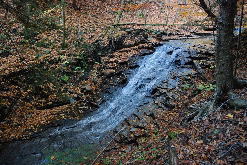
There will be up to three hikes for the group to select from, each lead by a leader well versed in both the history and the landscape of the Center’s property. We can expect up-close views of Mill Creek waterfalls, and long views of Springwater Valley.

A water slide in the woods.All hikers will meet at Wayne Coger and Susan McCallum’s house. Their house is adjacent to the east side of the Center property.  Hikes will start at 2:00. Following the hike, you are invited to a dish to pass social at Wayne and Susan‘s house. Please bring a dish to share or your own snack and your own beverage. Oven and microwave will be available to keep food warm or reheat, if needed.

Directions:

From Springwater: Heading south on Rte. 15A turn right onto Kellogg Road (1st right on the north edge of the village). Continue on Kellogg about ¾ mile to where Marrowback Road tees into Kellogg. Turn right onto Marrowback, continue about ¾ mile to the 1st driveway on the left. Turn left, continue a short distance to the top of the T and turn left again. One of us will meet you and direct you to parking areas. Similarly, if heading into Springwater on 15A from south of the village, turn left onto Kellogg at the north edge of town and then follow the directions above.

If coming south on 15, turn left onto Kellog (it loops between 15 & 15A and then left onto Marrowback. Then continue as written above.

Please click for detailed directions from Rochester, Livonia, and Naples.

Posted on by

Ganondagan Hike

Weather Update, Sunday March 20:  Looks like there will likely be steady rain this afternoon. We’ll be hiking if any hardy souls show up, but please bring rain gear, traction footwear, poles and gaiters, as it’s likely to be muddy and maybe slippery. Hike may be shortened if that’s the group consensus. 

Our hike this Sunday will be at the Ganondagan State Historic Site, 7000 County Road 41 (Boughton Hill Road) in Victor.  Ganondagan is the site of a large 17th century Seneca town, and offers  hiking trails with interpretive markers illustrating the history and traditions of the Seneca people. The trails will take us through wooded rolling hills and meadows just south of the Village of Victor. Highlights will include the Granary Trail, where the Seneca protected and distributed their corn supplies on a palisaded mesa, and the Earth is Our Mother Trail, where interpretive markers describe local plants and their particular roles in Seneca life.   See   https://ganondagan.org/Visit/Hiking-Trails   for more on Ganondagan and its interpretive trails. 

We will meet at 1:45 at the Seneca Art and Culture Center parking lot, about .2 miles west of the intersection of Route 444 and Boughton Hill Road. All hikers will proceed past the Longhouse and around the Great Meadow to the Seneca Trail and then follow the Earth is Our Mother Trail along Great Brook.  After about 2 miles, we will divide into two groups, with the Tourists and Naturalists returning to the Longhouse and parking area via the Great Oak Trail for a total hike of about 2.5 miles. The Climbers will cross School Street and proceed up the hill by the Eagle Trail to the Granary, where we can stop for a long view to the south over the Bristol Hills and Bare Hill, then return to School Street and the starting point via the rest of the Earth is Our Mother Trail. Total hike for the Climbers will be about 4.5 miles.  Trails are well maintained and gently rolling hills, with switchbacks up steeper areas. In case of mud, poles and traction devices are advised. 

Social – Will be at Cheap Charlie’s Restaurant, 8 Elm Street, Bloomfield (on Route 444, left side, as you enter Holcomb)

Directions:  From Springwater/Honeoye area: Go north to Honeoye and then east on 20A to Route 64.  Go north on 64 for 3.7 miles to the 5 and 20 intersection. Go west on 5 and 20 for 1.25 miles and make a right on Route 444 (Maple Ave.).  Proceed 5.3 miles to Boughton Hill Road (County Rd. 41).  Turn left at Boughton Hill Road (flashing light), proceed .2 mile down the hill. The Seneca Art and Culture Center is the white and glass contemporary building on your right, with a large parking lot in front. 

From points east:  Take 5 and 20 west toward Bloomfield. Go right at the Route 444 intersection, and proceed 5.3 miles north to Boughton Hill Road (County Rd. 41) (flashing light).  Turn left at Boughton Hill Road, proceed .2 mile down the hill. The Seneca Art and Culture Center (a.k.a. Interpretive Center) is the white and glass contemporary building on your right, with a large parking lot in front. 

From Thruway:  Take Exit 45, and follow Route 96 east to the Village of Victor. In the village center, turn right on Route 444 (Maple Avenue). Go 1.5 miles to the top of Boughton Hill (flashing light). Turn right on Boughton Hill Road. Proceed .2 mile down the hill. The Seneca Art and Culture Center (a.k.a. Interpretive Center) is the white and glass contemporary building on your right, with a large parking lot in front. 

To the Social: From the site, go east on Boughton Hill Road. Make a right at the flashing light and follow Route 444 to Holcomb, about 4 miles. Cheap Charlie’s is on the left at 8 Elm Street.