Posted on by

Ride Around Honeoye Lake or Sandy Bottom Hike

Warning: The weather report calls for rain this afternoon and possibly thunder storms. We will be  at the trailhead by 4 and will ride if the weather permits. If it looks like thunder we likely will postpone to another day and just have a beer.  Stay safe and keep hiking.

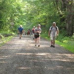
This Sunday we have a choice of activities, both starting from the northeast corner of Honeoye Lake – a hike in Sandy Bottom Park or a bike ride along or around Honeoye Lake. Note the start time of 4 PM for both activities. After the workouts we will adjourn to the Birdhouse Brewing Company at 8716 Main Street, Honeoye for our social/recuperation.

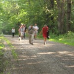
Everyone meets at the Sandy Bottom Park Trailhead on East Lake Road, about .3 mile from Route 20A/Main Street Honeoye. There are two parking lots side-by-side, each holding about 10 cars.   Hikers will all start out together on the field portion of the trail and proceed as long as you want, with some hiking all the way down to the creek, lakefront and wetland boardwalk.

Based on last year’s experience, most cyclists will opt for the full 18 mile circuit of the lake, all going at our own speeds. We’ll decide as a group whether to go clockwise or counterclockwise.   An alternative for those who want a shorter ride is the 5 mile dash down East Lake Road to the South Boat Launch, returning the same way for a 10 mile total.

Cyclists please bring plenty of water, and helmets are required.

Social:  Please join us afterwards at the BirdHouse Brewing Company at 8713 Main Street, Honeoye, for restorative food and beverages and maybe some entertainment. For the menu see https://birdhousebrewing.beer/

Directions to Sandy Bottom Trailhead:
From the south (Naples, Springwater, etc): Take Rte 21 North to CR 36, make left onto CR 36, make right onto East Lake Road – parking lot is on left just past the County Road 33 intersection.
From the north (Bloomfield, Victor, Rochester, etc): Take CR 40 south to Rte 20A, cross 20A onto East Lake Road, parking lot is on right, 3/10 of a mile from intersection.
From the east (Bristol, Canandaigua, etc): Take Rte 64 south to Rte 20A, make right onto 20A, left onto East Lake Rd
From the west (Hemlock, Livonia, etc): Take Rte 15A to Route 20A, make left onto 20A, right onto East Lake Road

Directions to Birdhouse Brewing Company: From the trailhead, return to Route 20A, Main Street Honeoye. Make a left and proceed through the village. Birdhouse Brewing is at #8713, just past the bridge on the right, a few buildings before the red light.

Posted on by

Little Lakes Paddle

It is June and sunny and warm.  What better way to spend a Sunday afternoon than on Hemlock Lake?  Bring you kayak or hiking shoes and meet Springwater Trails at the North End boat launch on Hemlock Lake. We will enjoy the water or Rob’s Trail and then will meet after the hike (and kayak) at Hemlock Lake Park for a pot luck social.  Bring a dish to pass and your own beverages or donate to the social fund.

Kayak or Canoe Paddle 

Boaters will meet at Hemlock Lake North Boat Launch and must arrive early enough to have their boat unloaded and car parked in preparation for a 4PM launch.  Try to arrive at 3:30 because the launch will likely be crowded. They will cross the lake to the western shore, paddle south, cross the lake to the eastern shore and return north to the boat launch.  Paddlers will need to determine how far south they can go and have enough time to get back to the launch by 6PM.

Hikers

All hikers will meet at the large parking area of Hemlock Lake Park off Rix Hill Road at 4PM.  All hikers will walk south past the gate on the flat part of Rob’s trail.

The Tourists and Climbers will walk south through the woods until Rob’s Trail heads uphill. Before turning up the hill, we will step out onto the beach and check on the progress of the kayakers. Then this group will continue up the hill to the bridge (or as time permits) and then will return down hill and back to the cars.

The Naturalists will follow the climbers but likely will turn around at or before the beach and return along the same path to the cars.

All hikers and kayakers are welcome to join us for a social at the Hemlock Park pavilion. Head north out of the boat launch to Rix Hill Rd. Turn left and take the second left into the pavilion..

Directions to Hemlock Lake North Boat Launch

From Springwater:  Head north on 15A for 10.1 miles.  Turn left on Rix Hill Road.  Take the first left and follow the road to the end at the boat launch. If the main boat launch is not crowded, we will launch kayaks from there. Otherwise, we can park in the parking lot or along the road and carry kayaks to the kayak launch site.

From Hemlock and Honeoye: From Hemlock head south on 15A. From Honeoye, head west on 20A and turn left onto 15A. From the intersection of 20A and 15A south of Hemlock, continue south for 0.7 miles and turn right onto Rix Hill Rd. Take the first left and follow the road to the end at the boat launch. Parking is available in the lot at the end, or along the road.

Posted on by

Hike, Bike or Both from Ontario County Park

PLEASE NOTE – THIS IS THE FIRST SUNDAY EVENT WITH OUR SUMMER STARTING TIME OF 4:00 PM

This Sunday we will explore Ontario County Park at Gannett Hill, the highest point in Ontario County,  and the surrounding terrain, using the travel method of your choice.  Hikers and Cyclists will all start at the Jump Off Parking Area heading off in different directions, and will rendezvous at the Jump-Off for our optional post-exercise social. Please gather promptly at 3:45 pm to get organized and be ready to hike or ride by 4 PM. The later start time is intended to allow participants to also attend the Bristol Hills Historical Society’s 2 PM event at the Burning Springs on Case Road – see https://bristolhillshistory.org/events

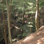
Hikers will follow the Finger Lakes Trail’s orange blazed trail to the south and west. Climbers and Tourists will hike down the hill to the Beaver Pond and back, a total of about 4.25 miles and 500 feet of elevation change, while Naturalists will explore the more level trails near the top of the park. Bring water, poles, and good hiking footwear for the park’s rugged terrain. The Park and FLT are full of wildflowers this week – on the prehike we found wild geranium, violets, star flowers, fringe flower, lupines, wild azaleas, trillium, and a lady slipper.

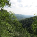
Cyclists will follow the one-way Park Road out to Gannett Hill Road, then head south toward Naples, rounding the south end of Gannett Hill on Seman Road and returning to the north along County Road 33 for a total of about 8 miles of mostly downhill terrain ( a 500 foot drop overall, with some uphill sections) with great views of the hills across the Naples Valley, and of West Hollow.  Upon reaching the County Road 33 trailhead and parking area, north of 6910 County Road 33 (look for wooded parking area on the left and orange trailhead marker on right), they will lock up their bikes, change their footwear, and hike back up the Finger Lakes Trail past the Beaver Pond to the starting point, returning to retrieve their locked bikes at the end of the social.  Cyclists please bring a bike lock and appropriate garb and equipment for both activities.  If you plan to ride, please contact Saralinda at    [email protected]   no later than Saturday, so that we can identify a ride leader.  If you prefer an all-riding event, please advise Saralinda and make your own arrangements for the return to the park by bike or a placed vehicle, and feel free to join us for the post-ride social around 6-6:30 PM. 

Social:  Bring food, beverages, and a lawn chair for a dish-to-pass gathering at the Jump-Off shelter, or nearby if the lodge is reserved. If you run out of time to shop or cook, bring $5 for the can.

DirectionsFrom Springwater: Go south to Naples via Wayland and Route 21. Continue north to Woodville and the start of Route 64. Turn left on Gannett Hill Road and enter the park at the top of the hill. Loop around the perimeter road until you reach the Jump Off parking area and trailhead. 

From Honeoye and Hemlock: Take County Road 33 south from East Lake Road, Honeoye, turning left on County Road 34 to meet Route 64. Go right on 64 and proceed 1.8 miles to make a right on Gannett Hill Road. Enter the park at the top of the hill and loop around the perimeter road until you reach the Jump Off parking area and trailhead. 

From Rochester or Routes 5&20:  Take Route 5&20 to Toomey’s Corners, about 2 miles east of Bloomfield. Go south on Route 64, about 13 miles to make a right on Gannett HIll Road. Enter the park at the top of the hill and loop around the perimeter road until you reach the Jump Off parking area and trailhead. 

Posted on by

Clark’s Gully Hike

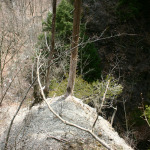
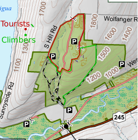
This Sunday we will be hiking in Clark’s Gully just north of where Sunnyside Rd crosses the West River outside of Naples. We will plan on meeting at the DEC parking lot. Try to be there a little earlier, at 1:45pm.

Climbers will start across the street from the parking lot. They will start up the main trail and then turn right where the trail splits. They will follow the logging road for about 1.5 miles until they reach the north end of the DEC border at which point the trail dead ends at the property line heavily marked with posted signs. They will turn left up the hill while staying on the DEC property. They will come out to a field on top and a DEC access road with a parking loop that comes in from north end of the DEC property off South Hill Road. There will be 2 choices to get over to the South Hill DEC parking area where the Tourist would have started their hike from. They can choose to either walk South Hill Road back to the South Hill parking area or take the ” yellow gated” access trail at the North end off South Hill back down to the waterfall and cross over the creek and up to the South Hill Parking area. They will be car pooled back to the DEC parking area off Sunnyside.

The tourists will drive up to the top of the park and start at the DEC parking area off of South Hill Road. They will follow the trail down to the creek and cross over following the trail up to access trail that comes in from the “yellow gate” at the north end of the park off South Hill  Road. They can return back to the Dec parking lot off South Hill Road, where they started or continue to the DEC  loop access road to the east  of the yellow gate off South Hill Road and take the logging trail back down to the DEC parking area off of Sunnyside Drive.

The Naturalists can drive to the top of South Hill Parking lot and walk into the same trail as the tourists without crossing the creek. The woods is dotted with pines and is a pleasant walk or they may choose to walk South Hill road taking in the various wild flowers along the roadside.

Those that wish can meet back to the DEC parking area off Sunnyside Drive for a social. Bring a sandwich and a drink.

Note: It is tick and mosquito season so dress for prevention and bring bug spray and plenty of water.

Directions: From Route 21 north of the village of Naples, turn onto Route 245 north. Continue  north for about 5 miles. You will pass the West River boat launch on the left.  Just pass the launch about 1/2 mile, turn left onto Sunnyside Drive and the Clark’s Gully DEC parking lot will be on your right about 1/2 mile down.


.

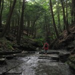
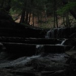
There was time to explore the waterfall while the mushroom hunters caught up.

Next we had a creek walk up to the “campground”.