Posted on by

Genesee Gorge, Mt Morris Dam and Lorenz Park-Hike

This Sunday we will hike the Finger Lakes Trail (FLT) starting at the Mt. Morris Dam and Visitors Center Parking Lot, as well as the Wildlife Loop Trail within the Dam property.  We expect to enjoy the start of spring colors and, as we follow the east rim of the Letch worth gorge, the spectacular views of the gorge and Genesee River below.

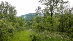
The Wildlife Loop trail within the dam property is beautiful in its own right, with forest and grassy fields.

Three levels of hiking are planned – “Climbers”, “Tourist, and Naturalists”.

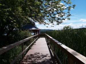
The Tourists will hike south on the yellow blazed (FLT) trail along the rim of the gorge, jogging east slightly away from the river across a boardwalk through a small wet area, stop at Hogsback Overlook to view the Hogsback formation of the river gorge, continue on the trail and after hiking 1 hour, turning around to head back.  On the way back, we will follow the same yellow blazes but take the alternate orange blazed trail along the rim of the gorge which joins back up with the yellow trail, back to the parking lot.  Total hike is 3.25 miles. Tourists may wish to walk the “Wildlife Loop”, once back to the parking lot.

The Naturalists may wish to walk the “Wildlife Loop” that starts to the right of the visitors center.

The Climbers who want a longer hike will carpool down to Lorenz Park in the village and pick up the Finger Lakes Trail and follow the yellow blaze markers south back up the gorge to the dam.

The Hike Assembly Point:

The Visitors Center will be closed.  However, there is a bathroom adjacent to the parking lot that may be open on the day of the hike.  All hikers will begin the hike at the Mt. Morris Dam Visitor Center Parking Lot.  The trail access is at the west end of the parking lot (to your left as you face the gorge).

Social:

After the hike, all are welcome to gather at the larger pavilion located adjacent to the parking lot.  Bring a dish to pass or a donation to the club fund would be appreciated, drink, and a chair.

Directions:

The Mt Morris Dam Visitor Center is about 45 minutes from Springwater, so please plan ahead. If you have a GPS, try entering Mt Morris Dam as your destination. Or enter Damsite Rd or 6103 Visitor Center Rd, Mt Morris.

From Springwater: Take Rt 15N and then left on Liberty Pole Rd.  Stay on that road all the way to Rt63. There, take a left, and a quick right, onto Rt 258. At Rt 36, take a right and proceed to Mt. Morris. Turn left onto NY-408 South.

From Wayland: you can take I-390 north to exit 7. Turn left at the exit on NY-408 S to Mt. Morris. NY-408 goes left at Main St, then right on Chapel St.

From Hemlock and Honeoye: follow 20A West through Livonia and Lakeville to 390S. Exit at exit 7 NY 408 S to Mt Morris. Stay on 408 through Mt Morris.

From Rochester: Take I-390S to Exit 7 NY 408S.  Stay on Rt 408 through Mt Morris.

From NY 408 in Mt Morris: Go south on 408 for 1.8 miles to Visitor Center Rd. Turn right at the Visitor Center Road and follow the road all the way to the Dam and Visitor Center Parking lot.

Posted on by

Keshequa Creek Walk

This Sunday, we’re returning to Sonyea State Forest in Livingston County, to hike along the Keshequa Creek.  We will take time to enjoy the spring flowers.

We will meet at 2 PM at the gate that marks the head of the Keshequa Creek Falls Trail about 2.7 miles from the beginning of Union Corners Rd.  See directions below. All hikers will walk around the gate to a well groomed trail the heads down a steep hill to the creek.  Be careful walking down, and on the way back you will want to take your time climbing this hill.  But the hill is not long and most of the rest of the trail is along the old Genesee Valley Canal and railroad bed. Our hike will take us to the western side of the forest, where we will encounter the gorge along Keshequa Creek.  Within the gorge, we will see remains of the Genesee Canal and a major branch of the Pennsylvania Railroad, as well as rapids and falls along the creek.

The Naturalists will hike about a mile along the trail to a beautiful wide point in the creek where we can explore the falls and the intricate cracks in the rocks. After exploring that location, Katherine will lead the Naturalists back to the car the way we came.

The climbers will continue on the trail past the falls to the end of the trail, and then will return to the cars by way of the field to the entrance of the State Forest, and will walk on Union Corners Rd. If conditions or time require, we may adjust the route and return the way we came.  Mark will lead the climbers..

After the hike, we will enjoy the August weather with a picnic in the woods.  Bring a dish to pass, or make a donation.  We will select a clear area so, bring folding chairs, and a table, if you have one.  There are no washroom facilities, not even portable ones, but lots of trees  If the day should turn out to be a rainy one, we will return to the Sunrise, in Dansville.

Directions: Please Note: Directions on Google Maps from Springwater takes you on NY 36 North to Craig Rd up through the Groveland Correctional Facility. This road is closed to cars, although walkers and bikers are allowed to use it as part of the Genesee Valley Greenway trail.. This is not a good way to get to our hike.  Please follow the directions below.

From exit 6 on 390, turn south on NY 36.  Then, take the first right onto CR 72, aka Presbyterian Rd.  Follow it for 3.7 miles, bearing right at the intersection with CR 11, to Union Corners Rd.  Turn right here and keep going for 2.7 miles,, till you see the gate.  Union Corners Rd is unpaved, with potholes, making for slow going so, consider this in planning your travel time. Turn around at the gate and park on either side of the road.

From Springwater: Take NY 15 west from the flashing light. At the top of the hill (1.5 mi), turn left onto Liberty Pole Rd.(CR 38). Continue for 8.1 miles as the road number changes from CR 38 to CR 1A to  CR 1. Turn left onto NY 63 S. In just 0.3 miles take the first right onto N 258. In 1.9 miles, continue straight across NY 36 and onto CR 72 (Presbyterian Rd). Follow the directions above to the state forest.

From Naples. Follow NY 21 S to Wayland.  At the first light, turn left to stay on NY 21. In 1.8 miles south of Wayland, turn right on I-390 N. In 16 miles, take Exit 6. Turn right onto NY 36. Follow the directions above.

Posted on by

Sonyea State Forest-Keshequa Creek Hike

This Sunday, we’re returning to Sonyea State Forest in Livingston County, to hike along the Keshequa Creek and enjoy early spring flowers.

We will meet at 1:45pm at the gate that marks the head of the Keshequa Creek Falls Trail about 2.7 miles from the beginning of Union Corners Rd.  See directions below.

All hikers will walk around the gate to a well groomed trail the heads down a steep hill to the creek.  Be careful walking down, and on the way back you will want to take your time climbing this hill.  But the hill is not long and most of the rest of the trail is along the old Genesee Valley Canal and railroad bed.

Our hike will take us to the western side of the forest, where we will encounter the gorge along Keshequa Creek.  Within the gorge, we will see remains of the Genesee Canal and a major branch of the Pennsylvania Railroad, as well as rapids and falls along the creek.

After the hike, we will enjoy an April weather picnic in the woods.  Bring a dish to pass, or make a donation.  We will select a clear area so, bring folding chairs, and a table, if you have one.  There are no washroom facilities, not even portable ones, but lots of trees.  If the day should turn out to be a rainy one, we will return to the Sunrise, in Dansville.

Directions: Please note: Directions on Google Maps from Springwater takes you on NY 36 North to Craig Rd up through the Groveland Correctional Facility. This road is closed to cars, although walkers and bikers are allowed to use it as part of the Genesee Valley Greenway trail.. This is not a good way to get to our hike.  Please follow the directions below.

From exit 6 on 390, turn south on NY 36.  Then, take the first right onto CR 72, aka Presbyterian Rd.  Follow it for 3.7 miles, bearing right at the intersection with CR 11, to Union Corners Rd.  Turn right here and keep going for 2.7 miles,, till you see the gate.  Union Corners Rd is unpaved, with potholes, making for slow going so, consider this in planning your travel time. Turn around at the gate and park on either side of the road.

From Springwater: Take NY 15 west from the flashing light. At the top of the hill (1.5 mi), turn left onto Liberty Pole Rd.(CR 38). Continue for 8.1 miles as the road number changes from CR 38 to CR 1A to  CR 1. Turn left onto NY 63 S. In just 0.3 miles take the first right onto N 258. In 1.9 miles, continue straight across NY 36 and onto CR 72 (Presbyterian Rd). Follow the directions above to the state forest.

From Naples. Follow NY 21 S to Wayland.  At the first light, turn left to stay on NY 21. In 1.8 miles south of Wayland, turn right on I-390 N. In 16 miles, take Exit 6. Turn right onto NY 36. Follow the directions above.

From Rochester: take 390 south to the Sonyea exit.Turn left onto Route 36 and drive a short distance then turn right on to county road 72. Drive a few miles and turn right onto Union Corners Road. Drive a couple of miles where you will enter the Sonyea State Forest. Drive about half a mile in until you reach the parking area. There is some logging going on so the road is a little bumpy but passable.

From Dansville: and points east, take Route 36 north toward Sonyea. Turn left onto CR 72. From there follow the directions above.


Posted on by

Letchworth State Park

On Sunday we will hike at the southern end of Letchworth State Park on the west side.  People will meet and hike from the Inspiration Point parking lot.

A short description of the history of the site is contained in a plaque near the overlook.: “Inspiration Point is rich in history and natural splendor.  The spectacular view here was once enjoyed by the Seneca Indians and by Mary Jemison, the “white woman of the Genesee”.  In the early 1800’s, however, the pioneers valued the falls and forests for their power and utility, not their natural beauty.  William P. Letchworth came to the valley in 1859 and began restoring the land.  The state of New York accepted his gift of 1000 acres in 1907; and upon his death in 1910, Letchworth State Park was born.”

Climbers will do a loop of 4 miles following parts of the Gorge Trail, the Mary Jemison Trail, the Hemlock Trail and the Trout Pond Trail.  This route has quite a few steps and some steep uphill and downhill sections.

Tourists and Naturalists will leave from the parking area and do a loop of several miles that will take in the Humphrey Nature Center, the Ant Trail, the Old School House and the Cemetery on Trout Pond Road.  This walk is relatively flat.

Directions to Inspiration Point:  If entering the park from the southern end, Inspiration Point is 1.7 miles from the Portageville entrance gate.  If entering the from the northern end, Inspiration Point is 15 miles from the Mount Morris entrance gate.

Social:  Letchworth Pines, 6985 State Route 19A, Portageville, Ny 14536.

Misc: There are restrooms available at Inspiration Point.  Arrive in enough time to be ready to start hiking at 2PM.  The weather report is calling for rain on Sunday so bring your rain gear!  It is my understanding that entrance fees will not be charged until Monday May 1st.

People wishing to make a day of it may want to also go to a park program scheduled for earlier in the day:  Mushroom & Moss Walk – Dishmill Creek Woods.  Meeting at the Parade Grounds at 10AM, entrance on State Route 436, bring a lunch (3hours, 1 mile).   For more information on that contact the Park directly.