Posted on by

Rochester Folk Art Guild, Middlesex

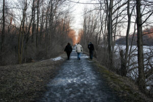
Sunday October15 we will visit East Hill Farm, home of the Rochester Folk Art Guild, to enjoy their annual Apple Festival and a hike across their 350-acre hilltop farm and woodlot. The Guild is a community of craftspeople, producing fine quality handmade products in wood, pottery, fabrics, paper, toys, books and more. We will have an opportunity to visit their artisan workshops and Gallery Shop before or after the hike – for more information about the Guild and the Festival see

https://www.folkartguild.org/events/open-house-and-apple-festival/

Please arrive by 1:45 for hiking starting at 2 PM.  Park on the road shoulder at 1445 Upper Hill Road, Middlesex (directions below). We will convene at the side of the East Hill Gallery, the first building on the left as you come in the driveway.

Climbers will head south through the Guild’s farm and neighboring properties, past a pond and sauna, through a spruce grove, and looping through woods and mowed fields to the Golden Valley, named for its spectacular fall color and views to the east across Italy Valley. We will return through the woods and pass an eclectic array of residential buildings, workplaces and gathering places, designed and built by community members over their 50 years of occupancy at the East Hill Farm. Total distance is about 3.5 miles.    Tourists and Naturalists will make a shorter loop of about 2 miles. Trails are gently sloped and well cleared. As a hunting season precaution, please bring some bright colored outerwear, along with water, poles and dampproof boots. With showers possible, good rain gear is also advised (as we learned last Sunday).

Social: We will convene after the hike for a bring-your-own social on the grounds of the Guild’s main farmhouse, or inside.  Homemade cider, local apples, lunch dishes and desserts will be on sale throughout the festival (11-5) or until everything runs out.


Directions: from Springwater/Naples: Take Route 15 south to Wayland and Route 21 east/north to Naples. Turn right on Route 245 opposite Bob’s and Ruth’s Restaurant, at the north end of the village. Follow Route 245 north to Middlesex, about 8.75 miles.  Turn right on Route 364 and go up the hill, one mile. Turn right on Upper Hill Road and go 1.5 miles.  East Hill Farm will be on your left, at #1445.  Park on the road shoulder and walk in the driveway to the Gallery building, the white house on your left.

From points north: Head to Routes 5 and 20 via Bloomfield or Canandaigua. At the east edge of the City of Canandaigua (first light after Wegmans/Post Office), turn south on Route NYS Route 364 (a.k.a. East Lake Road).  Follow Route 364 south 12.5 miles to Middlesex, where 364 turns to the east and you will make a left onto Route 245 and then an immediate right to continue on 364.  Go up the hill, one mile. Turn right on Upper Hill Road and go 1.5 miles.  East Hill Farm will be on your left, at #1445.  Park on the road shoulder and walk in the driveway to the Gallery building, the white house on your left.

Posted on by

Rob’s Trail Hike – Full Length or Partial – note alternate start times!

Notice: Sunday, Oct 8, 2023: The weather forecast seems to be consistently predicting rain and wind peaking at 3:00. So, check for updates before you head out today. We will hike if there is no lightning and there are hikers dressed for rain, but hikes may get shortened based on the weather. Also note the change to the social below. If you don’t come today, we will be at the the Folk Art Guild in Middlesex next week if the weather improves. Also note the change to the social below.

Rob’s Trail offers a peak opportunity for Finger Lakes hiking – a delightful woods walk from one Finger Lake to another. The full 8-mile walk is longer than our usual SWT event, so we’re planning separate start times and places for those wishing to do the full lake-to-lake distance, with shorter and easier hikes available to the Tourist and Naturalist groups.

For Climbers – lake to lake hike: meet at 12:45 for 1PM start at the Hemlock Lake north boat launch. 42.742059, -77.608443   We will hike for about 2.5 miles along the Hemlock lake shore, then climb to the Route 15A crossing and over the ridge on the loop trail, with a snack and rest break at the mid-point. We will descend on the Canadice side of Rob’s Trail and return to the Purcell Hill Road trailhead for carpooling back to the start. Estimated time is 3.25 hours. If you are seeking a possible bail-out in the middle, contact Saralinda through Comments section and we can arrange for an escape plan at Route 15A. Poles and rain gear are recommended, as showers are predicted and the ground will be slippery from earlier rains.

For Tourists and Naturalists – Canadice Lake Trail and Rob’s Trail to the Loop: meet at 1:45 at Purcell Hill Road trailhead for 2PM start42.743197, -77.574363    Tourists will hike 1.75 miles to the Rob’s Trail intersection and up to the ridge, around the loop trail, and back to the start the same way. Total distance about 4 miles with some moderately steep sections.  Poles and rain gear are recommended, as showers are predicted and the ground may be slippery from earlier rains.  Naturalists will follow along with the Tourists until the Rob’s Trail intersection, but remain along the Canadice Lake Trail as far as you want and return. All relatively level terrain, good wide trail surface.

Social – Join us for refreshments afterwards at the Valley Inn, 8790 Main Street, Honeoye (corner of Route 20A and County Road 37.

Directions – to Hemlock Lake North Boat Launch (for Climbers only, at 12:45 PM) –   From Springwater: proceed north on Route 15A 19 miles, then make a left on Rix Hill Road and an immediate left on Old East Lake Road, a.k.a Boat Launch Road.   From Honeoye and points east:  Take Route 20A west from the Bristol Valley and Honeoye. When 20A meets Route 15A, make a left and go about .6 miles to Rix Hill Road. Make a right and then an immediate left on the  boat launch road.    From Rochester and points west: Take Route 15 south from Henrietta or Route 15A south from Honeoye Falls, or Route 390 south to the Lakeville-Livonia exit, then go south on Route 15 and then east on Route 20A  through Hemlock. When Route 20A turns east toward Honeoye, go straight another .6 miles and make a right on Rix Hill Road. Then make an immediate left onto the boat launch road and go to the end, 1 mile. 

Directions – to Canadice Lake Trail (for Tourists and Naturalists, at 1:45PM)   From north: Route 20 between Honeoye and Hemlock, go south on Canadice Lake Road and west on Purcell Hill Road. The Canadice Lake Trailhead will be on your left.  From south: From Springwater, go north on Route 15A to Johnson Road, make a right and then a left on Canadice Lake Road. Pass the lake and make a left on Purcell Hill Road. The trailhead parking area will be on your left.

Directions to Valley Inn for Social – From Purcell Hill Road, return to Canadice Lake Road and go north to Route 20A and east toward Honeoye. The Valley Inn is on your left at the intersection with County Road 37.

Posted on by

Italy Valley to Italy Hill Hike

Meet at 3:45 at the lower end of the hike, at the Italy Valley Road parking area just north of the Flint Creek crossing (42.626312, -77.281368).  Everyone will set off together on the trail from here and head across the valley and uphill. Naturalists may follow a shorter trail along the edge of the valley, or follow the rest of the group and turn around after 45 minutes, Climbers/Tourists will hike to the Outback Inn shelter for a total of about 3 miles. Hiking poles will be a good idea. Make sure you bring water to stay hydrated.

Social afterwards at the Middletown Tavern in Naples, 183 South Main Street.

DirectionsFrom Springwater, Wayland and Danville: Take NY-15 south to Wayland. Turn left at the light onto NY 21 N. In 6.7 miles turn left to stay on NY-21. At the stop sign in Naples,  turn right on NY 53S. In 1.3 miles, turn left onto Italy Valley Rd. In 7.7 miles, near a white barn on the right, there is a trail head sign and road shoulder parking for the Bristol Hills Branch.
From Honeoye: Take CR 36 (West Lake Rd) into Naples. Turn right on S. Main St. and continue straight onto NY 53S. In 1.3 miles, turn left onto Italy Valley Rd. In 7.7 miles, near a white barn on the right, there is a trail head sign and road shoulder parking for the Bristol Hills Branch.
From Rochester, Canandaigua or points east: Take 5&20 to Reeds Corners (east of Canandaiqua) and Route 247 through Rushville to Potter, where it joins with Route 364. Just past Potter, take the first right, on Friend Road. In about .5 miles, take a right on Italy Valley Road. Go south on Italy Valley Road about 6.5 miles to the parking area just south of Flint Creek

Posted on by

Erie Canal Fairport – Hike, Bike or Paddle!

We will meet at the Erie Canal Boat Company at 7 Liftbridge Ln W, Fairport NY 14450 at 1:45 pm for a leisurely exploration of the Erie Canal. *Note: time change for this hike.

Hike – This hike starts and ends in Fairport on the paved canal path. From the parking lot turn left to follow the canal eastward to Palmira, a quiet section; or right toward the active Pittsford area   Everyone should be mindful of the time and turn around at 3:00 pm to meet back up at 4:00pm.

Paddle or Bike – Bring your own or rent from the Erie Canal Boat Company:   single kayaks $35 for 2 hrs, tandem kayaks for $45 per 2 hours, and bicycles for $30 for 2 hrs.  If renting, preregistration for equipment rental is recommended. The Erie Canal Boat Company also offers adaptive kayaks and bikes for those with special needs.

The Bikers will head east, under the lift bridge and along the Canal as far as Waynesport Rd. At that point (about 5 miles), we will turn around and head back to the bridge to the old trolley path. We will cross the canal and ride the trolley path as far as our legs and time permit.  This path goes by several neighborhoods in Perinton.

Social – We’ll enjoy a canal-side dish-to-pass social next to the Erie Canal Boat Company.  They will allow us to use their mini-park with 4 or 5 picnic tables, along with a shaded area to sit under.  Bring a dish to pass, your own beverage and some lawn chairs.

Directions to the Erie Canal Boat Company and boat launch:  The Boat Company is located in a Fairport public parking lot on the west side of NY Rt 250 (AKA Fairport Nine Mile Point Rd, AKA Main St in Fairport).  The entrance is 400 ft north of the bridge, directly opposite the RV&E Bike Shop on east side of Rt 250.   Google Maps is accurate.  Set to 7 Liftbridge Ln W, Fairport NY 14450.      Phone 585-748-2628.

From Springwater, Naples and Honeoye: From Springwater take Wheaton Hill Rd to Canadice Rd, to Ontario County Rd 37.  From Naples, take CR 36 (West Lake Rd) to Honeoye. From Honeoye, take US 20A west to CR 37. From the corner of CR 37 and US 20A, head north through W Bloomfield. At the light, continue straight onto NY 65. Outside W Bloomfield, continue straight onto CR 35. The road becomes CR 66 (W Bloomfield Rd) in Monroe County. You will cross NY-251 (Rush Mendon Rd) – continue straight for 4 miles. Turn right onto Thornell Rd. After 2.4 miles, turn right on NY-96. At the second light, turn left onto Kreag Rd. At the other end of Kreag Rd, turn right onto Ayrault Rd. At the first light, turn left onto Mosley Rd (NY-250). After you cross the canal and before you cross the railroad track, turn left into a parking lot behind the businesses.  The meeting place is on the far end of the parking.

From Canandaigua: The simplest directions are: Take the Thruway to Exit 45 (I-490) Stay on I-490 to exit 26 (NY 31). Turn left onto NY 31 East. At the light, turn left onto Ayrault Rd.  At the second light, turn left onto Mosley Rd (NY-250). After you cross the canal and before you cross the railroad track, turn left into a parking lot behind the businesses.  The meeting place is on the far end of the parking.