Posted on by

Memorial Day Weekend Event – Hike/Bike/Kayak in Western Maryland – May 27-May 30, 2016

moving 037I believe this could be the first time Springwater Trails has attempted to organize a holiday weekend event in a new location, outside of New York State.  There is an interesting area that is easy to travel to through Pennsylvania, just about 5 hours from Springwater, into Western Maryland. The terrain is similar to the Little Finger Lakes, complete with farmland, mountain-like hills, lush state forests, reservoir lakes, multitude of fishing creeks and rivers, hiking trails, old railroad beds (which are developed biking and hiking trails), outfitters, Amish and craft stores, and excellent restaurants and campgrounds. We’ve spent 3 months planning this event into this secret place and to date, we have 15 persons already registered from Springwater Trails and joined by some members of the Secret Hikers from Kentucky.
moving 014Our event will begin Friday afternoon after hikers settle into their respective campsites or motel rooms.  We will gather at 4:00 at our campsite in New Germany State Park in Grantsville, Maryland.    grantsville, maryland 012A short 2-3 mile hike in New Germany State Park will exercise our bodies after our long car ride, followed by dinner at the Cornucopia Restaurant on the Casselman River at 7:00.   Reservations have already been secured for 12-15 persons.
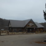
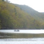
On Saturday morning, we will gather at 9:00 at the Ranger Station of New Germany State Park, and will divide into two groups, one for kayaking, the other for hiking, and travel to the Savage River State Forest 10 minutes from our campsite.  moving 043 We have a local outfitter that will deliver rented kayaks to the dry boat launch on the Savage River Reservoir for a  4 hour tour. (lunch will be provided, bring water shoes, and prepare to possibly get wet).   Those experienced kayakers, with their own kayaks, will join us at the same boat launch to determine their own route with some suggested directions.(bring your own lunch). moving 058
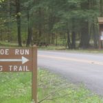
Hikers will travel close by to a
spring wildflower trail called Monroe Run, moving 059crossing the creek several times for a 5 mile, mostly flat hike in the State Forest. (bring water shoes for creek crossings and lunch).
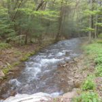
 

Evening pot luck dinner and campfire  will follow around 6:00 at our campsites in New Germany State Park.
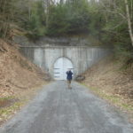
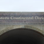
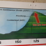
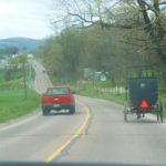
grantsville, maryland 039grantsville, maryland 022On Sunday we will bike the Great Allegheny Passage from Deal to Cumberland and hikers will walk from Deal to Frostburg or to their ability level. We will gather at 9:00 in Grantsville. Bikers will carpool to Cumberland where the outfitter will shuttle us and all bikes to Deal.moving 034 Regardless of whether you have your own bike or are renting from the outfitter, we will all ride the shuttle with the outfitter. The 24-mile ride from Deal to Cumberland will then take us back to our cars/bike racks.moving 035   Bikers can decide if they want to continue on C& O Canal trail, have lunch in Cumberland, or return to their cars.  Hikers will walk the same downhill flat path, passing through the Big Savage grantsville, maryland 026Mountain Tunnel about 2 miles south of Deal and a mile south of the Eastern Continental Divide.  grantsville, maryland 031Some hikers may continue to hike 8 miles to Frostburg.  Hikers will decide if they would like to lunch in Frostburg or join others in Cumberland at the railroad station and visitors center. Hikers may also choose to walk some on the C&O Canal trail. Dinner, which includes a cooking contest, will be provided by Canadice Kitchens. (bring your outdoor cooking stoves and cooking pot). Campfire and hot chocolate to follow.
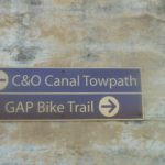
On Monday, after checking out of our rooms or campsite before 11:00, we will have a short hike at 11:00 for those interested in staying longer. Others may want to check out the moving 029historic Western Maryland train ride in Cumberland or other tourist areas located nearby.moving 007grantsville, maryland 020


If you do not have reservations and would like to join us, we will try to accommodate late reservations if possible due to the holiday weekend.    Contact Pam or Bill for details. Costs for outfitters:  Kayak/tour $65.00  Bike rental (full day) $30.  Bike shuttle as group of 8 about $27 each.

Directions from Springwater:   Take 390 south to the Southern Tier Expressway (I-86, NY  17).  Drive east towards Corning.  Take US 15 which is also I-99 south into Pennsylvania.  At Williamsport, take US 220 south.  220 is a bypass around Williamsport. The signs will say Lock Haven.

Take 220 south to I-80.  Go west on I-80 (which is also 220).  At the second exit, take 220 south.  Signs will direct you to State College and Bellefonte.  220 also becomes I-99.  Take 220 all the way through PA down into Maryland.  The I-99 designation ends after Bedford.

In Maryland, you reach I-68.  Go west, passing through downtown Cumberland, to Exit 22, the first of two Grantsville exits.  After taking the ramp at Exit 22, turn right if you’re staying at the Casselman Inn.  At the light on Alt 40, turn left and drive about 2 miles to the Casselman which will be on your right.  If you’re staying at the Comfort Inn or camping at New Germany State Park, turn left from the Exit 22 ramp.  The Comfort Inn is on your right on the other (south) side of I-68.  For New Germany, continue on the road (Chestnut Ridge) until it dead-ends at a T intersection.  Turn left and drive 2-3 miles – look for signs for New Germany State Park.  The Park HQ and Visitors Center is on the right, the campground entrance is on the left – follow the signs.

Our Friday evening dinner is at the Cornucopia Cafe which is less than a mile from the Casselman going east on Alt 40. The restaurant is behind the Penn Alps restaurant.

Posted on by

ILMPD 2016 – GVGSP with FOGVG

ILMPD 2016 – – – I Love My Park Day, is an initiative of New York State Parks celebrated annually on the first Saturday of May which in 2016 falls on the 7th of May.  It is an effort to improve NYS Parks from a grassroots perspective.  Many NYS Parks hold an ILMPD event and activities may vary greatly from one state park to another.  – – – Checking the NYS Parks website is one way to ascertain where and what some activities will be for this May 7th 2016 event.   two web addresses are:  parks.ny.gov  -and-  www.nysparks.com     Parks and Trails New York ( ptny.org ) also is a website to check for info.


This “event post” speaks specifically to – 2016 ILMPD on the GVGSP with Friends of the Genesee Valley Greenway (FOGVG) who will be working on clearing debris at one specific extant former Genesee Valley Canal (GVC) lock situate on the GVG.  This locale is situate in the southeastern reaches of Letchworth State Park, essentially at the hamlet of Oakland.   Any hikers interested in joining in to clear the extant lock of the former GVC which has now become the GVG should feel free to join in this effort. (Of note: lock 60 is a very short walk in from Oakland Rd, so this is mostly a maintenance event and not much of a hike event.)

Plans are to start the day at 9:30am, working and providing for snacks and breaks as apropos, and work until Noon, with lunch provided to volunteers at 12:30pm in nearby Nunda.  All volunteers are welcome, and if you need to leave early you are welcome to do so, easily accomplished since the ILMPD – Oakland Locks site is very near the car parking area.

ILMPD is coincidentally the same day that one of Springwater Trails’ own, Katherine (Secretary of Springwater Trails, and hiker/hostess extraordinaire), will be honored with an award at Livingston County’s 30th Annual Seniorama 2016, in recognition of the many community volunteer activities she has been involved in throughout many years.  So, … if you wish to attend both the ILMPD event at Oakland locks and the Seniorama event honoring Katherine, you’ll need to make  the ILMPD lunch at Nunda Historical Society pavilion at 12:30pm a quick lunch stop and be on your way by ~12:40PM to make it to Seniorama for the 1:30PM start time.


Below (between the triple arrowheads) is the info copied from the FOGVG website relevant to ILMPD – GVGSP at Oakland Locks.

>>>

2016 I Love My Park Day – Saturday, May 7, 2016 

I Love My Park Day (ILMPD) is an exciting statewide event to celebrate and enhance New York’s state parks and historic sites and bring visibility to the entire state park system and its needs. Volunteers from across the state will participate in cleanup, improvement, and beautification events at New York State parks and historic sites.   
This year the Friends of the Genesee Valley Greenway (FOGVG) have selected one work site rather than three for the Genesee Valley Greenway State Park.  Volunteers will clear the last lock (#60) in the flight of Genesee Valley Canal locks that begin at Oakland Road in Oakland.  We will gather at the work site at 9:30 am.  Parking is available at the parking lot on Oakland Road and along Rt. 436 or Oakland Road.

Volunteers should bring water, gloves, pruning shears or brush cutters, insect repellant, and wear heavy shoes and protective clothing to guard against heavy brush, poison ivy, and ticks.  Snacks will be available and lunch will be provided at about 12:30 pm at the nearby Nunda Historical Society pavilion.  Volunteers will receive ILMPD T-shirts.  If questions: email [email protected] or call 585-476-2354.

Volunteers are encouraged to register at the PTNY website at http://www.ptny.org/ilovemypark/ or by calling 585-476-2354.  Registering in advance on the website is strongly recommended since it avoids the need to complete Volunteer Service and Photo Release Forms on May 7th.

<<<

hyperlink –  http://nysparks.com/parks/189/details.aspx

The flight of Oakland Locks where lock # 60 is situate is accessed via Oakland Road just north off NYS Rt 436, in the hamlet of Oakland in the Town of Portageville (just a bit west of the Village of Nunda, NY).

Of note: On the 4/24/2016 Springwater Trails hike on the GVG, hikers learned about the former Genesee Valley Canal (GVC) and also learned some about the GVG too, at the AP&HS program presented by Tom S Cook on the GVC at the Avon Opera Block on April 24th, 2016 and then following the presentation we furthered some knowledge on the S/T hike in the Town of Caledonia on the GVG .  In fact in traveling to start points all hikers paused at and one group of hikers started their hike on the GVG at NYS Rt 5 trailhead, which was the same locale used for the 1840 party celebrating the opening of the first section of the Genesee Valley Canal.


Additionally, the following paragraph is copied from The Genesee Naturalist, a quarterly periodical about Letchworth State Park, the Genesee Region and surrounding area.  This ILMPD info is about the broader Letchworth State Park effort for ILMPD, as delineated from the Oakland locks of the GVGSP at the southeastern reaches of Letchworth SP.

“Saturday, May 7th, 2016 at 8:00am  I LOVE MY PARK DAY.  A variety of volunteer projects are offered throughout the day: tree planting, invasive species removal, landscaping, leaf raking an canal locks beautification.  Lunch and programming with Friends of Letchworth.  Trailside Lodge.  Volunteers may preregister at www.ptny.org  (4-6 hours) (led by park staff and others)”

Below (between the triple arrowheads) is the info copied for Letchworth SP – ILMPD (copied from the NYS Parks website).

>>>

Saturday, May 7, 2016 09:00 AM – 02:00 PM
Letchworth State Park

(585) 493-3600

Come join us at Letchworth State Park in celebrating the fifth annual I Love My Park Day! I Love My Park Day is an exciting statewide event to improve and enhance New York’s parks and historic sites and bring visibility to the entire park system and its needs.

Project 1: Raking Leaves, Litter clean up, staining benches at Wolf Creek, Great Bend overlook.

Project 2: Maintaining fall material of playgrounds on the south end of Letchworth park.

Project 3: Invasive plant removal

Project 4: We will have a group participating in stream bank erosion control by planting live stem dogwood branches. Please bring work gloves,knee high rubber boots/hip waders, and 5 gallon pails.

All ages are welcome. Volunteers should meet at the Tea Table/Eddy’s parking lot and to wear long sleeves, long pants, and enclosed shoes.

Register Now

Contact event coordinator Douglas Kelly for more information: [email protected]

Registration: Required

<<<

hyperlink – http://nysparks.com/events/event-results.aspx?pk=79


If perhaps you are interested in ILMPD efforts for another park location – you can start at www.nysparks.com and select the park and then select upcoming events.


Also of note, here are three upcoming hikes on the GVG.  All three are led by NYS Park staff.

* on Saturday April 30th, 2016

Nature Hike from Fowlerville Road to York Landing
Saturday, April 30, 2016 10:00 AM
Genesee Valley Greenway State Park

(585) 493-3600

Explore the GVG as it travels south, on the west side of the Genesee River. Meet at the York Landing Parking Area off River Road north of Piffard. Car-pooling is required. Bring a lunch. (3 hours, 2.6 miles).


** on Saturday May 14th, 2016:

Quaker Road to Lehigh Valley Trail (Wegmans Hike Number 4)
Saturday, May 14, 2016 10:00 AM
Genesee Valley Greenway State Park

(585) 493-3600

This hike is located in Monroe County just south of the Village of Scottsville. Take River Road South from the Village, or north from Route 20. Turn east onto Quaker Road (Rt. 251). The trailhead is approximately ¼ mile ahead. Meet at the trailhead. (3.1 miles)


*** on Saturday June 11th, 2016:

Fowlerville Road (Wegmans Hike Number 5)
Saturday, June 11, 2016 10:00 AM
Genesee Valley Greenway State Park

(585) 493-3600

This hike is located in Livingston County in the Town of York. Park on the south side of Fowlerville Road. Meet at the parking area. (2.5 miles)


View all events for Genesee Valley Greenway State Park

Posted on by

National Take a Hike Day 2016

Well, annually, November 17th is National Take a Hike Day.  So, for some “in-touch time”, consider grabbing one or more friends, or for some solitude “in-touch time” consider heading out solo, for a hike.

In 2016, November 17th happens to be a Thursday.  Can’t get out and hike on this day?  Well, it is just a day, like any other. So if this day of recognition does not work for you, get out and take a hike on a day that does work for you.

But, then, I’m preaching to the choir.  Am I not?

Perhaps you may want to spread the word and share a hike with someone who normally would not  get out and do a hike on his/her own.

See you Sunday?

Happy Hiking!

Posted on by

Devil’s Hole at Niagara Falls – guided hike, 2nd week

This unique opportunity for a guided hike at low water level in the Niagara River gorge features Devils Hole State Park as the start point and heads down hill to the river and then up-river in the gorge before returning. { GPS Coordinates of Devil’s Hole State Park = 43.13346, -79.046684 }    The hike is listed as 5 1/2 hours but do not let that scare you, because with the distance to cover the hike must have a slow pace and substantial time for “look see”.   But, do consider this is a hike with elevation gain & loss & stairs!  This hike is offered on Saturday November 7th, 2015 & again on November 14th, 2015.

While this hike is a trek to drive from Springwater environs, it may be a rare opportunity (perhaps even a once in lifetime hike for you) for such a hike.  That’s why its posted on this website for hiker awareness and consideration.  Perhaps consider carpooling with some other interested S/T hikers.  (The Niagara Region of New York State Parks does schedule multiple guided hikes per year, within a number of Niagara Region NYS Parks, among one in the past has been Whirlpool State Park.  So, if you were to search in subsequent years at the right time, you’ll likely find some hike of interest.)  (note: currently, autumn 2015, Whirlpool State Park is undergoing construction along the top gorge edge where the trail along the gorge rim & viewing area of the Whirlpool in the river gorge is situate, so some access is partially limited.)

This hike is listed on the NYS Parks website as “registration required”.  Registration Phone # (716)-282-5154.

FYI – Devils Hole State Park has numerous steps / stone stairways from the top of the gorge to reach river gorge level (think gorge trail at Stony Brook State Park).  Albeit of note between the Rainbow bridge and Devils Hole SP there are numerous ways to reach the river gorge at river level from the top of the river gorge.  You may want to discern what route specifically will be used for this hike, by calling the registration phone number, if you are concerned about you ability on stairs.

——————————————————————————————————————–

*** MORE INFO ***  some of it excellent hikers’ tips and little known info.

Between the Rainbow Bridge area of Niagara Falls State Park (just north of the falls, yep, ‘Niagara Falls’) and Devils Hole SP, there are at least four ways to get from the top of the gorge to the bottom of the gorge. But first know that for the entirety of the described length – Rainbow Bridge northward to Devils Hole SP – there is a rim trail along the upper gorge, and there also is a paved multi-use (bikeway & walking path) that was formerly half the laneage of the Robert Moses Parkway (roadway) in this section.  Several years ago half the laneage of this section of the Robert Moses Parkway (closest to the river gorge shoulder) was decommissioned and given over to a multi-use recreational trail, that’s why its wide and paved.  (Currently there are plan proposals to make further alterations along this corridor.)

Listed here are four specific ways into the river gorge: 1) Devils Hole State Park trails (substantial number of stairs) ;  2) there is a trail in Whirlpool State Park, figure on stairs here too (Whirlpool SP is contiguous to DeVeaux Woods State Park which is situate on the opposite {east} side of Robert Moses Parkway) ;  3) there is the “Great Gorge Railway Trail” (yep, there was a former tourist railway into the lower gorge, it closed down approx in the 1930s) that leaves the Gorge Rim Trail and heads northward sloping downward into the gorge (the Great Gorge Railway Trail trailhead is situate about 2/3 the distance south from the Whirlpool Bridge and 1/3 the distance north from the Rainbow Bridge) which in looking at a map has its trailhead ~ on an east-west plane of Cedar Avenue as a reference point  (also could be described as nearly adjacent the area where the downward traversing sewage treatment plant road crosses under Robert Moses Parkway)  ;  4) EASY PEASY there is a newly recommissioned elevator most folks do not yet know about free and open to the public.  The elevator building, a rectangular shaped brick building along the top edge of the gorge, can be found a short distance south of the  “Niagara Gorge Discovery Center(another hyperlink) the funky shaped kinda roundish/satellite-ish looking building formerly known for years as the Schoellkopf Geological Museum.  (There is an outdoor man-made climbing wall there too, point of reference.)  The elevator building could also be described as being on the “campus area” of the “Niagara Gorge Discovery Center” area of Niagara Falls State Park.

[detail note: The “Niagara Gorge Discovery Center” situate to the west side of Robert Moses Parkway should not be confused with the nearby Aquarium of Niagara (also a round shaped building located at 701 Whirlpool St, east side of the street) which lies just east of the Robert Moses Parkway.  (Of note, these two edifices are pedestrian accessible to one another, via the “flyover pedestrian bridge” that crosses above the Robert Moses Parkway and serves as a tourist and hiker walkway connection.  The pedestrian bridge landing points are as follows,  west-landing: the grounds or campus of the “Niagara Gorge Discovery Center”, east-landing: the west side of Whirlpool St which is directly across the street {Whirlpool St} from of the Aquarium of Niagara).]

The elevator building is immediately adjacent the parking area for the “Niagara Gorge Discovery Center”.   The top lobby of the elevator “SL” street level and the much smaller bottom lobby have limited hours of operation (about 8 hours a day, or so, but hours vary by seasonal dictate).  Hours of operation are posted on the entry door of the elevator building.  Please note, elevator lobby hours are not the same as the nearby “Niagara Gorge Discovery Center” hours.

At URL immediately below is a photo of the elevator building and the “Niagara Gorge Discovery Center”.  https://lh5.googleusercontent.com/-fSKbL86nUuU/VWJwgOSGjHI/AAAAAAAAH8A/W98ccpzeO84/s408-k-no/

The elevator at the bottom lets out to the newly built seasonal boat storage area for the American side “Maid of the Mist” boats.  There is a self guided tour pamphlet (available free in the upper lobby of the elevator building) depicting points of interest in this immediate area, and trails lead both north and south from this point near river level.  The elevator shaft itself, is the repurposed and reinforced shaft of the former Schoellkopf Power Plant. The ruins of the power plant and the power plant’s demise are pointed out via the self guided tour pamphlet.  So you’re definitely getting some history via the elevator ride and self guided tour pamphlet.

Still not sure where the “Niagara Gorge Discover Center” and the elevator to the river level are? (Both of which are within Niagara Fall State Park.)  Well, as a reference point, Howard Johnson’s Closest to the Falls and Casino Hotel, at 454 Main Street, Niagara Falls, NY (which in part has the iconic bright orange roof HoJos is known for) is within sight of this part of Niagara Falls State Park.  This HoJos is situate at the corner of Main Street and the Robert Moses Parkway, and is situate such that it is not crowded by other buildings, so is is easily discerned in line of sight.  Niagara Falls State Park itself runs from south and east of Goat Island to north of Niagara Gorge Discover Center” & beyond.

If you go to this Devils Hole SP hike, and have the time either before the hike or immediately after, well, … this elevator ride and self-guided tour is a “gotta do”, and its free.

If you go to this hike, and are looking for more hiker’s tips / options  and some info to use for after the hike, well …, exclusive info for S/T members may be something you wanna read.


And, perhaps too, if you go to this hike, you’ll come back from it having “Niagara Fever” with impetus & idea that this is an “away” hike worth planning for a future S/T Sunday hike.  Yep, even though it would be an exceptional distance to travel to a Sunday hike.


— Some hyperlinks on salient area history — 

lots more photos, mostly older historic of the Schoellkopf Power plant area

one website of many, that gives accounts of the Schoellkopf Power plants, and developments of the area

another history account


An on-line search of  – Schoellkopf Power Station – , and such similar terms will produce many results for reading.

*** Quiz questions.  What is America’s oldest State Park?  While on this related topic, what is the smallest NYS Park.  (hint, these are not one and the same.)


L

O

T

S


O

F


W

H

I

T

E


S

P

A

C

E

… between the Quiz questions, and now the answers.

  1. Now named Niagara Falls State Park and initially authorized by law in 1885 as Niagara Reservation, this is the oldest State Park in the USA.  The establishment to preserve the natural beauty of Niagara Falls, reclaiming the area from industry that had built up along the falls area did not come easy.
  2. New York State’s smallest state park is The State Park at The Fair, on the NYS Fair Grounds near the Syracuse area.