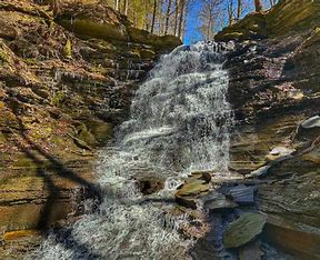
This hike is a guaranteed crowd pleaser! Please check back for more details.
Category Archives: Hikes
Hike Rob’s Trail – Hemlock Lake side
Join us on Sunday April 27th to hike the west side of Rob’s Trail, the DEC/Nature Conservancy property in the northeast corner of Hemlock Lake!
Options are to hike out and back to the south along the trail from the North Hemlock Boat Launch, or to carpool up to the Hemlock Side trailhead on Route 15A and hike down the hill and north along the trail back to the boat launch. In the flat part of the trail there may be small streams to ford by wading or jumping, so waterproof footwear and poles are advised.
Meet at 1:45pm for a 2:00pm start the north boat launch, at the end of Boat Launch Road, a sharp left after you first enter Rix Hill Road from Route 15A.
Naturalists/Tourists will hike south for an hour, or as far as you want, and then return. The terrain is wide and flat with beautiful views of the lake.
Climbers (or in this case Descenders) will climb into a few cars and head for the Rob’s Trailhead on the right (west) side of Route 15A (not the one on the east side, off South Old Bald Hill Road). From there we will take the trail back to the start, a total of about 4.5 miles.
Please respond to info@springwatertrails.org if you plan to join the longer hike and can volunteer for the carpool.
Social: Please join us at the Bird House Brewery in Honeoye – 8716 Main Street, just east of the traffic light, for craft beer and pub food.
Directions:
From Springwater: proceed north on Route 15A 19 miles, then make a left on Rix Hill Road and an immediate left on Old East Lake Road, a.k.a Boat Launch Road.
From Honeoye and points east: Take Route 20A west from the Bristol Valley and Honeoye. When 20A meets Route 15A, make a left and go about .6 miles to Rix Hill Road. Make a right and then an immediate left on the dead end road to the boat launch parking area in one mile.
From Rochester and points west: Take Route 15 south from Henrietta or Route 15A south from Honeoye Falls, or Route 390 south to the Lakeville-Livonia exit, then go south on Route 15 and then east on Route 20A through Hemlock. When Route 20A turns east toward Honeoye, go straight another .6 miles and make a right on Rix Hill Road. Then make an immediate left onto the boat launch road and go to the end, 1 mile.
I Love My Park Day – Cleanup Hike on Canadice Lake Parking Areas
Saturday May 3rd is the New York State “I Love My Park” day – the day the state begs for free labor to pick up trash and clear trails on the land that it owns. We usually do our bit, and this year the bit we have chosen is Canadice Lake. The trails themselves don’t need much cleaning up, but the parking areas are usually dumping grounds for some less courteous visitors and most of all, there is plenty of invasive Tartarian honeysuckle to pull up, cut down, or just destroy by any means available.
This Saturday hike is in addition to our usual Sunday hike!


We will meet at the north parking lot off Purcell Hill Road in Canadice (42.74447,-77.58297). Please bring tools for trail clearing – work gloves, clippers, lopers and hand saws. We will pick up whatever trash we can find, but the bulk of the work will be cutting down and attempting to destroy the invasive honeysuckle.
Optional Social: Please join us at the Birdhouse Brewing Company in Honeoye – 8716 Main Street, just east of the traffic light, for craft beer and pub food. http://birdhousebrewing.beer
The northwest parking area for Canadice Lake is off Purcell Hill Road west of Canadice Lake Road. Please note that this is not a boat launch.
From Rochester and the I390 Exit 11 Park and Ride: From Rochester, take I390 south to Exit 11. Turn left (south) on Rt 15. The park and ride is on the right side. From the park and ride, turn right onto Rt 15 and then an immediate left onto Rt 251 toward Rush. After 1.3 miles, bear right onto 15A. Follow 15A through Rush, Lima and Hemlock for 18.5 miles. Turn left on Purcell Hill Road for 1.2 miles. At the bottom of the hill, the parking area is on the right before you cross the Canadice outlet.
From Springwater: Take 15A north from the Rt15 intersection for 7.6 miles. Turn right on Purcell Hill Road for 1.2 miles. At the bottom of the hill, the parking area is on the right before you cross the Canadice outlet.
From Honeoye: From Rt 20A, turn south on CR 37. After 3.7 miles turn right at the white church in Canadice. Stay straight onto Burch Hill Rd when CR37 bears to the left. Follow Burch Hill Rd down to Canadice Lake Rd. Turn right (north) on Canadice Rd for 0.7 miles, then left on Purcell Hill. The parking area is on the left in 0.2 miles.
From Canandaigua: Take Rts 5&20 west out of the City of Canandaigua. About 4 miles out of the city, turn left onto US-20A and NY-64 S. In 3.7 miles, turn right to stay on 20A toward Honeoye. Continue with the directions above from Honeoye.
From Pen Yann and Naples: Take NY-364 W for 12 miles to Middlesex where 364 joins NY 245. Continue straight on NY-245 for 9 miles. At the end of 245, turn left onto N Main St (NY 21 S). In 1.2 miles, at the south end of Naples, turn right onto Clark St which becomes CR 36. In 12 miles, turn left onto Jersey Hill Rd (Gratsley Hill Rd is not recommended, especially in the winter when it isn’t plowed). At the end of Jersey Hill Rd, turn left onto CR 37. After 1.1 miles turn right at the white church in Canadice. Stay straight onto Burch Hill Rd when CR37 bears to the left. Follow Burch Hill Rd down to Canadice Lake Rd. Turn right (north) on Canadice Rd for 0.7 miles, then left on Purcell Hill. The parking area is on the left in 0.2 miles.
Ontario County Park at Gannett Hill Hike-Naples

This is one of our group’s favorite hikes!
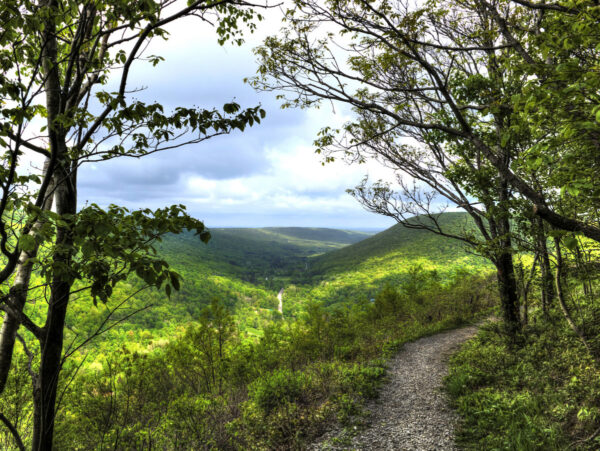
Ontario County Park at Gannett Hill is one of the highest points in Ontario County and located in the scenic Bristol Hills. At an elevation of 2,256 feet above sea level, you’ll enjoy expansive views to the East and view portions of Ontario County and the hills behind Seneca and Cayuga Lakes.
Location:
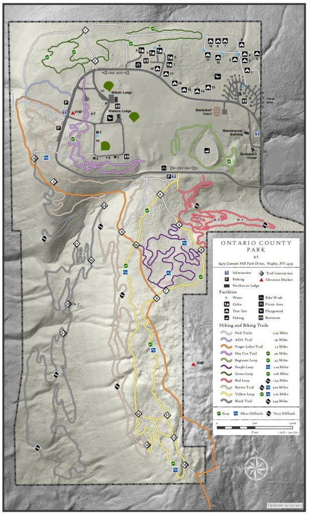
6475 Gannett Hill Park Dr, Naples, NY 14512. This address takes you to the entrance to the park. At the top of the Gannett Hill Rd, turn right to drive past the entry booth. Stay on the main loop road around the first curve to the west, then the second curve to the south. Park in the lot along the right side of the road (All hikes will start at the crosswalk at the middle of the parking area).
The hike on Sunday, April 13th will begin at 2:00pm. Please plan to arrive by 1:45pm, dress for the conditions and feel free to bring poles.
 Hike Details: We have three hikes planned, but we can adjust based on interest.
The Social:
After the hike, please join us at Lock Stock Bar & Grill 5432 NY 64 Canandaigua, NY 14424. All are welcomed!
— From Springwater, Wayland and Naples: From Springwater, head south on NY-15. At the light in Wayland, turn left and follow NY-21 through Naples. Just past the village, bear left onto CR-12 (Bristol Springs Rd). In 1.9 miles, bear left onto Rhine St. Continue straight (In .6 mi, the name changes to Powell Rd and then in .3 mi to Gannett Hill Rd, and then in 3.2 miles it enters the park). From the camping check in booth, follow the park road around the loop for about 1/2 mile to our meeting place at the crosswalk on the west side of the loop.
—From Hemlock and Honeoye: From Hemlock, head south on NY-15A. Just outside of the hamlet, turn left on US-20A. Continue through Honeoye and turn right onto East Lake Road. In 0.6 mi, turn left onto CR 33 (Egypt Valley Rd.). In 6.9 miles, continue straight onto CR 34. In 1.6 miles, turn right onto NY-64. In another 1.9 miles, turn right onto Gannett Hill Rd. In 1.3 miles, turn right into the park. From the camping check in booth, follow the park road around the loop for about 1/2 mile to our meeting place at the crosswalk on the west side of the loop.
